Continued from the previous page.
MOUNTAIN BIKING NIRVANA: THE THUNDER MTN. TRAIL
Bikes are also allowed on about half of the multi-use trails in Red Canyon,
including Cassidy, Casto Canyon, Grandview, Losee Canyon, Rich, and Thunder
Mountain trails.
I've hiked on all or part of those trails and will show photos of them later.
The only one that Jim rode on his bike was
Thunder Mountain, which also happens to be my
favorite hiking trail in Red Canyon.
Mountain bikers come from all over
the region to ride this popular and very scenic trail, which stretches about
eight miles point to point. I've seen many more cyclists on it than hikers
(or equestrians).
You can see a map of the trails
here.
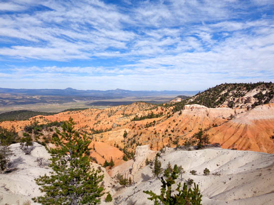
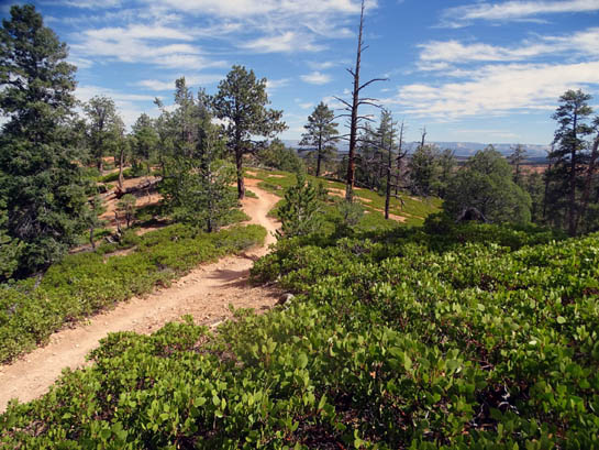
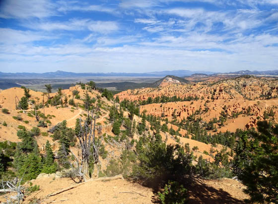
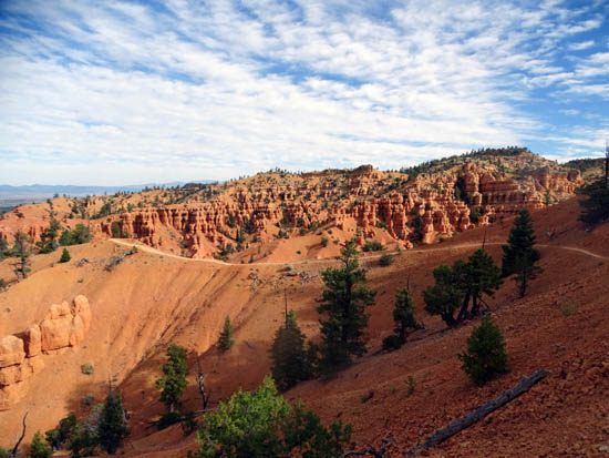
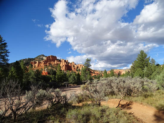
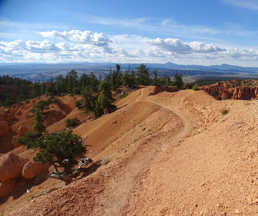
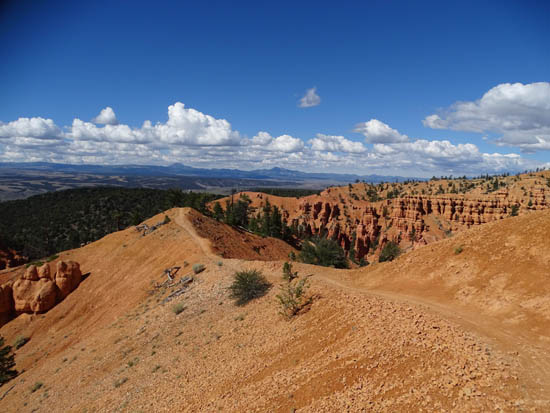
This is one of Jim's pictures from a high
point on the Thunder Mtn. Trail near White Point.
View before descending into Red Rock Canyon
I have tons of photos from this trail and Jim
even took a few when he rode it -- once.
Only once, he emphasizes. I doubt he'll ever ride it again because he prefers
roads and bike paths to single-track trails.
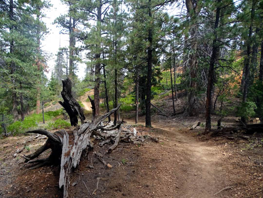
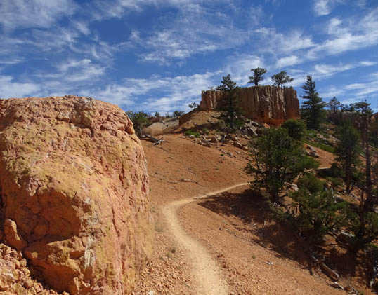
Thunder Mountain is mostly smooth as it gradually undulates through the forest
in the upper three or four miles between Coyote Hollow, the eastern trailhead,
and the highest part of the trail near White Point. That's where you start to
see the expansive canyon vistas called the Claron Formation like those in the
photos above.
I could probably ride that upper forested part
OK out and back on
my cyclocross bike:
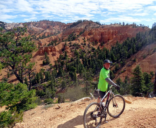
Another one of Jim's photos
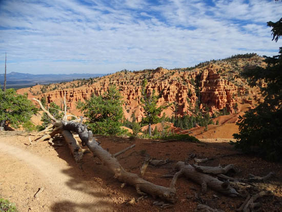
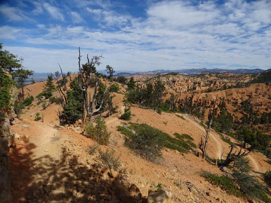
However, the terrain for about three miles in the second half of the trail
along the high ridges and down through the open canyons is very challenging --
steep, rocky, sharp switchbacks, and narrow with some long drop-offs
if you slide off the trail.
THE REAL FUN BEGINS
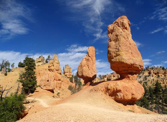
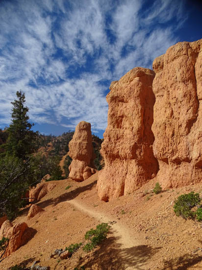
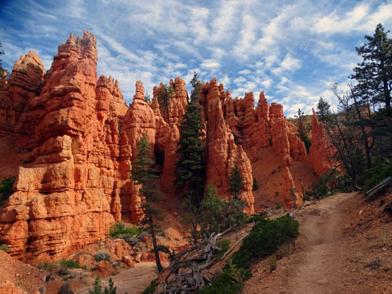
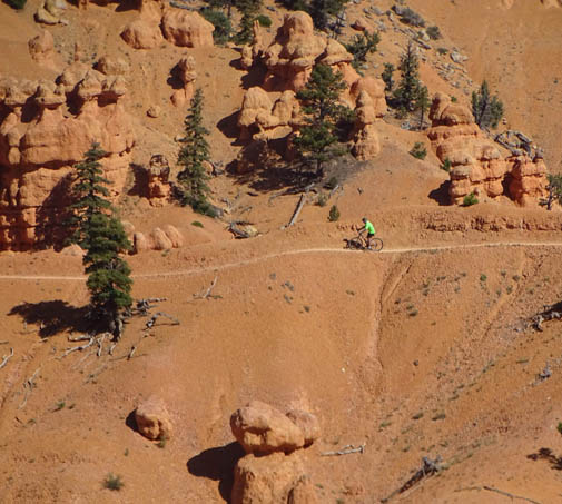
In the downhill direction (starting from Coyote Hollow), the fun starts
midway through the course after you come out of the treed area and pass these
two distinctive hoodoos:
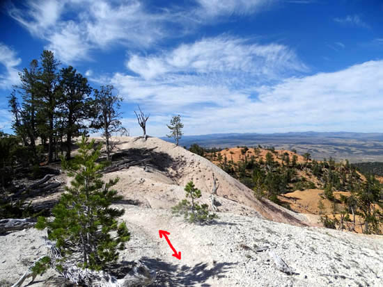
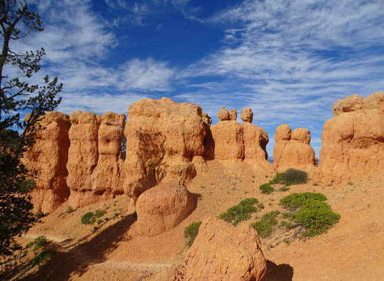
Above and below: The high point
through the white rock area is fascinating.
It looks like snow, but isn't.
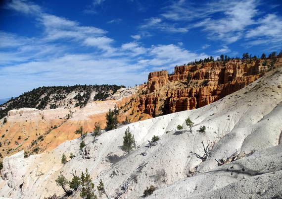
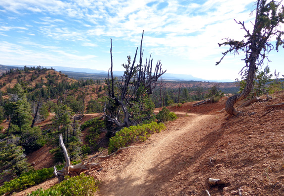
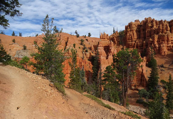
Although the trail is fairly smooth the next mile across the
ridge the scenery down into the canyon amphitheaters is distracting and
riders have to watch for trickier turns and drop-offs.
The switchbacks and bigger descent through the canyon begin in the next photo:
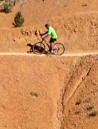
I didn't take pictures of all the rocks on various parts of the trail
but take my word, they are there. I'd never be able to ride a bike
through the most difficult three miles of this trail so I can really
appreciate Jim's and other cyclists' ability to negotiate it.
Although some parts of that section are difficult to even hike,
it's my favorite part of the trail because that's where I can walk right
next to colorful, sometimes whimsical, hoodoos and see the magnificent
canyon scenery all around me and in the distance. Ditto for cyclists if
they stop periodically to see the views.
There are lots of tight switchbacks
dropping into (or climbing out of) Red Rock Canyon.
The last mile gradually down to the trailhead at the entrance to Red
Canyon is a cake-walk in comparison -- way more smooth. Cyclists really
gun it there, even if they're going the less-popular uphill direction.
This is a nice way to end (or begin) the ride:
You can hike or ride this point-to-point trail in either direction.
Because most of the lower half is so steep and rocky (i.e., harder to get
traction and momentum), most cyclists start at the top of the trail on the
east end at Coyote Hollow and go down to the trailhead at the western
entrance to Red Canyon.
On my hikes I talked with a few tough riders who either 1) deliberately chose
to ride the uphill direction, knowing what they were getting into and
accepting the challenge, or 2) hadn't been here before and didn't know
any better.
Most of the clueless riders were in good humor,
though, because it's such a gorgeous ride.
The trail goes right by many cool
rock formations and hoodoos, like these.
Going one direction is about an eight-mile ride but cyclists need a
buddy if that's all they want to do.
Since this is a point-to-point trail, they don't end up back at their
vehicle unless they 1) spot a vehicle at either end, 2) have someone drop
them off at one end and pick them up at the other end, 3) ride out and
back (about 16 miles), or 4) do a 15-mile loop -- either CW or CCW
-- that includes the paved Red Canyon bike path and dirt
Coyote Hollow Rd.
YOUR TIME HAS COME
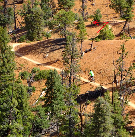
Most of the photos in this section are ones I took on two of my hikes
on this trail, including the day Jim rode the trail. I got pictures of
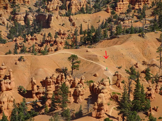
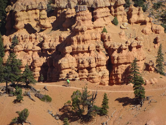
him as we crossed paths (he was riding down, I was hiking up):
I continued up the trail to a vantage point and stopped
for a few minutes where I could watch him as he switch-backed down to
one of the hoodoo clusters and out on a narrow ridge with long drop-offs
on either side:
Jim's view of the next part
It was fun to watch Jim and other cyclists navigate the two scariest places
with big drop-offs on both sides. I could see them from places
higher up on the ridge.
Here's the other narrow spine:
Jim rode across them just fine but it was obvious that riding those spines
was a butt-puckering experience for some less-experienced riders, if their
hesitation and/or screams were any indication! I'd probably have to walk
my bike across them. (I've met some hikers who will turn around
before walking across something like that.)
After he completed the ride safely I got Jim this humorous shirt at the
Red Canyon National Forest Service Visitor Center to commemorate his
achievement:
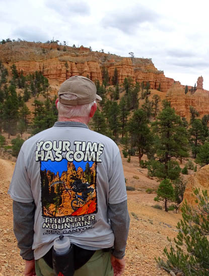
It shows the Grim Reaper on a mountain bike on the Thunder
Mountain Trail. I have no idea if anyone has ever died riding
it, but I'm guessing there have been some nasty crashes.
BIKE-RIDERS' PARADISE
In summary I'll just say there are scads of cycling opportunities
in the Red Canyon-Bryce Canyon area, whether you like to ride on paved
or dirt/gravel surfaces. I was more focused on hiking during this trip
but ventured out more on my bike when we returned the next spring.
I'll show more photos from Thunder Mountain and all the other
trails I hiked in Red Canyon, some of which allow bikes, in subsequent
entries.
Next entry:
Jim's long bike ride on Scenic Byway 143 from Cedar Breaks National
Monument to Panguitch
Happy trails,
Sue
"Runtrails & Company" - Sue Norwood, Jim O'Neil,
Cody the ultra Lab, and Casey-pup
Previous
Next
© 2015 Sue Norwood and Jim O'Neil
