Picturesque, indeed.
The first time I hiked this 8˝- to 9-mile loop I took over 600 photos. It
quickly became my favorite trail in Bryce Canyon. I hiked it three times
this fall and convinced Jim to go with me one of those times. It's
the longest hike he's done in quite a while. He rates it second to
Peekaboo.
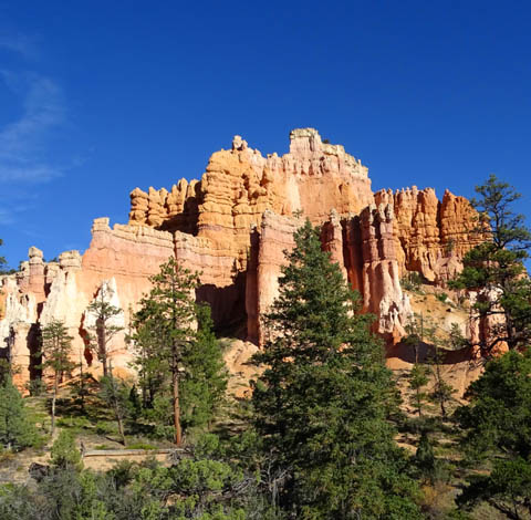
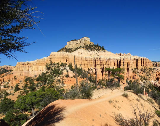
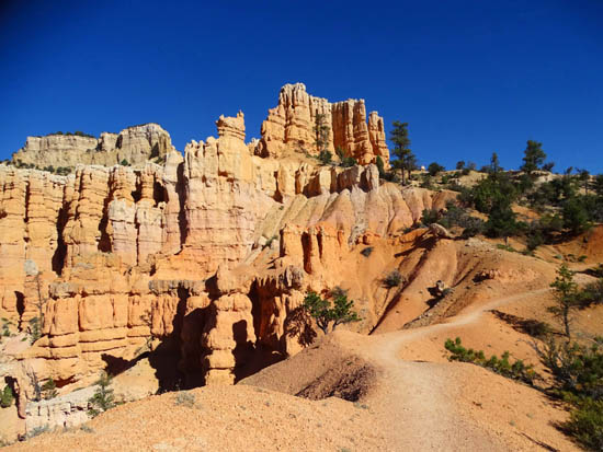
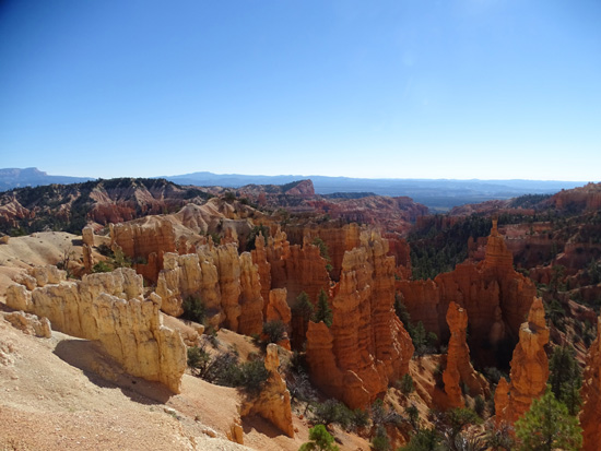
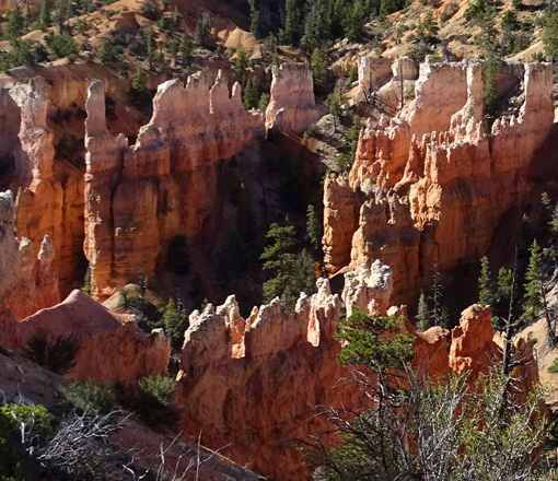
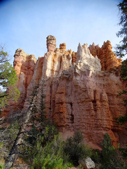
Pretty castle-like formation on
the Fairyland Trail
I like Fairyland even better, so much that I hiked it several more
times in the spring and fall of 2016 on our second and third trips back
to Red Canyon RV Park. So expect even more pictures next year!
TRAIL LOGISTICS
Like Peekaboo, you can't just do the Fairyland Loop in isolation.
Here's the map section from the park website:
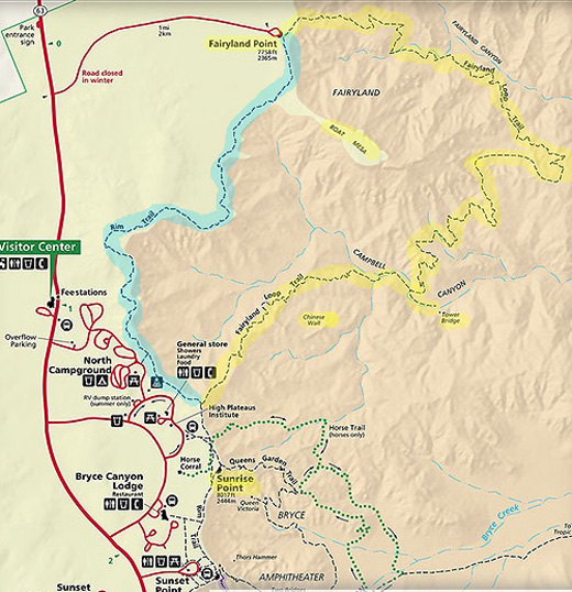
I marked the Fairyland Trail in yellow. By itself, it's about six
miles long (add another half mile if you go back to Tower Bridge)
-- whether you start at Fairyland Point and hike clockwise or
begin at the trailhead on the Rim Trail a little north of Sunrise Point
and go counterclockwise.
Either way, you have a gap of about
2˝ miles at the beginning or end of
the Fairyland Trail.
There are two ways to close this gap --
hike the Rim Trail, too (it's marked in blue on the map above) and make
it a real loop or spot two vehicles so you can eliminate the extra miles
on the Rim Trail.
Note that the park
shuttle buses don't go to Fairyland Point so that isn't an option
like it is for some of the other trails in Bryce Canyon.
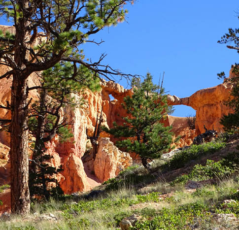
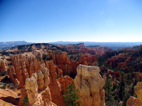
Bryce Canyon has lots of "windows" (hole on left)
and "bridges" (on the right).
All three
times I hiked the Fairyland Trail I did the whole loop, including the
Rim Trail and the short spur trail out and back to Tower Bridge.
I did the loop a little differently each time. I experimented with parking
at both trailheads, hiking both CW and CCW, and either starting on the
Rim Trail or finishing the hike along the rim.
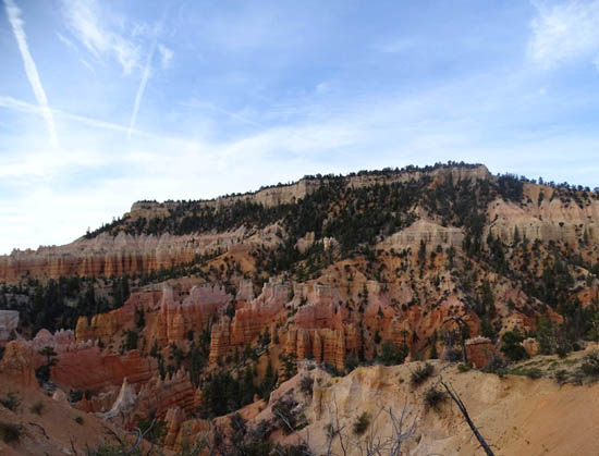
The "fairy land"
below Fairyland Point
By the third hike on the
Fairyland Loop I had a definite preference -- park in the
shade near the general store at Sunrise Point, go north on the Rim Trail
before it got hot, go clockwise on the Fairyland Trail, and come back up near
the car at Sunrise Point. I also did it that way almost every time on
our second and third extended visits to the area in 2016.
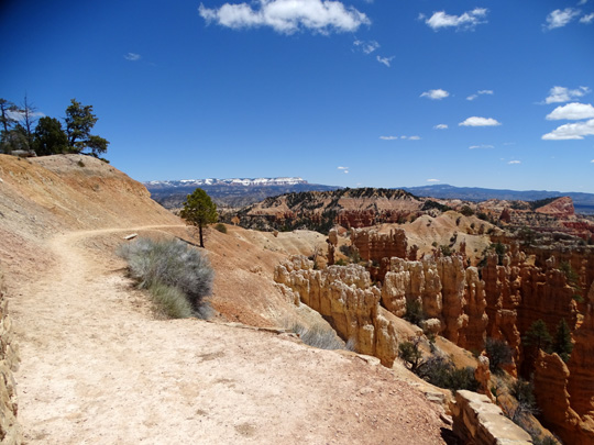
In general, I like the ascents and descents better in the clockwise
direction, as well as the scenery. For example, the approach along a narrow ridge
toward Boat Mesa is breathtaking that way:
Regardless of which way you hike the loop, stop often to look up and all
around. Every time I hiked the trail in 2015 and 2016 I saw some new things.
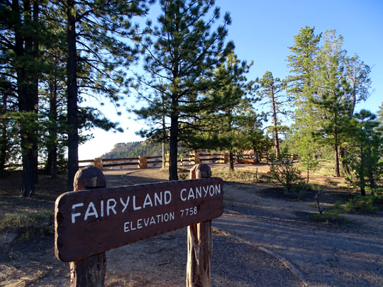
Fairyland Point has limited parking but you should be able to
find a spot before 9 AM in the spring or fall (we haven't been here in the
summer). The road to the parking area is located before you get to the
entrance gate. It is not marked going that direction and you can't
see the parking area from Bryce Canyon Road. There is a sign for the road
on the way out of the park.
Pretty sure we know why they did it that way, and it's smart.
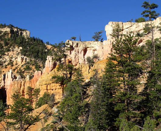
BOAT MESA
Do you see Boat Mesa on the map above? It's in the middle of the loop
and I marked it in yellow.
The Fairyland Loop encircles this large plateau. It looks small on
the map but it's visible along much of this loop and from all the
overlooks on the rim between Fairyland and Bryce Points. You'll see
it in a lot of these pictures; it looks different from every
direction.
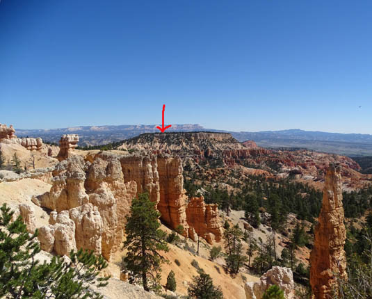
Arrow marks Boat Mesa as seen from the Rim Trail
between Sunrise and Fairyland Points.
Most visitors
to Bryce Canyon don't have the time or ability to do this entire hike.
Some of them just go down to Tower Bridge and back up, a total distance of
three miles with a significant elevation gain and loss.
In my opinion, if that's all the time you have, a more scenic hike
would be the Queen's Garden and Navajo Loop. I think the rock formations on the
Fairyland Loop are more spectacular on the northern half of the loop
-- going down from Fairyland Point -- than the south side
where Tower Bridge is located.
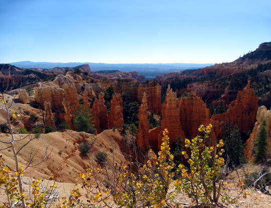
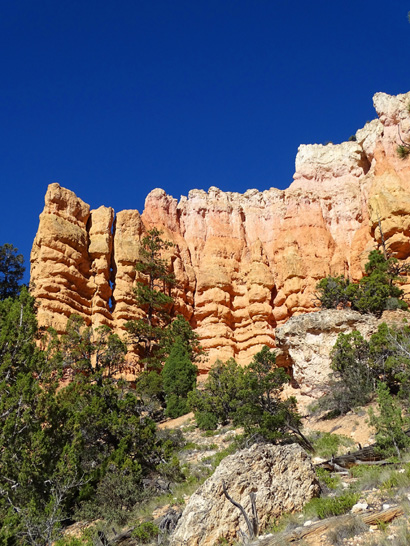
Another elaborate "castle"
formation on the Fairyland Trail
The National Park Service rates the Fairyland Loop as strenuous
because of its length, altitude (approximately 7,100 to 8,200 feet
elevation), and elevation gain and loss (over 4,000 feet total).
If you're used to hiking hilly trails at this altitude or higher
-- and for this distance -- I'd rate the Fairyland Trail as
"moderate" difficulty. I heard more grumbling from unprepared
hikers on the Peekaboo Trail than Fairyland.
TRAIL CONDITIONS
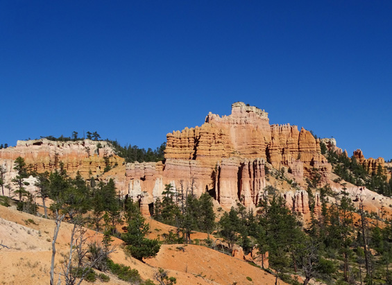
In addition to the fantastic rock colors and formations, there are
other things to love about the Fairyland Loop.
For one thing, not nearly as many people hike it as the trails closer
to the main Bryce Amphitheater (Navajo, Queen's Garden, Peekaboo, and
Bryce Point).
The busiest section of the Fairyland Loop is the least
scenic, in my opinion -- from the rim near Sunrise Point down to
Tower Bridge and back. That's where I've seen the most people on this
trail. Ironically, it's the steepest, longest descent and ascent on the
whole loop.
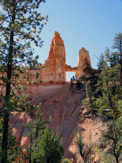
Tower Bridge
On the other hand, I've hiked clockwise from Fairyland Point in the
morning without seeing anyone on that side of the loop for
several miles -- and I think that's the most scenic part of it.
When I'm hiking alone it's interesting to talk with some of the other
hikers but I like the quiet solitude of having only a few other people
around. YMMV.
Fairyland has some long ascents and descents
but none are very steep. The loop is a roller coaster, with only a
few sections that are relatively flat.
The trail is mostly in the Bryce Canyon Wilderness so it is more narrow in
some places and a little more rough than the heavily-used trails in
the main amphitheater.
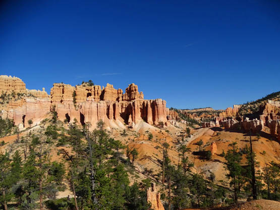
Winding, narrow trail below
beautifully-colored sculptured rocks
Like other trails in Bryce Canyon, this is high-desert country with
arid conditions and a lot of open, sunny areas that feel hot
even if it's only in the 50s or 60s F. Carry plenty of fluids. There is
no potable water or any restrooms on the loop. I haven't even seen any
water in the washes.
After it rains, parts of the trail can become muddy, sticky, and/or
eroded but the sandy-rocky surface dries out quickly. Dust is much more
likely than mud.
The Fairyland and Rim Trails are hiking only so you don't have to
dodge any horse poop.
VIRTUAL TOUR OF THE FAIRYLAND TRAIL
Since my preferred direction to hike this trail is clockwise these
photos start at Fairyland Point, go back the spur trail to Tower Bridge,
ascend to the intersection with the Rim Trail about a quarter mile north
of Sunrise Point, and continue north along the Rim Trail to Fairyland
Point -- a total distance of about nine miles.
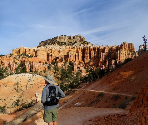
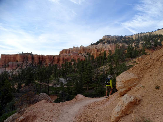
Jim stops to absorb the fantastic
scenery halfway around the Fairyland Loop.
Boat Mesa is poking up in the
background.
Like the Peekaboo Trail, most park visitors never experience this
entire loop.
These photos are from three different hikes. I'll include over 100
pictures on four pages so readers can see a spectacular
area of the park they may probably haven't seen -- and maybe some will
decide to hike it and experience its wonder for themselves.
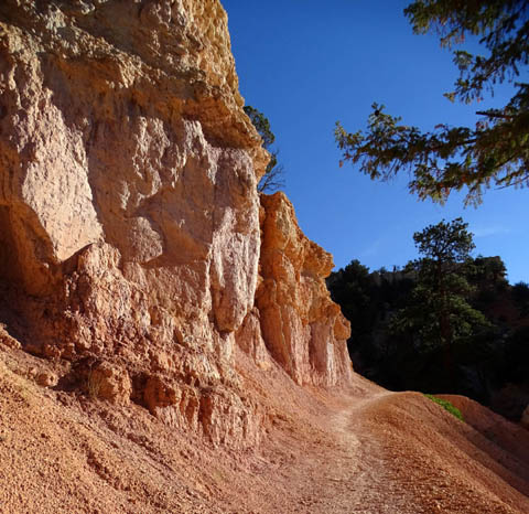
DESCENT FROM FAIRYLAND POINT
The trail descends gradually as it winds past more
beautiful pastel-colored rock formations:
Jim rounds a curve as the trail
winds in and out of small side canyons.
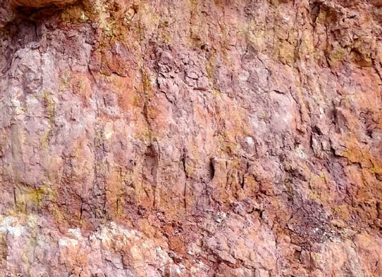
Looking back up the narrow trail
(above) past multi-hued sculptured rock walls (below);
where else are you going to see
purple rocks except southern Utah?
It's impossible to capture this whole sculpted wall in one shot when
you're walking right below it. The next picture is about half a mile
later, looking back. It's the formation in the background on the left
:
The formation on the right is the one you pass in the next quarter mile
when going clockwise. I think it's one of the prettiest formations in
the whole park.
Continued on the
next page: hiking through
what I call "Castle Country" on the Fairyland Trail
Happy trails,
Sue
"Runtrails & Company" - Sue Norwood, Jim O'Neil,
Cody the ultra Lab, and Casey-pup
Previous
Next
© 2015 Sue Norwood and Jim O'Neil
