Cedar Breaks has many fewer visitors than either Zion National Park
or Bryce Canyon National Park. There is less to see, fewer trails to
hike, and its season is relatively short because it's located above
10,000 feet elevation -- but if you're in the area it is
definitely worth a visit of at least a
couple hours to see the views from the four overlooks, or longer if you have time.
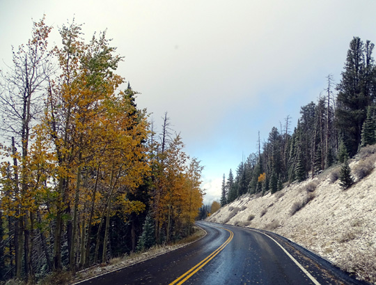
The drive getting there via Scenic Byways 14 or 143 is memorable any
time of year. We saw lots of fall color in September and October, as
well as some fresh snow at Cedar Breaks in early October.
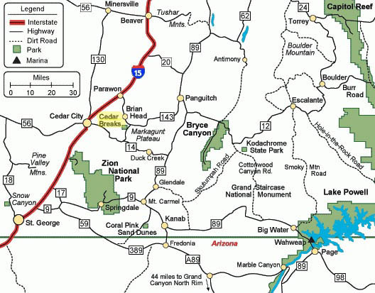
Here's the regional map that shows where Cedar Breaks is located in
relation to other public parks and lands in southern Utah's canyon
country:
We visited Cedar Breaks twice this fall -- on September 21,
when Jim rode his bike down Hwy. 143 from Brian Head to Panguitch, and
again on October 5 so we could see the winter's first snowfall. The
photos in this entry are from those two dates.
Cedar Breaks is bounded on two sides by Hwys. 143 and 148. Hwy. 148
is shown on the map above but it isn't marked. It's about five miles
long and connects Hwy. 14 to Hwy. 143.
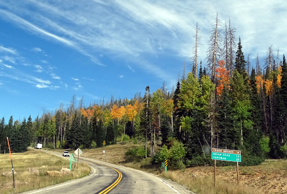
Scenic Byway 148 near its
intersection with Scenic Byway 14
There is one overlook on the north side of the amphitheater along
Hwy. 143 near Brian Head (the mountain) and three overlooks plus a
visitor center and campground along Hwy. 148.
SCENES FROM THE OVERLOOKS
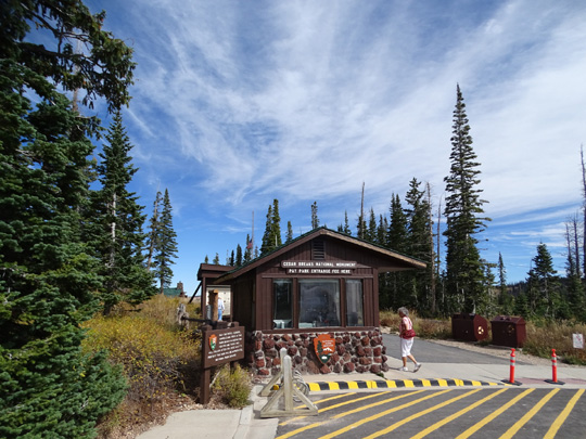
Entry into some national monuments is free. Cedar Breaks charges a small
fee to visitors who don't have a national park pass.
There is no
entrance gate on either Hwy. 143 or 148 but visitors -- even
those with NPS passes -- are expected to stop at the little building
near the visitor center on Hwy. 148 and get a pass to hang from their
rearview mirror. Rangers do go by the overlooks randomly to see if folks
have those hang tags.
On our first trip to the monument we stopped to get our hang tag, go to
the small visitor center, and walk out to the Point Supreme Overlook to
gaze into the huge amphitheater:
Visitors pass the pay station on the way back to
the visitor center and Point Supreme Overlook.
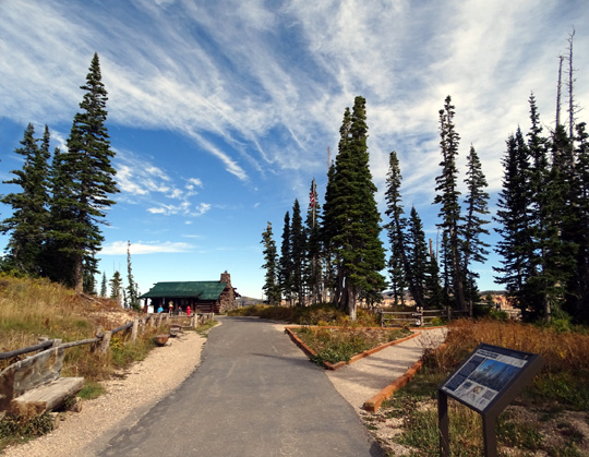
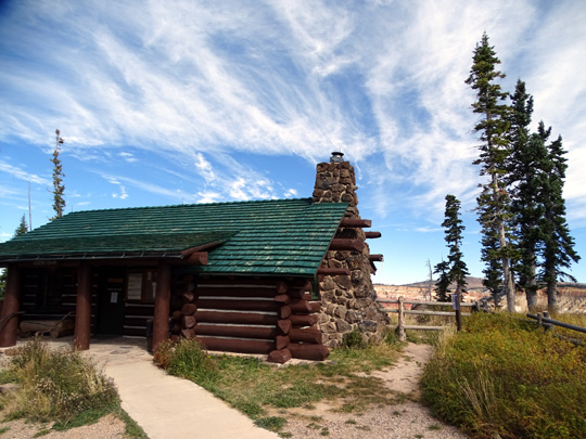
Above and below: the
small visitor center built in the 1930s by the CCC
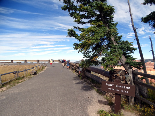
The elevation at Point Supreme is 10,350 feet --
a nice, cool place in the summer, and rather chilly
in the autumn!
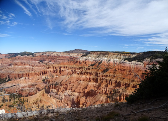
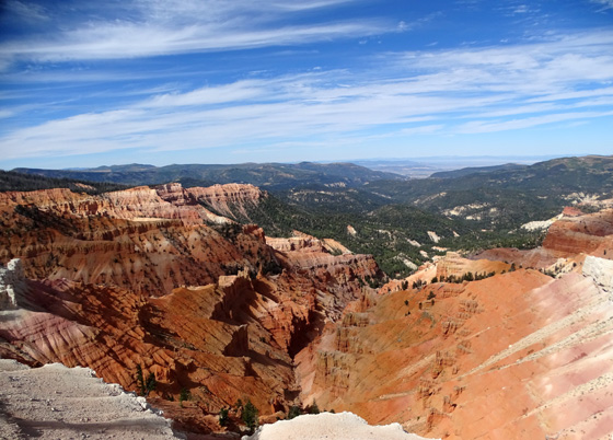
Above and below: views of amphitheater from
Point Supreme
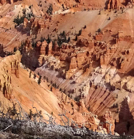
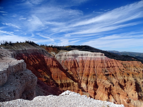
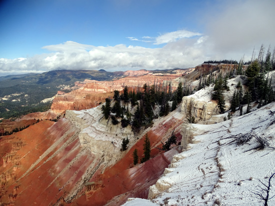
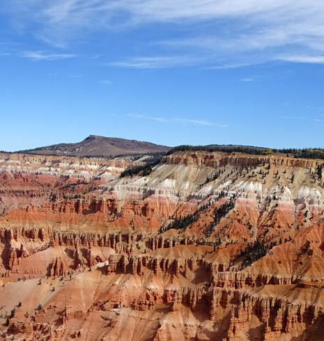
Although the large amphitheater at Cedar Breaks is over three miles
in diameter, it isn't as wide as the main Bryce Amphitheater. However,
it is almost twice as deep as Bryce at 2,000+ feet deep. Millions of
years of deposition, uplift, and erosion have carved this huge bowl in
the steep face on the west side of the Markagunt Plateau.
The Cedar Breaks amphitheater has fewer hoodoos, columns, arches, and
canyons than Bryce Canyon's largest amphitheater. We didn't hike
down into the canyon but we could
see some interesting shapes and lots of vibrant colors of the rocks in the
amphitheater from the overlooks:
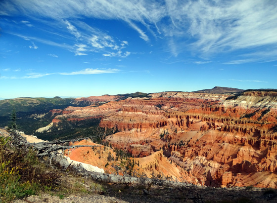
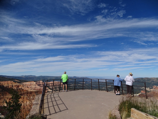
Here are some scenes from the other three overlooks. The first set of
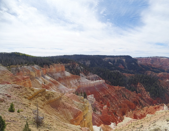
photos is a panoramic sequence from the Sunset View Overlook:
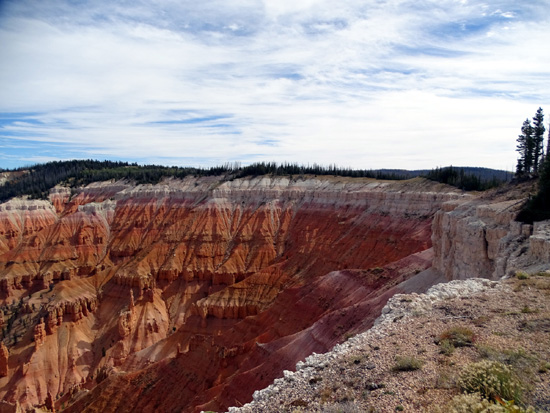
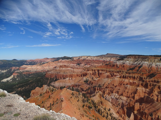
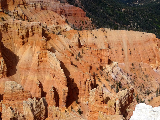
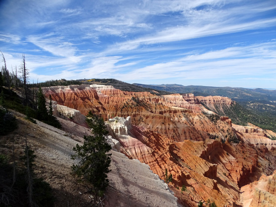
The Chessmen Ridge Overlook has a short walk to the rim and a different
perspective of the amphitheater, also shown in a panoramic sequence.
Aren't the colors pretty? The white rock and soil is not snow in
these photos:
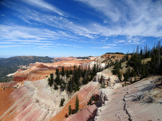
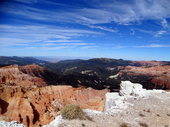
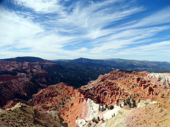
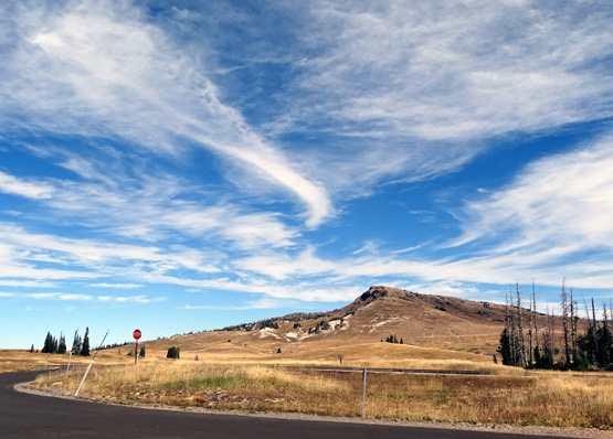
The fourth overlook, North View, is on Scenic Hwy. 143 near Brian Head
Peak. The elevation here is 10,435 feet:
WHAT ELSE TO SEE & DO?
There's more to Cedar Breaks than the signature amphitheater.
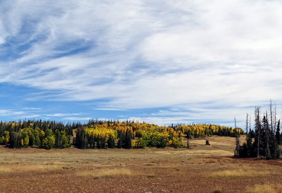
The monument is surrounded by Pike National Forest land with
spruce-fir-aspen forests and large sub-alpine meadows full of grasses
and seasonal wildflowers. The Markagunt Plateau gets significantly more
rain and snow than the desert canyons at lower elevations so it looks
and feels very different.
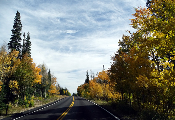
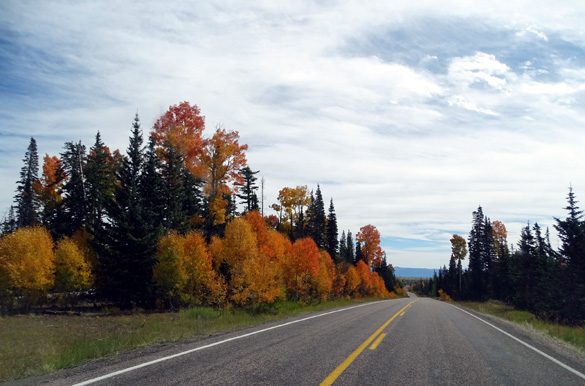
We missed the summer wildflowers at Cedar Breaks but were treated to
colorful displays of yellow, gold, and orange aspen leaves in the
monument along Hwys. 143 and 148:
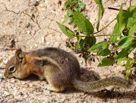
The luxuriant forest retreats and ponds in the high country afford
refuge to an abundance of wildlife that includes all sorts of birds,
small mammals, and larger species like deer, mountain lions, and black bears.
On our two trips through the monument we saw birds, deer, and this
cute little guy:
In addition to driving about six miles through the national monument
and walking out to all the overlooks, visitors can hike on three trails,
ride bikes and horses, camp in the developed campground (open only from
mid-June to mid-September because of the high elevation), picnic, watch
wildlife, participate in seasonal festivals, attend daily ranger
programs and guided hikes, enjoy weekly star-gazing parties, or drive up
to Brian Head Peak, which is located just outside the park.
Visitors can also drive up to Brian Head (the town) in the winter and
snowshoe or cross-country ski on Hwy. 148 when it is closed.

We heard that it doesn't take much snow for the Park
Service to close Hwy. 148 at least temporarily in the spring and fall.
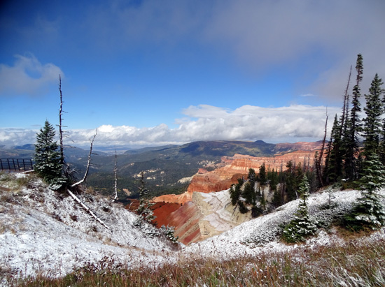
On our second trip to the monument in early October we knew it was
snowing up high on the plateau while it was raining down at our
campground. I wanted to see the Cedar Breaks amphitheater with some snow
on the colorful rocks so we drove from our
campground in Red Canyon to Panguitch, then up Hwy. 143 to Cedar Breaks.
The state keeps that road open all year and we were able to enjoy some
snow on the plateau from about 9,800 to 10,600 feet elevation:
We discovered that Hwy. 148 was open that day so we
drove to a couple of the overlooks and I took some pictures:
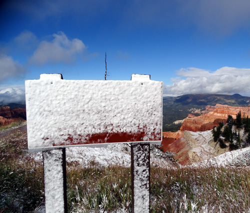
White on white: this time some of the white
color IS snow.
The dogs had fun playing in the snow for a few minutes. I was happy to have a snow fix
and see the colorful rocks with a little snow on them.
BRIAN HEAD PEAK
I got some photos of Brian Head Peak, the highest point on the
Markagunt Plateau at 11,307 feet, but we didn't drive up
to the top until fall of 2016. That's an interesting drive, too. The
three-mile dirt road is closed most of the year because of snow but when
it's dry it's OK to drive in a 2WD passenger vehicle. May as well go see
it, too, while you're in the vicinity.
The peak is visible in the distance in this shot over the rim of the
amphitheater:
This is a closer view of Brian Head Peak from the North View Overlook at
Cedar Breaks:
Cedar Breaks doesn't have as much "wow" factor as Bryce and Zion but
it's a good place to visit if you want a quiet southern Utah canyon experience
without the crowds.
Next entry: day drive to very crowded Zion National Park
Happy trails,
Sue
"Runtrails & Company" - Sue Norwood, Jim O'Neil,
Cody the ultra Lab, and Casey-pup
Previous
Next
© 2015 Sue Norwood and Jim O'Neil
