The various landforms, geologic features, and topography of this
six-million acre park have been shaped over the millennia by many forces
-- shifts in tetonic plates (earthquakes), fire (volcanoes), ice
(glaciers), erosion (weather, wind, water), and gravity.
I've always been just about as fascinated with colorful and/or
unusual rocks and rock formations as I have been with colorful and/or
unusual flowers. Over the years I've taken many photos of rocks
and rock formations that have caught my eye.
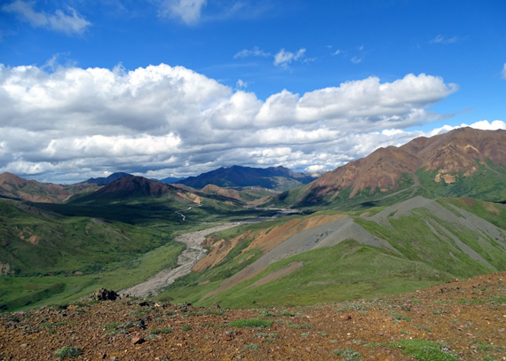
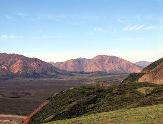
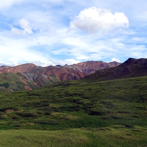
View of colorful mountains from a
mountain ridge above Stony Creek
Although the ones I've admired in Alaska, and specifically Denali
National Park, haven't been as spectacular as those in southern Utah or
northern Arizona, they are special in their own right.
This entry showcases some of the more colorful mountains and
interesting rocks and rock formations we've seen in the park in the last
two weeks.
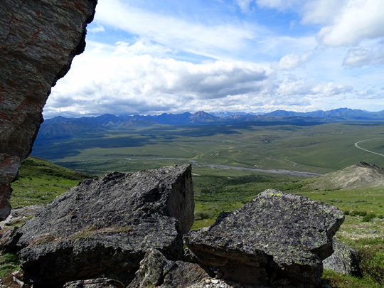
POLYCHROME AREA
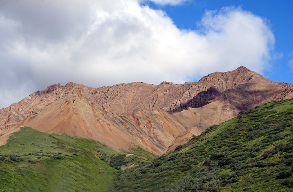
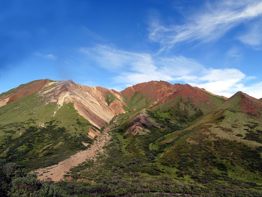
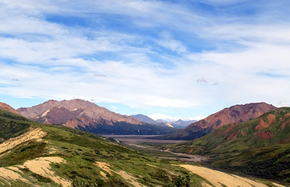
One of the best places to observe colorful rocks in Denali National
Park is the aptly-named Polychrome area between the Toklat River and the
East Fork of the Toklat.
This is about Mile 45-53 on the park road. The buses get right up
next to some colorful slopes and you can see other taller mountains in
the Alaska Range across the broad river plain:
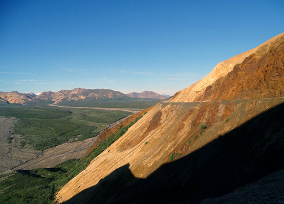
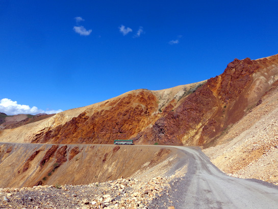
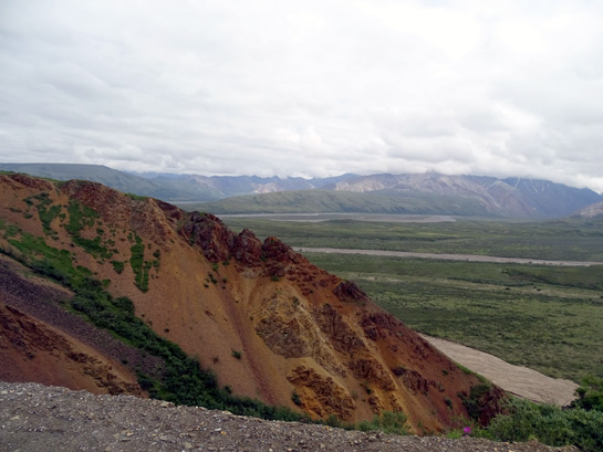
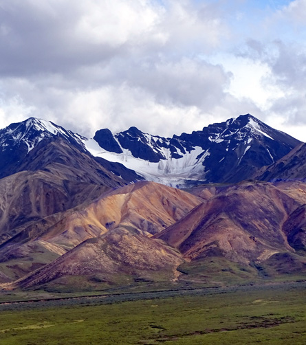
According to the website referenced above, the short but colorful
mountains in this area were formed by molten rock that both hardened and
eroded quickly. The volcanic rock is primarily basalt, rhyolite, and andesite.
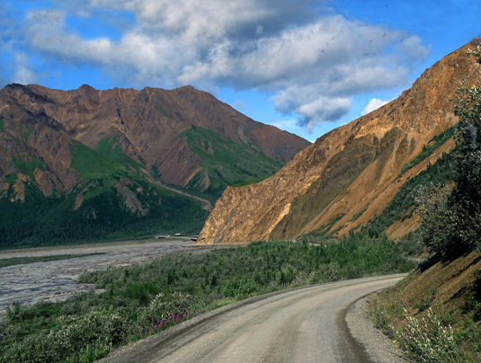
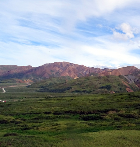
Here are some more photos of the colorful mountains in the Toklat-Polychrome
area that Jim and I have taken in the past two weeks:
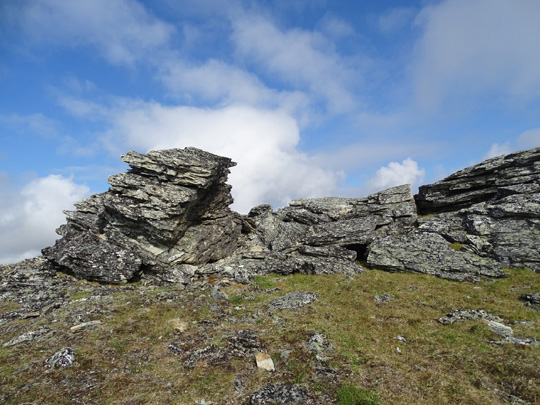
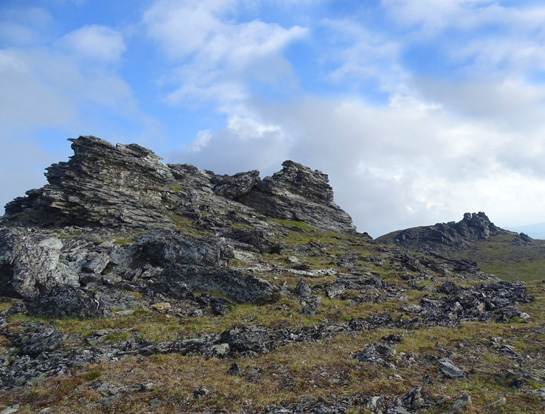
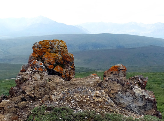
ROCK FORMATIONS
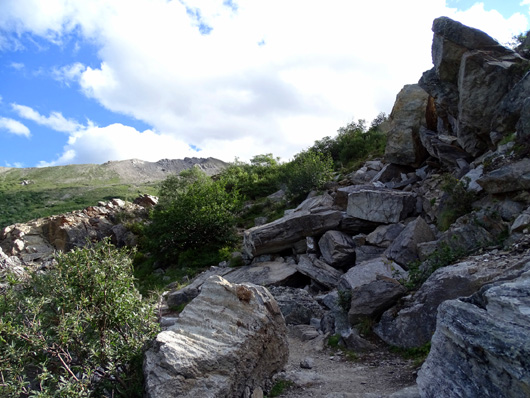
Several of the trails I hiked had large and/or interesting rock formations.
Most of the time the trails skirt these formations. Sometimes,
however, the trail goes right up and over or through them:
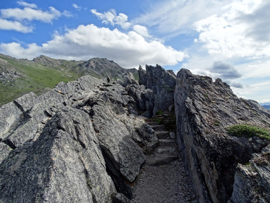
Savage Alpine Trail
Other times you can see little spur trails where hikers have
gone off-trail deliberately to climb the rocks -- just for fun:
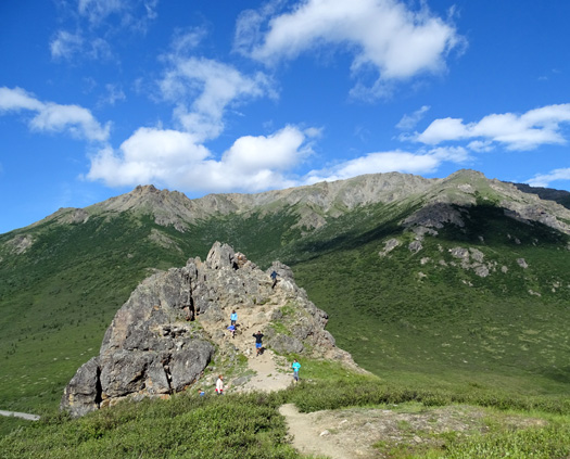
Savage Alpine Trail
I'll feature three trails in this category and show some examples of the
rock formations found there.
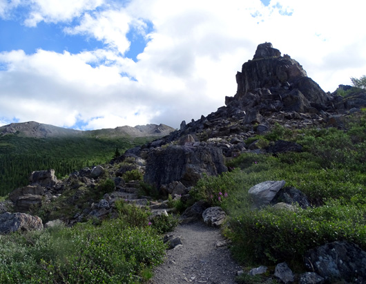
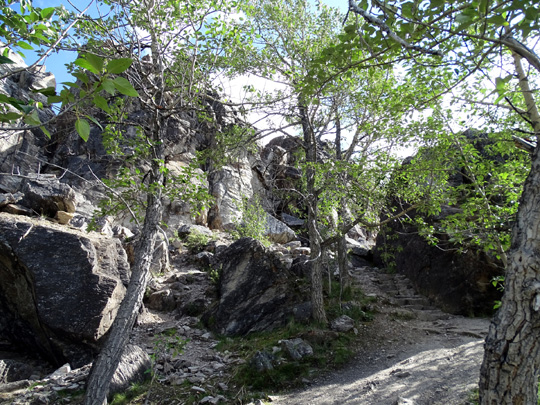
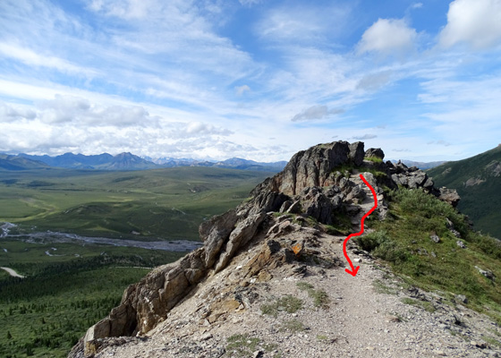
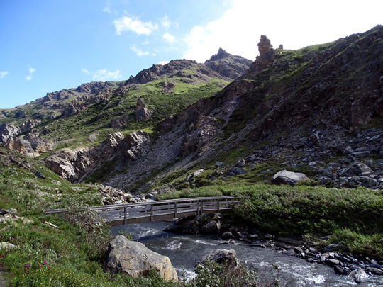
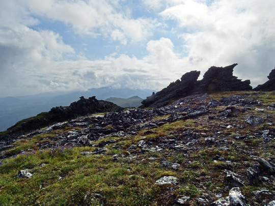
SAVAGE ALPINE TRAIL
I'll start with this one since I already showed two photos from it.
This relatively new, partial-loop
trail
has two trailheads. The rock
formations shown here are close to the trailhead at the Savage River
parking area at Mile 15 on the park road. Visitors are allowed to drive
their own vehicles to this location. The other trailhead is near the
Savage River Campground at about Mile 13 on the park road.
These pictures start near the Savage River trailhead and are in order as you hike
eastbound:
I'll show some colorful individual rocks from this trail later in this
entry.
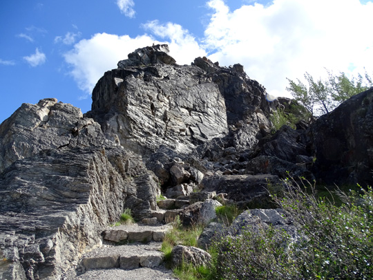
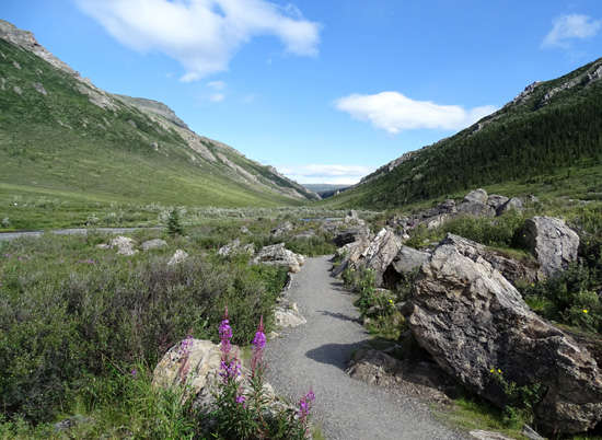
SAVAGE RIVER LOOP TRAIL
Here's another view of the rock formation at the beginning of the Savage
Alpine Trail from the Savage River Loop Trail:
Here are a couple other pictures of rocks and rock formations along the
river loop:
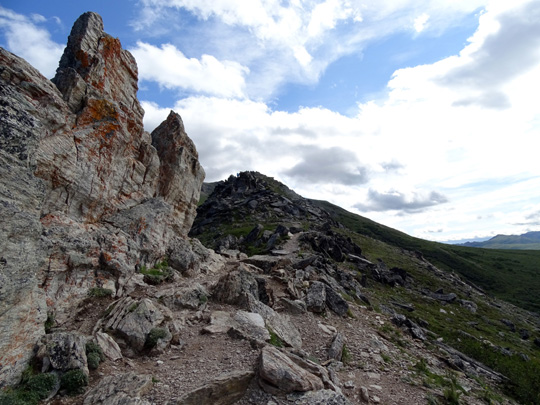
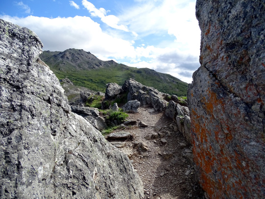
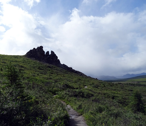
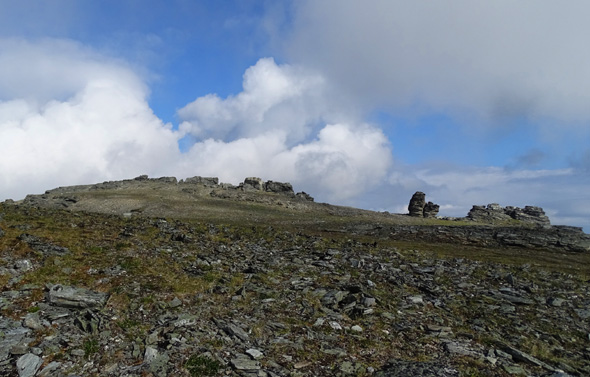
MT. MARGARET
I wrote about this trail in the entry dated
July 25. The only trail I know
of on this mountain that towers above the west side of the Savage River is
only a mile long and begins 2.5 miles up the road past the river.
However, hikers can wander for several more miles through the tundra
on Primrose Ridge and the large, undulating plateau of Mt. Margaret.
There are lots of large rocks to scale, if desired:
Continued on the next page: lots more
really cool rocks!
Happy trails,
Sue
"Runtrails & Company" - Sue Norwood, Jim O'Neil,
Cody the ultra Lab, and Casey-pup
Previous
Next
© 2015 Sue Norwood and Jim O'Neil
