Four miles will only get you point to point, which works if you spot
two vehicles or use the free Savage River shuttle bus in one direction or the other
(or both -- you don't have to drive your own vehicle out there at all).
If you want to close the loop on this hike on foot, you'll
need to walk another 2+ miles along the park road.
I chose this option for a total distance of seven
miles -- or a little less if you get off the bus or park your own
vehicle on the east side of the
river in the first parking area you see:
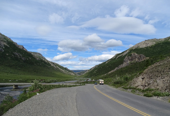
This is the end of the line for
most private vehicles -- the parking area at Savage River.
The alpine trailhead is to the
right beyond the parking lot and goes up past that rock formation.
I was curious to see this newly-completed trail because it was only
about a mile long when we were here three years ago.
The trail began at the Savage River parking area, 15 miles back the park road.
The trail rather steeply ascended the cliffs on the east side of the river, then leveled
out and disappeared in a wide alpine cirque. I had fun exploring the tundra
off-trail back then, but wanted to see
where the new 3+ miles of trail would lead me now.
WIND-BLOWN BUT PERSISTENT
Except for the wind, today's sunny, warm weather was great for being
outdoors at Denali National Park.
During Jim's bike ride and my hike we
had gusts that were probably as high as 50 MPH and sustained winds of
30-40 MPH. Jim rode out on the park road from Savage River (Mile 15) to the Teklanika
AKA "Tek" River CG
(Mile 29) and back, plus some more toward the entrance until he decided
to return to the truck we had parked at Savage River.
Outbound Jim had mostly cross and
tailwinds. On the return he was really fighting the wind.
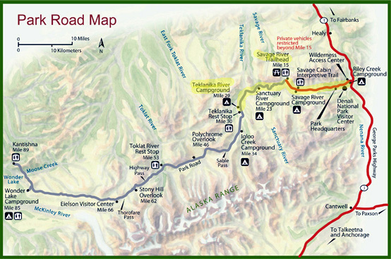
The map shows how far we drove
(highlighted red road to Savage River). Jim continued out to
Teklanika River CG on his bike
and back to Savage River. My hike was near that river.
I was fighting headwinds, too, going
clockwise on the new Savage Alpine Trail loop. There were times up in
the tundra and on ridges where I had trouble standing upright, even with
two trekking poles to help with stability. It was that strong.
We left Riley Creek CG about 9:45 AM to drive our truck out to the
Savage River parking area.
We had partial views of Denali on the way to
Savage River and on high places in the road beyond that where Jim was
cycling. He took the next picture several miles beyond the river:
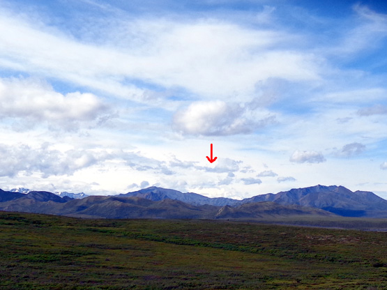
I could also see Denali off and on from ridges where I hiked but the
mountain was mostly under clouds today:
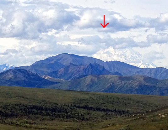
Since I knew where it is in relation to nearby mountains, I was able to
tell some other hikers where to look. The white snow on Denali looks
different than white clouds.
JIM'S BIKE RIDE
We parked on the far side of Savage River so Jim
wouldn't have to cross the bridge in the wind. That added a bit more
than half a mile to
my hike, which was OK.
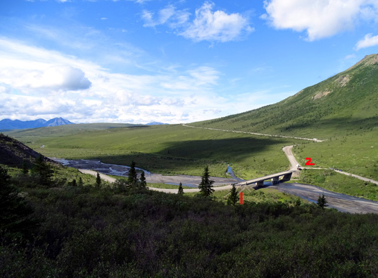
There are
two parking areas at Savage River -- #1 on the trailhead side (not
visible in this photo
taken
partway up the ridge) and #2 on the other side of the bridge past the
rangers' checkpoint.
Jim's main concern about riding on the park road was traffic, with all
the shuttle and tour buses coming and going. Rangers make sure no
private vehicles, with a few exceptions, go beyond the river.
Fortunately the
buses, the RVs coming and going to the Teklanka River CG, and some large
construction trucks were not a major challenge for Jim. He said all the
drivers were courteous and slowed down when they passed him.
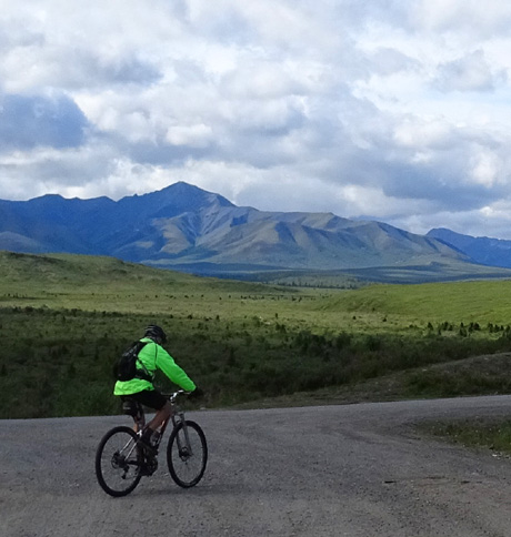
The start of Jim's ride at Savage River; past the
river the road is not paved.
Jim's main problem was the wind. He rode a total of 33 miles before
getting so tired of the wind that he packed it in. He would have done
another 12 miles if he'd returned on the bike to the CG as he
originally planned.
He didn't take any photos besides a couple of Denali and he didn't see any large critters along the
way. That was a disappointment to him. In 2012 we almost always saw one
of the "Big Five" Denali favorite animals along the road when we were hiking,
biking, or riding the buses. (The
Big Five are grizzly bears, moose,
caribou, Dall sheep, and wolves.)
Since we'll be going out to Tek soon to camp Jim rode through the
campground to refresh his memory of the sites and the location of the
water spigots.
SUE'S ALPINE HIKE
I'm pretty sure I had more fun on my hike than
Jim did on his bike ride. Wind is less of a challenge when hiking than
cycling.
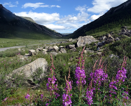
There are two established trails that visitors can access from the
parking areas at Savage River.
One is a two-mile loop trail along both sides of the river (photo
above), with a foot bridge at the far end.
It was closed yesterday because a bear killed a moose or caribou calf
but it was reopened this morning. I did that trail several times in 2012
so my goal today was to hike the new section of the Savage Alpine Trail.
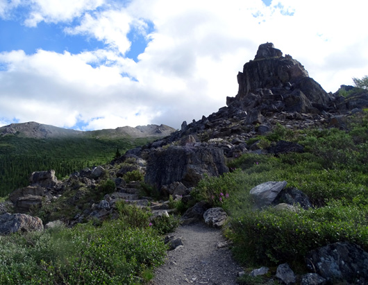
The Alpine Trail
goes steeply up the mountain to the east of the river, across a
rocky ridge, and into a high cirque (large bowl-shaped area) in the tundra.
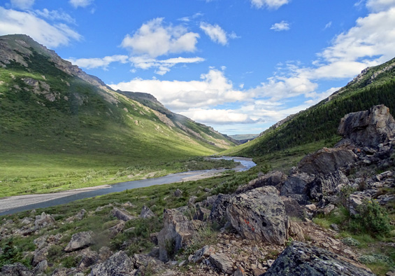
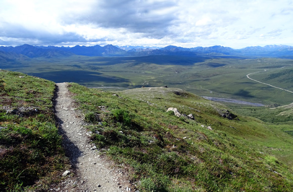
Looking back toward the river from part of the
rocky ridge
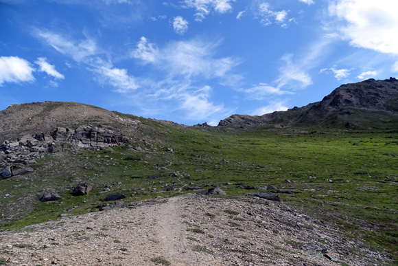
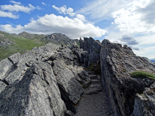
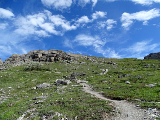
Looking up toward the cirque in the tundra
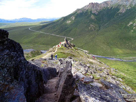
The trail used to simply disappear near the middle of the picture above. The
last time we were here I continued hiking up into the tundra cross-country
to a higher ridge so I could look over it to the north, where I could see
some different mountains and canyons.
At that time trail crews
were just beginning to work on another three miles that continue through
the cirque, over another ridge to the southeast, and down to the Savage
River CG area.
Today I got to see
the results of their efforts. Most of the trail is smooth and I loved
seeing new views.
I hiked the loop clockwise, starting with the steep, rocky section by
the river. It's easier on my bum knees to go up than down steep trails.
I didn't know what the last part of the new trail would be like but I
figured it couldn't be any more difficult for me to descend than where I
went up.
Luckily, I was right -- the last two miles, which basically go
downhill, were much more gradual, with many fewer rocks, than the
spiny western part of the trail above the river:
Folks who prefer a more gradual ascent and can handle a steep descent
might prefer going counter-clockwise on this loop.
The downside of going clockwise today was the wind, because I had a
headwind much of the time. It was so strong on the ridges and
through the large exposed cirque that I had trouble walking. Even my
lightweight trekking poles were blowing in the wind!
But the trail is easy to follow and the views were great, even as the
clouds increased during the afternoon. I love this trail and will
probably do it again next week or at the end of August when we come back
a second time.
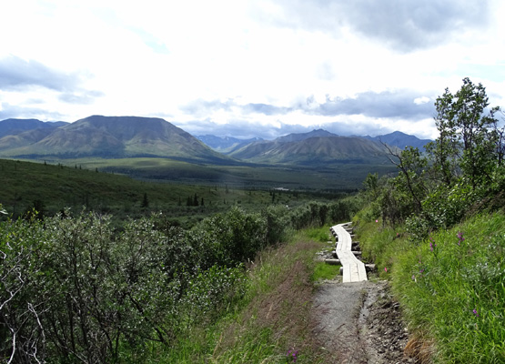
Part of the new trail
is either still a work in progress or some repair work was being done in
a wet area.
About 15 volunteers, some retired and some college age, were working on
a long section of bog boarding about a mile from the east end of the trail.
They had to haul their supplies, including boards and rocks, in wheelbarrows
and in large canvas back packs.
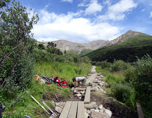
I talked with most of them and thanked them for their hard work. They
are with an organization called
Wilderness Volunteers and they spend a week at various
locations around the country, building and maintaining trails.
I talked to several hikers along the way, too. One group of four was
heading up from the east (Savage River CG end) and wondered if they
should continue. I described the trail and the views and encouraged them
to continue because they looked fit and were dressed for the weather
conditions.
I saw them again when I was almost back to the river and they
thanked me -- they really enjoyed it.
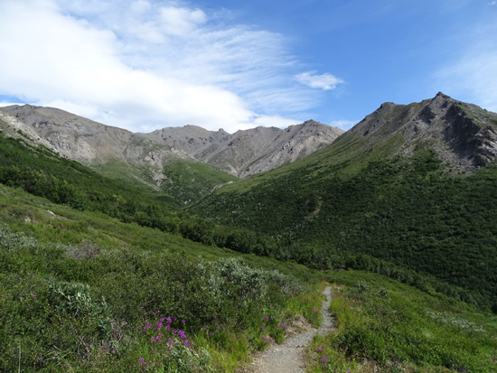
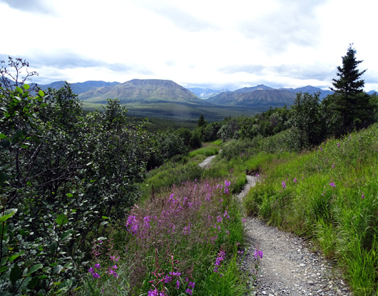
MORE SCENES ALONG THE TRAIL LOOP
Although the trail starts at a lower elevation at the river (west end)
it is out of the brush and trees in about 1/4 mile because it gains
elevation so fast through two sections of rocky cliffs:
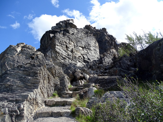
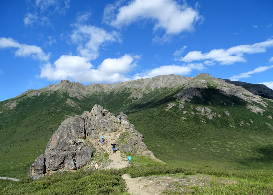
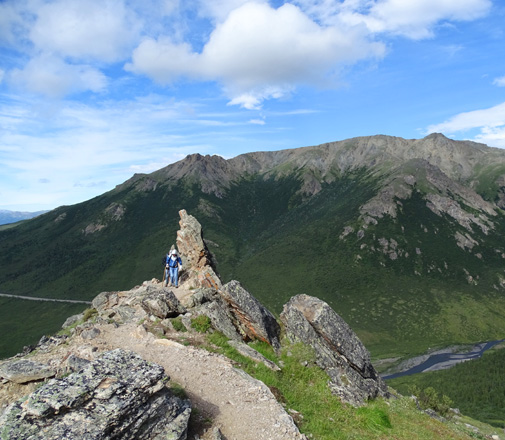
Looking back to the first rocky prominence, which
some folks like to climb;
Mt. Margaret is in background and across the river.
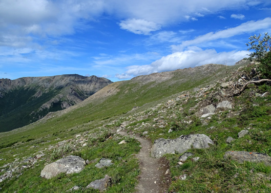
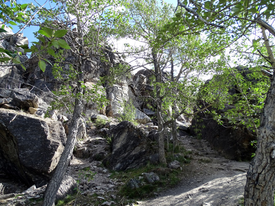
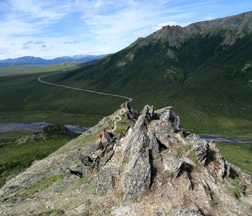
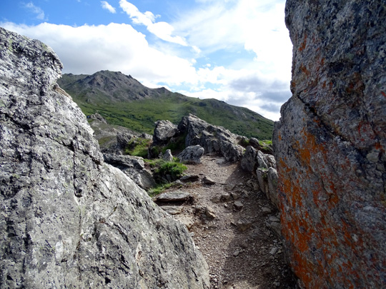
The mostly-rough trail continues to climb rather steeply to a rocky
ridge that is fun to negotiate:
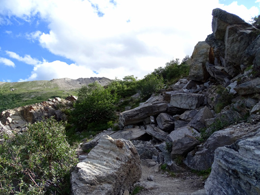
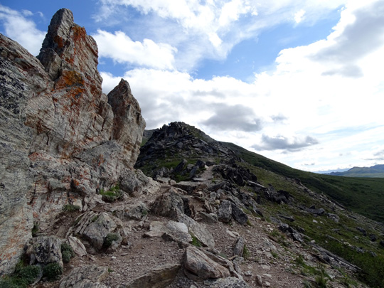
The trail along the ridge is narrow in some places, with long drop-offs.
If you're afraid of heights, don't look down or back.
I came up on one woman (about where the people are located in the next
photo below) who refused to continue along the ridge because there
wasn't a "wall" to protect her on one side. Her husband's efforts to
nudge her forward were futile and they both descended back to the river.
Good thing she wasn't going the other direction!
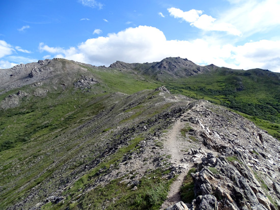
The trail continues rolling through some more rocks and across a pass
toward the large cirque on the slope to the north:
Continued on the next page: photos from the second half of
the hike + critters and flowers seen along the way
Happy trails,
Sue
"Runtrails & Company" - Sue Norwood, Jim O'Neil,
Cody the ultra Lab, and Casey-pup
Previous
Next
© 2015 Sue Norwood and Jim O'Neil
