Denali is one of the few parks in this country
where visitors are actually encouraged to hike off-trail. It's
fun and it's easy, especially in the tundra where you can see where
you've been and where you're going and have little chance of getting lost.
The Savage Alpine Loop is one of my favorite
hikes in Denali National Park. I've experienced it both on and off-trail.
I hiked the trail a mile up from the Savage River
in 2012 and wandered around the tundra but most of the loop was still a
work in progress then. I was happy to be able to complete the loop on
the new trail this past
July.
I enjoyed it so much that I really wanted to
share it with Jim. He was game to try it today if the weather
cooperated.
As you can see, it did.
Although the morning began with lots of clouds at the campground near
the park entrance we decided to go on out to Savage River and see what
the weather was doing there.
As we've discovered previously, that was a good plan because it was
sunnier out there and got better and better as the day wore on. There
are so many micro-climates in this huge park that it's likely to be
quite nice just a few miles from where you are if you're in rain or clouds.
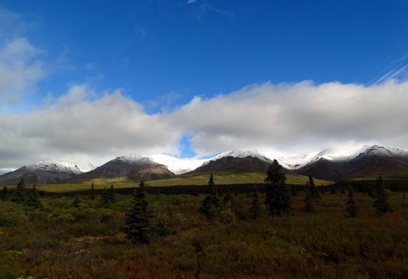
More blue sky and fresh snow on low peaks on the way to Savage River
this morning
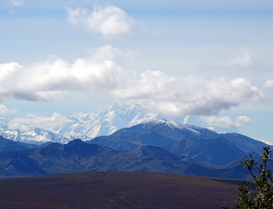
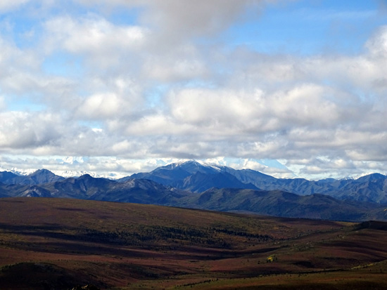
Our only
disappointment was not getting to see Denali completely "out."
We got views of Denali's lower snow-covered slopes during most of our
hike but never could see the north and south peaks clearly:
Although it was
cooler again today than average --
37 F. overnight at Riley Campground and only 55 F. in the afternoon
-- we stayed warm in the sunshine during our hike. There was some
wind on the exposed slopes but not nearly as bad as the gusts I
encountered last month on this trail.
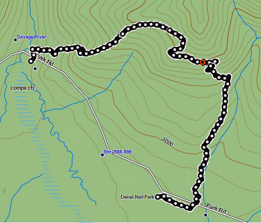
ABOUT THIS TRAIL
The Savage Alpine Loop Trail is
advertised as 4+ miles in length from
the Savage River parking area at Mile 15
to the Savage River Campground at Mile 13 on the park road, or vice versa.
That distance doesn't close the loop, though. No
matter the direction you hike the "loop" (more of an arc, actually), you
end up a couple miles from where you started, as you can see from our
GPS track below:
 .
.
There are several ways to close the loop besides
spotting two vehicles, which isn't practical for most park visitors.
In July, I parked our truck on the other side of the river,
hiked clockwise, and walked along
the road at the end, for a total distance of about seven miles. I was
hoping to be able to see some moose, caribou, or other large critters in
the wide gravel riverbed during the road walk but didn't see any wildlife.
Another option is to drive your own vehicle to
either end of the trail and use the
free Savage River shuttle bus. It conveniently stops at both ends of
the loop so you can hike in either direction and get on or off either at the
beginning or end of your hike.
Or you can leave your vehicle at the entrance
area and use the shuttle bus the whole way. Just get off where you want
to begin the hike and get back on when you're done. Easy peasy.
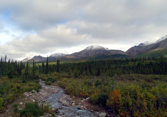
Stream and
snow-frosted peaks along the park road to Savage River this morning
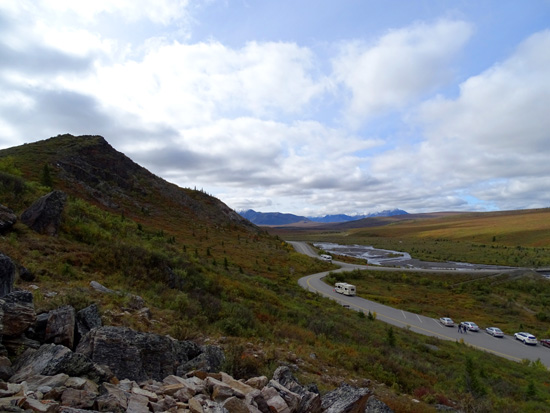
Our choice this morning was to park our truck near the
Savage Campground shuttle stop. We arrived just in time to take the
free shuttle bus two miles farther to the Savage River, where we began
our hike.
That way we could walk clockwise on the loop, doing the steeper climb
through the rocks and rock ridge above the river first. Not only is that
the easier way on our knees (it is more gradual down to the campground
at Mile 13 than down to the river at Mile 15), but we were also glad to
have the truck at the end of our hike instead of having to wait for a
bus then.
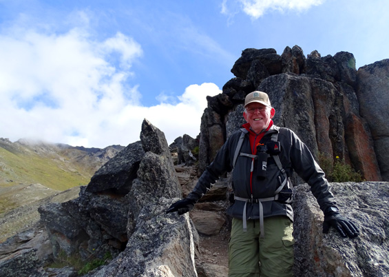
ASCENT FROM THE SAVAGE RIVER
Jim hasn't gone up this trail previously through the various rock
formations so I was curious if he'd find it as much fun as I do. He did!
Here are some scenes from the rocky ascent to the
tundra:
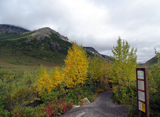
Some fall color at the trailhead
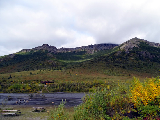
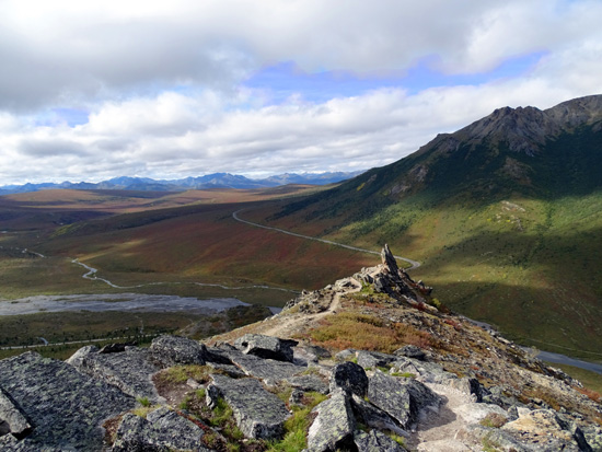
West toward the Savage River and Mt. Margaret
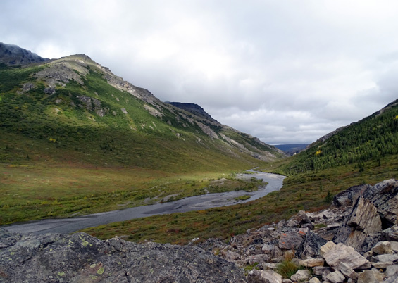
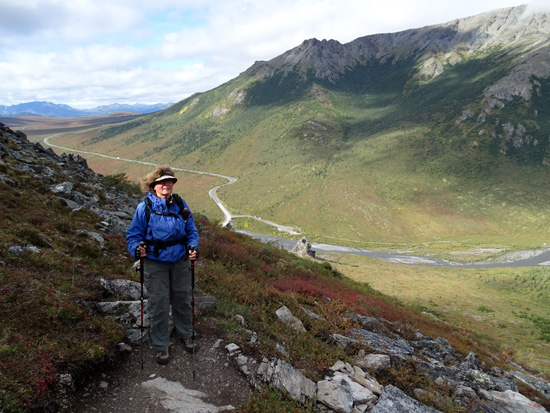
North along the river
South to the park road, one of two parking areas,
and the river upstream
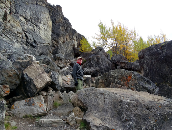
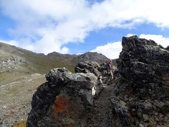
Jim pauses to look around in the first rock
formation area.
The narrow trail switchbacks up this slope through
rocks and some smoother spots.
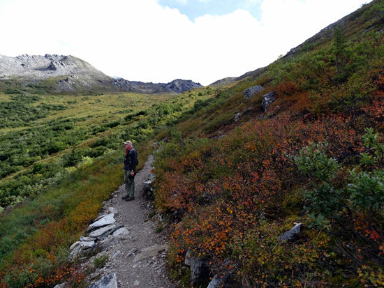
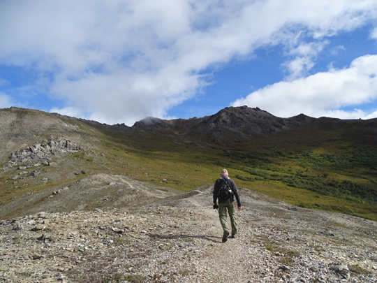
At this elevation the tundra isn't as bright red
yet as it was three years ago but it's getting there . . .
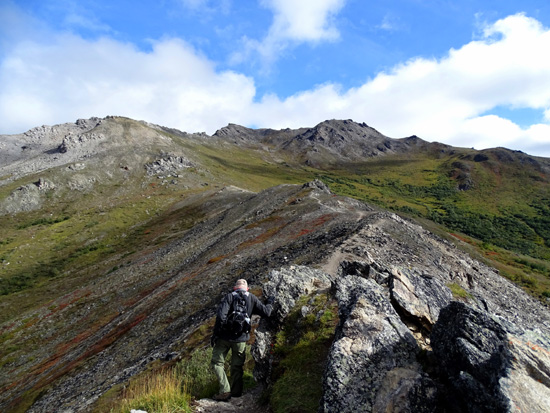
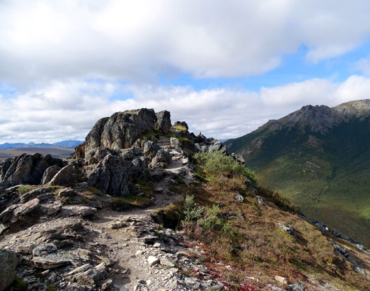
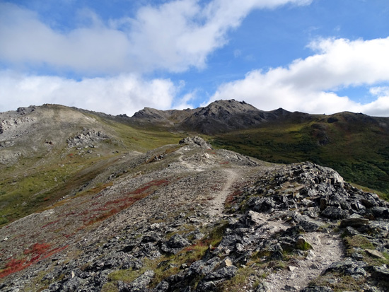
Once at the top of the switchbacks the trail undulates over a ridge and
through some other cool rock formations that are like the jagged spine
of some giant creature:
Looking back = the view if you hike the other
direction.
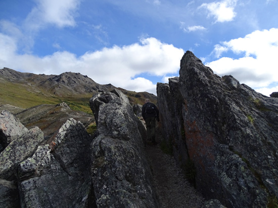
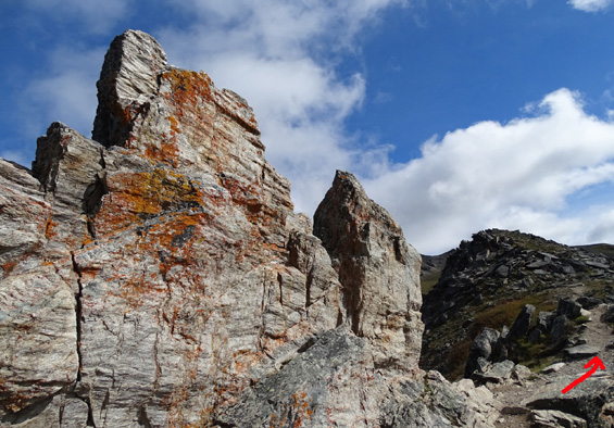
First of two "slots;" you have to kind of lean to
get through this one!
Jim follows the trail around the side of these rocks.
Looking back
A few more rocks ahead
The second slot is a little wider.
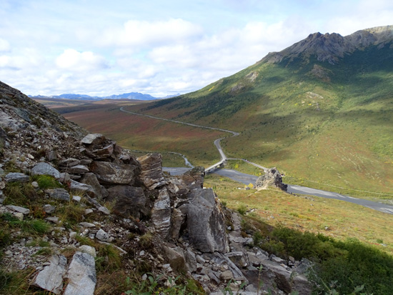
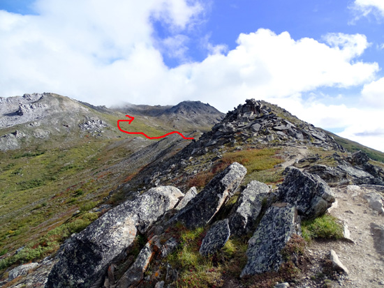
Almost through the rocks and across the saddle AKA
pass
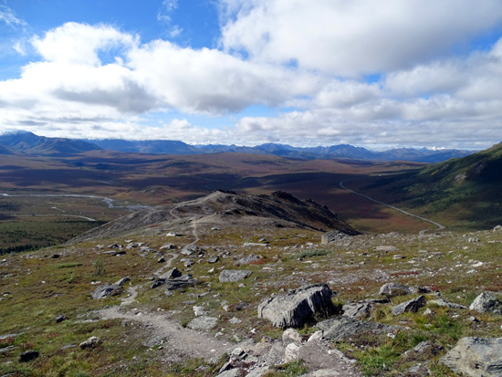
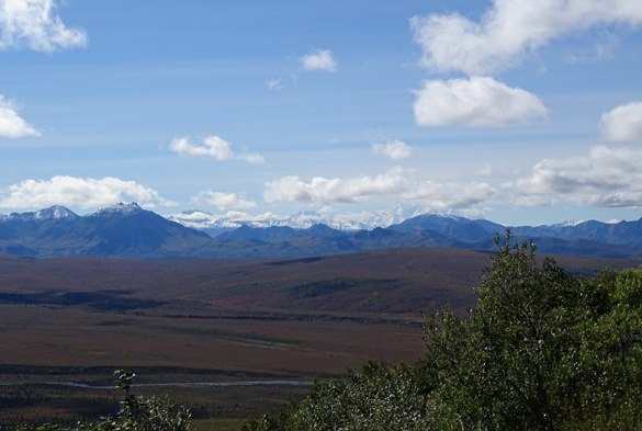
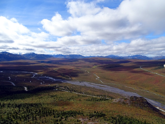
Looking back from the tundra to the SW toward the
Alaska Range and Denali
Denali's upper slopes and peaks are mostly hidden
under the clouds.
Continued on the next page: scenes from the last
three miles through the tundra and down to the road
Happy trails,
Sue
"Runtrails & Company" - Sue Norwood, Jim O'Neil,
Cody the ultra Lab, and Casey-pup
Previous
Next
© 2015 Sue Norwood and Jim O'Neil
