Continued from the previous page.
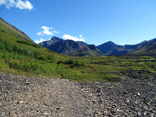
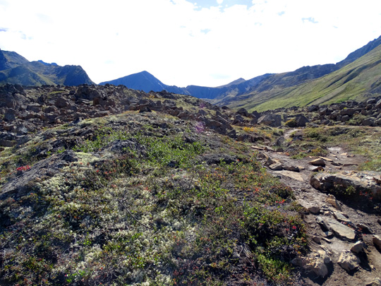
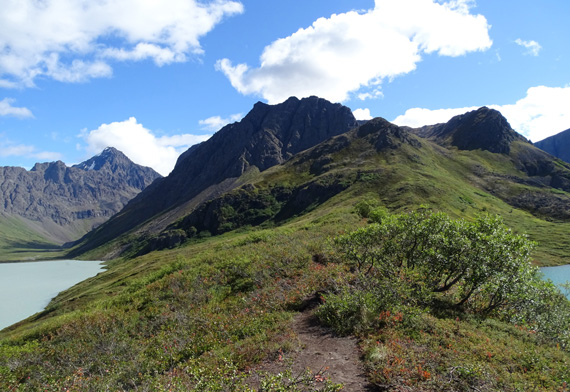
The trail
gets more rocky as it nears the outlet for Eagle Lake. From this gravel
bed you can begin to see the moraine full of boulders
at the north end of the lakes:
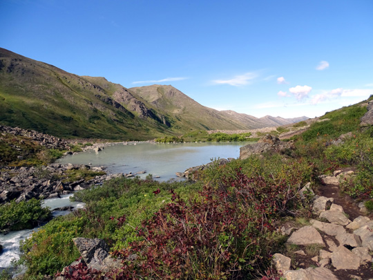
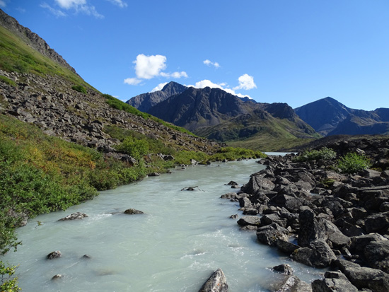
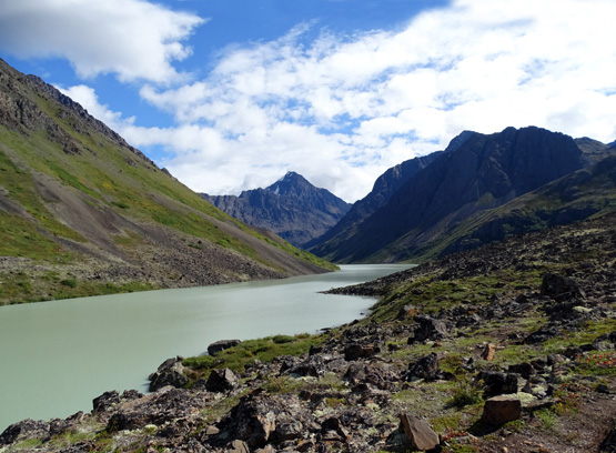
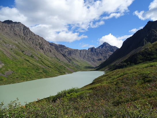
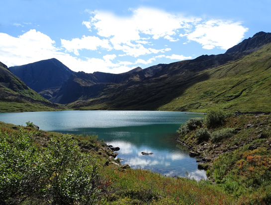
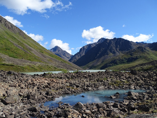
Soon I could see this pretty turquoise-colored pond, which I've dubbed
Eagle II.
From what I'd read
I knew it wasn't Eagle Lake itself, which is long and linear. It's a pond at
the outlet of Eagle Lake but in a photo at the trailhead it's
identified as Eagle Lake:
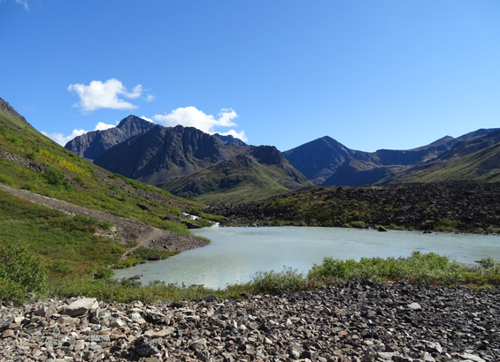
I think the pond is as photogenic as the lake.
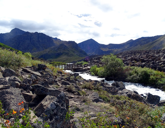
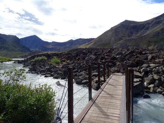
The trail continues right along the left side of the pond and outlet
creek, over another rocky slope, past a large boulder, and comes to a
bridge across the creek:
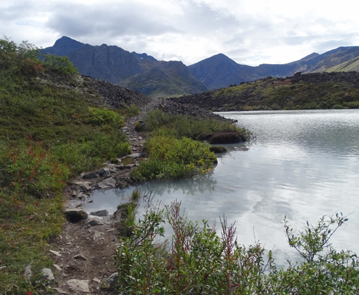
This is probably more flooded in early summer when
more snow is melting.
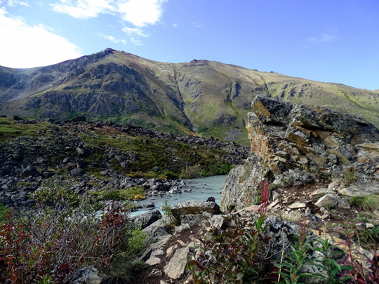
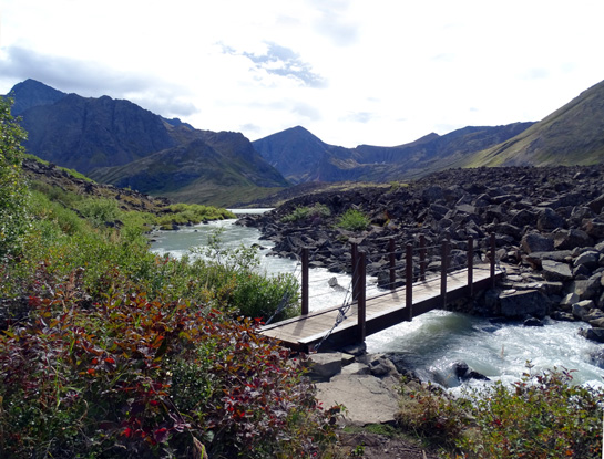
The bridge near the north end of Eagle Lake crosses the rushing flow of
turquoise glacial water through the outlet and dumps hikers into the
boulder field:
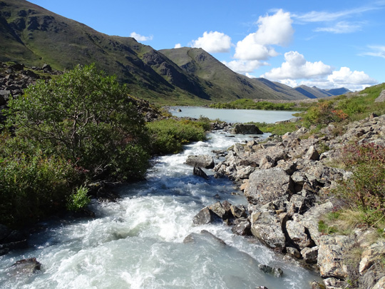
View of outlet creek downstream toward the pond
More sunny afternoon view of outlet creek to the
south, toward Eagle Lake
THE
DEVIL'S PLAYGROUND?
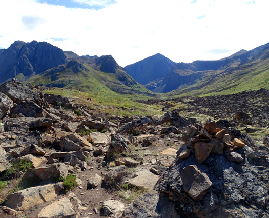
Ah, the boulder field! It's the work of the devil, I'd say. Or, less
dramatically, the moraine left by a retreating glacier . . .
Whatever, it's very difficult to negotiate, at least for an older woman
with lousy balance and arthritic joints. Supposedly there is a "trail"
through the rocks but for a solo hiker of any age in the boulder field for
the first time, the "trail" is neither obvious nor intuitive:
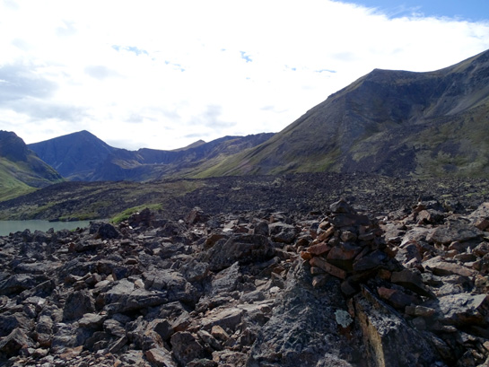
There's a cairn, but where is the "trail?"
The largest boulders are near the bridge. Even though the rocks tend to
get gradually smaller, they weren't any easier for me to negotiate
safely. I spent a long time
trying to follow the maze of cairns and "trails" through the rocks. It
was a relief when I finally got through the worst of them.
It's a miracle that I didn't slip, fall, or twist
an ankle through the boulder field. It took a tremendous amount of concentration and
a very slow pace in and out of that mess of rocks for more than half a mile to the
high dirt/rock divide between the lakes.
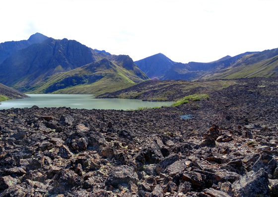
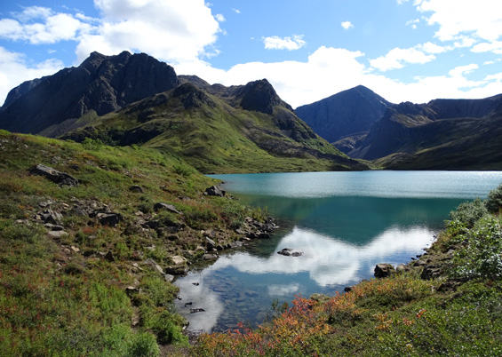
Eagle Lake
(turquoise color from glacial silt) and a little puddle from rain (blue)
Above and
below: almost to Symphony Lake, to the right of Eagle Lake going
outbound
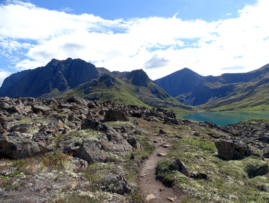
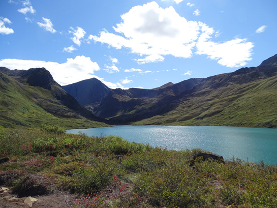
There it is! Pretty blue Symphony Lake is on the
right, the green hump between the lakes to the left.
I could see Eagle Lake from most of the boulder field but had to get
over several false summits and small ridges to see Symphony Lake. There was more
dirt to walk on as I approached Symphony -- but still a maze of trails.
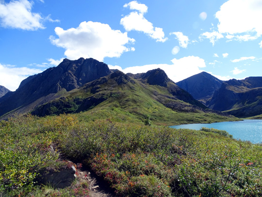
ALPINE JEWELS
The two pretty lakes were long ago separated by a landslide, which I walked
across:
It's pretty fascinating to see the
two different colors of lakes at the same time from "the land between,"
although I captured only a little bit of Symphony Lake's color on the
right in the next photo:
Eagle Lake appeared more
cement-colored today at ground level than the bright turquoise I've seen from up on
Rendezvous Ridge:
I like rounder, smaller Symphony Lake (45 A., per my GPS track) better
than longer, more linear Eagle Lake (124 A.), mostly because of Symphony's
prettier blue color:
I spent about half an hour wandering along Symphony's shoreline,
enjoying the views and wildflowers.
Both scenic alpine lakes, surrounded by mountains and glaciers, are
stunning either from their shorelines or from high places like
Rendezvous Ridge or any of the nearby peaks.
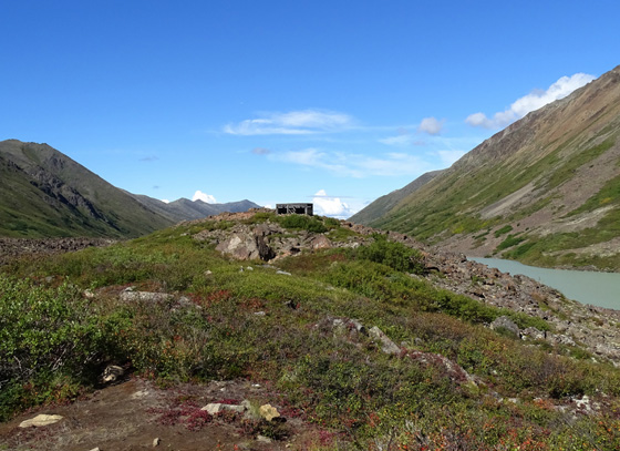
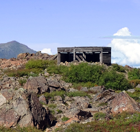
There is something else interesting to examine in the rocks between the
two lakes -- an old dilapidated wooden structure with different
origins I've read (former homesteader's cabin, or one used by scientists
and/or forest rangers studying
the area). Park officials don't want folks staying in it overnight
but it might provide a bit of shelter if hikers are caught out in a
storm:
SCENES FROM THE RETURN TO THE TRAILHEAD
When it was time to go I returned to the bridge over all the rocks on a
route closer to Eagle Lake. That was easier than my outbound route
trying to follow the "trail."
No one else was at the lakes until I was most of the way back to the little
bridge over the outlet of Eagle Lake. All of a sudden four groups of people
arrived and took different routes over the rocky moraine (nine total,
with two dogs). I saw only three people outbound and 23 on my way back.
I didn't see any wildlife except those ubiquitous (and cute) arctic
ground squirrels, doggone it. I went through perfectly good
habitat for moose, bears, and marmots through the valley and Dall sheep
up on the rocky hillsides. When I was editing my photos I zoomed in on
ones I thought might show sheep on mountainsides but, alas, they were
just rocks.
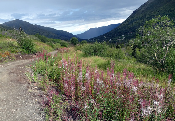
Almost all of the fireweeds have stopped blooming in this valley. Some have silky
seeds and most have bright red leaves now, their last stages before
winter arrives.
I did a total of 11.72 miles in 6:23 hours. I took tons of
photos. The light was better on the return because I was facing the sun
in the late morning as I headed to the end of the valley.
Elevations ranged from 1,847 to 2,641 feet with a total gain and loss of 3,228
feet. There was nothing steep, so it's a fairly easy trail for most
kids, adults, and dogs to hike -- until you reach the boulder
field!
I wish I'd discovered this trail earlier in the summer because I'd
like to have gone up the Hanging Valley Trail to see the "surprise"
hidden lake (tarn) at the end. It's too late to do any more hikes here
now because we're leaving Anchorage soon.
Next entry: back to Denali National Park
Happy trails,
Sue
"Runtrails & Company" - Sue Norwood, Jim O'Neil,
Cody the ultra Lab, and Casey-pup
Previous
Next
© 2015 Sue Norwood and Jim O'Neil
