It was sunny when we got up, so Jim and I both decided to do some major
exercise today. As we left about 9:45 AM it was sprinkling . . . but
fortunately, that soon stopped and it was mostly sunny again for the rest
of the day.
Jim rode his bike from JBER to the air museum downtown, which we first
visited in 2012, and on the Coastal Trail for a total of 38 miles.
I chose to do a scenic 12-mile hike that's new to me -- the South
Fork Eagle River Trail to Eagle and Symphony Lakes, which I've seen several
times from Rendezvous Ridge. I took the next three pictures of the valley
and lakes from the ridge in July and August of 2012:
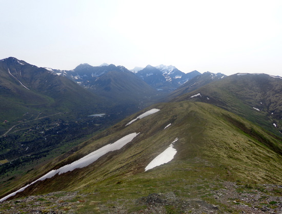
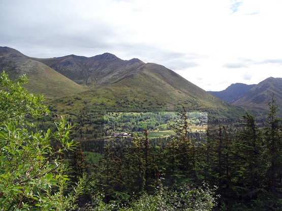
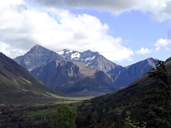
This view
of the South Fork Eagle River valley shows some of the houses and a
closer lake
on private
property. Eagle and Symphony Lakes are at the far end of the
valley.

Eagle Lake is on the left, Symphony on the right.
A rather steep trail goes down from the south end of the ridge to the
river trail:
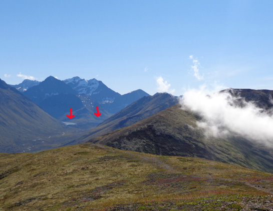
The arrows mark Eagle and Symphony Lakes in the distancve. I've never gone down
that trail to the valley because it's a very long way
from the Arctic Valley trailhead I've always used to reach Rendezvous
Ridge -- and I'd have to come back up it on the return.
There are several options for other hikes along the South Fork Eagle
River trail, such as the Hanging Valley Trail, Hunter Pass Trail, access
trail to Rendezvous Ridge,
and smaller paths to mountains and glaciers at the end of the valley. I
didn't have the time or energy to do any of those other spur trails today.
This map from
AlaskaHikeSearch.com shows some of the
trail options. I marked today's route in orange:
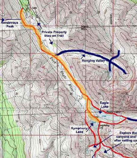
I couldn't get the whole map on here so click on the link if you want to
see the other trail options. The trails up to Hunter Pass and Rendezvous
Ridge aren't shown on this map.
You can see another more detailed topo map on the Chugach State Park
web page re: the South Fork
Eagle River Trail.
It was interesting to go back almost six miles into the valley to see the
two lakes close up, especially since the color of the water in the
adjacent lakes is different -- Eagle Lake is more of an aqua green from
glacial silt while Symphony Lake is deeper blue and more clear from snowmelt and
rainfall. I'll show several pictures of both lakes later in this entry.
I've only seen the far end of the valley from up on Rendezvous Ridge
during four or five previous hikes.
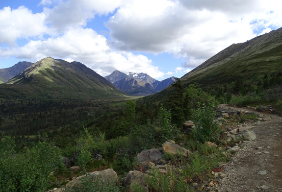
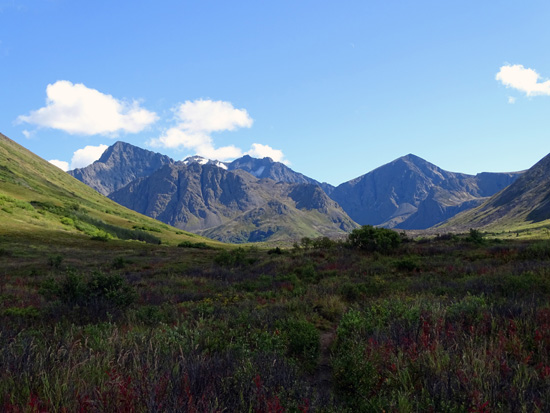
It was also interesting to get a different perspective of Rendezvous Ridge,
including Gordon-Lyon, Rendezvous, and Little Teton peaks, from the
valley below:
View of Rendezvous Ridge from about 3 miles out the
S. Eagle River Trail;
Mt. Gordon-Lyon is the pointed peak in the far
distance.
PHOTOS OUTBOUND ON THE TRAIL
The trailhead is about eight miles back Hiland Drive, a windy, curvy
paved road that's fun to drive.
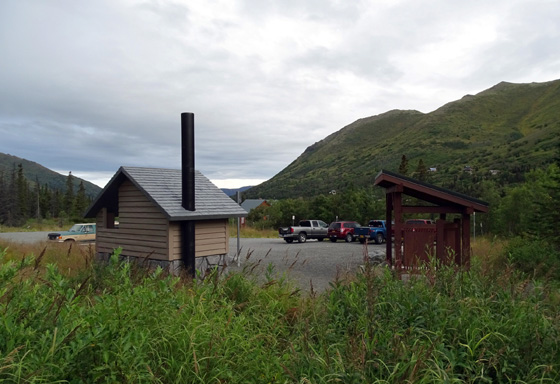
The parking lot, which is in a residential neighborhood, holds about
twenty vehicles and reportedly fills up very quickly on weekend
mornings. There were only four other vehicles there when I arrived (next
photo) and a lot more when I got back.
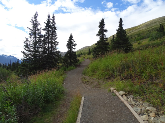
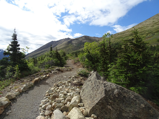
The first 2.3 miles to the bridge over the river are wide and pretty
smooth, part of a controversial remodel of the trail several years ago
(neighbors wanted it to stay more rugged and unappealing). Bikes aren't
allowed on the trail, just pedestrians, dogs, and horses.
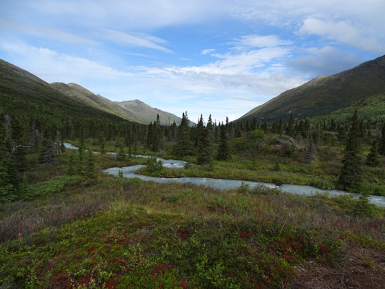
The trail goes up from the parking lot, undulates along the
mountainside for a couple miles, then drops to the river after passing the intersections
with the trails up to Hunter Pass and Rendezvous Ridge.
The next set of
photos shows some scenes from the trailhead to the bridge over the
river. Some are from this morning, some from this afternoon when there
were fewer clouds. Most show the view outbound (south) toward the
lake end of the valley:
This is the last house below the trail. I
love the lake; it's shown in one of the
photos above that I took from Rendezvous Ridge.
What an idyllic setting!
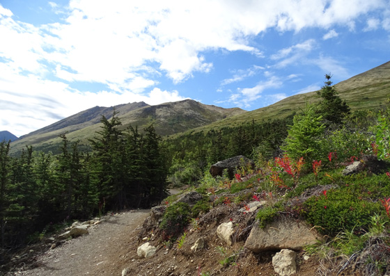
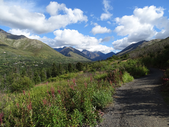
Above and below: You can see more of the
glaciers from several miles out
than you can near the lakes at the end of the
valley.
Mountains in the background are Hurdygurdy, Eagle, Cantata, and Calliope,
all approximately 6,000 feet high. There are some glaciers,
including Fluke, that drain into Eagle Lake to
the left.
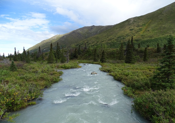
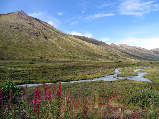
You can see the river from the trail for a couple miles before you drop
down to it
 .
.
A sturdy bridge crosses the river. The water comes from both lakes,
a combination of the glacial silt-laden grayish turquoise water from Eagle
Lake and clear snowmelt-rain water from Symphony Lake.
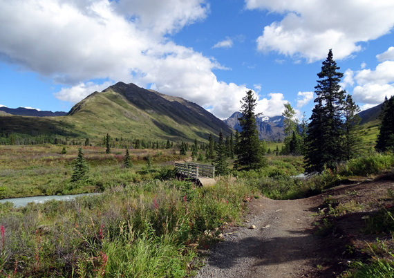
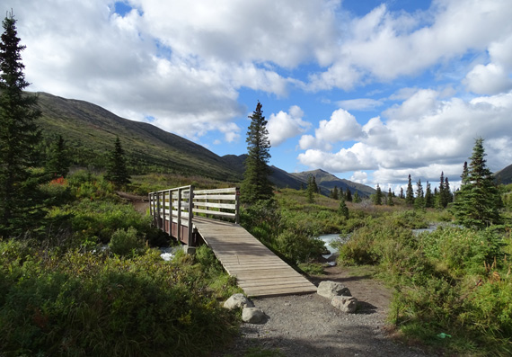
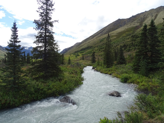
The river still looks more like a creek here;
above = upstream/south and below = downstream./north.
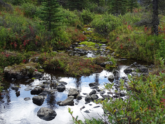
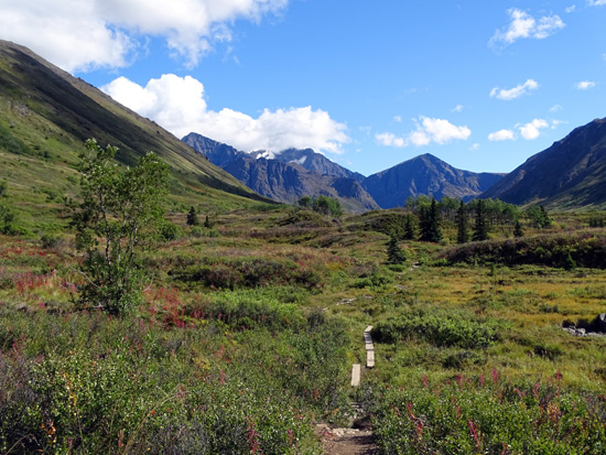
The next mile of the trail past the bridge is pretty good, although it
is more wet, a bit rocky, and narrows to single-track.
It continues to undulate through the scenic valley on the east side of
the river:
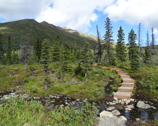
Nice, long set of steps -- but you have to ford the
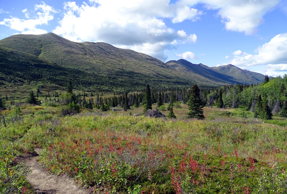
little stream at the bottom.
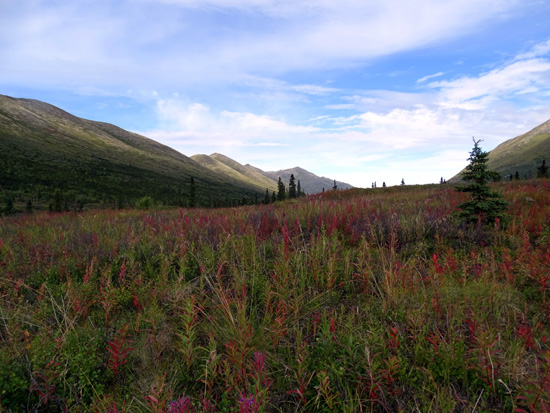
In mid-August the fireweeds, grasses, and other
deciduous plants are turning pretty fall colors.
Photos continued on the
next page.
Happy trails,
Sue
"Runtrails & Company" - Sue Norwood, Jim O'Neil,
Cody the ultra Lab, and Casey-pup
Previous
Next
© 2015 Sue Norwood and Jim O'Neil
