You can say that
about bike rides in the White Mountains, too!
This is a two-part
entry that includes both a bike ride and a hike in the same general
area. Lucky for us, it's close to our campground in Twin Mountain.
ZEALAND ROAD BIKE
RIDE
About 10 AM we left on a bike ride from our campground, following US 3
and US 302, which has very wide shoulders, to Zealand Road.
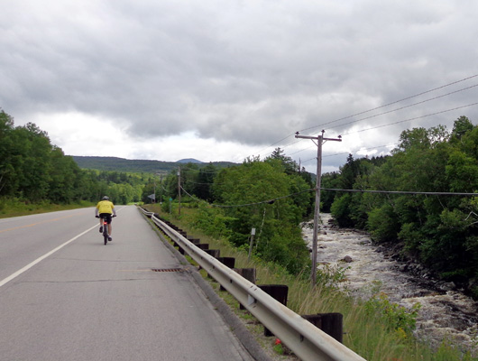
Following
Jim on the wide shoulder of US 302, with the Ammonoosuc River to our
right
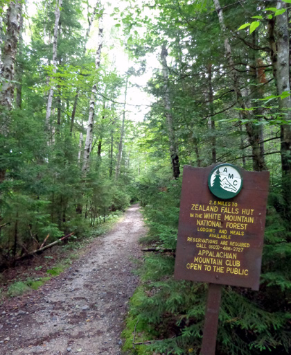
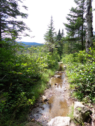
Zealand Road is a narrow gravel White National
Forest Service road that is about four miles long. There are two
campgrounds and several trailheads along the road. We had to be careful
when meeting vehicles, especially the larger AMC shuttle bus that takes
hikers to the trailheads.
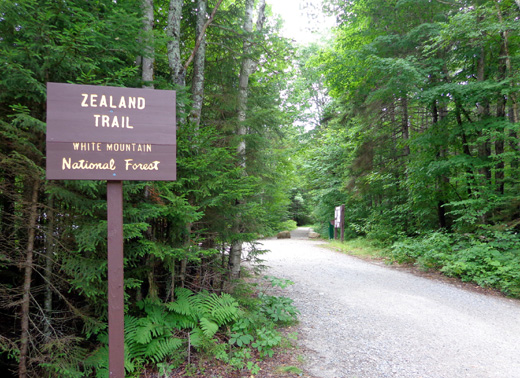
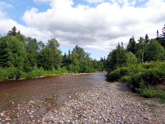
We cycled to the end of the road and turned around in the parking area
for the Zealand Trail that leads up to Zealand Falls and AMC's popular
Zealand Falls hut:
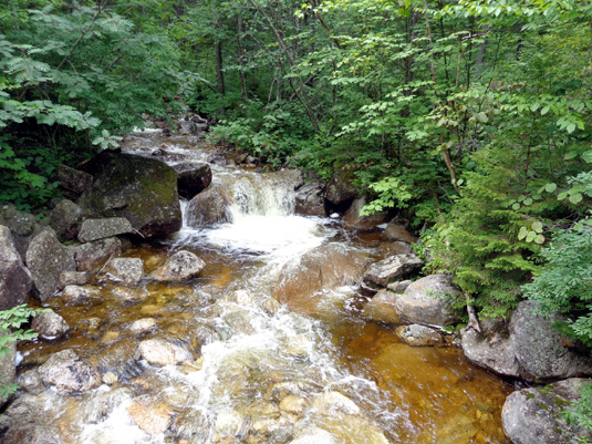
Pretty little cascade near the trailhead
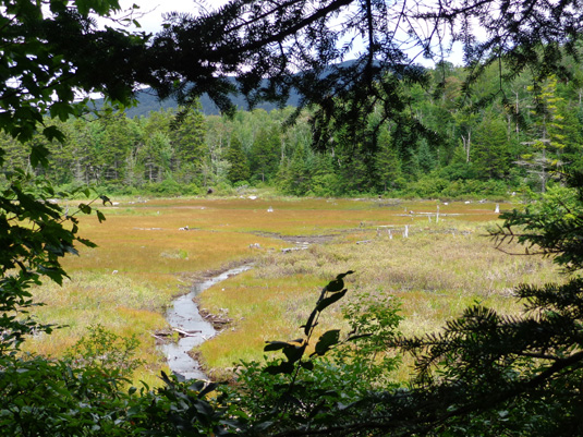
There are some very nice views of Zealand River
along this road. I took this photo as we were riding outbound:
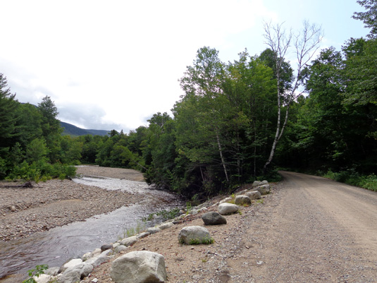
I got better pictures of the river in the afternoon after hiking to
Zealand Falls.
I parked the truck at a tiny pull-off a little past the Sugarloaf
Mountain trailhead and walked a hundred feet to a beautiful overlook
with a bench:
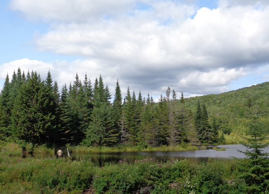
Above and below: There's a pond on the other
side of the Zealand River at this location.
Those pictures came out better than the morning photos because it was
more sunny this afternoon.
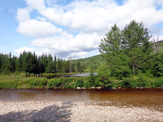
Out and back to our campground was 13.71 miles in 1:30
hours. Outbound was net uphill from 1,508 to 2,131 feet and back down on
the return. Most of the gain was on Zealand Road. It was gradual but
unrelenting. US 302 is more flat.
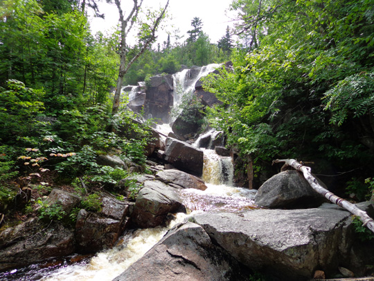
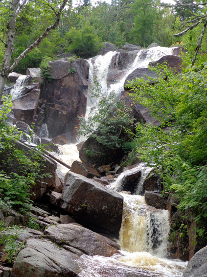
HIKING TO ZEALAND FALLS
After lunch I drove with Cody to the parking area at the end of Zealand Road
and we hiked 2.75 miles up to Zealand Falls, which looked great after
all the rain this week.
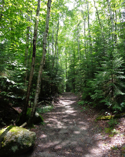
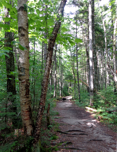
Most of the trail was new to me and I really liked the scenery. When I
saw the falls during my Appalachian Trail Adventure (Day 119, August 26,
2005) the flow of water was very low. Today it was higher and looked
better.
According to the GPS I went from 2,131 to 2,579 feet outbound and back
down on the return. Total mileage was 5.5 miles. This is sure a
faster, shorter way to see the falls than it was on the A.T. along
Franconia Ridge!
Above and below: very nice trail the first quarter or third of a
mile
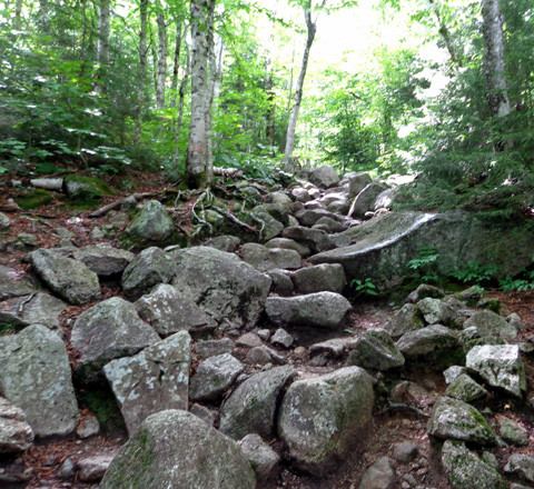
Like most trails in the White Mountains, it quickly deteriorated for a bit.
Despite all the rocks, roots, and streams to cross, this is a relatively
easy trail for the Whites. (And despite the trail conditions in some of the next
photos, trust me on this one.) About half the trail
was very good treadway. Really.
The rest was gnarly and in some places, super gnarly:
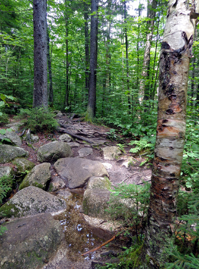
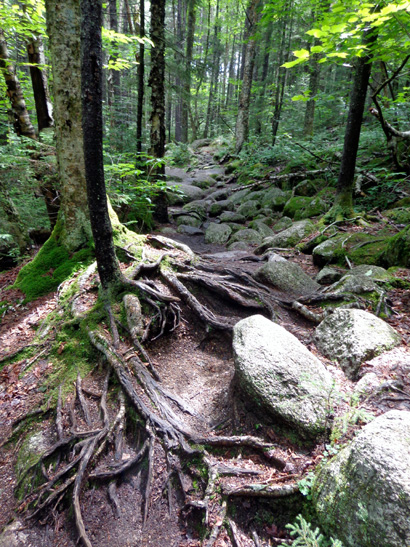
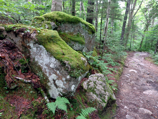
The trail has some interesting moss-and-lichen-covered boulders, too:
As you can see in the photos in this entry, much of the trail is shaded with
beautiful paper bark birches, pines, and other trees. I saw very few flowers.
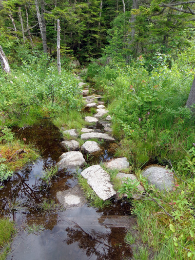
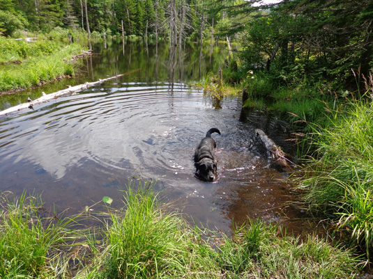
There were numerous places to get my feet wet after a couple inches of
rain fell this week but it was fun to ford the low creeks and go over
bog boards and bridges on the more serious streams and ponds:
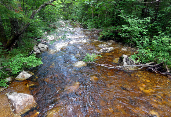
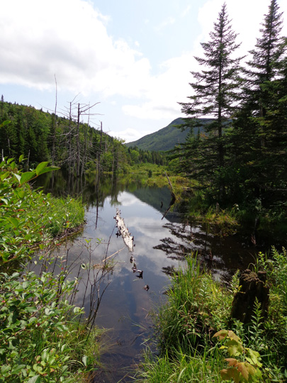
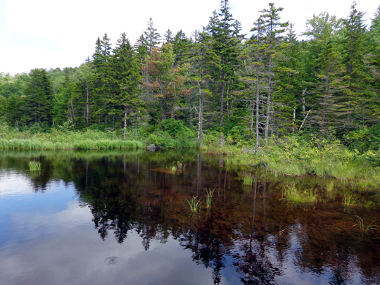
Above and below: I think this is the upper
section of the Zealand River.
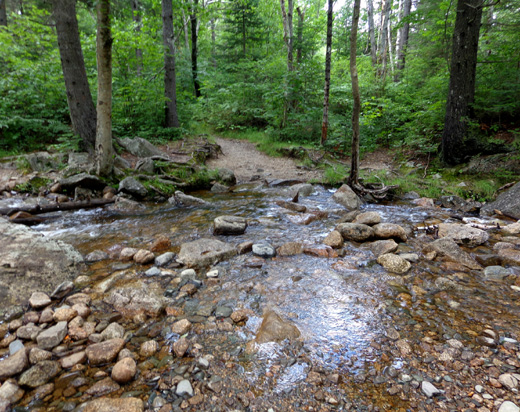
One of the creeks that must be forded
Wet trail next to the large marsh area
I loved the marshes I crossed:
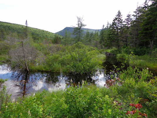
The wet areas looked perfect for spotting moose but I
didn't see any.
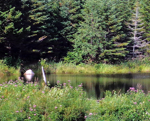
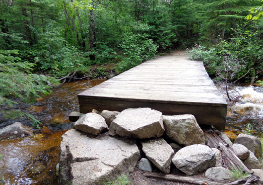
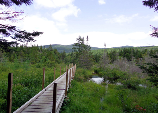
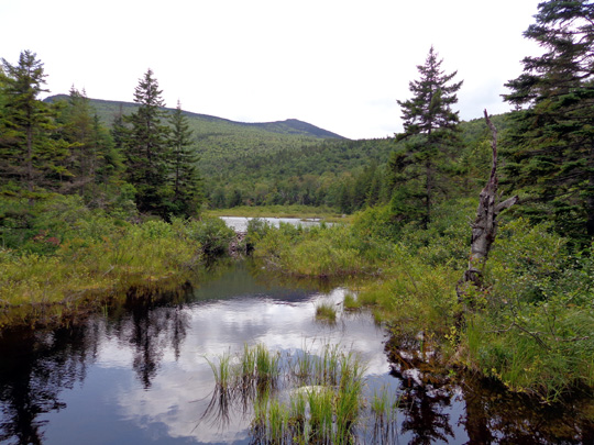
There was also a lake -- Zealand Pond -- a couple miles in.
I took the next photos from a second long wooden footbridge over one end
of the pond:
I had to do some more rock-hopping at the end of the footbridge:
At 2.5 miles I came to the intersection with the Twinway Trail,
which the Appalachian Trail follows in the vicinity of the Zealand hut.
The first part of the Twinway Trail AKA A.T. was relatively flat and had
some rocks and bog boards.
This is a falls a couple hundred feet below the main waterfall:
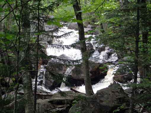
I couldn't get close to that falls because of all the water next to the
trail.
Then the trail became very rough and began a steep inline. I was too busy
maintaining my footing to take a photo more representative than this
from the bottom of the steep, rocky slope:
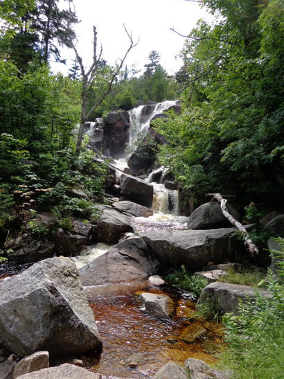
I followed the trail for a quarter mile to a side trail to the falls. (The hut
is another quarter mile farther uphill.)
Cody and I spent about ten minutes there, all alone, enjoying the beauty of the water and
rocks:
When we got back to the trail, a group of about ten kids with two AMC
leaders was slowly coming down the rock steps from the hut. I decided
not to go up. I've seen the hut previously and I wanted to stay ahead of
the kids on the way back to the trailhead.
I saw another group of young girls with two leaders outbound and caught
up to them on the return, too. They were cute and loved petting Cody.
I saw about 20 people on the trail today and four dogs. I left Cody
off-leash the whole time and he did very well. People loved him.
Cody could "smell the barn" near the end of our
hike.
At 11 years old -- getting relatively old for a Lab -- he
didn't get tired today and led the whole way back down to the trailhead,
which was a good sign. (He lags behind when he's tired.)
This was the longest hike Cody's done in a while -- 5.5 miles in 2:45
hours. He loved all the water everywhere. With all the creeks, marshes,
and ponds he didn't have to carry his own water. It's a great trail for
dogs.
I really enjoyed this hike. Jim would have liked the smoother parts
of the trail but definitely not the roots and rocks in other areas.
The bike ride and hike didn't wear me out. Good thing, because I've
got a very tough hike planned for tomorrow.
Next entry: hiking up to Franconia Ridge, one of my very
favorite parts of the A.T.
Happy trails,
Sue
"Runtrails & Company" - Sue Norwood, Jim O'Neil,
Cody the ultra Lab, and Casey-pup
Previous
Next
© 2014 Sue Norwood and Jim O'Neil
