|
2014 HIKING, CYCLING, & RV TRAVEL ADVENTURES
| ||

|
Runtrails' Web Journal
WEDNESDAY, JULY 23
I'd rather be regarded as a loafer!
I really enjoyed this section of the Appalachian Trail when I ran and
hiked almost 25 miles on Day 113 (August 30) from Pomfret Rd. across the
Vermont border into New Hampshire during our A.T. Adventure nine years ago.
There were several good reasons to hike part of this segment today. It's
fairly close to our campground, the trail is less rocky and rooty than
most of the 2,200-mile long A.T., and I wanted to see it on a beautiful, sunny day. It
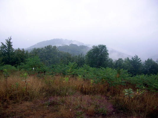
was raining off and on when I ran/hiked it in 2005 and I didn't get to
enjoy the hilltop views.
It's fun to compare today's sunny photos with the misty ones from then.
Both have their own beauty.
Since it was predicted to be
another hot and humid day with temps near 90 F. I tempered my original
plan for an all-day hike with Casey.
Plan B was to hike east from Pomfret Rd. for two hours, turn around wherever
I was at that point, and return to
the trailhead where I began. Four hours sounded reasonable and would give Jim a good
idea of when to pick me up.
LET'S GO!
This morning Jim drove Casey and me to Pomfret Rd. north of Woodstock.
There is a small pull-off on the west side of the road
where the A.T. crosses it.
But it was mostly fun! I do like this section of trail.
Although there were mostly nice smooth sections of trail there weren't any
flat places today.
The hilly route had 1,396 feet of elevation gain and the same amount of
loss, per my GPS. The lowest point was 982 feet, the highest,
1,766 feet.
The first half-mile
ascent was definitely a relocation of the trail in the last few years.
The
trailhead was about a mile north of its location on my
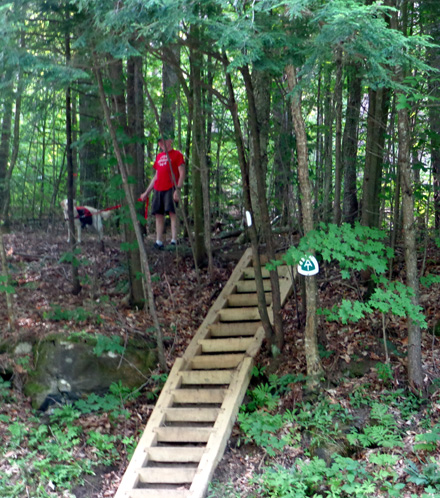
old A.T. map and we initially had trouble finding it. The steep steps
up the bank by the roadway looked relatively new:
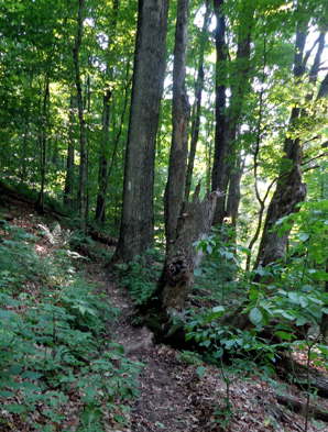
The moderately steep trail up the first mountain also looked
relatively new. I could see where the old trail came in before I
reached the first high meadow.
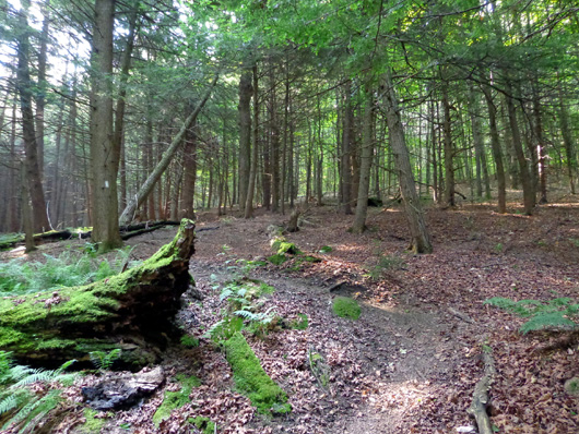
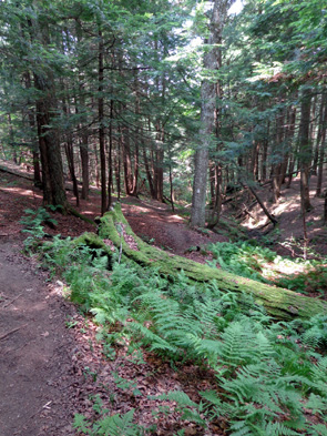
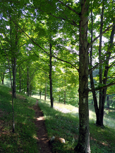
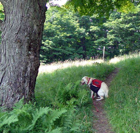
Most of the section of trail I did today was shaded -- some
hemlock forest with soft pine needle footing, some hardwood forest with
a few tree roots but mostly soft footing.
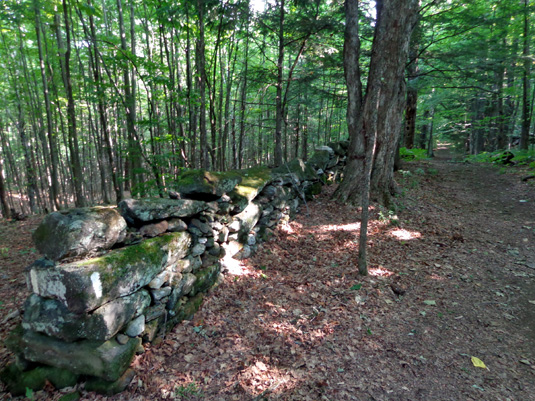
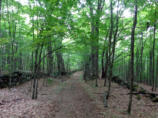
My favorite treed part was two-thirds mile of wide trail that apparently used
to be a dirt road leading to someone's house.
It was very smooth, about
12 feet wide, and lined most of the way with moss-covered stacked stone
"fencing" on one or both sides:
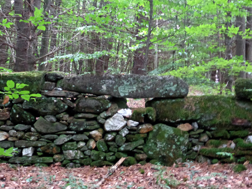
I don't remember that at all from my thru-hike and I have no photos or
journaling about it from then. It's got to be one of the nicest pieces of trail on the
entire A.T.
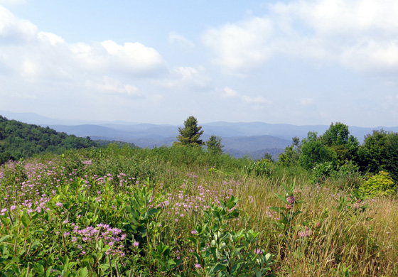
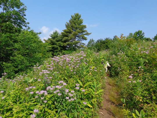
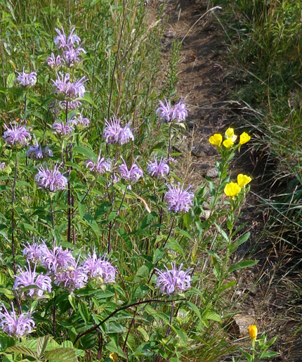
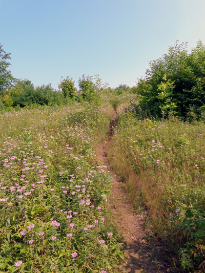
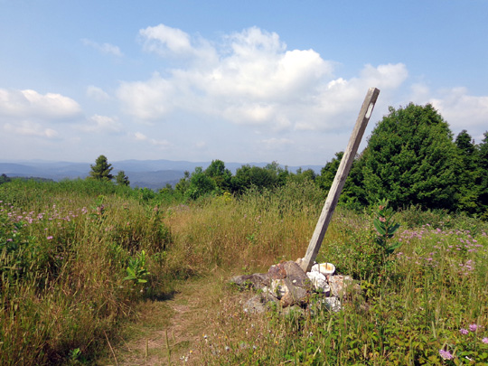
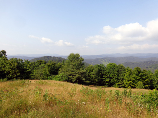
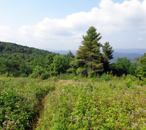
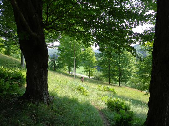
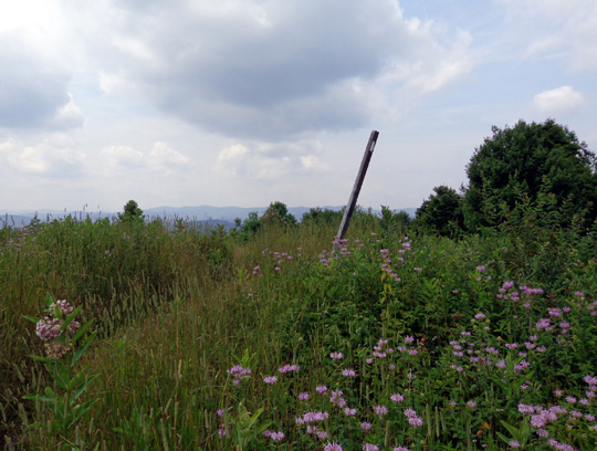
This segment also goes over three high meadows with tall flowers and grasses, lots
of ripe raspberries, just-forming blackberries, nice breezes, and great
views to the west of layers of blue ridges, including Killington and
Pico Mountains:
It's so comical to watch Casey stripping berry branches in her attempt
to get berries! It's a good thing she's learning to spit out the leaves,
stems, and stickers before swallowing the berries. I also give her at
least half of the berries I pick -- it's fun and they have fewer
calories than dog treats.
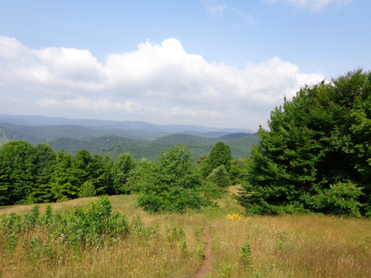
The next two photos
show the descent to Cloudland Road:
That's where I caught up to the first hiker I saw today.
THRU-HIKERS
It was fun to talk to several NOBO (i.e., northbound) thru-hikers near
Cloudland Rd. They were the only people I saw on the trail today.
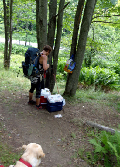
I had the longest conversation with "Winging It," a young man from the
Catskills of NY. I caught up to him near Cloudland Rd. when he was
stopped at two nearly-empty coolers of food and drinks left by a trail
angel.
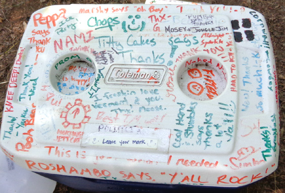
"Winging It" knows a lot of hikers in front of and behind him so it was
almost as interesting for him to see who signed the cooler tops as
reading a trail register:
We sat on the grassy hillside and talked for about 20 minutes about his
trail experiences and what's ahead in NH and ME. It'll be interesting to
see if I run into him again in the White Mountains or in Maine.
By the time he left it was 11 AM, halfway through my planned hike. I
turned around even though I'd gone only 2Ľ miles.
In a couple minutes I met another NOBO thru-hiker, "Lucky B"
(for "Bastard"), a 40YO male from Philly who is "between
jobs." Despite Casey's usual exuberance, he insisted
on playing with her because he really misses his own dog. They both loved it.
Casey got so excited she started doing one of her little "devil
runs" -- really fast circles with her tail tucked in.
She was more tuckered
out on the way back to the trailhead:
After we began hiking again I quickly met three more NOBO thru-hikers,
one a woman who's a friend of "Lucky B," and later saw a young
man and woman going the same direction.
On the way back more
clouds were forming and we got heavy rain later in the evening:
I can highly recommend this section of the A.T. for a lovely hike. It
can be shortened if you just go point-to-point or lengthened by adding
any additional mileage you want in either direction.
Next entry: two glorious weeks in the northern White
Mountains of New Hampshire Happy trails,
Sue
© 2014 Sue Norwood and Jim O'Neil |
|||