Continued from the previous page.
PICTURESQUE WOODSTOCK
After we left Sugarbush Farm we headed to Woodstock, where we found a
bench in the village green. We ate a leisurely lunch -- the
cheese and sausage we bought at Sugarbush Farm -- while we
watched people going by. We also talked to a group of cyclists doing a three-day
tour of Vermont.
This is my fifth time and Jim's fourth to visit the small town of
Woodstock -- three times for the Vermont 100 foot race, once for
the A.T., and now. All have been short visits.
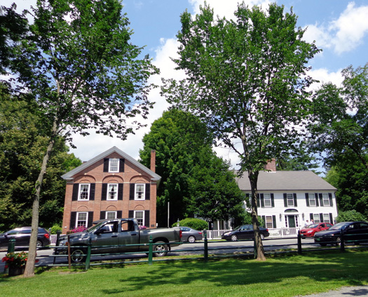
Woodstock is the quintessential New England town with its gorgeous
houses, shops, public buildings, parks, and covered bridges. If it
wasn't so expensive and so crowded with tourists in the summer and fall,
we'd love to spend more time here.
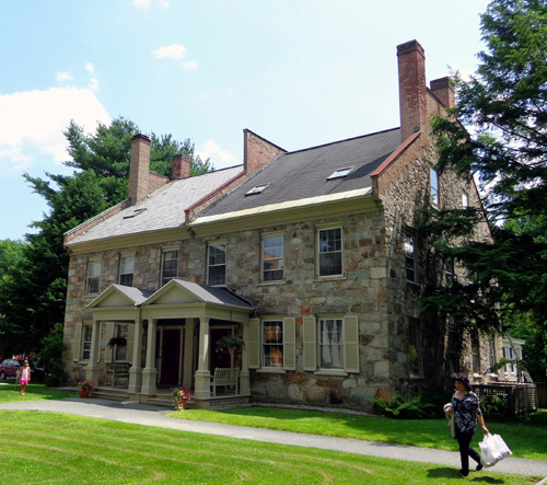
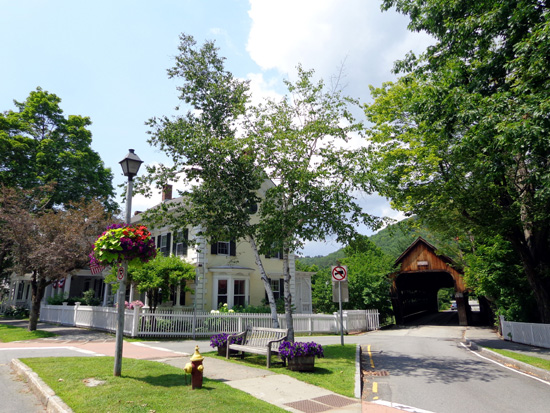
Our bench was in a great place -- the handsome stone library was
behind us and a covered bridge was in front
of us (photos of bridge in next section).
We've been in the
library before but I wanted to see the beautiful woodwork inside again:
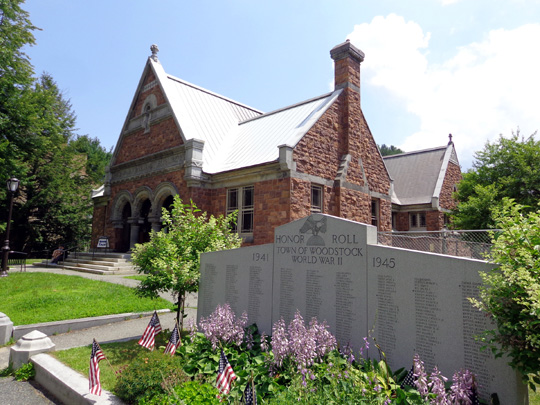
War memorial next to the library
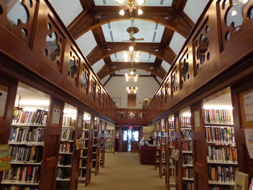
First floor
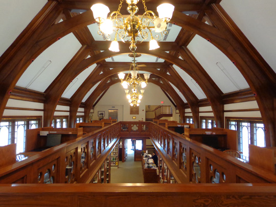
Top floor, looking down
I love the houses and other buildings in Woodstock. If you visit, take
some time to slowly drive, walk, or cycle through the downtown area so you can
really see their architectural details.
There are also numerous little shops but we didn't want to take time to
explore any of them, especially since we have only so much room in our
rolling residence. The last thing we need to do at this point in our
lives is to accumulate more "stuff." We just got rid
of most of our stuff!
We need a sign like
this one at a full-timer's site at the Pine Valley KOA:
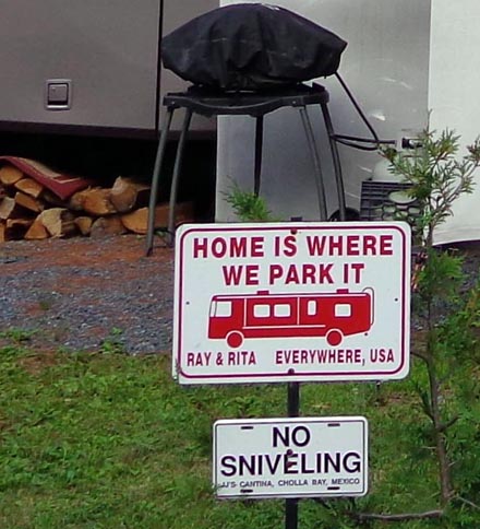
The "No Sniveling" part is pretty funny, too.
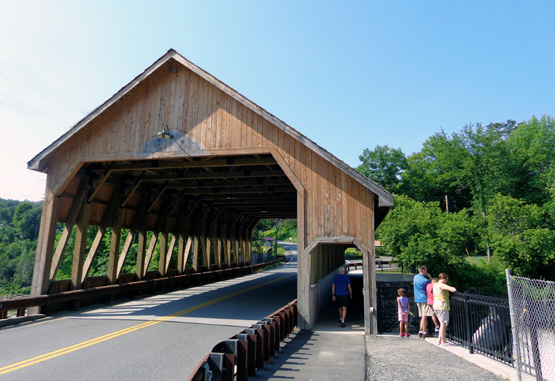
ICONIC COVERED BRIDGES
Who doesn't love an old, nostalgic covered bridge? Vermont is full of
them and this area has several to see.
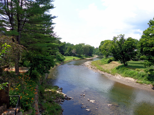
Our sentimental favorite is the bright red Taftsville Bridge across
the Ottauquechee River because we ran through it several times on the
Vermont 100 course:
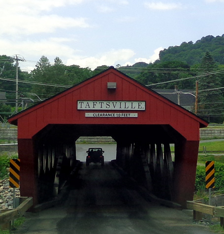
The Taftsville bridge is easy to see right off US 4 between Woodstock
and Quechee. It was rebuilt in 2013 after a devastating flood in 2011.
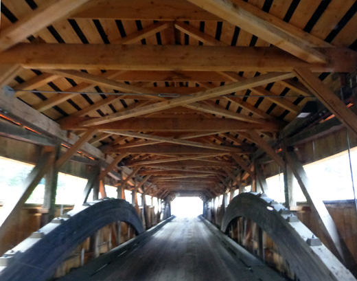
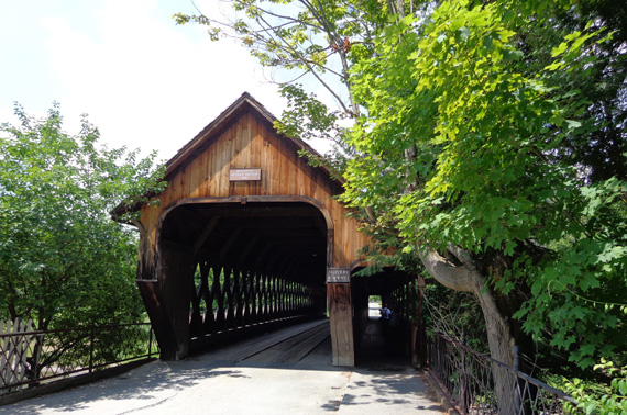
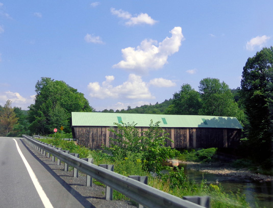
This covered bridge rebuilt in 1969 is called "Middle Woodstock." It is near the
town's village green:
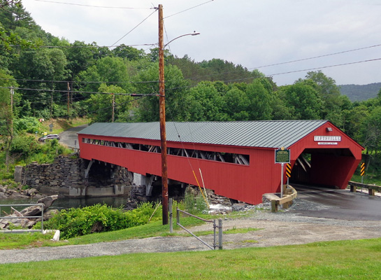
The next bridge is about half a mile above Quechee Gorge in the little town
of Quechee. It also had to be rebuilt after the devastating 2011 flood:
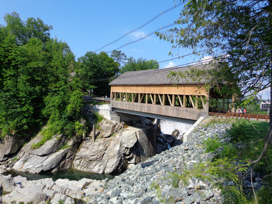
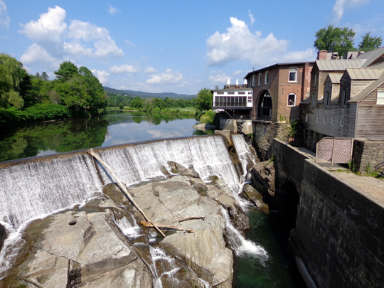
I like the interesting old buildings to the right above the dam. They
contain shops.
The last bridge I photographed in the area is on
US 4 west of Woodstock:
A.T. REDUX #3: CLARENDON GORGE
We saw all
those bridges today on a whirlwind tour of the area.
This afternoon we
also drove farther west and south of Woodstock so I could
show Jim the Clarendon Gorge and swinging bridge where
the A.T. crosses Mill River. It impressed me when I did the trail in
2005.
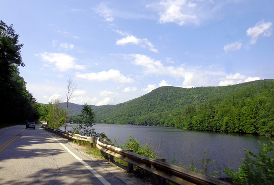
We found a very scenic route through beautiful green hills and mountains
-- US 4 west to Bridgewater Corners (following the Ottauquechee
River), southwest on VT100A past Coolidge State Park and the Calvin
Coolidge State Historic Site, south on VT100 past the Black River and a
long, pretty lake (next photo), and northwest on VT103 to the A.T. trailhead parking
area at Mill River and the Clarendon Gorge.
I was surprised the parking area was full -- about 15 vehicles. We
found a spot to park and took the dogs 1/10 mile down the narrow trail to the bridge over
the gorge.
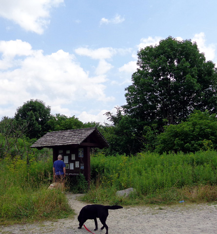
Jim and the dogs at the trailhead kiosk
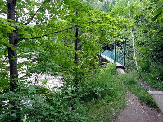
Above and below: Clarendon
Gorge suspension bridge
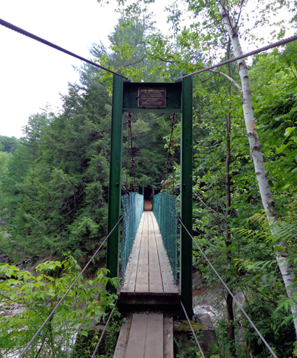
If the thought of crossing a river about a hundred feet above a rocky
river gorge on a narrow, vibrating suspension bridge gives you the willies,
consider this: prior to the construction of this sturdy bridge, a
young man lost his life in 1973 while hiking the A.T. He was washed
downstream and his body was never found.
(A.T. maintainers in Maine, where hikers have to ford streams even more
dangerous than this,
take note.)
Today the river was at a very low flow so we could see most of the
boulders and other rock formations that A.T. hikers used to have to cross to get from one side of
the water to the other. It's a deep and beautiful chasm to the west. I
was able to appreciate the beauty more today than nine years ago when I
was in more of a hurry to get to the end of a long section of
running/hiking.
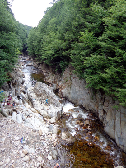
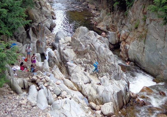
About a dozen people were down at the river on either side of the bridge, swimming and sunning.
It was a long hike down so we just observed from above.
We drove back to Woodstock and Quechee the same route,
stopping along VT100 at the Green Mountain Sugar House for some yummy
maple-flavored softserve ice cream that was more creamy than what we got
yesterday.
Maybe that's why Vermonters call it a "creemee."
We sat on the front porch while we devoured it:
We also stopped at the Woodstock Farmer's Market on the west side of
town and got some fresh veggies and whole wheat bread:
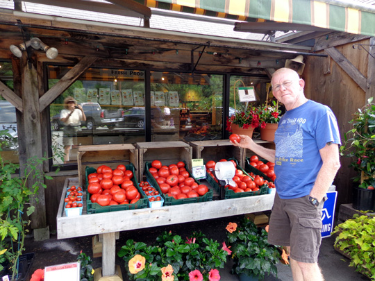
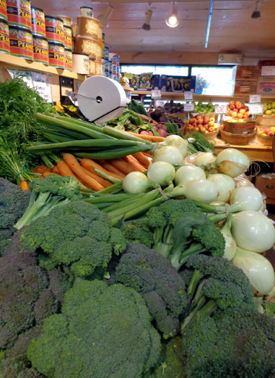
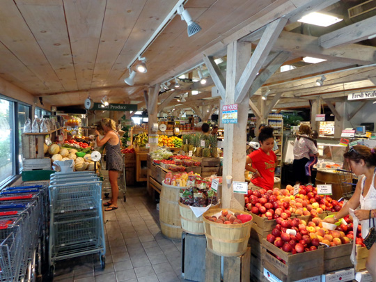
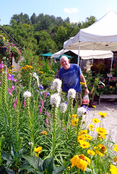
The farmers' market prices are high but the quality of the potted and cut flowers,
herbs, produce, and other edibles is very good.
We've had a busy two days in the Woodstock area and we've barely
scratched the surface of all there is to do and see around here.
Next entry: A.T. Redux #4: hiking the Trail
east of Pomfret
Happy trails,
Sue
"Runtrails & Company" - Sue Norwood, Jim O'Neil,
Cody the ultra Lab, and Casey-pup
Previous
Next
© 2014 Sue Norwood and Jim O'Neil
