Today I got to hike on part of the Appalachian Trail that was on my Top Ten Sections
list from my thru-hike/run in 2005 -- Sages Ravine, which is on
both sides of the MA-CT state line, and CT's Bear Mountain (there is another
Bear Mountain on the Trail in NY).
Because this section is too far for me to easily hike point-to-point or
even out-and-back from
the trailheads I used nine years ago when I could run and cover more
territory, Jim, Casey, and I went up from CT 41 on two side trails and
made a counter-clockwise loop with the AT.
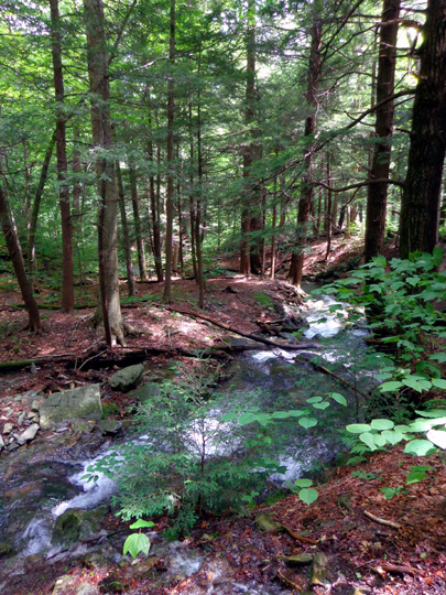
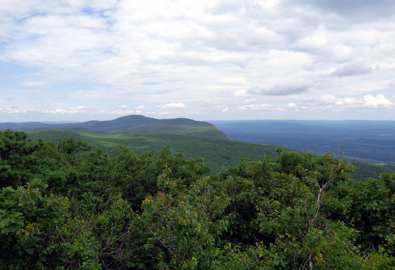
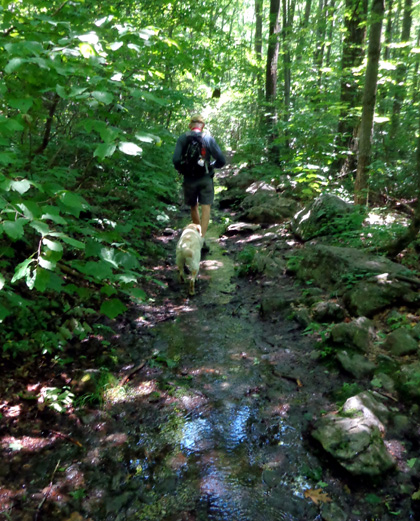
Scene from Sages Ravine
The website above, which is written for average day hikers and not
hard-core ones, calls this loop a "strenuous" option. In 2005 I would have
dubbed it "moderate." Now that I'm not trained as well --
and nine years older -- I agree that it's strenuous for the average
person.
It's all a matter of perspective.
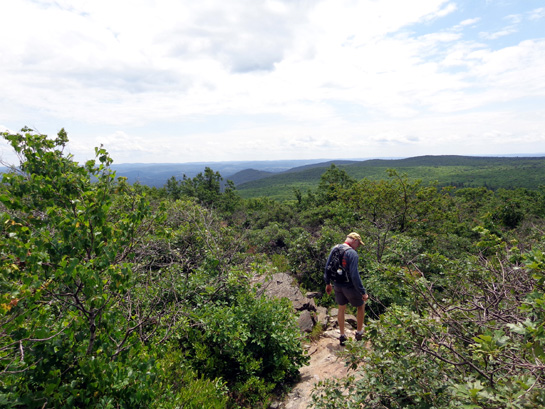
I sure didn't remember the north side of Bear Mountain was so difficult to
hike, even after reading my journal entry from Day 100 on the AT in 2005. If I
had, I wouldn't have suggested Jim go on this hike with me today. This
is an example of the rocky ascent:

Today we covered over six miles on the Undermountain, Paradise Lane (anything
but!), and AT and it was hard on both of us, especially Jim. He can bike
like crazy but his bad knee prevents him from doing much walking or
hiking, especially on a gnarly loop like this one.
Before we were done with the hike today he said he wasn't going on any
more of the AT or connecting trails with me. <frown>
Casey did fine, with more energy at the end than either Jim or I had.
I'm glad we didn't take Cody. Although he could hike difficult sections
like this with me in '05 when he was only two years old, at ten the
rocks would have been too hard on him.
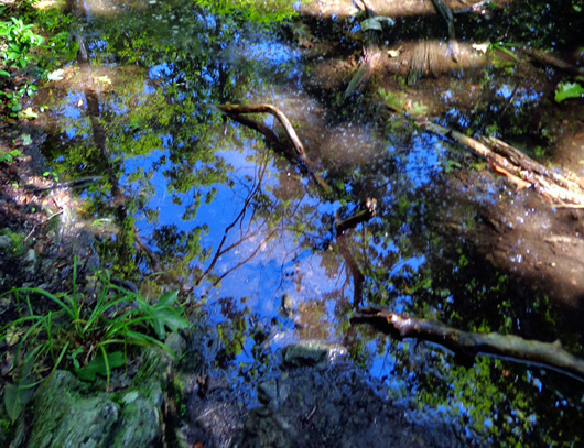
Pretty reflections in a little pool of water on the
Paradise Lane Trail
I did OK because I've done more hiking than Jim has but it was more
difficult than any hiking I've done since last summer in the Rockies.
The worst was going up the north side of Bear Mtn. (southbound) to the
summit from Sages Ravine. I went the other direction in '05, which is one reason I
didn't remember the difficulty. Even with bad knees it would have been
easier for me to descend that way today.
Although . . .
when I get on the
even gnarlier trails in the White Mountains of New Hampshire next week I'll
probably look back on this hike as "easy" in comparison!
THE ASCENT TO SAGES RAVINE
The weather was great today -- upper 50s overnight, clear blue
sky in the morning, mid-70s in the afternoon, with pretty
clouds and a breeze in the afternoon.
We started about 10 AM and finished about 2 PM. Elevations ranged from about 900 feet
at the trailhead to 2,316 feet on the top of Bear Mtn. It's the highest
peak in CT -- but not the highest point in CT; that's
on the flank of Mt. Frissell, whose summit is in MA.
Confused yet??
The trailhead parking area is 9.3 miles south of the PA 41-23
intersection in S. Egremont. There is room for only about a dozen vehicles.
Three were there when we arrived and about ten when we left.

We climbed a mile on the Undermountain Trail, then turned right on
the more narrow but less hilly Paradise Lane Trail.
At that intersection it is only 9/10ths of a mile to the AT on the Undermountain
Trail. It intersects on the south side of Bear Mountain at Riga Junction. That's a
shorter way to get to Bear Mtn. summit but I wanted to show Jim the
beautiful
Sages Ravine first.
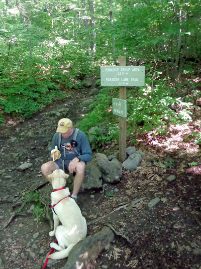
Jim shares a banana with Casey at the
Intermountain-Paradise trail intersection.
We hiked another mile on Paradise Lane to reach the AT.
"Paradise Lane." That conjures up a rather wide, smooth trail,
doesn't it?
Boy,
was I wrong!! It was even more rocky, rooty, narrow, and wet than the
first mile of the Intermountain Trail, with lots of puddles and little
creeks to cross:

Casey-the-Lab loved all the water, of course.
It was a relief when we reached the intersection with the AT and the
sign pointing north toward Sages Ravine. I didn't remember that section
of the AT being rough, just very serene along Sages Creek.
I've either been on too many trails since then or I have selective memory.
Fortunately, the AT was wider and easier to follow than Paradise Lane.
Unfortunately, the AT descends through more rough rocks for about 1/4
mile to Sages Creek and the beginning of the ravine.

The creek was clear and beautiful today.
With all the recent rain in the area, it looked much different than it
did when I saw it in '05. There was much less water in it then but it was still memorable.
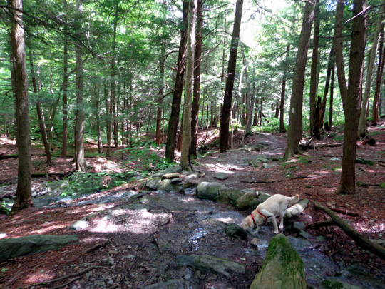
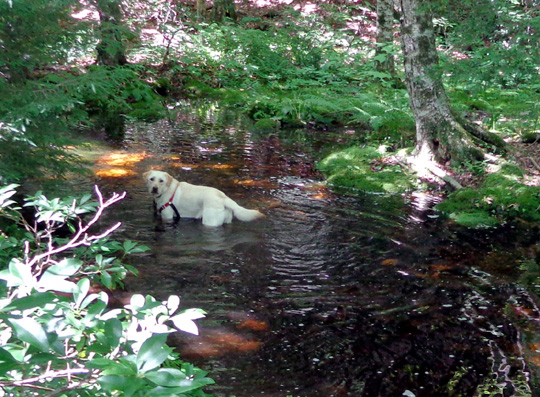
Casey drinks from a little feeder stream along
Sages Ravine.


We found some rocks to sit on near a little waterfall (above). Casey had fun playing in the water
while we ate our lunch.
The whole time we were in the ravine we saw just one person, a thru-hiker
heading north.
HIKING SOUTHBOUND TO BEAR
MOUNTAIN SUMMIT
It was a strenuous hike back uphill on the AT to the summit of
Bear Mountain.
Good thing it was only about a mile from where we ate lunch.
We had to wade through some more water, then carefully plan our route up
some of the large boulders, rock ledges, and smooth areas of partially
wet bedrock so we didn't slip:


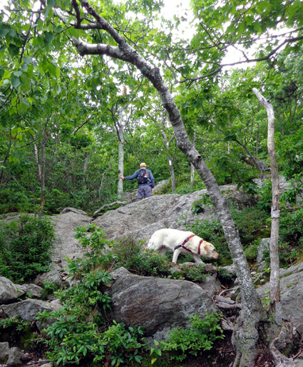
I apologized profusely to Jim. I never would have suggested he hike up
there with me if I'd remembered how rough it was.
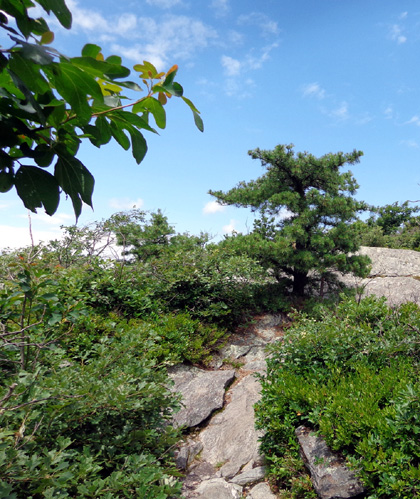
At the summit of Bear Mountain is a large rock cairn about 25 feet
square and 12 feet tall. It is the remains of a tower built in 1885 by Owen
Travis, a Salisbury mason, and paid for by Robbins Battel, who leased the top
from the Millerton Iron Company. The tower stood unharmed for eighty years
but has since been vandalized. It is now only one-third of its original height.
I didn't take a photo of the whole cairn today. I took this one when I
did the AT nine years ago:
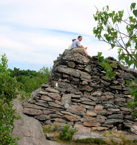
Day hikers on the cairn 8-7-05
We reached the rock tower on Bear Mountain summit just after two young
women who day-hiked in from the south. They were doing the loop
clockwise; we did it counter-clockwise.
A middle-aged section hiker from Poland soon joined us on the rock
tower to enjoy the breeze and fine views to Twin Lakes in the pretty
valley to the east. He's doing the AT in four quarters. This year he's
hiking north from Harper's Ferry to Bennington, VT. It was fun to talk
with him about other long trails he's done in Europe.
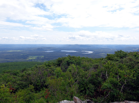
Lakes in the valley east of Bear Mountain

View north to Mt. Frissell (elev. 2453') and Mt.
Everett (2624')
One other day-hiker joined us. All four left, heading north, before Jim
and I started down. Two other young NOBO hikers arrived as we were leaving
the tower.
The descent on the south side of Bear Mtn. on the AT was much easier
than our ascent from the north side. Although it was rocky, we didn't
have to shimmy down steep rock faces. We also had nice views to the
south:
Looking
south
Looking back
up some bedrock we just came down; glad it was dry.
We got back down into taller trees in less than a mile, just before
reaching Riga Jct., where we got on the Undermountain Trail.
It was a gradual downhill with lots of wet spots for about 9/10ths of a
mile to the intersection with Paradise Lane:
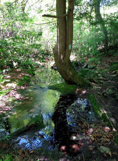
This
interesting reflection took my mind off all the rocks and water.

Sometimes
the trail was a creek because of all the recent rain.
The final mile was the one we went up at the beginning. It is rockier
and more steep than the upper half closer to the AT.
SUMMARY
The trails today were very, very wet from all the rain that fell
recently. There were numerous puddles, several little creeks to ford,
and lots of mud.
Casey loved that, of course. Jim and I just plowed through it all. I did
OK with the one trekking pole I carried and neither of us fell down.

All but about a mile of the six-mile loop was in the shade, which was
nice since it was warm.
We saw very few flowers even on the sunny open ledges on the south side
of the mountain, and it was too early for any ripe blueberries.
We saw only ten people and two dogs on the trail loop. Casey was
off-leash most of the time.
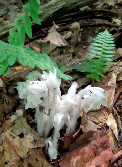
Indian pipe is as interesting as
most flowers.
I'm glad I had the opportunity to see Sages Ravine again. I'm just
sorry neither of us was in as good shape physically as we needed to be
to really enjoy this beautiful area.
Any bets on how long it is before Jim will go on a hike with me again???
Next entry: exploring more of the Berkshires from North Adams,
MA
Happy trails,
Sue
"Runtrails & Company" - Sue Norwood, Jim O'Neil,
Cody the ultra Lab, and Casey-pup
Previous
Next
© 2014 Sue Norwood and Jim O'Neil
