Many people travel to the Berkshires for its art, music, skiing, and
shopping in quaint little towns.
Although we're interested in culture and history, we came here
primarily to see more of the charming architecture and scenic beauty in
western Connecticut and Massachusetts than we were able to see during
our Appalachian Trail Adventure in 2005.
Then I was just focused on moving north along the Trail as quickly as
possible. Jim was so busy keeping everything operating smoothly that he had little
time to see much of the Trail or the interesting little New
England towns he drove through when he moved the RV from campground to
campground.
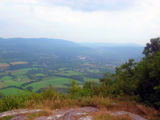
Photo I took into the valley from
Greylock Mountain when I was doing the AT;
I saw farms and towns mostly
from this perspective, not at ground level. (8-12-05)
Now we wanted to spend a little more time exploring the area.
This entry describes our trip from the Poconos, our first of two
campgrounds in the Berkshires, and a day trip through the lovely
mountains of western Massachusetts. (Berkshire County covers the whole
western side of Massachusetts from the Connecticut border to the Vermont
border. It's approximately 25 miles wide and 50 miles long.)
FROM THE POCONOS TO THE BERKSHIRES
Yesterday we drove to our current campground near the small town of
North Egremont in far southwestern Massachusetts from Promised Land State Park
in Pennsylvania, a distance of 184 miles.
This was our scenic route: PA 390 north to I-84. I-84 east
through the rest of PA and part of NY to Danbury, CT, then north on US 7
to Great Barrington, MA. West on MA 41 to MA 71 Prospect Lake Rd. and
Prospect Lake Park.
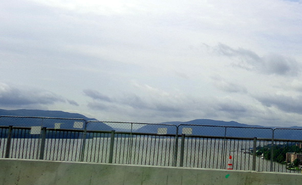
Traffic was heavy across the broad Hudson River (above) and moderately heavy on the
rest of I-84. Jim was glad to exit the freeway and get on US 7 north
of Danbury. We're glad we probably won't be on another freeway for
several weeks. If we are, it won't be for long and it'll be in much less
urban areas in New England.
The scenery was all we hoped for and more on our way to Prospect Lake.
The freeway through PA and NY was hilly, heavily treed, and mostly very rural.
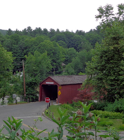
US 7 is just gorgeous most of its length, especially when you can see the Housatonic
River on one side or the other. I took a picture of one of the covered bridges
(shown above) from the highway. We passed close to several others that we couldn't go back to see
because of the camper.
We really enjoyed US 7. There are pretty houses and yards along the way,
interesting towns like Kent, CT, long stacked stone fences, and scenic
farmland.
A bookstore in Kent
I didn't see many of those things when I did the AT nine years ago. Jim
remembered several things we saw today because he was on the roads a lot
more back then than I was. This is our first time since then to visit
New England.
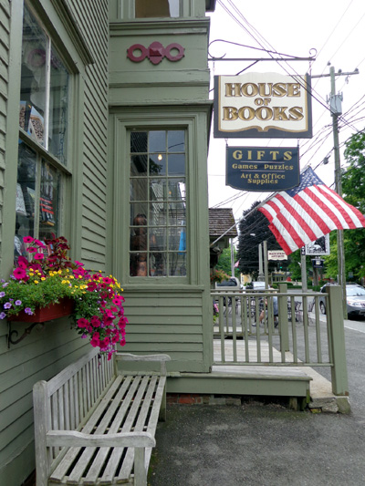
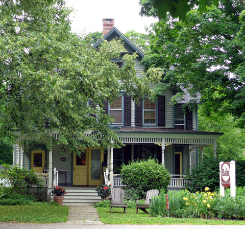
We stopped for about an hour in Kent, CT. We didn't get
to explore the artsy town when we were here in '05 because it was raining
heavily after I got off the AT on a trailhead near Kent.
Yesterday we
parked along the highway just north of the two-block "downtown" area and
walked the dogs for a few minutes so I could see the shops and
some beautifully-restored old houses which have been turned into stores or art galleries:
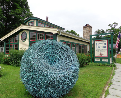
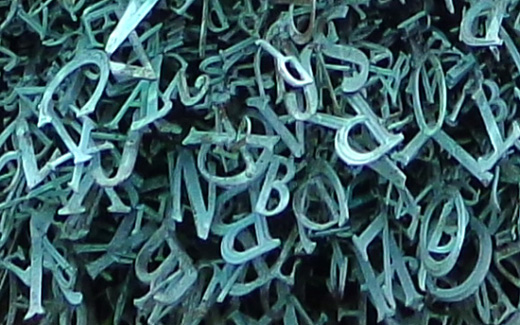
There is a lot of public art in town, too.
Although this isn't as
aesthetically pleasing (to me) as some of the other sculptures we saw, we were
both intrigued by this big ball of intertwined plastic letters near a restaurant:
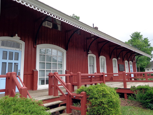
AT hikers often come into this town to re-supply and hang out for a
little while.
I saw one young male thru-hiker napping on a bench near
this old train depot which has been converted into shops. I took his
picture but since it was unbeknownst to him, I'm not including it here
-- just the old depot:
PROSPECT LAKE PARK
We had hoped to find a nice campground closer to Kent for our next
stop but for several reasons we were unable to find a suitable place. We
ended up about 15 miles into Massachusetts at
Prospect
Lake Park near North Egremont.
Even though we stayed here in our old HitchHiker 5th-wheel for one or
two nights in 2005 we don't remember any of it! That says
something about how focused we were on getting the AT done.
Warning to other Rvers: This is a nice campground but
it's not suitable for big rigs.
Unfortunately, the website doesn't say
that and the woman who took my reservation didn't warn me when I
called a few days ago. They think it's perfectly fine for a 36-foot
5th-wheel, travel trailer, or motorhome. We're here to tell you that's
questionable. Some of the sites are long enough and wide enough for
big rigs but the roads are too narrow and/or the trees
are too close to maneuver a large RV into almost every site in this park.
And if you stay here get an escort to your site so you don't make a
wrong turn and have to back out. Been there, done that, and Jim won't
forget the harrowing experience any time soon -- no damage to the
rig, but ulcer-inducing.
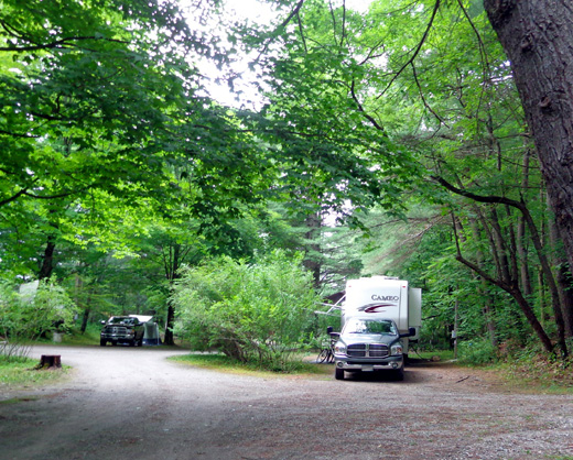
We have a nice "pull-through" site. It is pull-through for
little rigs but not one as large as ours. Once we found the correct
access road we got into it easily enough. However, we can't make
the sharp turn to get out when we leave so Jim will have to back
out of it. Fortunately, that should not be difficult.
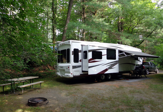
We have 30 amps, water, and sewer. The regular rate is $34/night plus
$4/night for the dogs, minus 20% military rate, plus tax = about
$31/night for three nights.
Also note that all
the roads and sites in this park are dirt, not gravel or paved. It was
nice and sunny when we arrived yesterday but it rained very hard last
night. Because our site is not sloped correctly, we had a pond in our
front yard during the night. It was mostly drained by the time I took
the dogs out this morning. The rest of the week should be clear.
Most of the sites here are seasonal, occupied by various types of RVs
that are semi-permanent with decks and patios. Many have nice flowers
and other landscaping:
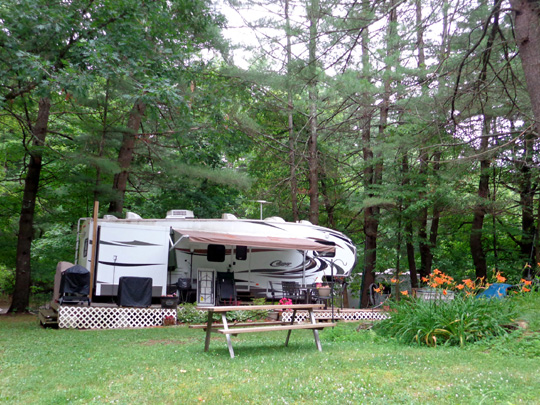
Some rigs have been here quite a while and trees have grown up around
them. One woman said she has lived here for 15 summers.
It is mid-week so most of the overnight sites will be empty until the
weekend. Some short-term vacationers are here in smaller rigs or tents
that can be set up next to the lake.
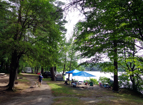
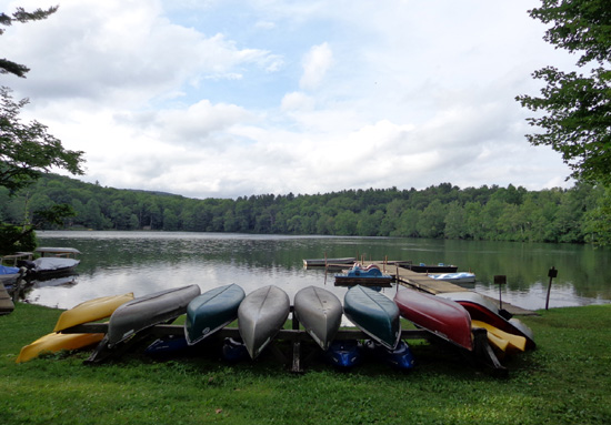
Prospect Lake is rather small but it is pretty and the water looks
clean. The dogs enjoy swimming near the boat dock area, where several
canoes, kayaks, and row boats are docked (some are for rent). There is a
swimming beach, long slide to get in the water, and kids' play area near
the office, plus a volleyball court and pavilion.
We can recommend this
place for people with tents or small to medium-sized RVs.
There are several camping loops, most of them too narrow and/or lined with
tree branches too low for a large camper to pass through.
DAY-TRIPPING THROUGH THE BERKSHIRES
We took advantage of a warm, sunny day today to make a large loop
through western Massachusetts.
One goal was to pick up our mail in North Adams, about a 50-mile
drive, and to check out our next campsite there. After the difficulty we
had with our site at Prospect Lake, Jim wanted to be sure we could get
into our next site with less trauma. We also wanted to drive through
Greylock Mountain State Reservation and enjoy more interesting Berkshire
scenery.
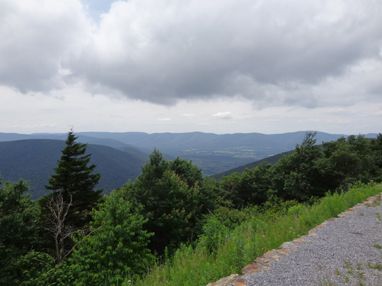
View from Fitch Overlook on Mt.
Greylock
It's a beautiful drive continuing north on US 7 past Great Barrington.
Much of the terrain is lush wooded and farm land between strung-out
towns with lovely old architecture from the 1700s and 1800s. There's a
lot of "history" here and many of the homes and gardens/landscaping
have been well-preserved.
I especially enjoyed driving through Stockbridge twice and regret that I
won't have time to take a walking tour of the downtown area before we
move on up the road.
We didn't make any stops until we got to North Adams. Jim got the mail
and I picked up a few tourist brochures at the nearby Chamber of
Commerce. Then we located the city campground where we'll be staying
this weekend. Jim was relieved to see that our site there will be
manageable.
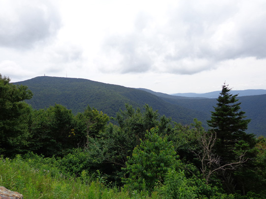
View of Greylock summit (left) from the scenic
byway
This is another campground where we stayed in 2005 when we did the AT
Adventure but neither of us remembers being there. We both remember some
parts of the town, particularly all the stately white marble buildings.
There are many pretty marble and quartz rocks along the Trail in the
nearby mountains.
Then we hunted for AT trailheads on the Mt. Greylock Scenic Byway, a
narrow, winding 11-mile road over Mt. Greylock. We started at the north
end from N. Adams off US 2 and drove south to the end with the visitor
center near US 7 in Lanesborough.
We could see into the valleys on either side of the ridge and crossed
the AT several times. I'll be hiking up to the summit on the AT
tomorrow.
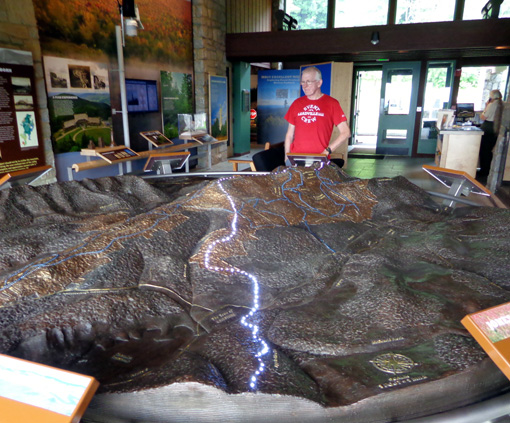
Jim looks at
the relief map at the Greylock visitor center.
The south
approach of the AT to the 3,491-foot summit is lit up.
Before exiting the park we stopped in the visitor center at the south
end and got some brochures re: other trails on the mountain.
The ranger told us about a scenic multi-use trail that runs through the
Hoosic Valley from Adams to Lanesborough. Both of
us want to ride it this weekend after we move to N. Adams. We haven't
found any good places near Egremont for Jim to safely ride his bike.
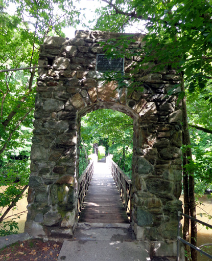
LAUREL HILL TRAIL
On our way back through Stockbridge we turned on Park Ave. and parked in
a small area next to a pedestrian bridge across the Housatonic River. We
learned about three trails from this trailhead in one of the brochures I
picked up in N. Adams.
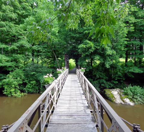
We chose to take the flatter crushed rock path along the east side of
the river, out and back about 3/4 mile total. (The mosquitoes were bad
and we didn't have bug spray with us.) Dogs are allowed on this trail.
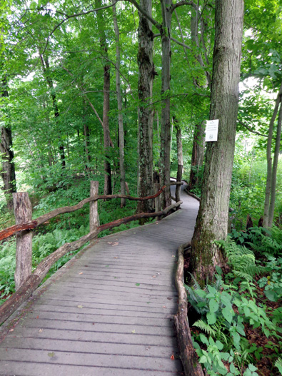
There's another relatively short trail that leads to some glacial
boulders that have ice crystals in them all year long but we didn't go
there today.
The third trail goes to the top of a small mountain and reportedly has
nice views into the valley.
Next entry: sharing one of my favorite AT sections
with Jim and Casey -- Sages Ravine and Bear Mountain summit
Happy trails,
Sue
"Runtrails & Company" - Sue Norwood, Jim O'Neil,
Cody the ultra Lab, and Casey-pup
Previous
Next
© 2014 Sue Norwood and Jim O'Neil
