It was such a pretty day that I decided to take Cody with me on a three-mile hike to
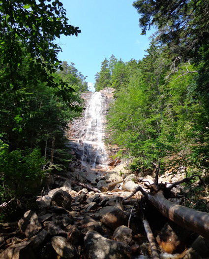
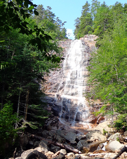
Arethusa Falls.
With an uninterrupted 200-foot drop, it's reported to be the tallest
falls in NH, although there are others that cascade farther than that.
It was very pretty and I enjoyed having it to myself for a few
minutes.
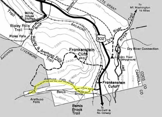
I went outbound on the Bemis Brook
Trail to the Arethusa Falls Trail and back entirely on the falls trail. I marked the
trails on the map below, which I copied from the
Crawford Notch State Park website:
There is a sign for
the parking area
along US 302 in Crawford Notch.
I initially parked in the large, lower lot that
has a trailhead for Frankenstein Cliffs, then realized the Arethusa
Falls trail begins farther up the paved road. I drove about a quarter
mile uphill and parked near the railroad tracks:
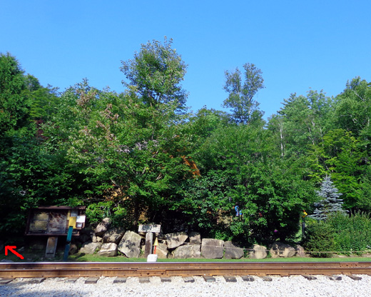
The trailhead is on the other side of
the tracks where the arrow points. There is a Crawford Notch State Park building hidden behind the
trees but I didn't go into it.
This parking area has room for about
a dozen vehicles. If it's full, you'll need to park in the larger lot
closer to the road and hike up to the trailhead. Some hikers do a
five-mile loop with the Frankenstein Cliffs Trail or go over to Ripley
Falls.
Soon after the Arethusa Falls Trail begins, the Bemis Brook Trail goes off to the
left:
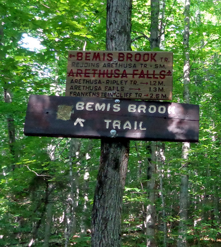
I followed it for 1/2 mile, partly along the creek and partly above it:
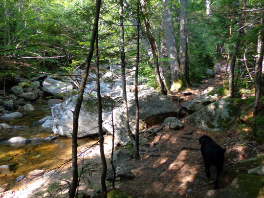
There were some pretty falls, cascades, and pools of water for Cody to
cool off in:
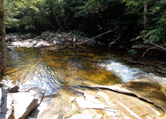
Fawn Pool lies below some cascades.
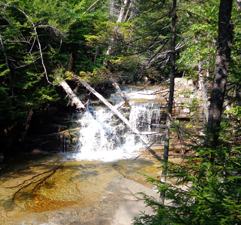
Bemis Falls
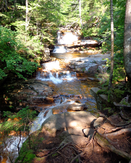
Coliseum Falls
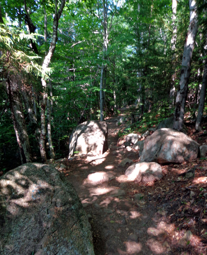
The Bemis Brook Trail is rougher than the main Arethusa Falls Trail, which is
rated "moderate" in the White Mountain Guide. I'd guess the Bemis Brook Trail is rated
moderately strenuous (I don't have the guide any more).
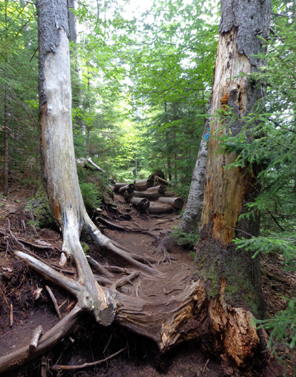
The last 2/10th mile up to the main trail is extremely steep and rooty:
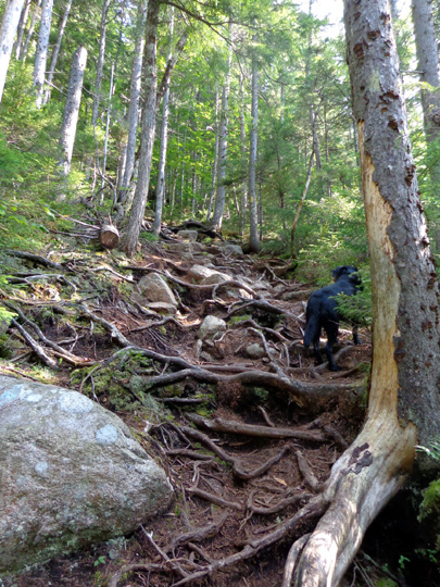
I would never go down that thing with my bum knees. Uphill was
manageable by picking my footing very carefully and using my hands to
pull myself up the roots and rocks.
I was happy to reach the falls trail again and I came down it the whole
way back to the truck.
The falls trail gains and looses about 1,000 feet elevation with some
undulations between 1,285 feet at the parking lot to 1,970 feet at the
base of the falls. The high point was 2/10ths of a mile before the falls
at 2,083 feet.
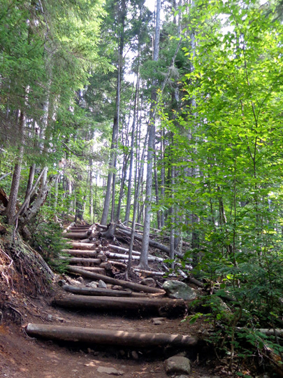
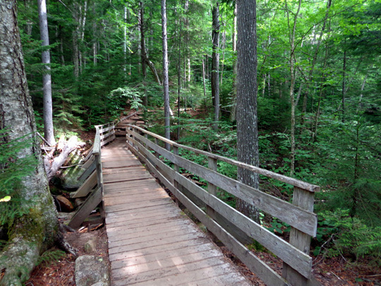
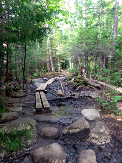
There are numerous rock and log steps, some bog boards, two decent
wooden bridges over side streams, and lots of pretty trees along the
trail.
I didn't see anyone until I was about 1/4 mile from the falls. The
couple said only two people were at the falls.
When I got there I saw
two teenage boys close to the base of the falls. I was about 75 feet
away, not willing to do any bouldering in the water. I took off my pack
and spent about 10 minutes at the falls. The young men left and I had
the place to myself for five minutes.
I was just getting ready to leave when two women arrived.
Cody loved getting into the water below the falls and in Bemis Brook.
Despite his advancing age (11) he did great navigating the rough trail
and he got lots of attention. We saw only two other dogs on the trail.
We saw lots of people, though. I'm glad I went up to the falls when I
did and that I went up the less-traveled Bemis Brook Trail.
In addition to the six people I mentioned that I saw at or near the
falls, I saw an additional 45 people on my way back the 1.3-mile main
trail. That's a lot! They ranged in age from a baby in a backpack to a
man who looked about 75 years old.
I sure
wouldn't have wanted to be at the falls with a bunch of other folks.
That's why I didn't go on a weekend day -- or take Casey. She's
a Wild Child when there are a lot of people on the trail. Cody likes
being petted but he is a Mellow Fellow.
MORE SCENES FROM CRAWFORD NOTCH
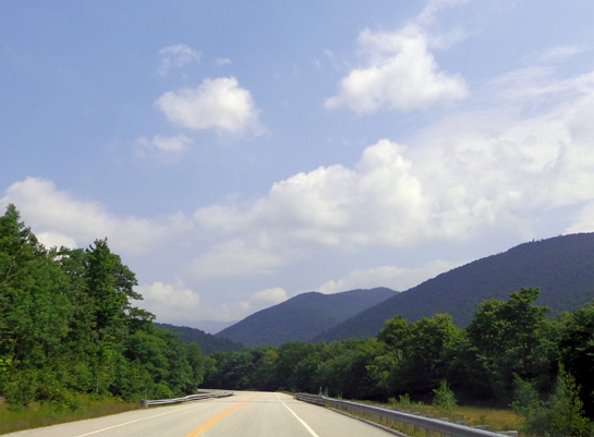
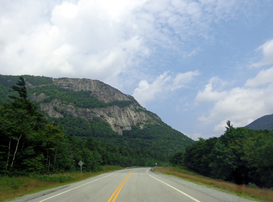
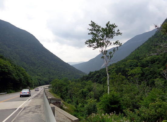
On the way to the falls I noted several photos I wanted to take along US
302 on the way
back north.
I took some pictures of the beautiful mountain scenery from the truck
as I drove . . .
. . . and stopped several times -- at the lake across from
the Willey House, at two nearby cascades,
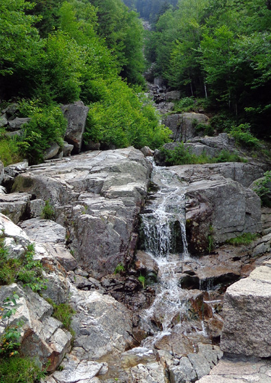
Lower part of the Flume Cascade
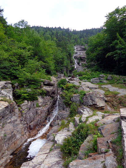
Silver Cascade
at another lake near
the Highland Center and Lodge,
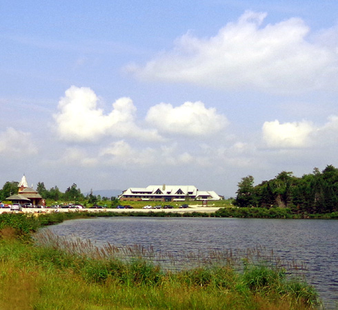
and at a parking area with a scenic view of the large Washington Hotel
below Mt. Washington:
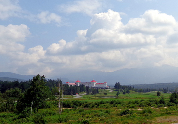
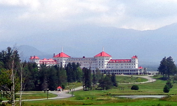
The clouds were too low to see the summit of Mt. Washington but I
enjoyed what I could see of the Presidential Ridge "behind" the elegant
lodge. (Bet it costs a bunch to stay there for a week.)
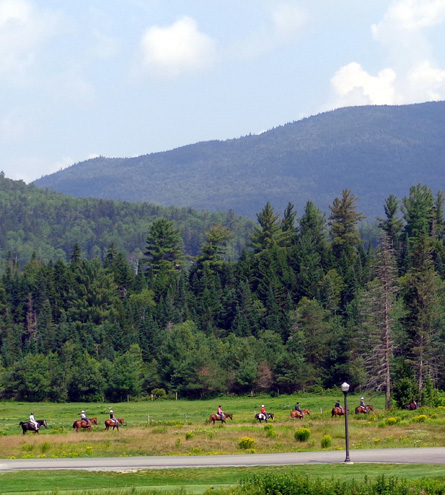
There was a group of equestrians just beginning a ride near the road
when I was taking photos:
I love all the great mountain views from the Crawford Notch area.
This
is such a gorgeous region to visit! I hate leaving in a couple days but we are also
looking forward to exploring the Maritimes . . .
Next entry: Here we go -- the drive from Twin
Mountain, NH to Calais, ME and over the border into New Brunswick,
Canada
Happy trails,
Sue
"Runtrails & Company" - Sue Norwood, Jim O'Neil,
Cody the ultra Lab, and Casey-pup
Previous
Next
© 2014 Sue Norwood and Jim O'Neil
