I love poring over paper AAA maps. Jim prefers online mapping software.
Both are fun.The last two days we've been busy doing more planning
for our trip to the Canadian
Maritimes later this week.
Our plans are about as viscous as when we went through Canada and
Alaska two years ago. Since we haven't been to the Maritimes before, we want to
be as flexible as possible. We aren't even sure how long we'll stay in
Canada. There are lots of variables.
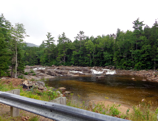
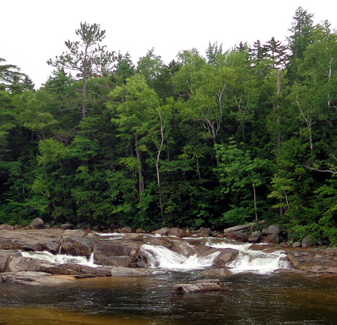
Cascades in the Swift River along
the Kancamagus Highway (close-up in next photo)
While we have a good internet connection at our current campsite
we're doing lots of online research about places to visit and and things
to do in the Maritimes.
We've devised a tentative route through Maine, New Brunswick, Nova
Scotia, and Prince Edward Island to hit interesting scenic, historical,
and other highlights.
We're also
researching
campground options, distances between tentative destinations, diesel
costs, exchange rates, phone and internet service, health coverage
(Medicare doesn't work in Canada unless you're passing through to Alaska),
and other financial considerations.
Jim has been doing routine maintenance on the vehicles to make sure they
are travel-worthy for this leg of our journey. He also installed new air
bags on the truck this week so our ride will
be more level and smooth towing the Cameo. We're hoping the roads are
better in the Maritimes than they were in British Columbia and the
Yukon.
The more we read about the Maritimes, the more excited we get about
going to these provinces! They sound beautiful and all the people we've
talked to who have visited the area loved it.
DAY TRIP THROUGH THE
WHITES
Meanwhile, we have
more plans for our remaining four days in the White Mountains of New
Hampshire. There is
a whole lot to see and do here, too.
In fact, we like this area
-- and
campground -- so much, we plan to stop by here again for a week or two in
September when the autumn leaves should be near their peak. We're going
to try to follow the fall leaves through New England and south to the
Mid-Atlantic this fall.
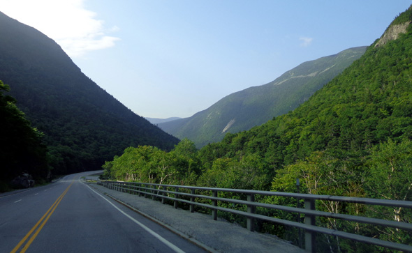
This morning began with low clouds and a few drops of rain. The clouds
mostly lifted by 10 AM so we decided to drive a loop around the Whites.
There were clouds all day and a bit of rain in the southern Whites about
1 PM while we were driving but we still got to see some beautiful
mountain scenery that was new to us.
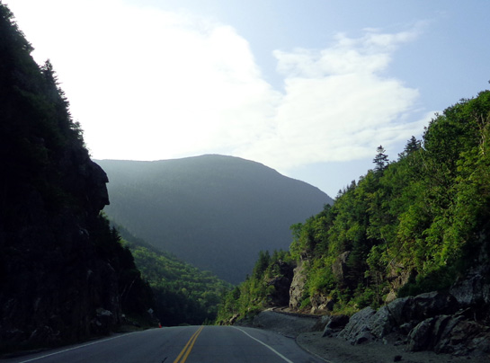
A railway follows the road through Crawford Notch; the tracks are on the
right.
Descent into the Notch
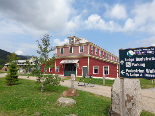
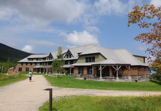
We drove south from Twin Mountain on US 302 through Crawford Notch,
stopping at the Highland Center. Neither of us has been in there before.
It has a very nice lodge and several trails begin there. I'll have to
check those out another time.
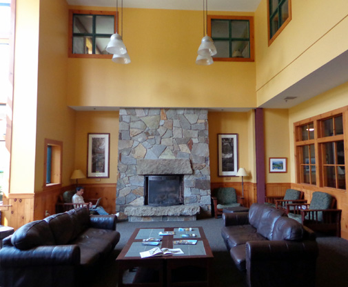
I bought some lightweight Smartwool socks and an ergonomic coffee travel mug
with the AMC logo.
We continued south through Crawford Notch. I noted various trailheads I might
use tomorrow or the next day, including the one to popular Arethusa Falls.
The road curved east through several communities -- Bartlett,
Glen, Intervale, North Conway, and Conway.
Traffic increased the closer we got to busy North Conway. It was stop
and go for about a mile through the business area. We didn't realize it
would be such a tourist trap with so many shops, resorts, attractions,
restaurants.
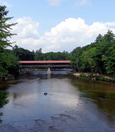
East of Bartlett on the Saco River we passed a covered bridge that isn't
used for traffic any more; there were goods for sale inside.
Later we saw two covered bridges that are still in use by vehicles over
the Swift River.
This attractive red-roofed bridge that can
be seen from US 16 before that highway merges with ME 113:
We drove through the
other
covered bridge over the Swift River about six miles west on ME 112, also
known as the Kancamagus Hwy. It was raining a little bit and I didn't
get a good picture of that one.
We followed the Kancamagus Hwy. for about 37 miles between Conway and
Lincoln. Some of it was very bumpy, some was smooth. Road crews were working
in several places.
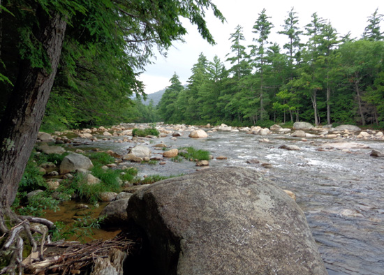
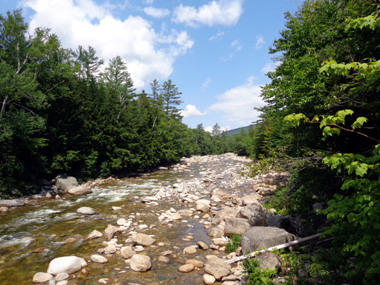
The eastern part of the road closely follows the Swift River, with many
pull-offs to enjoy the boulder-filled river. We let the dogs play in the
water at one of those:
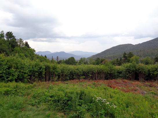
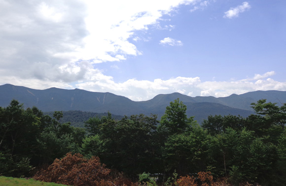
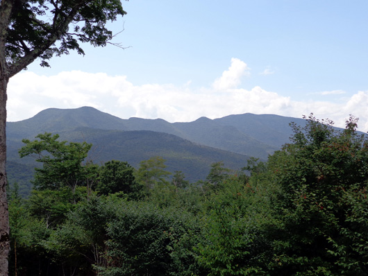
We passed lots of trailhead parking areas and small campgrounds, saw
some lakes, and went over a 2,800+ foot pass with great views of
surrounding mountains and the Pemigewasset AKA "Pemi" Wilderness.
We stopped at several
of the overlooks for photos:
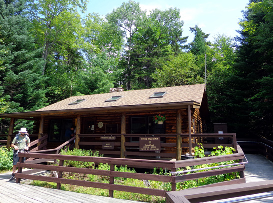
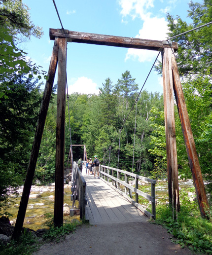
We also stopped at the Lincoln Visitor
Center. It was closed but a couple dozen vehicles were parked there. Several
trails start at the visitor center, leading hikers through the Pemi
Wilderness to various peaks and Franconia Ridge.
We didn't do any hiking from there today. We just walked down to a pedestrian
suspension bridge over the Pemi River:
We completed our convoluted loop through the Whites by driving north
from Lincoln on I-93 through Franconia Notch toward Twin Mountain
without making any more stops because it was raining lightly again.
That's OK. It gave us
more time in the camper this afternoon to continue planning the
logistics for our trip to the Maritimes.
Next entry: hike to Aresthusa Falls
Happy trails,
Sue
"Runtrails & Company" - Sue Norwood, Jim O'Neil,
Cody the ultra Lab, and Casey-pup
Previous
Next
© 2014 Sue Norwood and Jim O'Neil
