We initially chose Halifax as one of our "home bases" to explore Nova
Scotia because of the numerous historical and scenic attractions in and near the city.
Then Jim got busy searching online for good places to hike and cycle.
He discovered a good network of rail trails in the area, some of which
are part of the extensive-but-not-totally-connected Trans-Canada Trail
that stretches from British Columbia to the Maritime provinces.
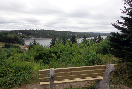
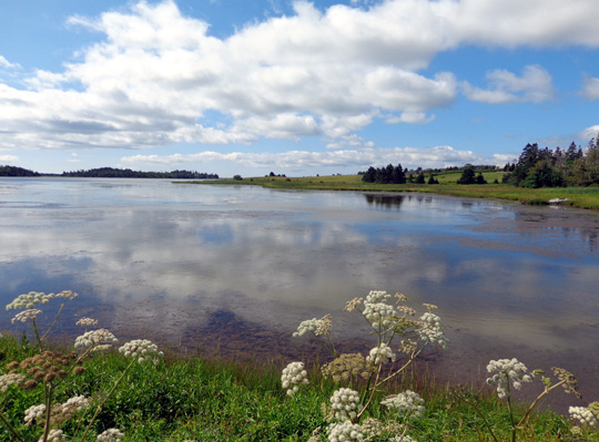
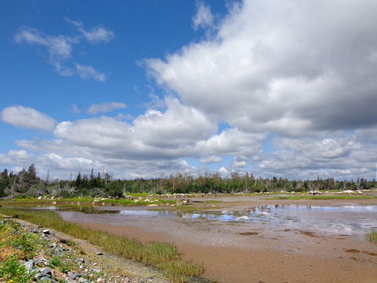
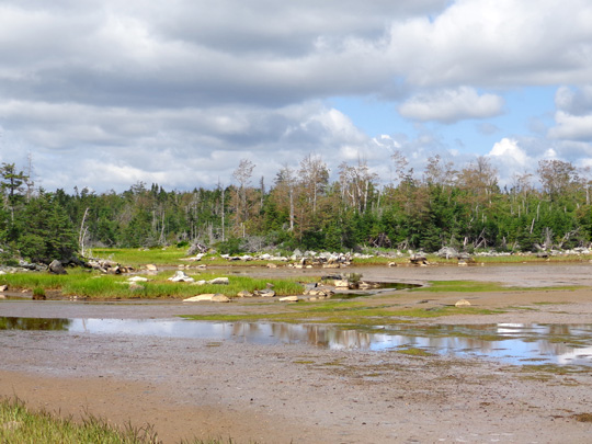
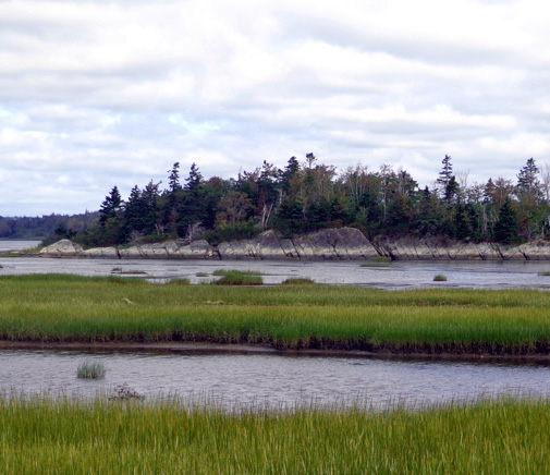
Above and below: scenes
from the Salt Marsh Trail
How's that for a great trail??? Salt Marsh and Atlantic View
are our favorites in the Halifax area.
This entry includes photos and information about bike rides we did on
the five trails listed in the heading above, on three different days this week.
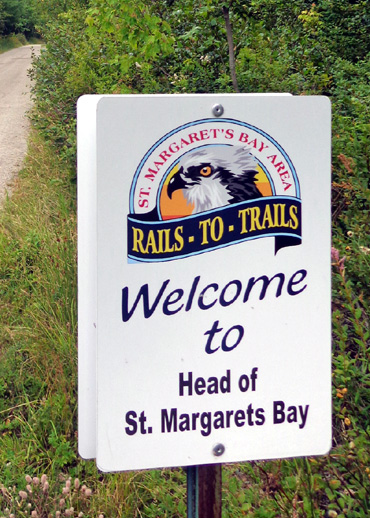
ST. MARGARET'S BAY RAIL TRAIL
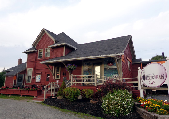
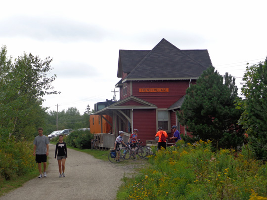
On Sunday we took Casey with us to the Bike & Bean Cafe on NS 3 about
seven miles west of our campground. It's a bike shop and cafe in the
former French Village train station, which was in use on the Halifax &
Southwestern Railway from 1904 to the 1990s.
The temperature was
still in the 50s F. and overcast so Casey did fine in the truck while we
rode our bikes.
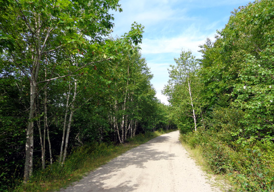
The St. Margaret's Bay section of rail trail is about 30 km long,
stretching NW of Halifax and SW toward St. Margaret's Bay. It
connects with other shared-use trails in the metro area and south shore.
The surface isn't as nice as the Celtic Shores Coastal rail trail that we
rode on Cape Breton Island last week or the other four trails in this
entry but it's still easy to ride --
a few ruts and gravel in some places instead of smooth crushed rock the
whole way.
I rode 5.25 miles SW and Jim went about 7 miles that direction before
turning around. I had a total of 10.5 miles riding when I got back to
the truck.
I put my bike inside the truck and started walking with Casey to the SW, the same direction I
rode. Just then Jim came back. He rode another five miles the other way
(more hilly, he said), then caught up to Casey and me when we reached a
reservoir above a dam where Casey could swim:
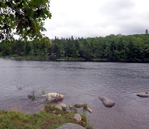
We threw sticks to her in the water, then went back to the truck and
home. I walked a total of 1.5 miles with her on the rail trail. Jim
ended up with a total of about 26 miles on his bike.
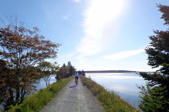
I was hoping for grand views of St. Margaret's Bay but we saw a lot more
of the head of the bay when we were driving the truck around on local
roads, hunting
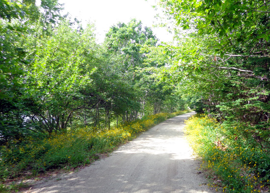
for a trail head. Trees blocked most of the views on the rail trail except for a half-mile
section where I took these pictures:
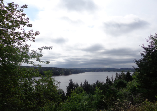
The bike path lies about 150 feet above the water, between NS 3 and 103.
The best water views besides the ones above are half a mile along the reservoir where Casey
swam. The rest of the trail we saw is mostly a
green tunnel of trees -- various conifers and hardwoods. That's
nice' but when water is nearby it's even better to be able to see
it.
There were lots of tall yellow daisies/asters in bloom in the sunnier
spots along the trail:
The parking area around the cafe was packed with vehicles that Sunday
morning. We expected to see more people and dogs on the trail than we
did. They must have been strung out along the 18+ mile trail.
Most people I saw were cycling; a
few were walking. Two ATVs went by when I was walking Casey. Trails like
these are also popular with cross-country skiers in the winter.
SALT MARSH & ATLANTIC VIEW TRAILS
These two popular rail trails connect and are
part of the vast Trans-Canada Trail northeast of Halifax. Built on the bed of a former
railway, they lie within the Cole Harbour Coastal Provincial Park.
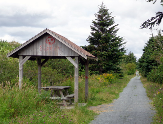
Two other trail segments we rode, Heritage and
Shearwater Flyer, connect at the Salt Marsh trailhead on Bissett Road where we parked.
I'll show photos of those later in this entry.
This track from Jim's GPS shows the relationship
of the four trails:
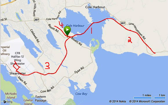
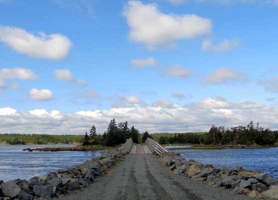
# 1 = the
Salt Marsh Trail, which goes across a lot of water on land dykes and
wooden bridges.
# 2 = the
first half of the Atlantic View Trail. It continues farther along the
coast than shown here.
# 3 = the Shearwater Flyer Trail;
Halifax Harbour is to the left of Shearwater.
# 4 = the
Heritage Trail.
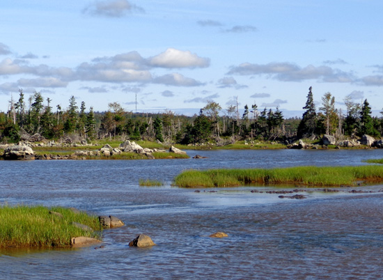
Both the Salt Marsh and Atlantic View rail
trails are very well maintained and smooth, especially nice for cycling
and running:
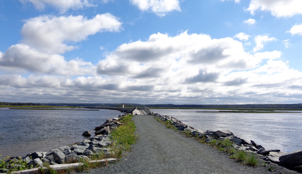
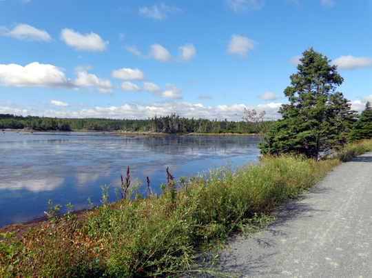
The Salt Marsh Trail lies very close to the
water for most of its length:
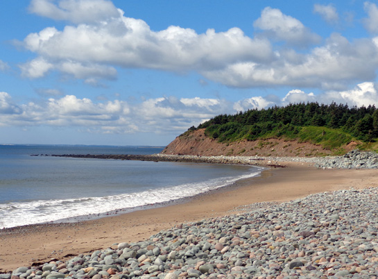
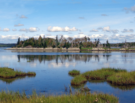
The western trailhead for the Atlantic View
Trail is on West Lawrencetown Rd. This trail is part inland and part marsh until reaching the
ocean at Lawrencetown Beach:
I took more photos where there were scenic water
views than through less interesting green segments so most
of the photos in this entry on the Atlantic View section show water.
Note that I've only seen 2.2 miles on the western side of this 6.2-mile
segment. Jim did 4+ miles of it but he didn't take any pictures.
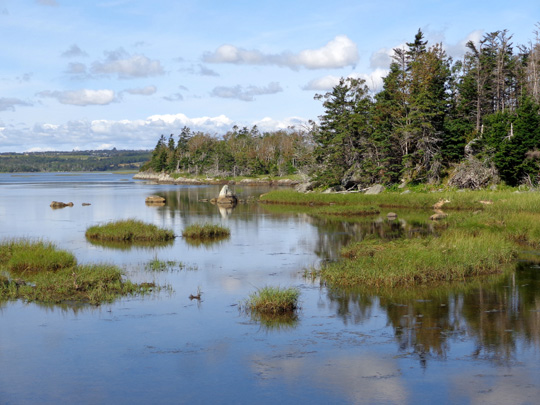
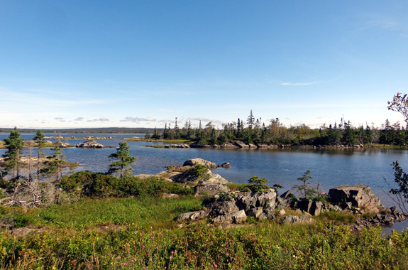
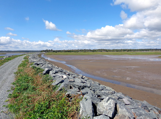
EBB & FLOW OF WATER
We liked these segments so much that we rode
them two different days this week. That was interesting because we got to see them
at various stages of the tides.
On this side of Nova Scotia's peninsula
-- the eastern, Atlantic side -- the tides are nowhere near as variable as
they are on the western side in the Bay of Fundy. Good thing, because these rail trails
are not much above sea level. You can see that in many of the pictures in this entry.
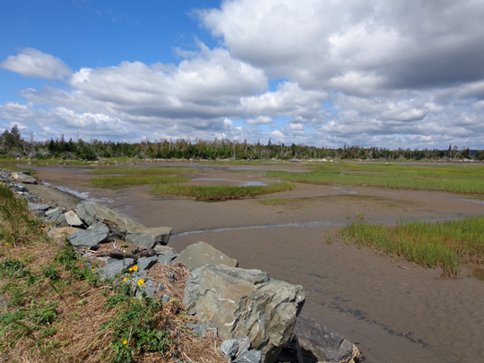
When the tide goes out, however, quite a bit of
mud is exposed in the shallow basins on either side of the trail.
That's when the marsh really comes alive.
In
the next set of photos, water was lapping against the rocks when the tide
was up:
This is the same area as the last
two shots when the tide is up:
Here's another example of one place on the Salt Marsh Trail with more,
then less, water:
Although I loved the
pretty blue water surrounding me when the tide was higher, I liked riding these
two trails better at lower tide levels because more rocks, mud,
and birds were visible then.
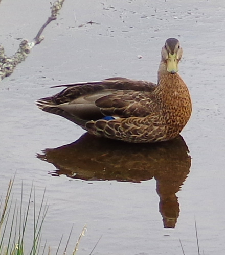
It
was fun to watch the ducks, geese, herons, and sea gulls feeding at all
stages of the tides:
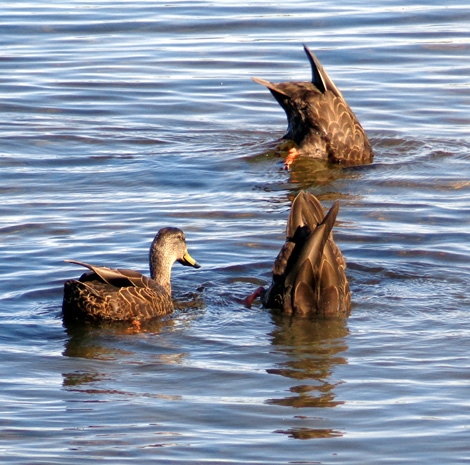
Bottoms up!
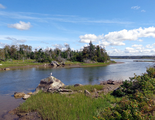
A seagull is sitting on the large rock, possibly
waiting for its next meal.
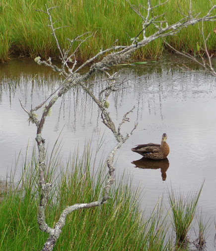
Above and below: This fella was watching me
closely because
Mama and two juvenile chicks were feeding several feet to
the left.
Continued on the next page . . .
Happy trails,
Sue
"Runtrails & Company" - Sue Norwood, Jim O'Neil,
Cody the ultra Lab, and Casey-pup
Previous
Next
© 2014 Sue Norwood and Jim O'Neil
