When we saw on the Jacksonville map that there was a nature preserve
with an historic fort near the Mayport Naval Station we knew we had to
visit one day while we were here.
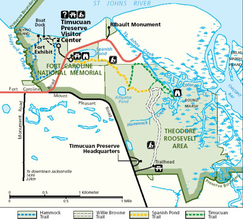
There are two units in the Timucuan (TIM-a-kwan) Ecological
and Historic Preserve, shown below. The southern unit borders the St. Johns River and includes a
National Park Service visitor center, a one-third size replica of Fort
Caroline, and the Theodore Roosevelt natural area:
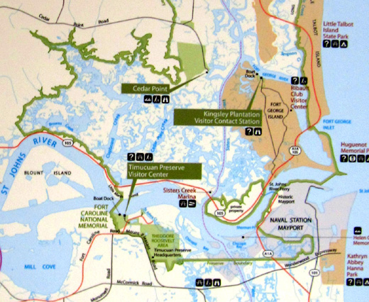
Many more acres are on the northern side of the river and include the
Kingsley Plantation and visitor center, the Ribault Club visitor center,
Cedar Point Park, and thousands of acres of watery salt marsh where
visitors can fish and kayak.
So far we've just visited the southern unit with the fort, which is open
for self-tours every day except a few holidays.
We'll have to check out the northern unit of the preserve on our next
stay to Mayport at the beginning of March. Tours of the house at
Kingsley Plantation are quite limited -- only twelve people at a time
and only at 11 AM and 2 PM on Saturdays and Sundays. We need to make advanced
reservations for that.
WHO WERE THE TIMUCUA?
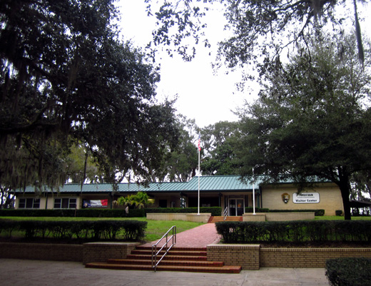
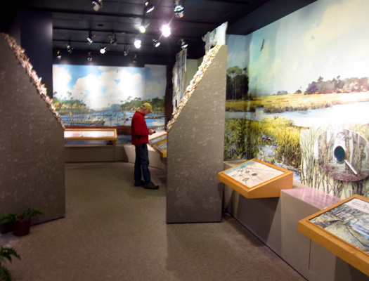
Our first stop was the National Park Service's
visitor center near the site of historic Fort Caroline so we could get a
map and brochure about the preserve. There is no cost to visit the
national memorial or Theodore Roosevelt area in the southern unit.
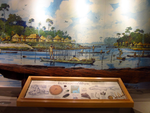
The visitor center has exhibits and lots of
historical information about the early Native Americans and French
colonists who populated this area of northern Florida.
For at least 12,000 years native peoples depended on
the rich natural resources of the St. Johns estuary; the forests
and marshlands provided an abundance of building materials and food.
Although no shelters have withstood the elements
all these years, discarded oyster
and clam shells that were piled into mounds for thousands of years by
pre-Columbian inhabitants are scattered throughout the preserve on both
sides of the river, indicating seafood was a dietary staple for these
early inhabitants.
It still is for many local residents in
the 21st century.
The Indians who made contact with the first
European arrivals to the area in the mid-1500s are now known
collectively as the Timucua (TIM-a-kwa). Their civilization can
be traced back approximately 6,000 years. Although there were some
cultural differences between the tribes they all spoke a common language.
The native groups appear to have gotten along
better than all the outsiders who fought over northern Florida beginning
in the mid-1500s.
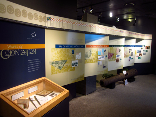
The French, Spanish, English, African Americans,
and Americans have all had an influence in this area. Settlements,
earthworks, forts, and plantations chronicle centuries of both the
assimilation and the strife of various cultures in this corner of
northeast Florida.
The first European settlers were the French, who
arrived in 1562 and established a colony two years later.
The Timucua offered food and even helped the newcomers build Fort
Caroline.
Spain soon declared that the French were
trespassing on Spanish territory. In 1565 they defeated the French and
massacred most of the fort's defenders, sparing the ones who declared
they were Catholic. "La Florida" remained in Spanish
hands for the next 200 years.
This was not good for the Timucuan culture or
health. These native peoples didn't survive European contact for very
long.
Not only did the Spanish impose their own
culture, including religious beliefs, on the native population, the
Indians had no immunity to the new diseases the Europeans brought with
them. Only 550 Timucua were recorded in 1698; the population had
once numbered in the tens of thousands. No known indigenous people now
call themselves Timucua.
TOURING FORT DE LA CAROLINE
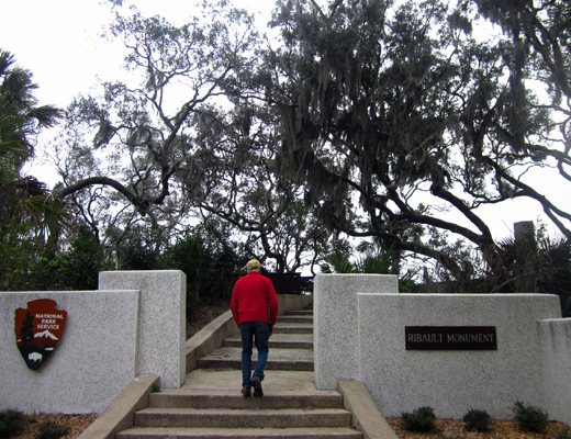
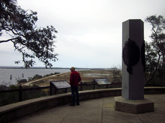
Jean Ribault was the first French explorer to
discover the St. Johns River. His corps erected a stone marker in the
area, then sailed north.
You can continue driving a mile or two east on
Fort Caroline Road to see a replica of the stone column erected by Ribault in 1562:
Two years later another French expeditionary
force led by Rene dé Laudonničre
established a colony a mile or two upstream from the Ribault Monument.
The 300 colonists were mostly Huguenot noblemen,
soldiers, artisans and their families. They named
their colony "La Caroline" in honor of King Charles IX. The Timucua
helped them build a triangular fort for protection.
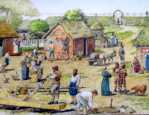
Section of an interpretive panel at the fort
The hopes and dreams of the French Protestants,
who were fleeing persecution from Catholics in their homeland, were
short-lived. As mentioned above, the fort and colony were soon overrun
by the Spanish, who were mostly Catholic. Most of the
French colonists were murdered.
Although the French recaptured the fort in 1568,
they never attempted to colonize this area again.
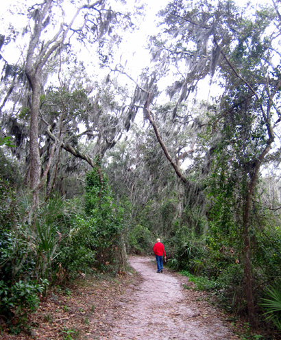
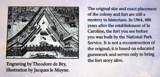
A one-third size replica of the fort has been
reconstructed from early engravings and descriptions to show modern
visitors what the original fort was like. It is located a half-mile walk along the
river and through a live oak forest from the visitor center.
There are several interpretive panels along this
trail and other things to see along the way:
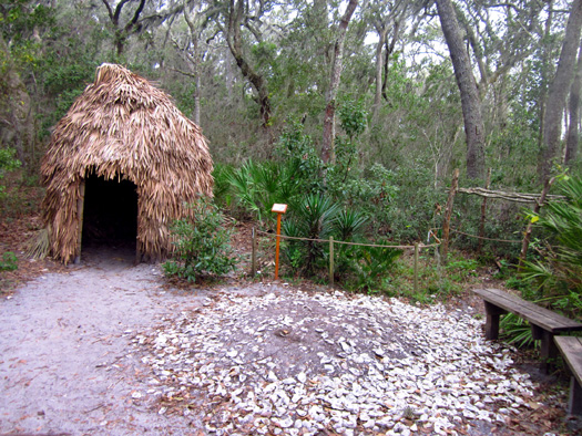
Timucua hut
replica and real shell mound
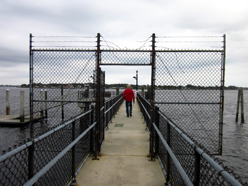
Jim walks
out to a boat dock along the way. There are signs warning boaters to be
careful
not to harm
the Florida manatees swimming in the river. They are an endangered
species.
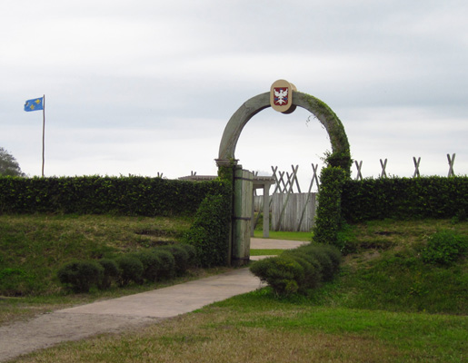
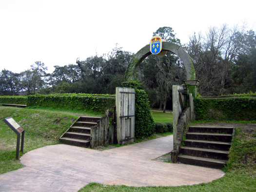
Entrance to
fort replica
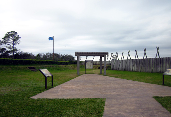
Interpretive
panels describe life at the fort in 1564-5.
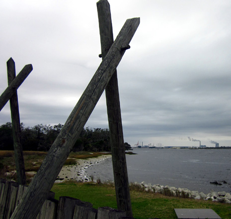
View of the
St. Johns River
This is an interesting place for history buffs
and nature lovers of all ages.
If you want to walk farther you can return to
the visitor center parking area via a loop trail:
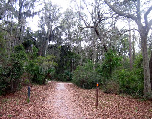
If you want to walk
even further than that, continue on to the Theodore Roosevelt natural area.
See map below.
THEODORE ROOSEVELT AREA
This 600-acre nature preserve located near Fort
Caroline was owned by the Browne family from 1889 to 1969 as a refuge
from city living. The two sons of the original owner lived very simply
off the land and water.
The last survivor, Willie Browne, was an admirer
of President Theodore Roosevelt and his conservation efforts. Browne
donated his land to The Nature Conservancy in 1969, a year before his
death. The National Park Service acquired the property in 1990 as part
of the Timucuan Ecological and Historic Preserve.
Here's a more detailed map showing the trails
through this natural area:
Visitors can access this part of the preserve
from trails near the visitor center or parking at the south end of the
unit on Mount Pleasant Road.
On the way to the nature preserve the trail
from the visitor center passes
Spanish Pond. I took these pictures at and near the trailhead parking
area off Fort Caroline Road near the visitor center:
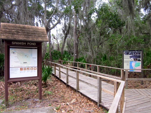
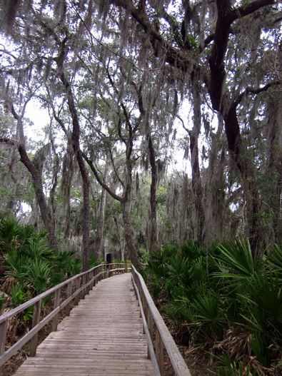
I didn't go far enough back as far as the pond this time.
Trails and boardwalks wind through a variety of
habitats including live oak forest hammock, scrub
vegetation, freshwater swamp, and salt marsh. A "shell peninsula"
contains mounds of oyster and clam shells left over from thousands of
years of pre-Columbian and Timucua Indian habitation. Numerous birds and animals live in the
preserve, including ospreys, great blue herons, snowy egrets, bald
eagles, alligators, dolphins, bobcats, tortoises, and many other species.
We'd like to come back here in March and hike on some of the trails.
Only one is open to bicycles. We also plan to visit Kingsley Plantation
and the Ribault Club visitor center when we come back.
Next entry: day trip farther north along the First Coast,
including a fun ferry ride
Happy trails,
Sue
"Runtrails & Company" - Sue Norwood, Jim O'Neil,
Cody the ultra Lab, and Casey-pup
Previous
Next
© 2013 Sue Norwood and Jim O'Neil