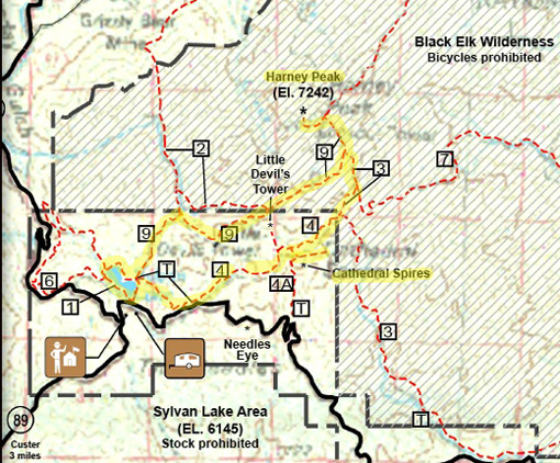
Continued from the previous page.TRAIL #9 TO HARNEY PEAK
Like last year, I took Trail #9 to Harney Peak and came back on Trails #3 and
#4 past Cathedral Spires to the trailhead near Sylvan Lake where I parked.
Here's the map again:
My total distance including the loop around Sylvan Lake (described on
the previous pate) was 8.6 miles in 4:13 hours. That included lots of
pictures and several stops.
Elevations ranged from 6,115-7,303 feet on my Garmin GPS. There was a
fair amount of up and down; total elevation gain -- and
equal loss -- was 2,788 feet. I think my GPS was off a bit.
Harney Peak, the highpoint in South Dakota, is officially 7,242 feet. I
climbed higher than that, however, to the upper floor of the old stone
fire tower on the summit.
TRAIL #9 TO THE PEAK
This trail is rated moderate to
strenuous for the elevation gain/loss and sometimes-rough trail
surfaces. It begins in Custer State Park and continues over the park
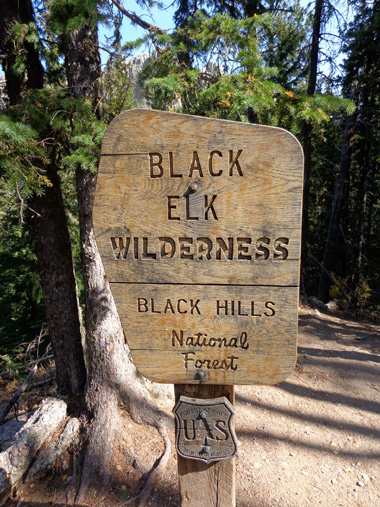
boundary into the Black Elk Wilderness Area. The wilderness area is
definitely more "wild" than the park, as it should be.
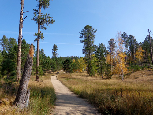
The photos on this page are
basically in order from the trailhead at Sylvan Lake to Harney Peak. The
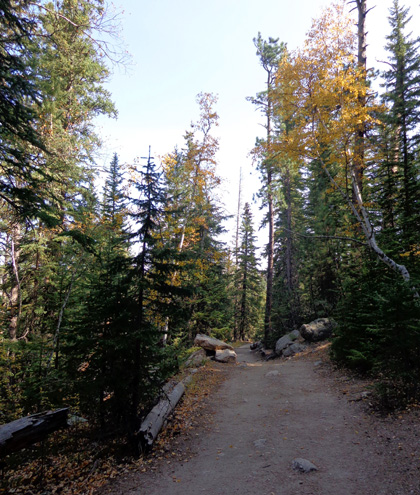
trail is fairly smooth near the beginning and becomes increasingly more
difficult as it gains elevation:
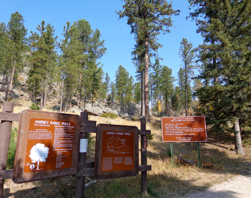
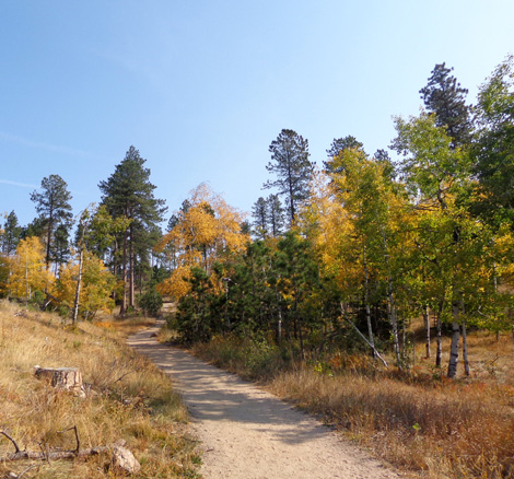
Trailhead at Sylvan Lake for
Trail #9 to Harney Peak
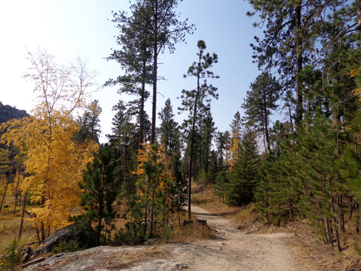
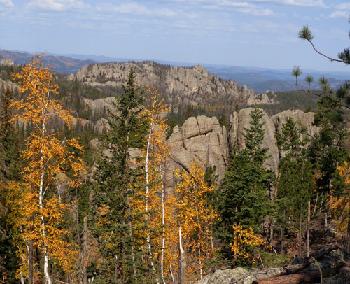
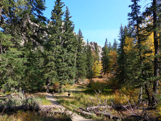
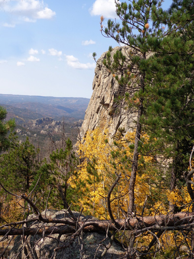
The yellow/gold colors of the aspens and birches are very pretty right
now. I wasn’t expecting so much color since South Dakota is several inches
below normal rainfall this year. A few flowers are still blooming, too.
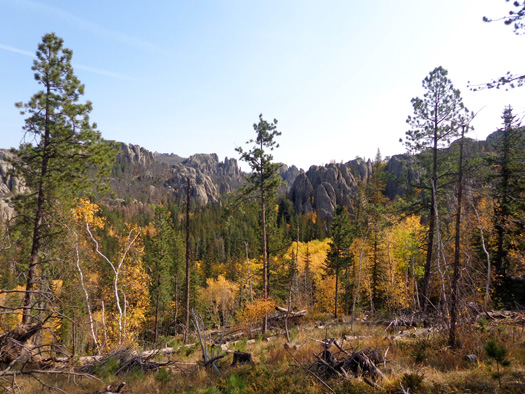
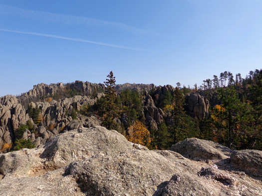
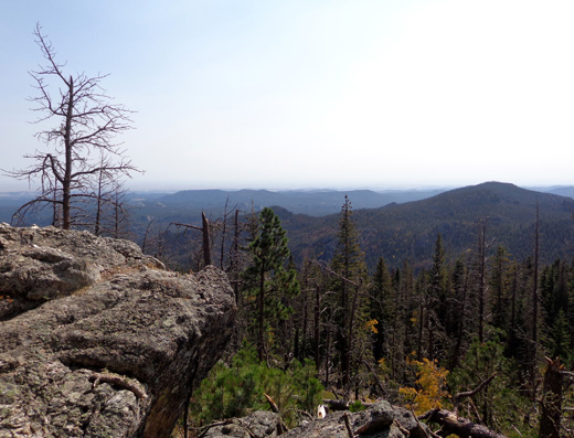
After the trail gains some elevation there are
increasing views of the granite formations in the distance. I especially
like the views from a wide rock overlook about a mile up the trail:
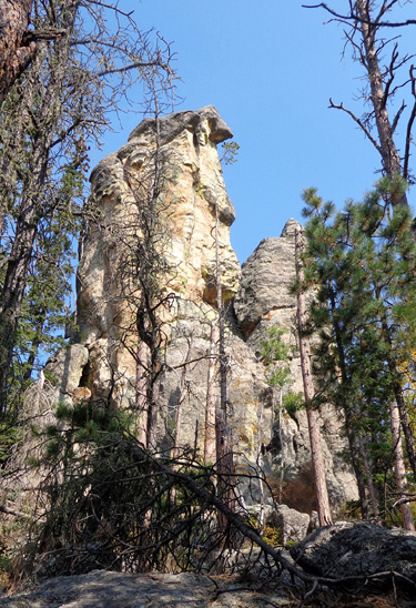
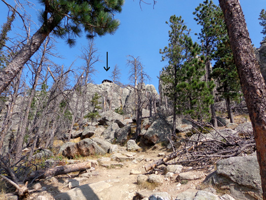
If hikers know where to look, they can start to see the old stone fire
tower on the summit halfway up the 3˝-mile
trail:
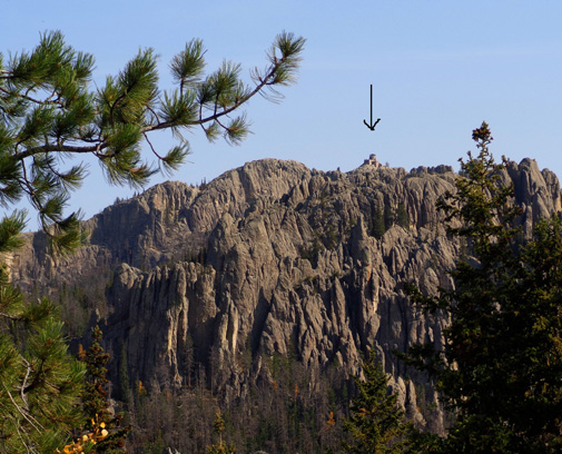
The first time I climbed the peak I didn't know where to look for
the fire tower from this far out (the photo above is zoomed in part
way). On subsequent hikes it's been easy to spot with the naked eye.
Within another half mile I was in the Black Elk Wilderness, where
hikers are supposed to sign a register. That is common in every
wilderness area I've ever entered. The purpose is safety -- name,
state, number in party, destination, how long you plan to be in the
wilderness. There is no fee.
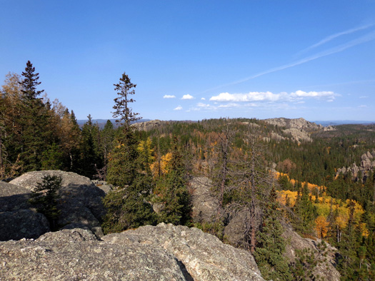
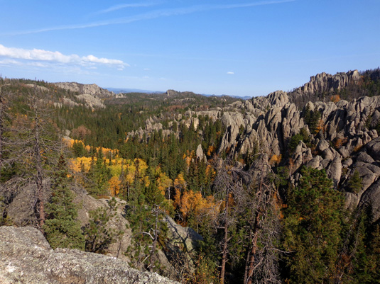
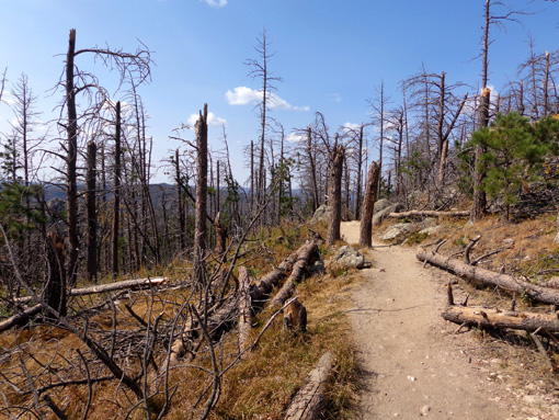
After the intersection with trails #3, 4, and 7, I
continued following Trail #9 up-and-back to the fire tower for about 1/2
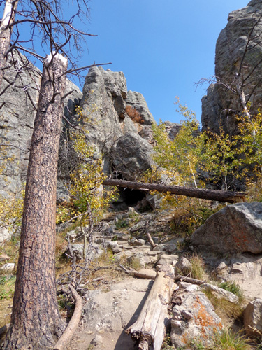
mile each way. The trail becomes rockier and more steep, and the trees
thin out, affording more expansive views:
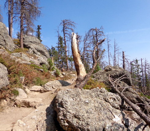
Wind damage 1/4 mile below the
fire tower? We're at about 7,000 feet elevation now,
high enough for all the
deciduous leaves to be down.
View of top of fire tower under
arrow; trail is pretty rough the rest of the way.
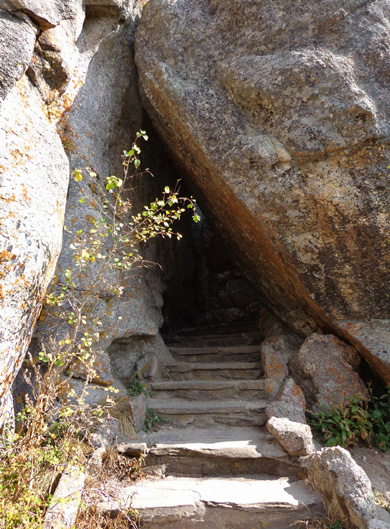
I love going through this narrow passageway to the
stairs leading up to the fire tower:
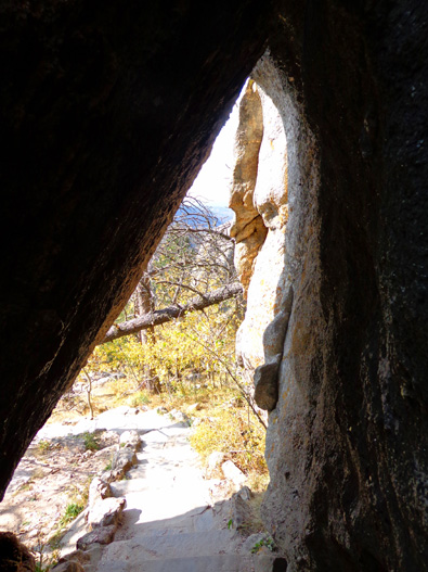
View back out to the trail
After negotiating some rough trail to reach this point, hikers must
climb up several levels of grated iron steps -- rough on dogs' toenails,
but Cody did OK -- and lots of stone steps to reach the fire tower:
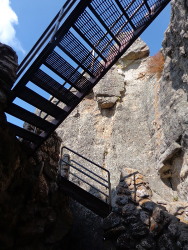
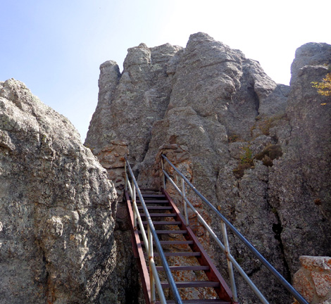
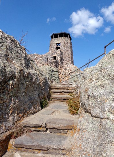
There are a lot more stairs and steps than I've shown
in these pictures but the effort is worth it to reach the handsome fire tower.
Continued on the
next
page: photos of the historical stone fire tower,
panoramic views from inside and out, and Cathedral Spires
Happy trails,
Sue
"Runtrails & Company" - Sue Norwood, Jim O'Neil,
and Cody the ultra Lab
Previous
Next
© 2012 Sue Norwood and Jim O'Neil
