Jim and I both covered a lot of miles on those
roads and trails in the Black Hills today.
In the last entry I wrote about his 40-mile bike ride
on the Mickelson Trail from Hill City to the town of Custer, around Stockade Lake,
and through part of Custer State Park.
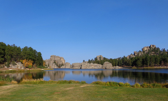
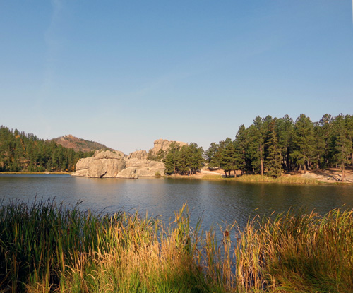
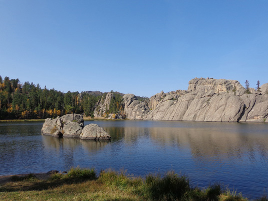
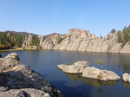
Sylvan Lake has lots of interesting granite rock
formations.
In this entry I'll cover the 8˝-mile
double-loop hike I did with Cody in the park around Sylvan Lake, past
Cathedral Spires, and up to Harney Peak, the highest point in South
Dakota. It also has the distinction of being the highest peak east of
the Rockies in the USA.
I'll also include
photos of colorful fall scenery on the Needles Highway as I drove to the
point where I picked up Jim.
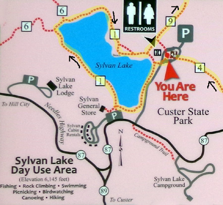
Here's a map
section that shows the route I drove from Hill City to Sylvan Lake, then
on to the location where I picked up Jim near the question mark on the
lower right. That route is highlighted in yellow:
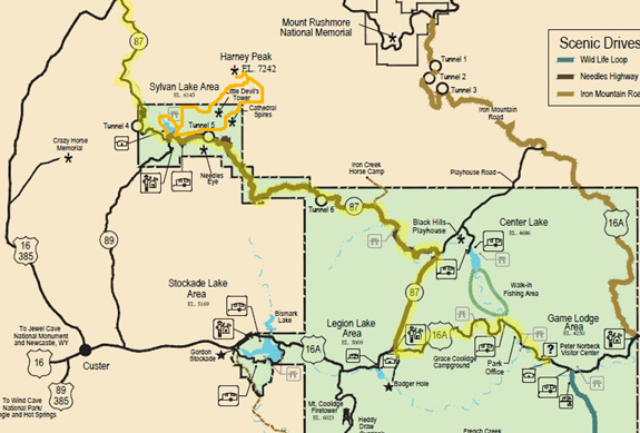
I drew an
approximation of my hiking loops in orange. Green sections = the
northern part of Custer State Park. Pink = Black Hills National
Forest and some private land.
PARK TRAILS
Custer State Park has many miles of dirt
trails to hike. Some are also open to
cycling and horseback riding. You can download a park map at this
link
and specific trail maps at this
one.
Here's a section of the Harney Peak area
map,
with the trails I hiked highlighted in yellow:
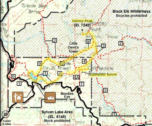
I was on several of the park trails today --
the Sylvan Lake Shore Trail, a bit of the Cathedral Spires Trail, and a
large loop incorporating Trails #4 and #9 to Harney Peak. Harney Peak is
outside the park boundary in the Black Hills National Forest and the
Black Elk Wilderness.
Dogs are allowed on all of these trails so Cody
was able to hike with me. Bikes are allowed around Sylvan Lake but not
the other Harney-area trails I hiked today.
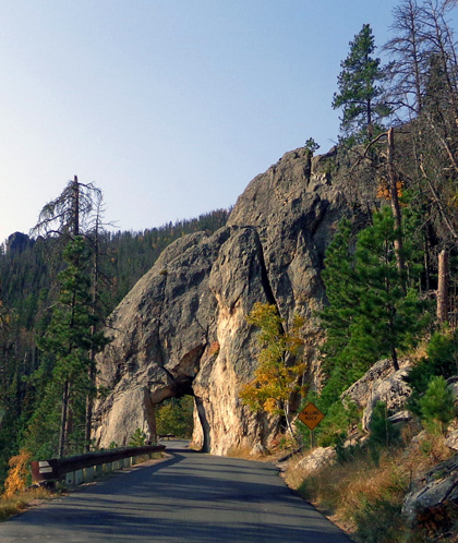
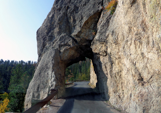
ENTERING THE PARK
After I dropped Jim off in Hill City I drove south on US 385 to SD 87
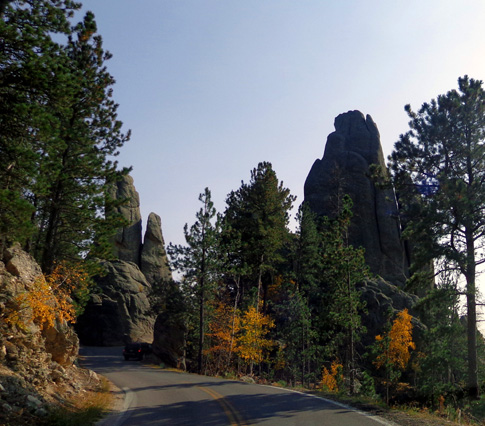
AKA Needles Hwy.
This scenic road winds through thick forests and has several narrow
tunnels over its 14-mile length. Its name comes from all the needle-like
granite formations that are visible from the road:
I paid the $15 Custer State Park entry fee at Sylvan Lake and parked
near the trailheads for Harney Peak.
The entrance fee is good for one week in the park. An annual pass is
$28. If you're just driving through the park on US 16a and not making
any stops you don't have to pay.
To stop and picnic, hike, camp, see the visitor centers, etc. or to travel
on any of the scenic roads in the park -- the Needles Hwy., Iron
Mountain Rd., or Wildlife Loop -- you need to pay the entry fee.
I think it's worth it, even for one day in the park. The longer you stay
or the more frequently you visit, the more cost effective the price. We
plan to come back a couple more times while we're at Ellsworth.
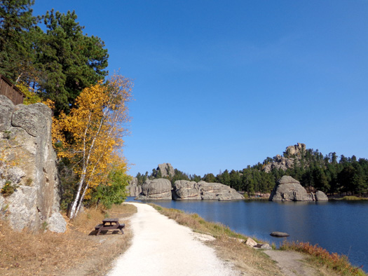
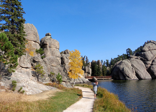
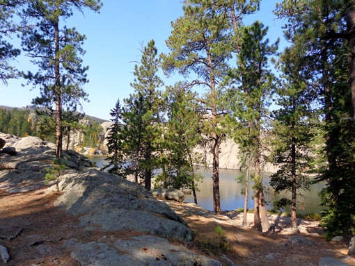
SYLVAN LAKE SHORE TRAIL
Cody and I did just about the same hike that we did last fall. [At the
time I'm writing this, the 2011 entry hasn't been uploaded so these
photos will be new to readers.]
This
time we hiked clockwise the whole way around the very scenic lake first,
not just the southwest side. Total distance around the lake is about a mile.
Here's a map segment
from a photo I took of one of the interpretive panels, with my route
marked:
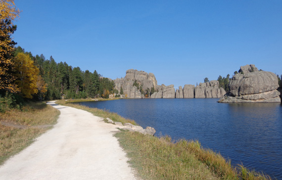
The eastern and
southern half
of the trail is easy and wheelchair-accessible -- flat and smooth crushed
rock -- for about half a mile to the far side of the
lake, where there is a pedestrian bridge overlooking the lake:
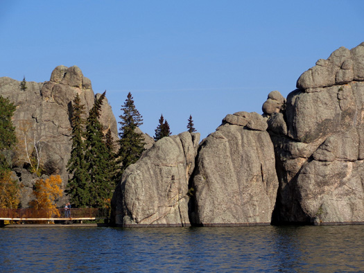
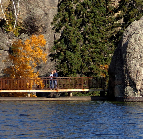
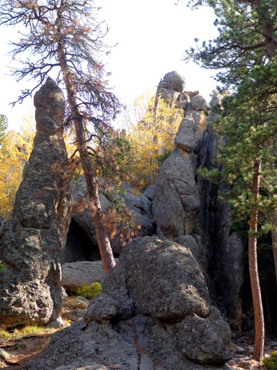
The bridge is a dead end. To continue on the trail around the north side
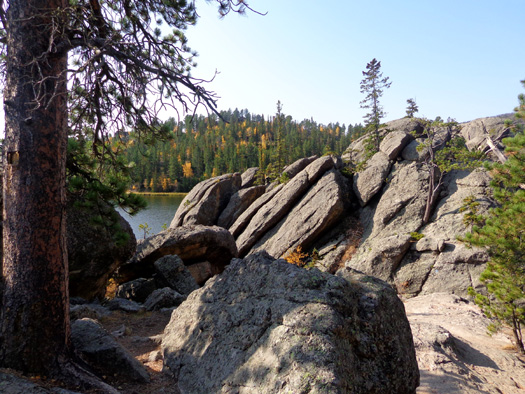
of the lake visitors need to walk through this tall, narrow rock slot
on the far side of the lake:
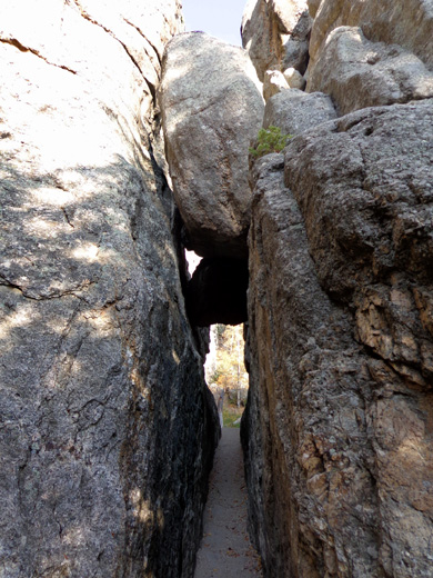
The path between the tall rock walls is about three
feet wide;
the wedged boulders are about fifteen feet above
the path.
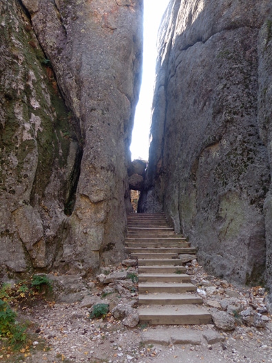
You can better see the height of the rock walls
from this direction.
The boulders stuck between the rock walls remind me of the "guillotine"
formation on the Appalachian Trail near Apple Orchard Mountain in
Virginia. It's a little nerve-wracking to walk under them!
Once through this rock formation the trail becomes more hilly, rocky,
and rooty for at least a quarter of a mile.
The Sunday Gulch Trail loop begins within a few hundred feet of the tall
rock slot:
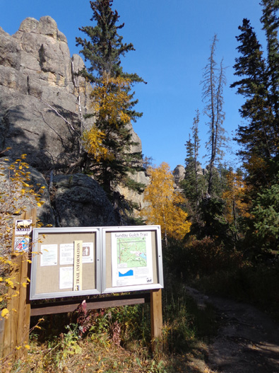
I haven't hiked that three-mile loop yet. Per the park
website and brochure it is strenuous
and "offers perhaps the most unique scenery of all the park's hiking
trails."
With a description like that, I'll have to check it out some day.
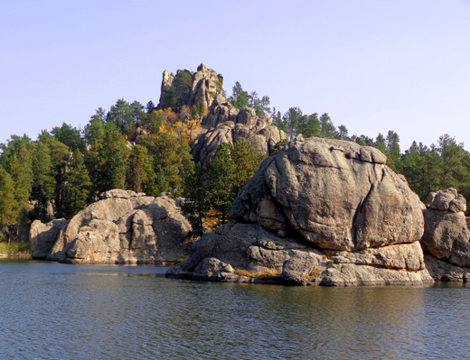
The north side of the lake is more difficult to negotiate with a bike,
stroller, or with physical limitations but you get different
perspectives of the water and it's interesting to get up into
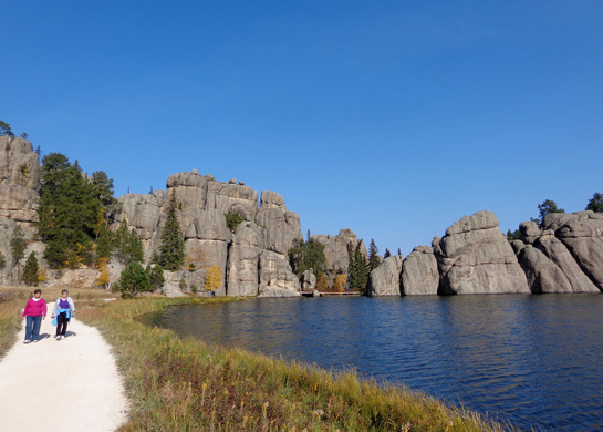
the rock formations:
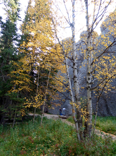
The two people give some perspective to the height
of the rock formations.
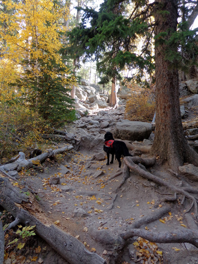
Cody checks out the gnarly trail ahead.
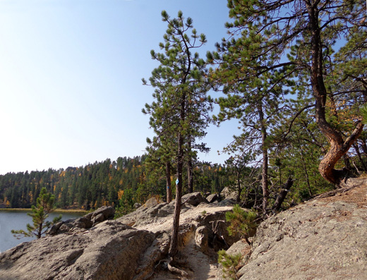
The Lake Shore Trail is marked with blue diamonds
through the rocks.
This would be a great place to just hang out for a
while to watch birds and kayakers.
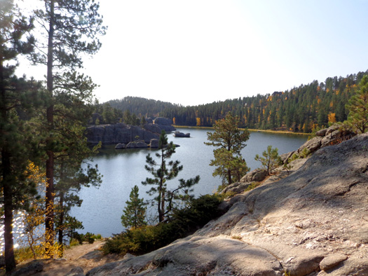
In the last quarter mile on the northeastern part of the loop, heading
toward the Harney Peak trailhead parking area, the trail is more flat
and smooth, perfect for picnicking and relaxing:
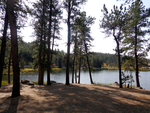
If you have very limited time at the park and can hike on only one
trail, I recommend walking around part or all of beautiful Sylvan Lake.
Continued on the
next page: hiking up to the stone fire
tower on Harney Peak, the highest point in South Dakota
Happy trails,
Sue
"Runtrails & Company" - Sue Norwood, Jim O'Neil,
and Cody the ultra Lab
Previous
Next
© 2012 Sue Norwood and Jim O'Neil
