This entry is a continuation of the previous one.
CENTENNIAL TRAIL
When I got to the Centennial Trail I turned left and followed it south
for another 1Ľ
miles, gaining more elevation to 5,600 feet.
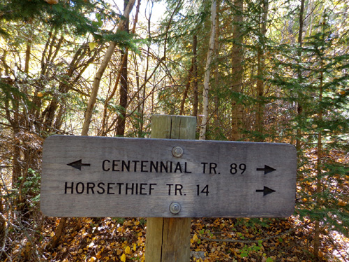
Those are the Forest Service trail numbers, not
miles.
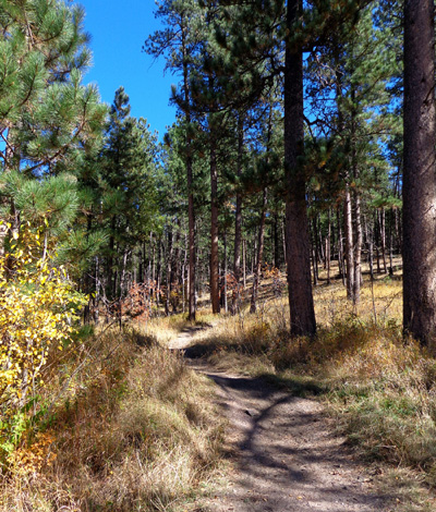
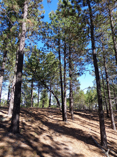
This part of the trail is generally smoother but also had some rocky
spots. Horses are allowed on the Centennial Trail. Bikes are allowed
on some parts of it but not within the wilderness boundaries.
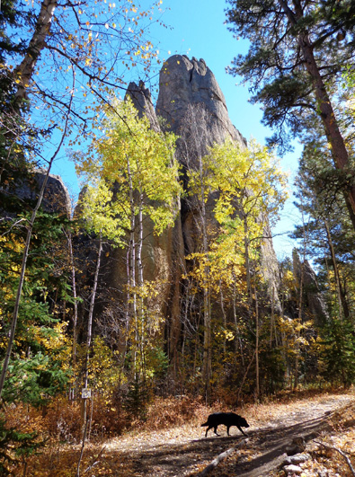
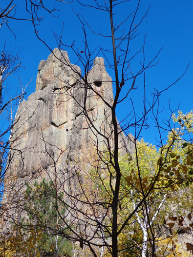
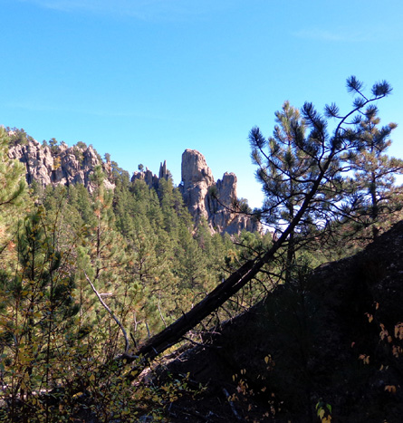
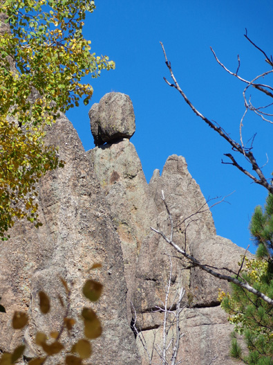
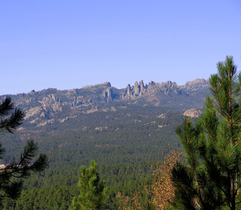
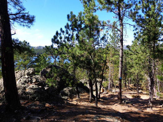
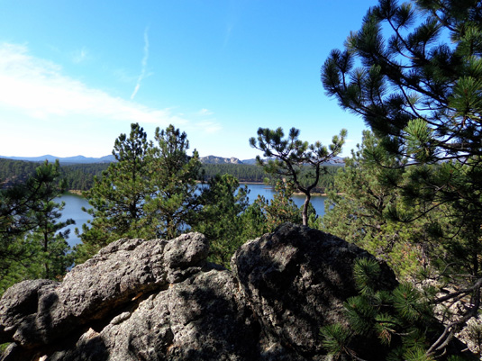
I really enjoyed all the tall spires
and other granite formations visible on this part of the trail:
On my way back to the lake
I also checked out a quarter mile of the Centennial Trail going
northwest but I didn’t see any more rock spires so I turned around.
The Centennial Trail runs 111 miles through the Black Hills from Bear
Butte State Park in the north to Wind Cave National Park in the south.
It was built in 1989 to commemorate the 100th anniversary of statehood.
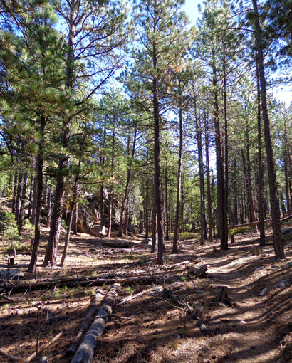
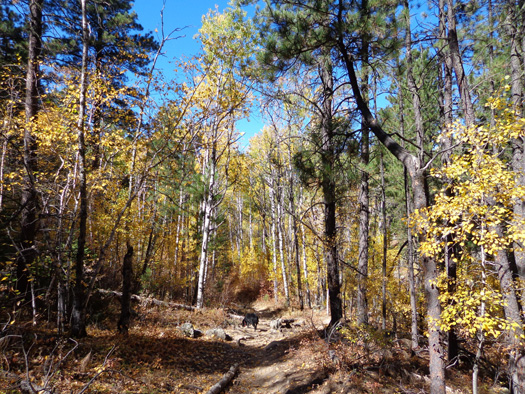
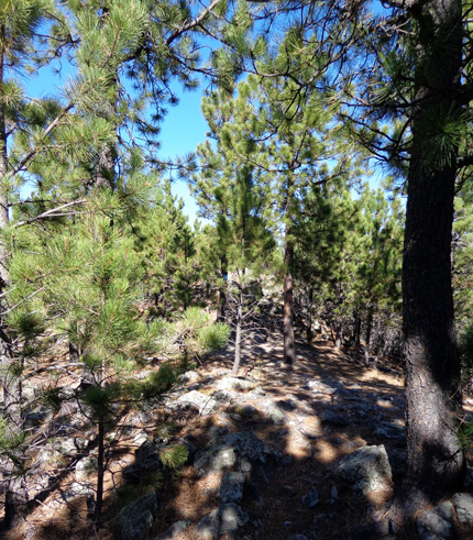
Above and
below: The Centennial Trail has a nice mix of pines and hardwoods,
too.
I've hiked several miles of the Centennial Trail at Wind Cave National
Park previously and would like someday to hike the whole length of the trail.
Cody and I walked
about 4˝
miles on these trails at and near Horsethief Lake. Elevations ranged from 5,200
to 5,600 feet with a lot of ups and downs.
I recommend other hikers check out these trails if they're in the area.
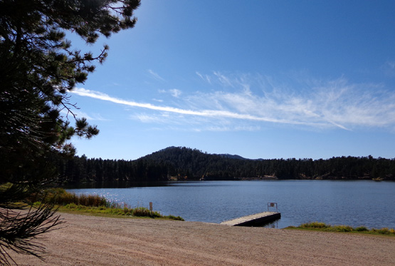
The lake is also a good place to fish and camp.
THE DRIVE TO STOCKADE LAKE
I drove the little
dirt road back to SD 244 and
stopped at two turnouts on the highway to take more pictures of
Horsethief Lake (shown on the previous page).
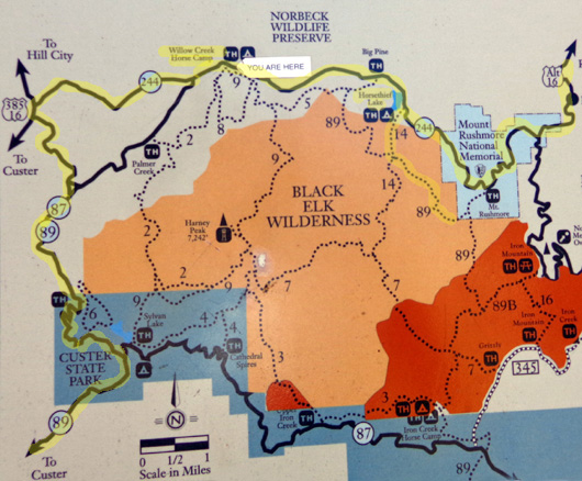
Here's another map
section of this part of my route this morning. This one is from an interpretive panel
at Willow Creek ("Your Are Here"):
I continued west several more miles on SD 244 to Willow Creek
Campground, which appears to be mostly for equestrians:
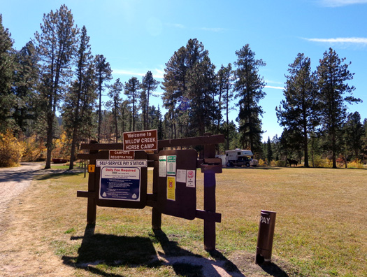
Two trails begin here and connect to
other trails in the Harney Range:
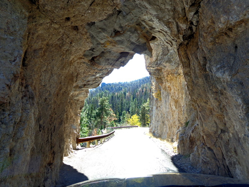
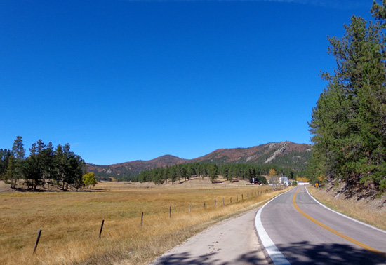
SD 244 ends at US 16. I turned south for less than a mile to SD 87 AKA
the Needles Highway, which I drove a few days ago. In a few miles this
narrow, winding road enters Custer State Park.
Here's one of those
skinny tunnels again and a fun photo looking back at the scenery:
My 7-day park entry sticker was still good today so I didn't have to pay
again. I was in and out of Custer State Park property several times
today on my circuitous driving route.
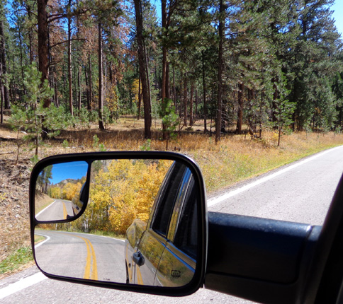
Soon I turned south on SD 89. I don't think I've been on this road
before. I drove out of Custer State Park into National Forest Service
territory again, where I saw five longhorn cattle grazing near the
road:
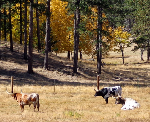
The longhorns were one of several nice surprises I had today.
I turned left onto US 16A just east of the town of Custer and drove a
couple miles to another entry station for Custer State Park. I bypassed
that one, too, since I already paid the fee. In a few miles I came to my
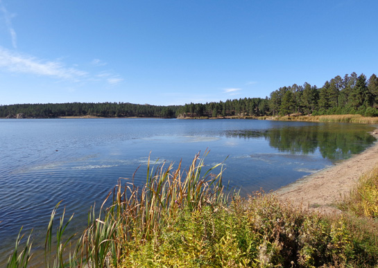
next destination, Stockade Lake:
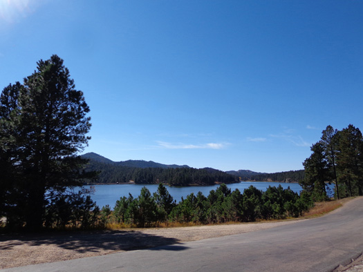
I stayed on the highway this time to the eastern end of the lake instead
of following the little loop road that Jim and I cycled a few days ago.
HIKE #3: STOCKADE LAKE TRAIL
I turned on the loop road at the far end of the lake and parked at the
trailhead for a 1.2-mile loop above the lake. It's called simply
"Stockade Lake Trail."
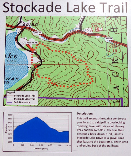
Elevations on this loop ranged from 5,200 feet to 5,611feet. The trail is steeper
up and down than the more gradual Horsethief and Centennial Trail
sections I hiked.
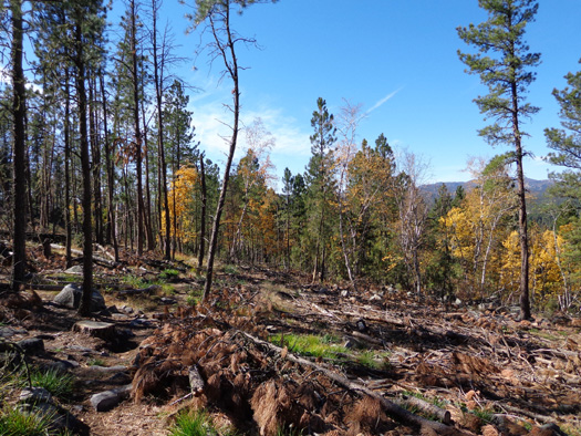
Although some parts
of this trail were pleasant it
wasn’t nearly as scenic as the trails I hiked earlier today – fairly rough
surface, no views of Harney Peak that I could find, lots of dead trees cut down and
not stacked up as they are in other parts of the state park.
Here are some
pictures as I hiked clockwise around the loop, ending on the beach:
When I was about two-thirds of the way around the loop I could see the
lake from the trail:
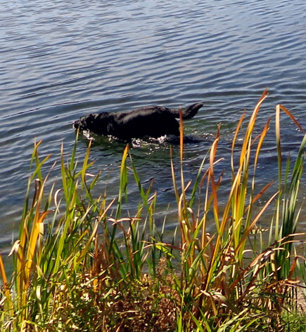
Then we descended to the beach and
Cody got to swim in the lake before we resumed driving:
Next entry: the rest of my scenic drive through Custer
State Park and Wind Cave National Park, including lots of wildlife and
bison photos
Happy trails,
Sue
"Runtrails & Company" - Sue Norwood, Jim O'Neil,
and Cody the ultra Lab
Previous
Next
© 2012 Sue Norwood and Jim O'Neil
