|
2012 HIKING, CYCLING, & RV TRAVEL ADVENTURES
| ||

|
Runtrails' Web Journal
Today I chose to hike on four trails that were new to me.
Two have trailheads at Horsethief Lake, located off SD 244 about two
miles west of the famous Mount Rushmore National Monument. I reached the third one, near the
midpoint of the 111-mile long Centennial Trail, from the Horsethief Lake Trail.
The fourth trail, located nearby inside Custer State Park, is a loop
in the hills above Stockade Lake. In this entry I'll show photos from those trails and the scenic road
that goes past Mount Rushmore. In Part 2 I'll describe the rest of my driving tour
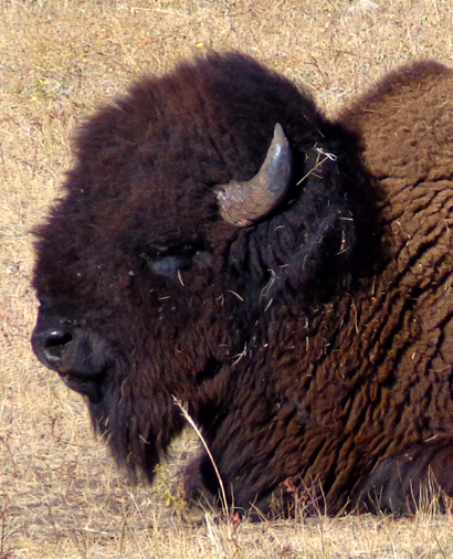
though Custer State Park and Wind Cave National Park, where I saw lots
of bison, pronghorns, white-tailed deer, prairie dogs, a friendly
burro, some longhorn cattle, and other critters.
Cody liked the pop-up prairie dogs the best! They are truly fun to
watch and quite a temptation for a curious Labrador retriever. THE SCENIC DRIVE TO HORSETHIEF LAKE
This was a beautiful day for my hikes in the Black Hills and Jim's bike
ride on base. It was perfectly sunny all day with temps in the mid-60s
F.
in the Hills and mid-70s in Rapid City.
Cody and I left the campground about 8 AM and spent all day in the
Hills. I didn’t get back until about sunset (~6:30 PM). Jim preferred to
remain on base to ride his bike, run some errands, and do some
maintenance on the camper.
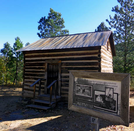
I took US 16 south of Rapid city to US 16A through the historic town of
Keystone, where I stopped briefly to check out two historic buildings.
This is the town's first schoolhouse, a cabin built in 1895:
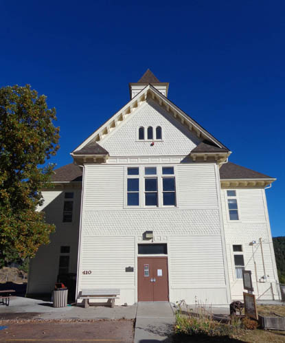
Next to it is the newer school built in 1899, a handsome
Victorian building that is listed on the National Register of Historical
Places:
Now a museum, I was hoping to see inside but I got there before it opened.
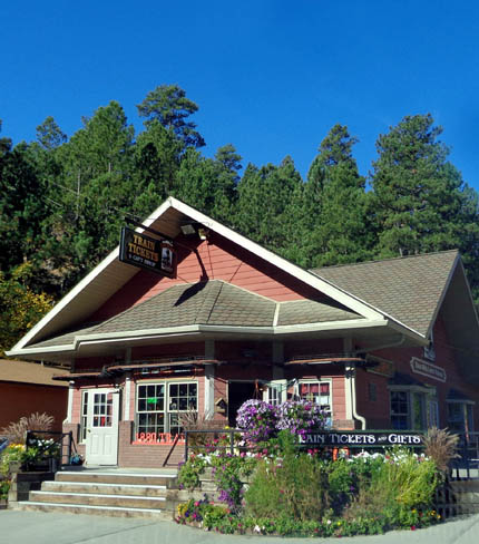
I also snapped a photo of this old Victorian train depot built in 1880
and still used as a gift shop and place to buy train tickets for rides
through the Black Hills:
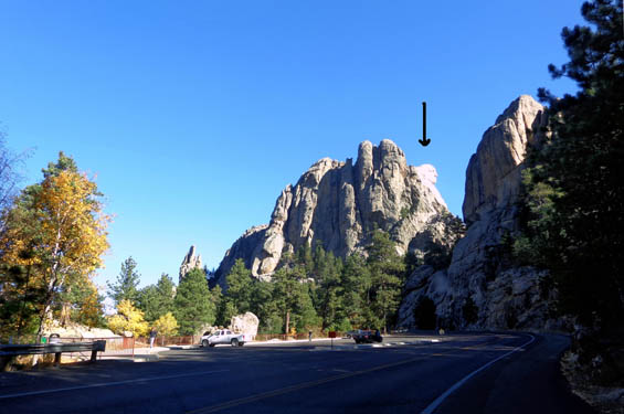
South of Keystone I turned west on SD 244 past Mount Rushmore and made my first
stop to hike at Horsethief Lake a couple miles past the monument.
It was a serendipitous find. I’ve never been to this lake and hadn’t even read anything
about it before seeing it this morning. My original goal was to hike
from the trailheads at Willow Creek,
farther to the west.
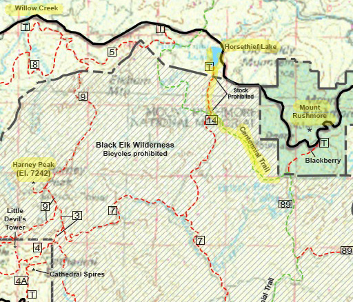
Here's a map section
of this area, which shows part of the Harney Range trail system:
Click
here for a larger version of the whole
map or
here for a map of Custer State Park. Mount Rushmore is the green section on the right.
SD 244 is the wavy black line near the top of the map. I highlighted Horsethief Lake,
Willow Creek CG, Harney Peak, and the three trails I hiked at and below the lake. I've been to Mount Rushmore previously but had
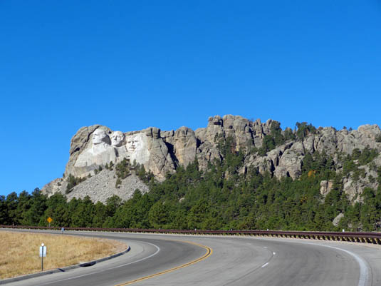
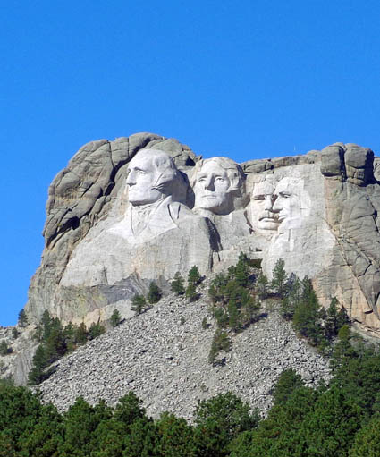
forgotten about all the views visitors can get from the road. Here's one
as you approach from the east:
I don't remember ever driving on SD 244 west
past the entrance to the monument. The highway continues for several
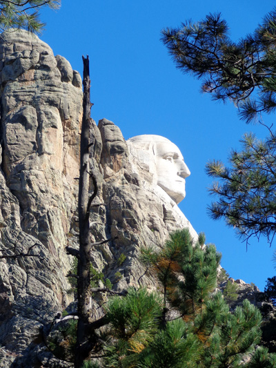
miles through scenic park and national forest lands. I was delighted to go around a bend on the left
side of the statues and see this profile of George Washington from the
road! I took the next picture from inside the truck, then parked at the
overlook to read the interpretive panels and take more pictures:
That was my first neat surprise of the day.
There would be lots more. I continued driving down the road and came to
Horsethief Lake soon after exiting Mount Rushmore park property.
HIKE #1: AROUND HORSETHIEF LAKE
I could see Horsethief Lake on my paper map of the Harney Range trail
system. When I got there I decided to drive back the half-mile dirt road to see what
was back there.
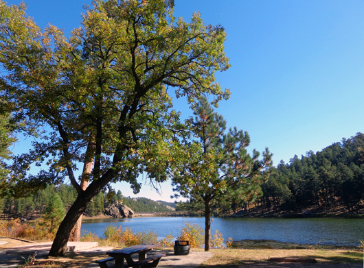
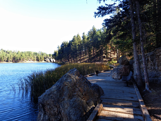
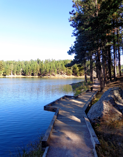
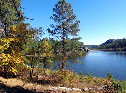
That was a good decision. It's a very pretty little lake, there is an
interesting path around half of it with wooden bridges and fishing decks, and
there is a nearby trailhead for a
path that connects to other trails in the Harney Range.
In addition, Cody and I had the lake
to ourselves for half an hour.
There was only one other vehicle in the two parking areas I passed. I never saw anyone else
around the lake or on the Horsethief Trail, which intersects the Centennial Trail
in less than a mile.
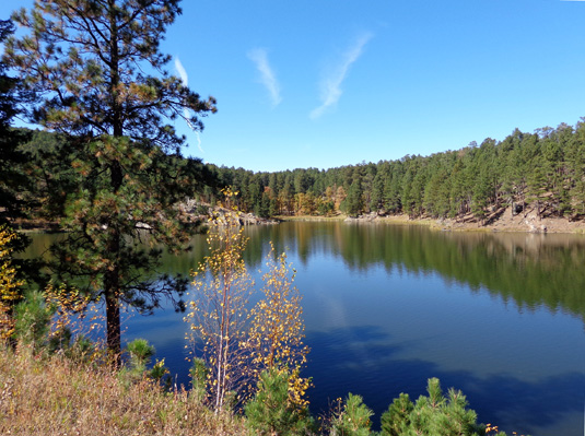
This manmade lake, formed in the 1930s when the Civilian Conservation
Corps dammed Pine Creek, is smaller than Stockade Lake but just as
scenic. The CCC built many roads, bridges, dams, lodges, and picnic
shelters in the Black Hills. Its legacy also includes forest
conservation projects.
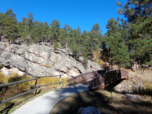
There are very nice dirt trails and wooden walkways, bridges, and piers
with seating on the south and east sides of Horsethief Lake:
The highway is on the north side, with two pullouts and interpretive
signs. I stopped there later when I was done hiking in this area.
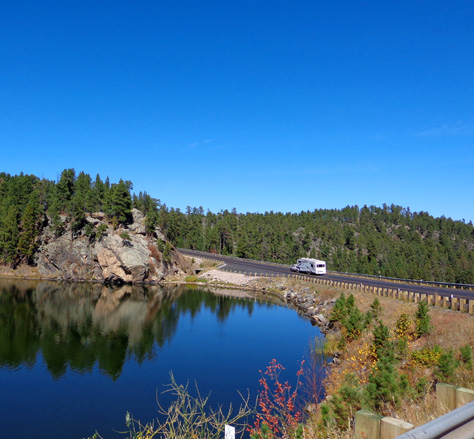
From the higher
overlook I was surprised to see a Cameo 5th-wheel coach drive over the
dam:
If you don't have time to drive back to the rather small parking area on
the south side of the lake -- or you're in a large RV that would have
difficulty turning around back there -- you can enjoy great views of the
lake from the two large pull-offs on the highway:
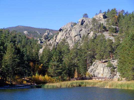
A handsome arched footbridge crosses
Pine Creek on the other side of the lake.
I followed a wide dirt trail uphill to
the Horsethief Campground, which has closed for the season:
This campground is run by the National Forest Service. The sites I saw
were all rather small but had magnificent views of the lake and
excellent access for fishing. The lake is stocked with rainbow trout
every year and also supports yellow perch and golden shiner.
Cody and I did about 1˝ miles of walking around the lake. He was happy
to get in the water a couple of times.
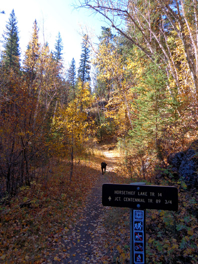
HIKE #2: HORSETHIEF LAKE & CENTENNIAL TRAILS
I moved the truck closer to the Horsethief Lake trailhead before I began
my second hike. I didn’t know about this trail, either, until I drove back to
the lake parking area.
The 2.7-mile Horsethief Lake Trail is in the Black Elk Wilderness
Area so I had to fill out another form and put it in the box like I did
when I went up Harney Peak.
This trail is just a few miles north of the 7,242-foot peak but I
couldn’t see it from any point on my hike today.
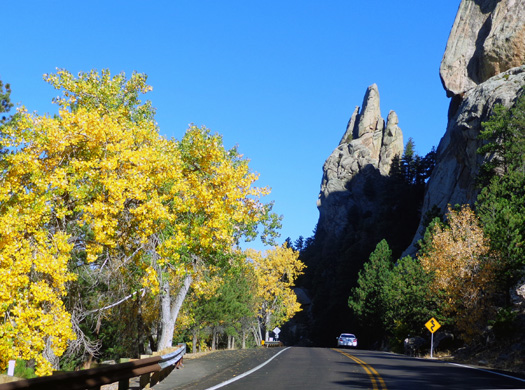
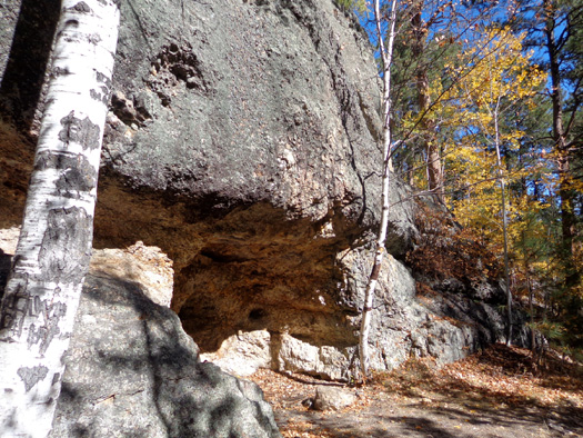
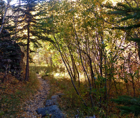
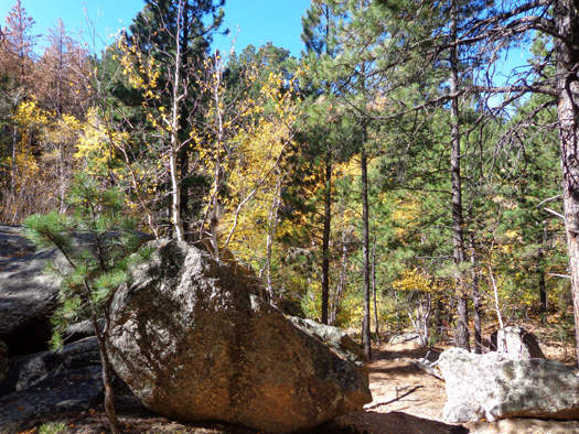
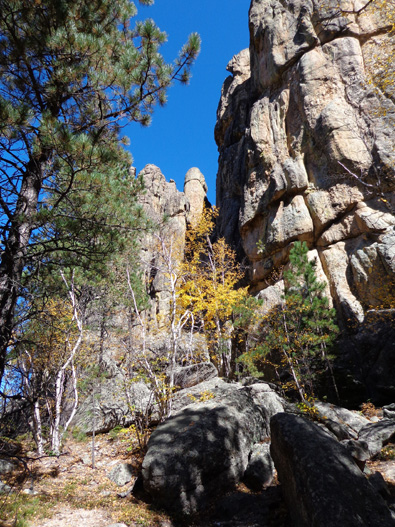
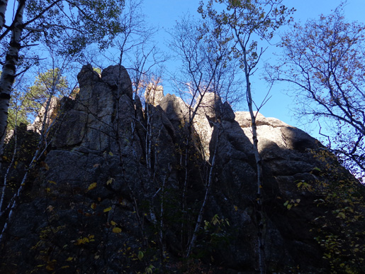
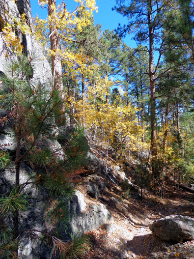
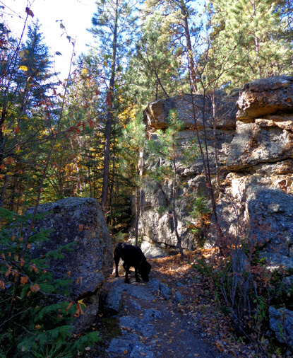
I did see lots of neat rocks, though. The trail weaves around tall
granite rock formations and passes through beautiful, shady terrain with towering ponderosa
pines and colorful stands of aspens and birch that light up the forest in
autumn:
The Horsethief Lake Trail surface is mostly rocky, although there are
some smooth places. It gains about 300 feet
in elevation over 3/4 mile to its intersection with the Centennial Trail.
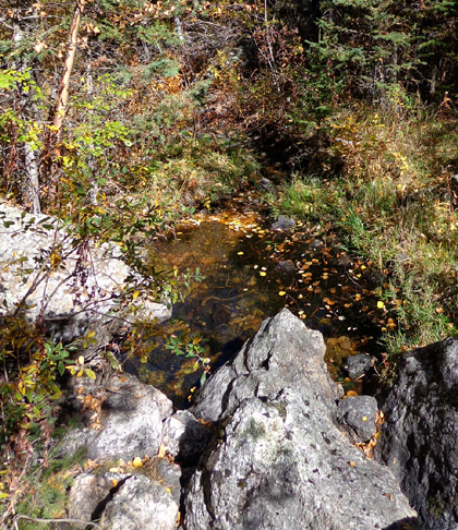
The trail
follows a little creek that had water in it for Cody:
This part of Horsethief Lake Trail is in a watershed
so horses and bikes aren't allowed on it. Equestrians may ride on
the remainder of the trail after its intersection with the Centennial
Trail.
The total length of Horsethief Lake Trail is only 2.7 miles but
it connects to other trails in the Harney Range from the Willow Creek
trailhead so folks can ride their horses a good distance in this area.
Continued on the
next page . . . Happy trails,
Sue
© 2012 Sue Norwood and Jim O'Neil |
|||