Continued from the previous page.
INDEPENDENCE MINE STATE HISTORICAL PARK
Although there were perhaps three dozen vehicles at the mine when we
arrived we never felt like we were in a crowd.
There are at least a dozen old buildings still standing, others that
have fallen into heaps of lumber, lots of interpretive signs to read,
and several trails that spread people out over the 271-acre park.
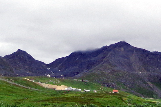
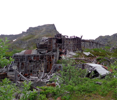
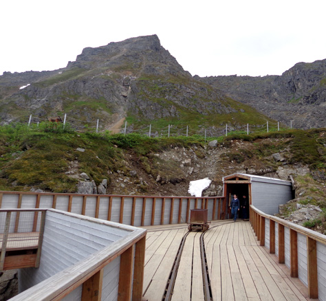
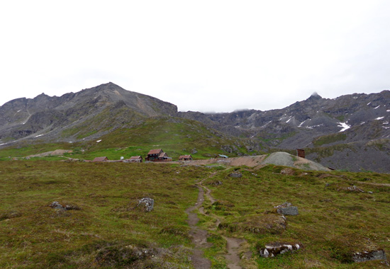
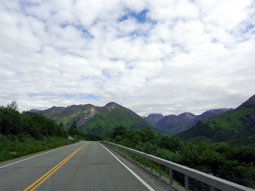
View toward mine from the entry station
Parking at the mine is $5/vehicle. I don’t know if folks with a state
park pass get in “free.”
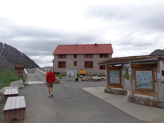
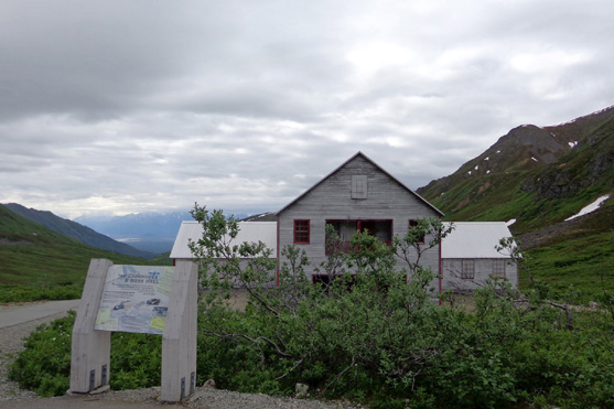
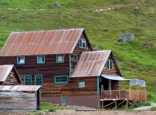
Guided tours of the mine are $6 per adult. We did a free self-tour,
starting at the visitor center. It is housed in what used to be the
mine manager's house:
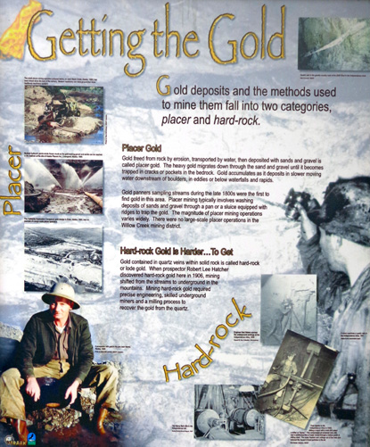
Jim went into the visitor center first to learn more about the
history of the mine while I stayed outside with Cody and read several
interpretive panels:
Dogs are allowed on the paved and dirt trails throughout the
historical site but not inside the buildings.
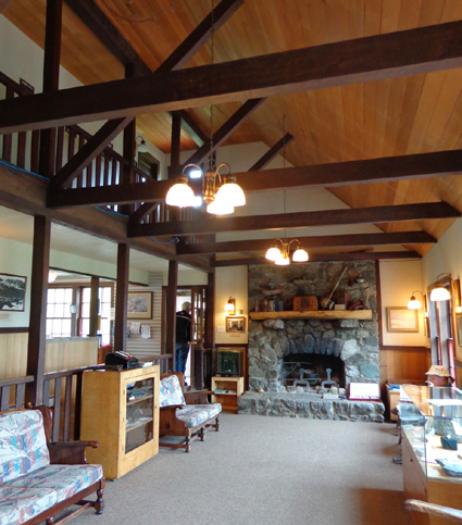
After Jim came out of the visitor center/former manager's house,
I went inside for a few minutes. This is one of
the handsome rooms with displays:
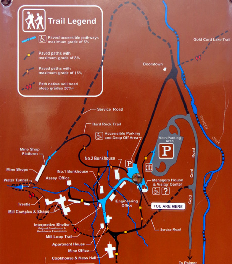
There are five trails at the mine
-- the Camp Interpretive Trail, Hard-Rock Trail, Mill Loop Trail,
Martin Mill Trail, and Gold Cord Lake Trail.
The lower trails to most of the
intact buildings are paved; the upper trails are dirt with some rocks:
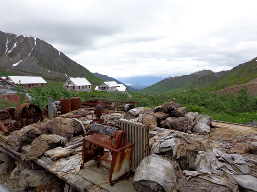
As we read the panels and walked around the premises we learned as
much about the culture of this mining operation as about the difficult, precise physical
process of hard-rock mining the gold from these mountains.
Independence Mine was its own little city for several years and
everyone played a part in its success. At its peak 204 men worked in
the mine, camp, and mill. The buildings ranged from the two large bunkhouses,
an apartment building for supervisors, a cookhouse, mess hall, and
commissary to various offices (general mine, engineering, assay,
etc.), shops (electrical, sheet metal, plumbing, framing), powerhouse
with diesel generators and air compressors, and the whole complex
where gold was extracted and milled:
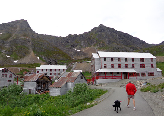
Jim and Cody head down the Mine
Camp Interpretive Trail toward the bunkhouses and other buildings.
Cookhouse and mess hall
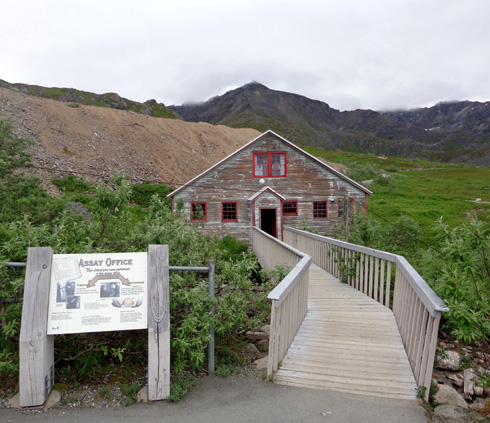
The assay office, where ore samples were tested
and gold was separated from mercury
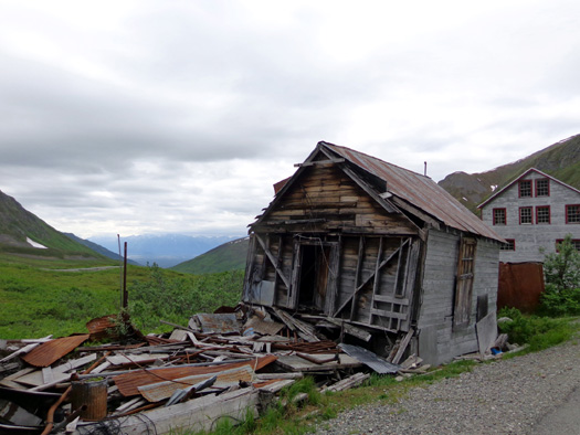
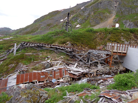
Many of the shops and mill operation buildings are in serious
disrepair but they are interesting to see anyway:
Some married women also lived here but no single women were allowed, even
to teach school.
Married men could build and own houses on company mining
claims. This housing area was known as Independence Village or
Boomtown. A territorial school -- with a male teacher --
was established for the children, and families could purchase food and supplies
at the cookhouse and camp commissary.
TOURING THE UPPER LEVELS & TRAILS
Jim and Cody went back to the truck after inspecting most of the
buildings on the lower level that are open to the public.
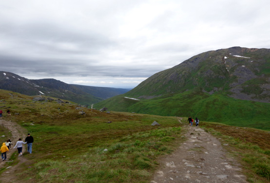
I continued to two higher levels to inspect a water tunnel, ore cars,
and some other buildings about a quarter mile up a steep, narrow dirt
trail (Hard-Rock):
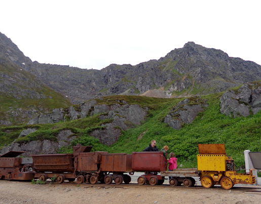
"Kids" of all ages love a train.
A visitor walks out of the water tunnel.
The development of this tunnel in 1940-41 greatly improved mining
efficiency. Before its completion all material was moved
in and out of the mine by aerial tram each morning and afternoon. Many
of the miners had to climb up more than 400 stairs each morning and down
again when their shift ended.
When it was finished the water
tunnel became the main portal for men and supplies entering and leaving the mine.
Battery-powered locomotives were used to transport most of the miners
and to haul most of the ore back out to the mill and waste
material to the dump.
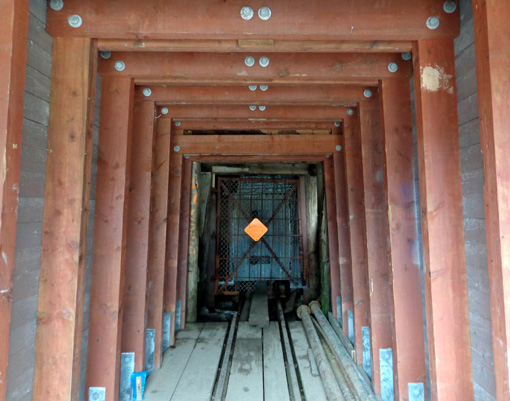
The horizontal tunnel extends at least half a mile back into the
mountain. From there, more shafts were dug to reach various pockets of
gold in the mountainsides. Water flowed through the tunnel year-round, providing a constant
supply for mine operations. (In case you were wondering why it's called
a "water" tunnel!)
From this walkway you can look down on the dilapidated ruins of
the mill complex. This was part of the tramway:
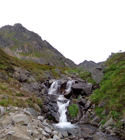
I continued up a rougher path past a
waterfall and along a creek in more open tundra on another level of the
mountainside:
Ahead of me were some of the houses that were in Boomtown:
The higher I got, the better views I
had of the mine buildings and the distant mountain-valley scenery. I
took these pictures as I descended back to the second and first
levels:
From above the mine you can see all the way down to
Knik Arm.
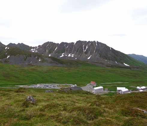
The bunkhouses and parking area look small
from up here.
I'll show more photos of the mine buildings on the next page.
HATCHER PASS
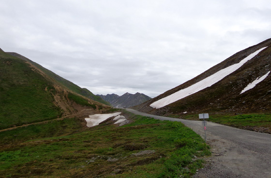
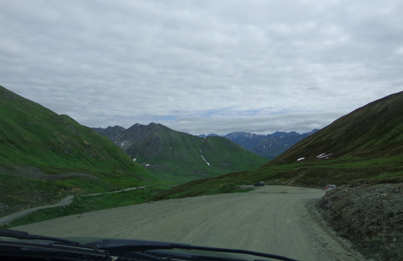
After I got done with my short hike we continued on Hatcher Pass Road
for 1.7 more miles to the pass at 3,886 feet elevation. The road
was dusty and washboard-rough:
I’m surprised Jim continued on up to the pass, considering he just got
the tires rotated. At least it wasn’t a front-end alignment!
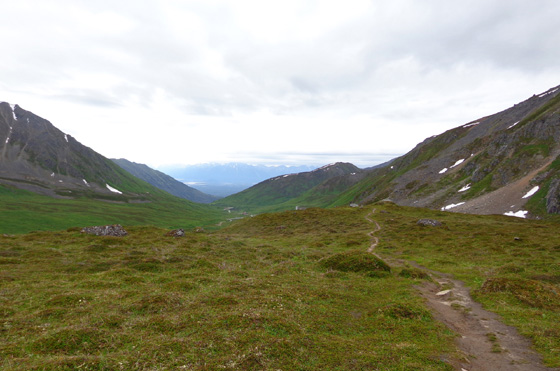
We got out with Cody to walk over to two bluffs overlooking glacial-blue
Summit Lake and the valley where the road descends from the pass:
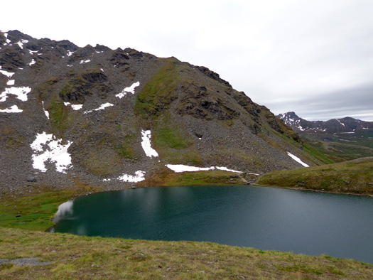
There are trails going up the mountains on either side of the pass, and
a flatter one around the lake. I didn’t ask Jim to drive another quarter
mile down to the lake because of the amount of traffic and the rough
road.
This is a partial
view to the west that shows Hatcher Pass Road beyond where we turned
around:
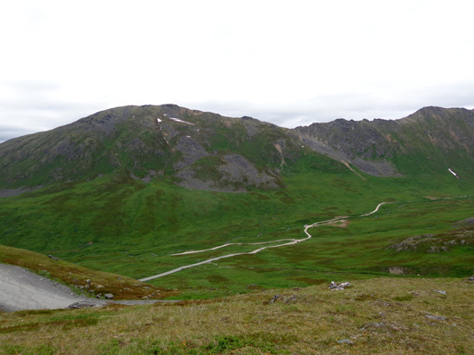
You really need a 4WD vehicle to enjoy Hatcher Pass Road. A utilitarian
Jeep would be even better. Some cyclists were riding it. I don’t think
that would be the least bit fun with all the traffic and dust on a
weekend day.
DESCENDING TO THE VALLEY
We turned around and went back down toward Palmer. The mountain and
Mat-Su Valley scenery on the descent was even better than going up to
the pass. We had great views into the valley where the Little Susitna
River comes down from Mint Glacier.
This time of year the mountainsides are a beautiful mix of green colors
with willows, cranberry bushes, and other low-growing plants in the
alpine and sub-alpine zones:
On the way back down we turned east on the Wasilla-Fishhook Road to see
what was there. It’s a good paved road through forests, becoming more
urban as we approached Wasilla. We turned south on the Parks Hwy.,
connected with the Glenn Hwy., and returned to JBER while the air show
was still going on.
VISITING THE HATCHER PASS AREA
There are lots of recreational and
sight-seeing opportunities here, including:
You can also enjoy skiing,
snowboarding, sledding, snowshoeing, and riding snow machines in the
winter months.
Descending from Hatcher Pass
In addition to the Independence Mine
State Historical Park, there is also the Summit Lake State Recreation
Site located at mile 19.3 along Hatcher Pass Rd. (a little
farther west than we went). You can camp in the backcountry or take
small RVs to the Gold Mint Trailhead at mile 14 or Government Peak CG at
mile 11.
I'm intrigued with the idea of hiking
along the Little Susitna River on the Gold Mint Trail to Mint Glacier.
Bikes are also allowed on that trail so I'll see if I can talk Jim into
going one day next week, too.
MORE PHOTOS OF THE MINE
ON
PAGE 3
Happy trails,
Sue
"Runtrails & Company" - Sue Norwood, Jim O'Neil,
and Cody the ultra Lab
Previous
Next
© 2012 Sue Norwood and Jim O'Neil
