It was just too good to be true – another sunny morning when we got up!
Alas, it was mostly cloudy in Anchorage by mid-afternoon when we got
back from our drive up to Hatcher Pass and the Independence Mine and
mostly overcast while we were up there in the Talkeetna Mountains.
We still had a great day and highly recommend the day trip we did
through and above the Matanuska-Susitna (Mat-Su) Valley.
You'll enjoy it, too, if you like history and/or pretty mountain
scenery.
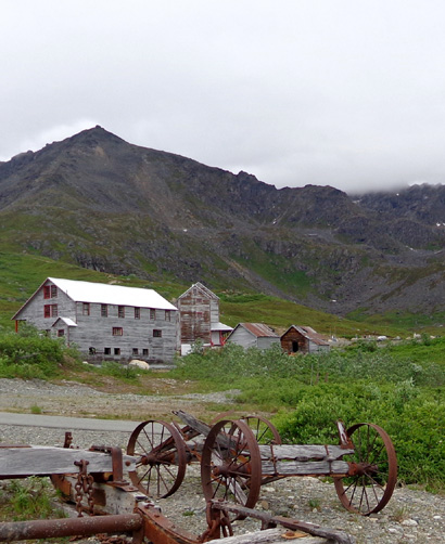
Scene from Independence Mine
Last night when we went to bed (late, because of the London Olympics
opening ceremony) Jim suggested not going to the Arctic Thunder air show
today but waiting until tomorrow when there will probably be fewer
people because the weather isn’t expected to be as nice.
That was a good idea because there was quite a crowd at the air show today, per the
local evening news, and gripes about how long folks had to wait to get
in the gates.
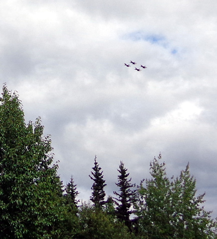
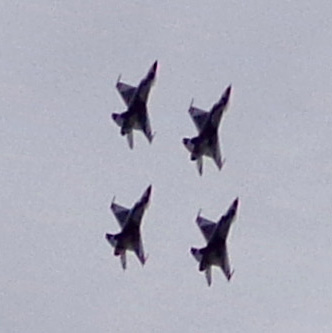
We were able to hear/see the F-16s and F-22s flying around when we
came back into the campground at JBER this afternoon. The Thunderbirds
got started about 20 minutes late and didn’t put on as
long of a show as they did yesterday. We could see them periodically from
the large meadow/playground next to the laundry room in the
campground:
Since we weren't going to the air show today we decided to check off a couple
items on my list of things to do in the area.
I’ve read only good reports in blogs and literature about touring the
Independence Mine State Historical Site on Hatcher Pass Road so that was
our activity of choice today.
Old buildings have always fascinated me. So have old mines. I love to
find abandoned mines and equipment in the Silverton and Leadville,
Colorado area when we visit there and it's no different in Alaska.
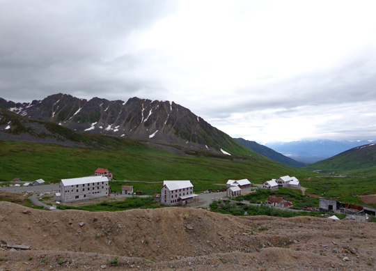
Overview of the old gold mine, in operation from 1936-1943
As soon as I read about Independence
Mine in RVers' journals I knew I wanted to go there. I also wanted to
see nearby Hatcher Pass because I love alpine scenery and views above treeline.
The 49-mile Hatcher Pass Road is a challenge for almost half of its
distance. It runs basically east-west through the Talkeetna Mountains
between Palmer and Willow, as shown at the top of this map section I copied from
our
Milepost book (2011 edition, p. 346):
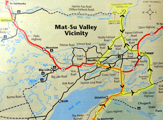
I marked our route in yellow. We turned around at the pass but Hatcher Pass
Road continues west along the top of the map section to Willow.
The road is
paved for about 17 miles on the east side from Palmer and 10 miles on
the west side from Willow. The paved segments are solid black lines;
the middle unpaved section is a dotted line along Willow Creek.
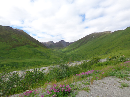
View from a parking area above the paved portion of
Hatcher Pass Rd.
Close to the pass the unpaved road is narrow,
bumpy, and dusty.
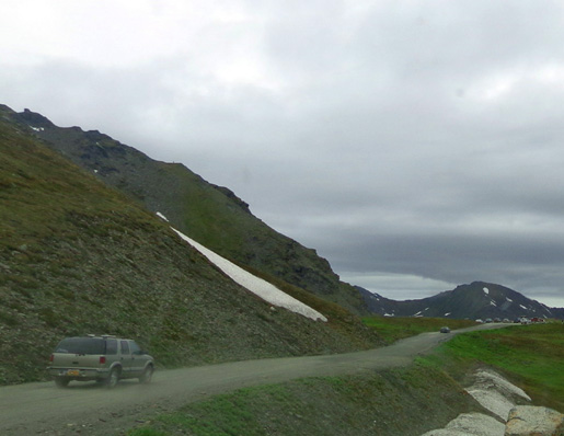
The middle 22 miles are reportedly steep, narrow, and very rough, with
washboard surfaces, potholes, and rocks.
The views are great if you have a vehicle suitable for that type of
road. We don’t, so we stayed mostly on pavement today.
SCENES FROM OUR ROUTE NORTH
We left the Black Spruce campground at JBER about 10 AM and drove north
on the Glenn Highway. A few miles past the Eklutna exit we turned east
on the Old Glenn Hwy. just to see some new scenery.
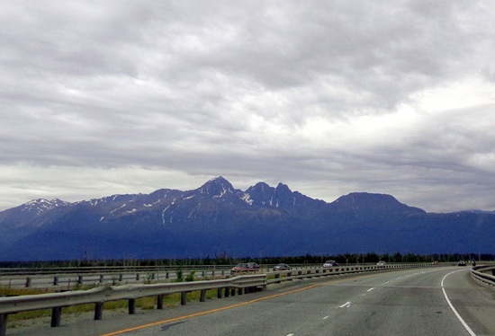
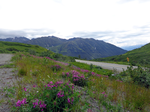
For 8+ miles Knik Arm was on our left and we could see the Talkeetna Mountains
to the north:
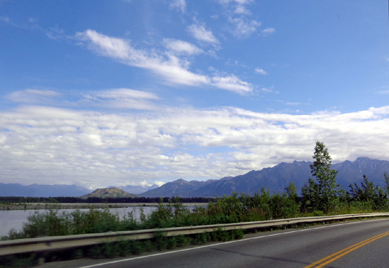
The northern edge of the Chugach Mountains rose up
on our right and I was able to see Twin Peaks from the opposite side I
saw when I hiked there the other day.
I took this picture of Twin Peaks from
the Glenn Hwy. on our way back today:
The Old Glenn Hwy. turned north and crossed the outlet of both the Knik and
Matanuska Rivers:
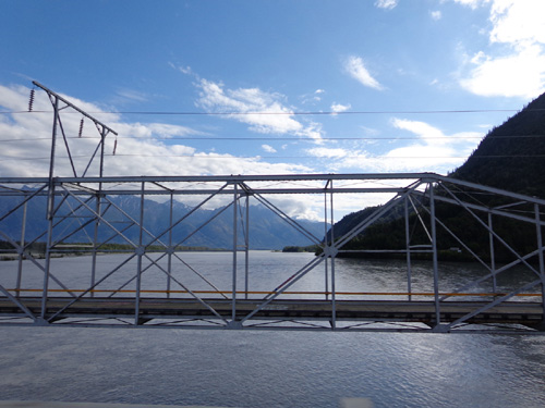
Crossing the Knik River on the Old Glenn Hwy.
The road became more urban as we approached the town of Palmer.
We turned east on the Glenn Hwy. and drove to MM 49.5, the road
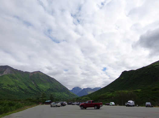
to Hatcher Pass and the Independence Mine.
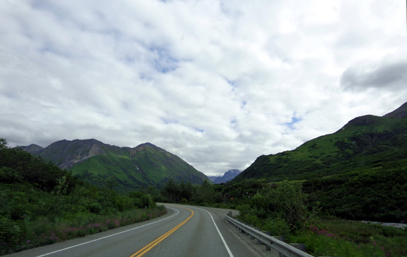
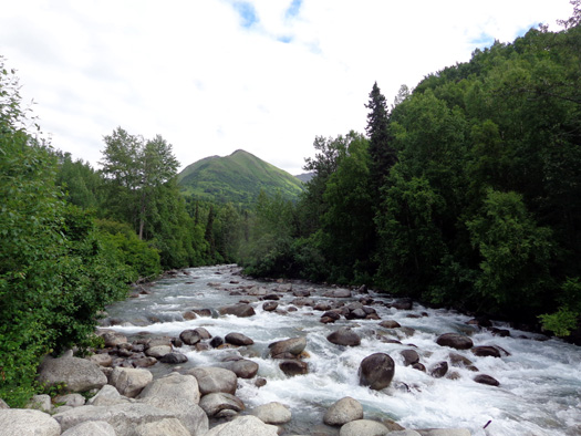
The paved road was in good condition all 18 miles to the mine.
It wound gradually along the Little Susitna River (AKA "Little Su")
through beautiful pine-and-birch/aspen forest, then more
steeply through sub-alpine and alpine terrain as we ascended to 3,500
feet at the mine:
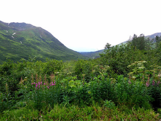
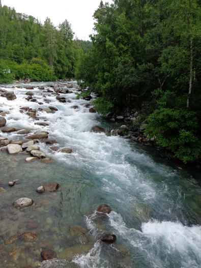
We stopped several places on the way up to the mine.
The first was the scenic
overlook with interpretive panels and big deck just past the bridge over the Little
Su. The river is a beautiful glacial turquoise color, full of scenic boulders
:
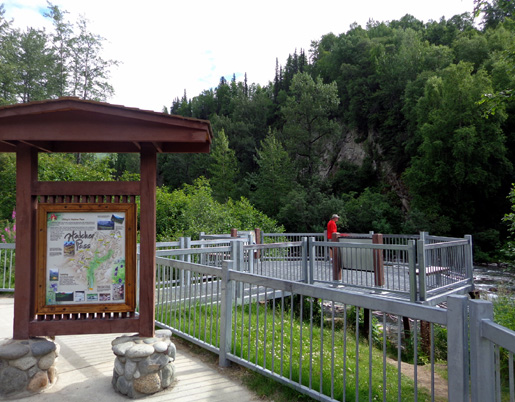
Several very informative
interpretive panels provide information about the origin and power of the Little Su,
the Castle Mountain earthquake fault we were standing on (!), mining
history in the Willow Creek Mining District (Hatcher Pass Rd. follows
that creek most of its length), hiking and camping in the area, and the
ecological zones we'd be passing through (mixed forest,
sub-alpine, and alpine).
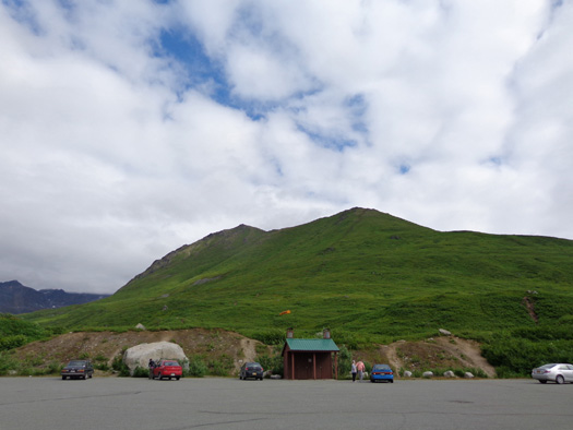
We also stopped briefly at the
Gold Mint trailhead parking area (that’s a trail I’d like to hike, 8
miles to Mint Glacier, headwaters of the Little Su) . . .
. . . and the Fishhook Trailhead (another place to access several trails):
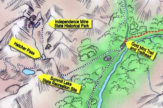
This little section of
a graphic from one of the panels shows the proximity of the Gold Mint
Trailhead, Independence Mine, Hatcher Pass, and Summit Lake, all of
which are mentioned in this entry:
We came to the mine before the pass so we turned off to see the mine first.
Continued on the
next page . . .
Happy trails,
Sue
"Runtrails & Company" - Sue Norwood, Jim O'Neil,
and Cody the ultra Lab
Previous
Next
© 2012 Sue Norwood and Jim O'Neil
