What a beautiful day! Everyone in South Central Alaska was probably as
thankful as we were to see lots of sunshine today.
It began quite overcast but by noon we had more sun than clouds. It
remained mostly sunny the rest of the day/evening. Temps ranged from the
low 50s F. to the low 70s in the Anchorage Bowl and just north of there
in the Eklutna (ee-KLOOT-na) area, where I spent the day.
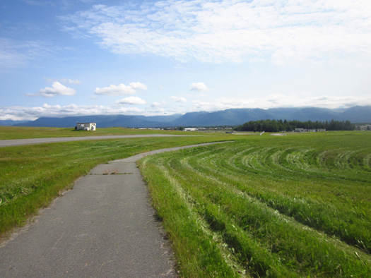
Picture Jim took this morning on the bike path as he rode toward the
JBER flight line
Since I had the truck most of the day Jim did a long ride on base – 26
miles. He's got loads of paved and dirt bike paths and roads to ride at
JBER.
He had a good time taking pictures of aircraft flying around the the
Elmendorf Air Force side of the base:
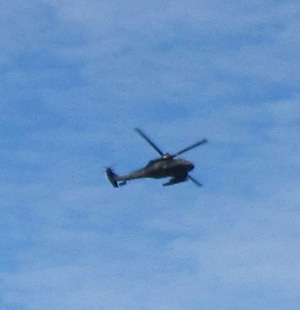
Helicopter
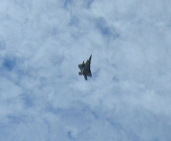
F-22
Some aircraft fly every day for training purposes but there are more now
because of this weekend’s big Arctic Thunder Air Show, which is
performed every other year at JBER. About 100,000 people are expected at
the show on Saturday and Sunday. A preliminary show is scheduled Friday
for special needs folks and other visitors.
I was surprised to see two F-22s over Lake Eklutna in the afternoon
while I was climbing in the Twin Peaks area.
I accomplished what I planned today – hiked to Thunderbird Falls with
Cody (2+ miles total), then did the Twin Peaks Trail above Lake Eklutna (another
6 miles). It’s about 11 miles to drive between the
two trailheads. This park web
page briefly describes both trails.
Because both trails are in Chugach State Park I paid just one $5 fee to
park. According to the sign at Thunderbird Falls, you can go to any of
the trailheads on the same day and pay the one fee as long as the
original permit with that day’s date is used at each parking area.
I'm up to $20 now in individual Chugach SP parking fees (an annual
permit costs $25). It'll be interesting to see if I go over $25 this
summer, which will mean I should have gotten the annual pass when we
first got to Anchorage.
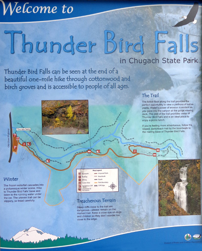
THUNDERBIRD FALLS
I'm confused whether Thunderbird is one word or
two. Two official Chugach State Park web pages for the falls and trail
use both Thunderbird and Thunder Bird. The official printed map and
description for the park has just Thunder Bird for both the trail and
falls. I'm more used to writing "Thunderbird" so I'll continue to use
that.
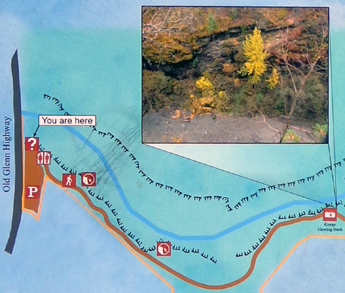
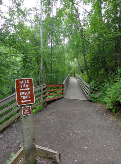
Thunderbird Falls is north of Anchorage on the Glenn Hwy. at MM 25.2
There was only one car – and one school bus – in the parking lot when I
arrived at 9:30 AM.
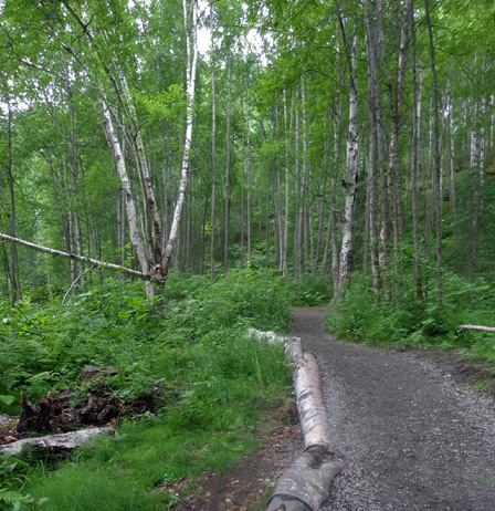
First part
of trail to the gorge overlook
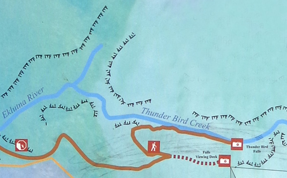
Second part
of trail to upper and lower falls overlooks
Cody and I had the
trail to ourselves for the first 3/4 mile to the intersection where the
trail splits into an upper and lower section.
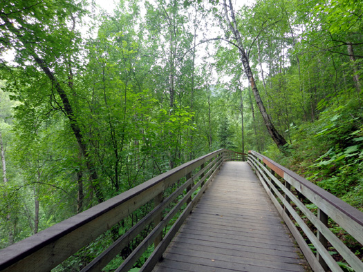
The wide, mostly
smooth trail follows a narrow wooded corridor of birch trees and shrubs
between private property on one side and a steep cliff above Eklutna
Canyon on the other.

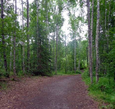
It's a straight
drop about 100 feet down to Thunderbird Creek so I kept an eye on Cody:
He's always
been very good about keeping away from edges of cliffs. Some dogs and
kids may not have as much sense so be careful if you hike on this trail
with an impulsive two- or four-legged companion.
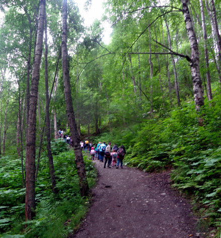
When I got to the Y
intersection I could hear what turned out to be
about 30 six and seven-year-old kids and several young adults who were
chaperoning them. They were on the lower trail so I took the shorter,
upper trail first to try to avoid them.
The upper trail has a nice boardwalk hanging off the cliff for several
hundred feet. It ends at a deck overlooking the upper part of the
falls:
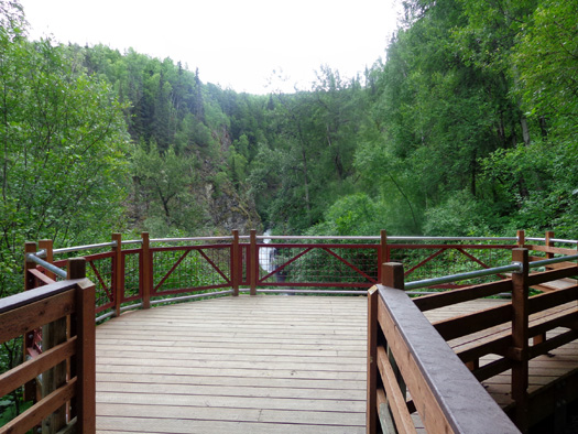
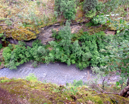
The falls are a total of about 200 feet high. I could see most of the
waterfall but not all of it from that perspective; it was a good
distance away:
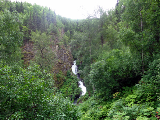
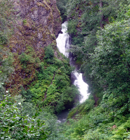
The falls looked to be fairly
full from recent rain and snowmelt. There was a lot of water spray above
the falls so I couldn't get a very clear picture of them..
When I got back to the trail juncture the kids were just coming up from
the lower trail along the creek. I took a picture after passing them:
Cody and I descended through birch and cottonwood trees and walked along the creek for about half a mile.
He got in the water to drink and inspect an underwater log:
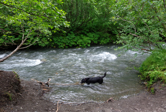
I didn’t see any fish in the creek. I don't know if salmon go upstream
here to spawn or not. It'd be quite a feat to swim up those falls but if
they can get up all the falls on the Russian River, they can probably
swim up these, too.
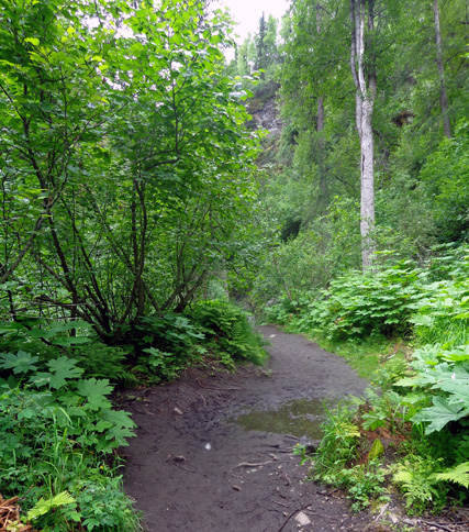
Note that the lower trail is more narrow than the main trail, it is not
as smooth, and it tends to get muddy. The upper trail was dry
today.
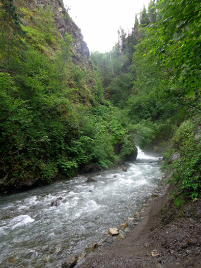
At the end of the
lower trail I could see only the very bottom part of the falls. The view
is mostly obstructed by a rock outcropping:
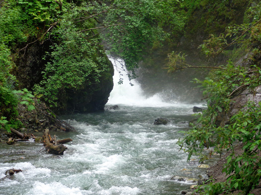
I walked along the edge of the creek a few more feet to get this photo,
then turned around because it was too rough and misty to continue:
To see the entire
series of the falls from the bottom you have to either walk through
boulders at the edge of the creek or through thick brush on the
hillside. It just wasn't worth the effort to me to bushwhack any farther
than this.
If you venture close
to the bottom of the falls beware of water damage from the spray to your
camera or cell phone.
I took these pictures going back up to the juncture with the main
(upper) trail:
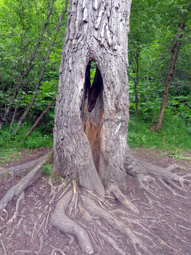
Hole-y
cottonwood tree trunk
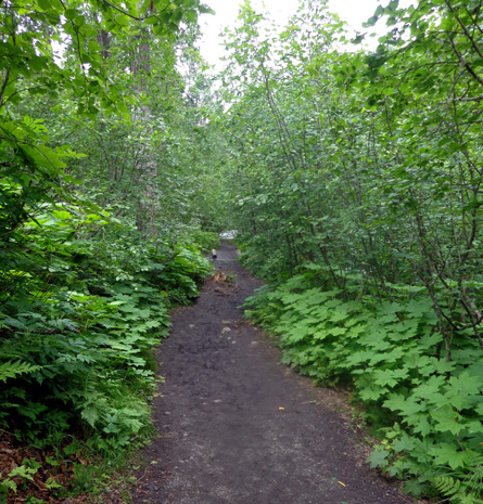
Peaceful
walk back up the lower trail
At the trail juncture I could hear the kids at the upper overlook but
couldn’t see that far. I got back to the truck without seeing them
again. That worked out pretty well! They were well-behaved kids but they
were loud. I prefer my hikes to be more peaceful.
Outbound I saw only one couple. On the return I saw about 20 people.
That was good timing, too.
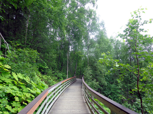
Boardwalk near end of upper trail
This trail was hillier than I expected. It’s listed as "easy" on my list
of local Anchorage trails because the trail surface is relatively smooth
and the elevation gain is only about 100
feet on the main trail. Add another 100 feet and rougher surfaces if you go down to the lower
trail, too.
It was easy for me but I don’t think the lower trail would be "easy" for some folks who
are less athletic. I’ve
decided that the trail ratings I've seen so far in Alaska are local
standards; they seem tougher than most trail ratings in the Lower 48.
I like that!
Next entry: a longer hike to Twin Peaks
Happy trails,
Sue
"Runtrails & Company" - Sue Norwood, Jim O'Neil,
and Cody the ultra Lab
Previous
Next
© 2012 Sue Norwood and Jim O'Neil
