The Lakeside Trail would be great for a run or hike, too!
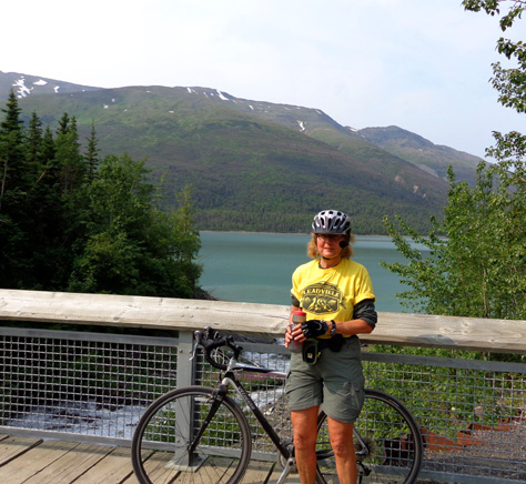
We enjoyed our first visit to this scenic lake in the north part of
Chugach State Park. Jim and I cycled along the shore today and now I'm
psyched to come back with Cody to do some hiking up in the mountains
above the lake.
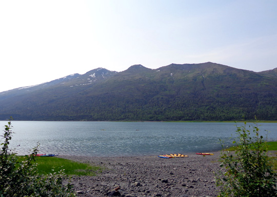
Colorful kayaks are lined up along the shore.
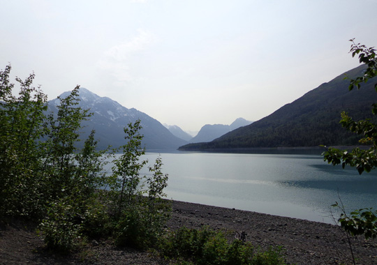
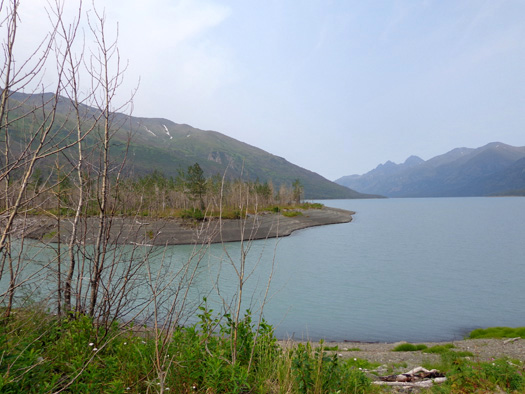
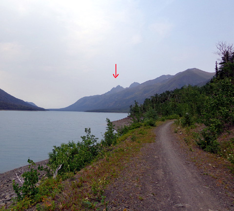
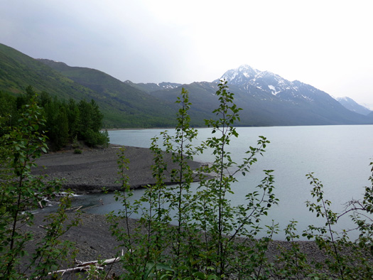
Scenic view to the far end of the lake
Today we got half a day of hazy sun, then mostly haze, in South Central
Alaska. That affected the quality of these pictures and may have been
part of the reason I was disappointed with the photos I took yesterday on
Rendezvous Ridge.
Turns out, there are some massive forest fires in Russia and other Asian
countries this week. The smoke is drifting to the northwest part of
North America, including Alaska, Washington, and Oregon.
Rain is predicted in the Anchorage area for the next few days, so maybe that will drive the
smoke out. I didn’t smell it today, but it sure looked hazy to the west
when we got up to 1300 feet on the road through the Eklutna
Valley.
WHY EKLUTNA? (ee-KLOOT-na)
Eklutna Lake, flanked
by towering Chugach Mountains in every direction, is
part of the humongous Chugach State Park located just east and north of
Anchorage.
Native Dena'ina
Athabascan peoples used to live here and fish in the lake. The name
Eklutna has its origins in their language.
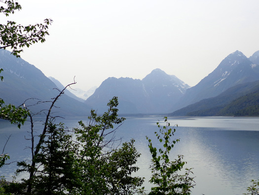
On a sunny day the lake's beautiful blue water coming from the Eklutna
Glacier mirrors the snowy peaks surrounding it.
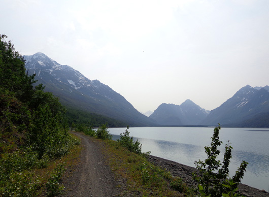
Today was too hazy for mirror images but you can still see some shimmer
in this view looking southeast toward the glacier end of the lake:
The lake is rather narrow -- about a mile wide -- but it
stretches for seven miles from NW to SE.
Over the last two centuries the glacier has receded ten or twelve miles
from the SE end of the lake, which is farthest from the trailhead. If
you follow the Lakeside Trail its full length, about 13 miles, you can
see the glacier.
We didn't go that far today, just eight miles out and eight miles back.
We want to return someday and go all the way to the end of the trail.
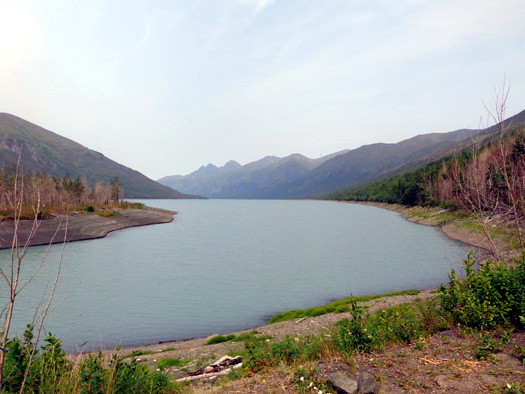
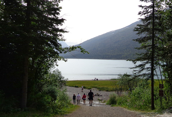
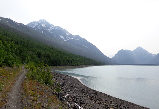
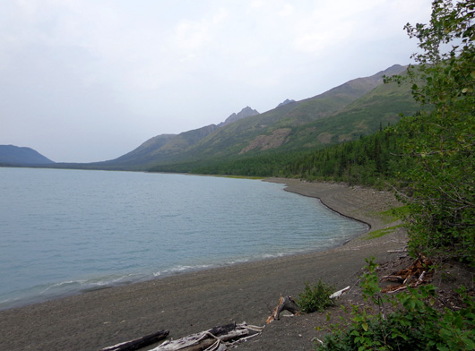
View to the northwest from south end of lake; the water
level is about 10 feet low right now (no tides here!)
Eklutna Lake is
popular for camping, fishing, boating (including kayaking), hiking,
cycling, snowshoeing, snowmobiling, and riding ATVs.
There are numerous
options for developed and backcountry camping so visitors can stay
several days to explore the place. However, it's
convenient enough to metro Anchorage to the south or the Mat-Su Valley
towns of Palmer and Wasilla to the north to be easily accessed on day
trips. That's what we're doing.
Bridge over Twin Peaks Creek near the beginning of
the ATV road that accesses the Lakeside Trail
The lake is about 30 miles one way from our campground at JBER, a little farther if
you're staying in downtown Anchorage. Just drive north on
the Glenn Hwy. to MP 26.5 and east on the hilly, narrow paved road to the
lake.
The road ends at the parking area at the NW end of the lake. You can't
see the water from the road but it's just a short walk from the parking
area to a nice grassy area where people like to picnic, swim, and put
their kayaks in the water:
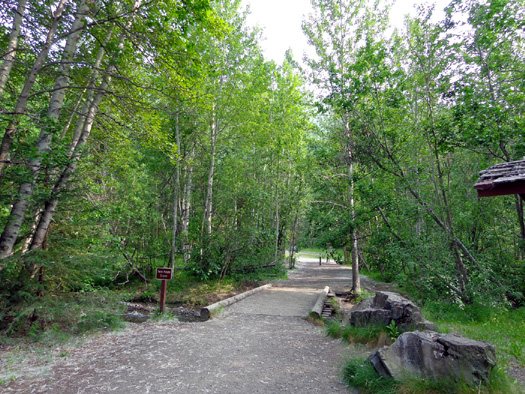
First glimpse of the lake
Parking is $5 per vehicle unless you have an annual park pass that costs
$25.
So far this summer, we're up to $15 in non-pass fees at the trailheads
where a pass can save frequent visitors some $$$.
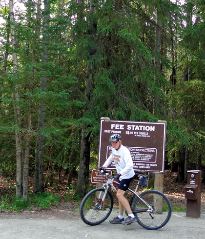
$5 was a small price to pay for the fun ride and
fabulous views we got today!
THE LAKESIDE TRAIL
Before we visited the lake we didn’t know much about the Eklutna
Lakeside Trail except its location on the NE side of the lake, distance (almost 13 miles one way),
and difficulty rating (easy -- elevations ranged from 863 to 1063
feet on the hike/bike and ATV trails we rode).
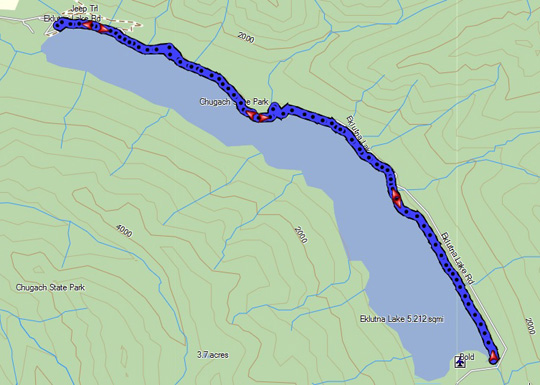
This was our GPS
track today:
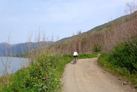
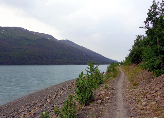
The rolling terrain close to the lake is easy to ride in general:
Above and below: going outbound (south),
about six miles from the trailhead
However, occasional deep gravel and rocks caused me some problems. The tires
on my TriCross bike are wider than road tires but not as
wide and grippy as mountain bike tires.
Jim didn't have any trouble maintaining traction over the rocks or
through 3-4 inches of gravel with his mountain bike on this trail.
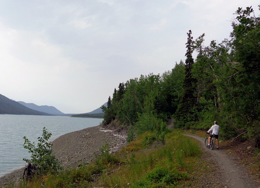
Jim rides along the somewhat-rocky trail soon after
we turned around.
A few rocks on the trail near the end of the lake;
note how few leaves are on the trees here.
We ran into mud and slippery roots in only one place on the trail today.
Otherwise both the ATV road and hiking/biking trail were dry.
We turned around after eight miles near the lake inlet instead of going
another five miles to the end of the trail. By then we were kind of beat
up by the rough surfaces and decided 16 miles were more sensible today than 26.
Near the lake inlet where we turned around
The scenery was gorgeous, however – the deep turquoise color of the
water from glacial silt, lots of green trees and plants,
some bright flowers and kayaks to add more colors to all the blue and green around
us, beautiful Chugach peaks on all sides, and glimpses
of Eklutna Glacier beyond the far end of the lake.
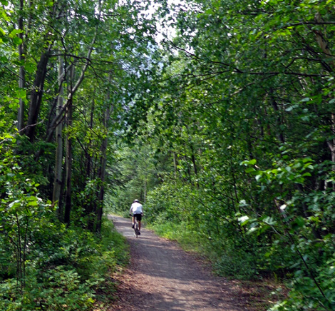
Although some sections of the Lakeside Trail are nicely shaded like in
the photo above, much of it is out in the open because it is so close to
the shoreline.
Because of the narrow trail in some places we should have begun riding
earlier than 11:45 AM. I was surprised there weren't more people in the
parking lot then.
Although we didn’t see any bikes on the trail until we got to the spot
where we turned around eight miles from the trailhead, we encountered
about twenty people going outbound as we rode back to the parking area.
With all the foliage in some areas where the trail is narrow it's
difficult to see oncoming cyclists around curves until you almost
collide with them.
TRAIL CHOICES
On Sundays and Wednesdays
ATVs are allowed on the narrow, rocky jeep road that roughly parallels above the
Lakeside hiking/cycling trail. We deliberately
chose a day ATVs wouldn’t be out there, which was a good decision.
What we didn't know is that the Lakeside Trail starts on the jeep road, then veers off numerous times.
In some places you have to use the road to get to the next segment of
trail.
Cyclists and hikers can stay up on the road the whole time if they want,
or they can use both the road and trail. There's a learning curve the
first time you're out there. We rode on a little more of the road
outbound and as much as possible on the trail on the return.
We much preferred the trail.
It is generally flatter, smoother, and closer to the lake
than the hilly, rocky jeep road. In fact, sometimes
the Lakeside Trail is right next to the cliff above the lake! We had to be very
careful in those places to not bounce or slide off.
When the lake is at "full pond," the water is almost up to the trail.
We rode for a little over two hours. By the time we got back to the
truck (about 2 PM) the parking area was pretty full.
I wouldn’t want to be out there on a bike or on foot on a sunny weekend,
or at least I’d get there early. The trail is rather narrow in some
places, too narrow for two bikes or a bike and hiker to pass comfortably:
Jim pauses on a narrow part of the trail to wait
while I take yet another picture.
Up ahead in the trees the trail is even more
narrow.
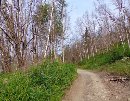
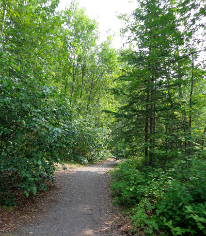
Most of the way the trail is wider, however:
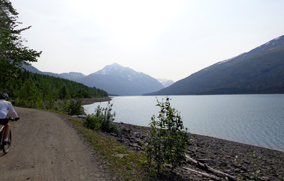
Near the beginning of the trail, heading south
toward Eklutna Glacier
I would like to go back with Cody to hike the Twin Peaks Trail, which is
open to foot traffic only. It
starts near the parking area so we wouldn’t have to contend with bikes
or ATVs.
I’d also like to hike up the Thunderbird Falls Trail, which is in the
general vicinity but closer to the Glenn Highway and faster to reach from
Anchorage than Eklutna Lake.
View of Twin Peaks from Eklutna Lake; bet the lake
looks good from the trail to the top!
Stay tuned for reports from those hikes.
THE REST OF THE DAY
On the way back home we stopped at the WalMart in Eagle River. Jim went
in to get more oil for his truck. I stayed out to guard the bikes so I don’t
know how it compares to the other WalMarts in the metro area.
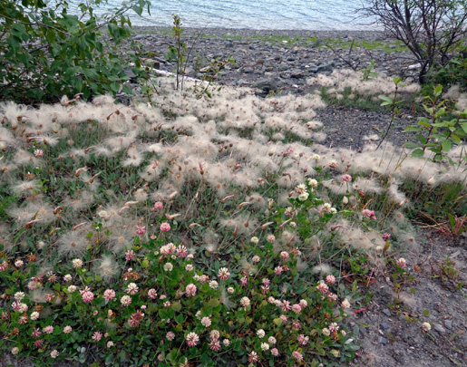
A patch of pinkish clover (foreground) and fluffy
Alaska cotton near the lake; see close-up below.
We relaxed in the afternoon and evening. I was on the computer a while
(we have a decent MiFi signal at JBER) and walked Cody around the
campground since he didn't get to go to the lake.
Jim repaired the bathroom vent in the camper and tried to
figure out how to fix the outside steps; a weld has broken. He
went to the BX after supper to get free WiFi.
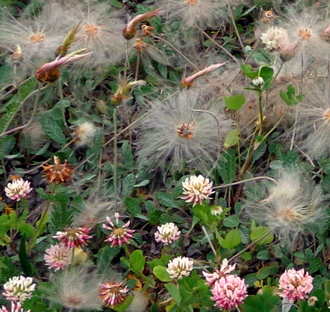
Alaska cotton and clover
By evening it was quite cloudy and/or hazy from smoke. It’s supposed to
rain the next week or longer. <frown>
I’m glad we got to enjoy some new trails while it was sunny. I’m a
little tired so it’s good to have a rest break for at least one day.
WE'RE NOT IN KANSAS ANYMORE, TOTO
Since we’ve been in Alaska we’ve read/heard about several of the
highways being shut down for several hours.
This is a hazard in Alaska and northern Canada that was only barely on
our radar before our five-day delay at Watson Lake in the Yukon last
month for road repairs after excessive rain and snowmelt wiped out
sections of the Alaska Highway.
There simply aren't all that many major roads in Alaska (and even fewer
in the Yukon Territories) so when one shuts down, alternatives are few
to none. Be very aware of this if you're driving to or in Alaska.
Nearing a creek crossing on the jeep road (one of
the places
where the Lakeside Trail gets back on the road)
Here are some examples that have occurred since our arrival in Alaska
five weeks ago:
-
The day after we went down to Homer, the Sterling Hwy. was shut
down for many hours to investigate an incident involving a wildlife ranger who shot an erratic female driver
in self defense after she shot at him (she later told police she wanted
“suicide by cop”).
-
The Seward Hwy. was closed for four to five hours on the north
side of Turnagain Arm for a serious accident several weeks ago, then
again yesterday south of Portage because of a car hijacking.
-
The Parks Hwy. was closed one day last week because of a wreck with a
fatality.
-
And the
Richardson Hwy. was closed for hours when a motorcyclist was killed by a
moose between Fairbanks and Delta Junction.
Just sayin'.
Ironically, none of these were for weather-related problems like snow or
flooding, which are also common reasons for road closures in Alaska.
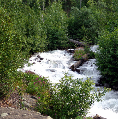
Above and below: on the bridge over the creek
crossing
At this point we’re not too surprised by any road closures up here.
It doesn’t take much to shut down a busy highway in the Far North, stranding
travelers for hours or days. This just doesn't happen much in the Lower 48
states because in most places there are alternate routes.
Fortunately, we usually don’t have to be somewhere at any particular
time during our trip to Alaska and we're here long enough that
inconveniences like these won't ruin our vacation.
Keep the likelihood of road closures in mind if you ever visit Alaska.
In many ways it isn't like the rest of the country. Allow plenty
of time to reach each destination, have alternative routes and/or
destinations in mind in case one of the above scenarios happens, and go
with the flow. It'll make your trip much more enjoyable.
Next entry: keeping busy on a rainy weekend in Anchorage
Happy trails,
Sue
"Runtrails & Company" - Sue Norwood, Jim O'Neil,
and Cody the ultra Lab
Previous
Next
© 2012 Sue Norwood and Jim O'Neil
