We're trying to see Alaska as travelers, not as
tourists.
So far, I think we're going a pretty good job.
We've already noticed a lot of things we haven't read or heard about
before. I love the joy of discovery.
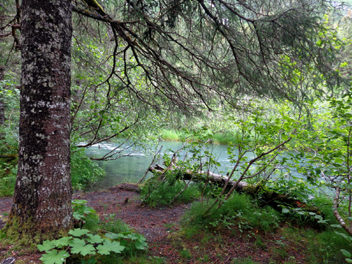
Idyllic spot
along the Trail of Blue Ice near Black Bear Campground; that's Williwaw
Creek.
We both slept until 8:15AM this morning, which is late for us. We
were happy to see some little blue patches of sky, although low clouds
still partially obscure the peaks around us. We were glad it didn't rain
this morning. However, it was misty and more rain is predicted later
today.
It's also pretty chilly. The temperature was only 45 F.
outside when we got up and didn't warm up much during our bike ride.
I'm not whining, just warning other visitors that South Central Alaska's
"summer" weather isn't always so summery!
TIME FOR A RIDE
Today we have a
relatively short but very scenic drive from Portage Valley to Anchorage,
mostly along the north shore of Turnagain Arm. We've been on this
road three times previously so we know that even when hauling the camper it won't take long to reach
our next destination in the northern part of the metro area.
That gave
us plenty of time for a leisurely morning exploring the whole length of
the Trail of Blue Ice, the Moose Flats Day Use Area, and the Williwaw Nature Trail on our bikes.
We had a very enjoyable ride. Because of stops to read signs and take
pictures, it took us about 1:45 hours to go 11˝ miles.
Here's the map again
of these trails, with our route highlighted in yellow:
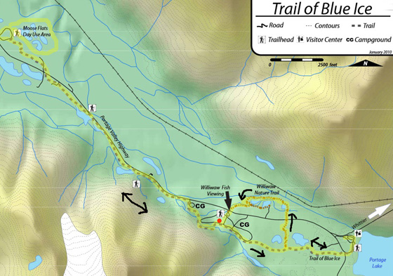
You can find a larger version on the
official US Forest Service
webpage for the Trail of Blue Ice.
All of this was new
to Jim. Several miles were new to me. Most of the pictures in this entry are
from places I didn't hike last evening.
We rode to the
trailhead close to our campsite at Williwaw Campground and went
west on the Trail of Blue Ice for about half a mile to Black Bear CG,
then another three miles to the western terminus of the trail at Moose
Flats -- and back. I didn't hike past Black Bear last night so that part was
new to me.
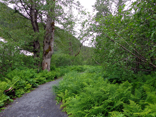
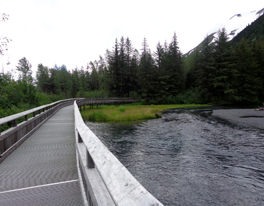
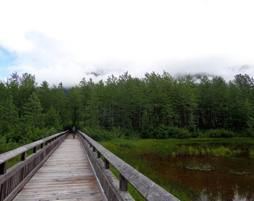
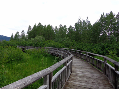
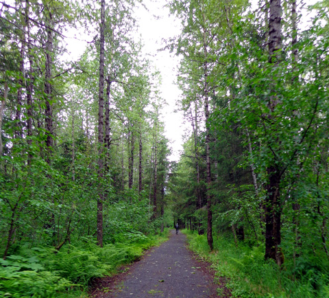
Lush ferns along the trail
The trail between Williwaw CG and Moose Flats is smooth crushed gravel,
with more of those attractive wooden bridges and boardwalks similar to
the ones I showed in the last entry.
One of my favorite areas is where the trail crosses Williwaw Creek
near the Portage Valley Highway on the second unique tied-arch bridge.
This series of photos shows the views going westbound first, then
eastbound:
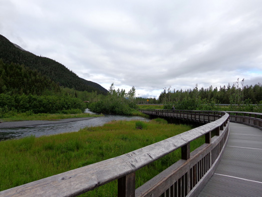
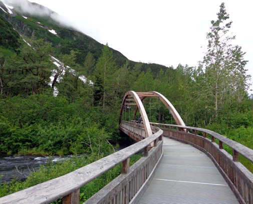
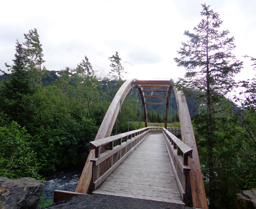
That's about the only section where
you can see the road from the Trail of Blue Ice and vice versa. It's a
short section and so scenic that I barely noticed the road while I was riding
either direction.
The first time we came down here on a
day trip (June 27) and didn't have time to get on the trail. We could
see this unique bridge and section of boardwalk from the road;
that preview definitely made us more curious to get out and hike and
ride on the bike path this time.
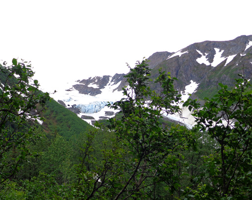
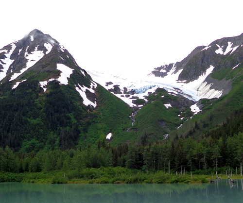
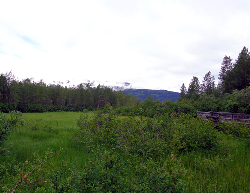
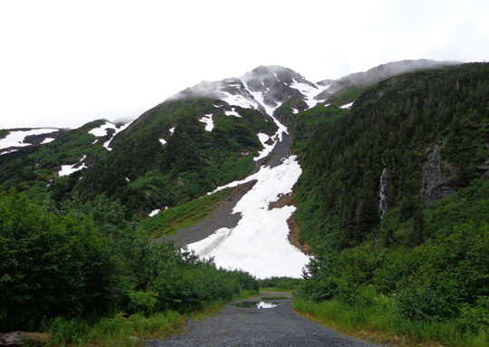
EXPLORER GLACIER
Another highlight of this section of the trail
is being able to get good views of the second "hanging glacier."
Explorer Glacier is even more interesting to me than Middle Glacier
because there is a pretty lake below it in the valley.
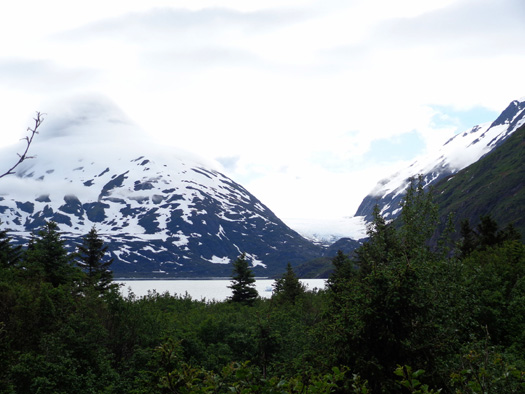
Going westbound we could see Explorer Glacier
through the trees before we saw Explorer Lake:
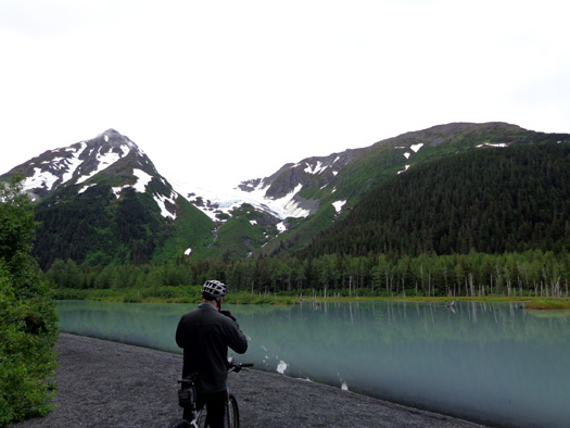
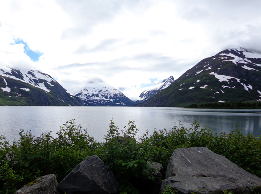
Here's another viewpoint of the lake and glacier
from farther west on the trail:
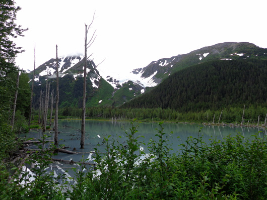
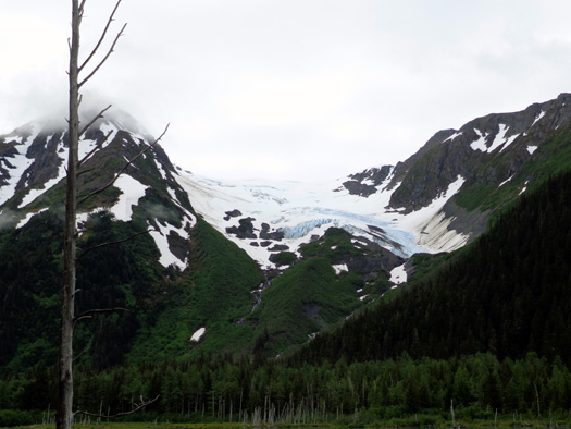
Explorer is one of three glaciers
with "blue ice" for which this trail is named. Middle and
Byron are the others.
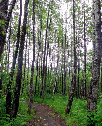
MOOSE FLATS
The western terminus of the Trail of Blue Ice is at the Moose Flats Day Use Area at
MM 1 on the Portage Valley Highway.
If you ride a bike or run/walk across the highway to the beginning/end
of the Trail of Blue Ice at Moose Flats be careful. It's amazing how
much traffic is on that road, which goes to Portage Lake/Glacier and
dead-ends in the seaport town of Whittier.
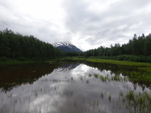
We crossed this
bridge over a pretty lake before reaching the parking area for Moose
Flats:
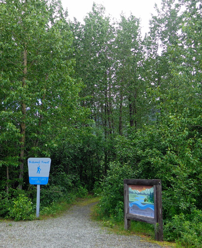
This is the trailhead in the
parking area for the Moose Flats trails:
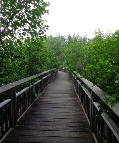
There is more bog bridging in the
wildlife viewing area:
Where are
all the moose?? Alas, we didn't see any here today.
Nor did we see a map for the trails
through this area so we had no idea how far they went.
Before I knew it
Jim was gone ahead of me, out of sight on a loop around the ponds (less than a mile).
I did
a couple out-and-backs on single-track trail and met him as he was
finishing his loop.
There are several places to park to access the Trail of Blue Ice. Moose
Flats is one of them.
MOOSE FLATS TO PORTAGE LAKE
After touring Moose Flats, we turned around and went eastbound for the whole length of the Trail of Blue Ice
(five miles) to the Begich, Boggs USFS Visitor Center at Portage Lake.
I've already shown photos of 4+ miles of the Blue Ice trail in this and the
previous entry.
Here are a few new pictures I took today:
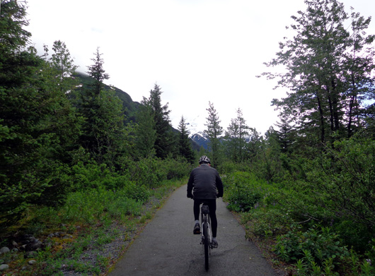
Jim rides ahead of me on the smooth crushed rock
path between Williwaw CG and Moose Flats.
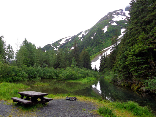
Nice place for a picnic area next to the trail
A side trail leads to what looks like an avalanche
area.
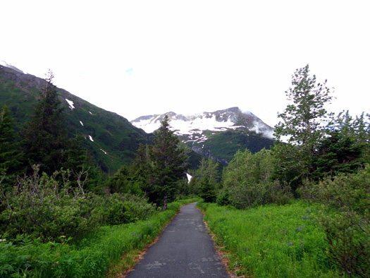
The trail is mostly paved between Williwaw Campground and Portage Lake.
Here Jim rides ahead of me about half a mile from the lake:
When we got near Portage Lake we intersected the paved road that goes to the Begich, Boggs USFS Visitor Center parking lot, the trailhead for Byron Glacier,
and the tour boats that take visitors back to Portage Glacier.
Trail users have a choice here. They can either follow the paved road toward
the lake and visitor center or go across the road to a crushed
rock trail that loops up, around, and down a small hill to get different
views of the lake and surrounding mountains and glaciers. We went that
way.
This is one of the pictures I got of Portage Lake and Burns Glacier (low
and to the right) from the hill:
The next picture of the lake and Burns Glacier is from down near lake level
at the visitor center parking area:
We circled through the visitor center parking area and headed back west on the Trail of Blue Ice for approximately a mile to
the intersection with the Williwaw Nature Trail. Jim hadn't seen that
trail yet and I wanted to share it with him.
I had told Jim about the Fisheries Habitat Enhancement project I wrote
about in the last entry.
Workers were on the job today, getting gravel out of one of the ponds
that the Forest Service then turns into salmon spawning areas.
We rode through the
tunnel under the highway, swung by the Williwaw Salmon Viewing Platform
so Jim could see that, and rode back through the campground to our
camper.
RIDE SUMMARY
What an interesting
ride! We sure saw a lot in 11˝ miles
(and some of that was out and back).
View westbound on the Trail of Blue Ice halfway
between the lake and our campground.
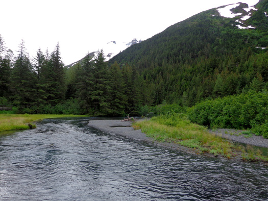
We had great views of Explorer, Middle, Bryon, and Burns Glaciers,
beautiful snow-clad mountains, blue creeks and ponds. We couldn’t see
salmon yet in any of the very clear streams but it was fun looking.
I’m still totally impressed with the attractive wooden bridging over creeks and
wet areas on the Trail of Blue Ice. Jim is, too.
As noted, most of Blue Ice is crushed rock and wooden boardwalks/bridges
in the 3˝ miles from Williwaw CG to Moose Flats. The 1˝ miles from
Williwaw to the visitor center are paved. The nature trail loop is
crushed rock and also fairly wide like Blue Ice.
Both of those trails are accessible to wheelchairs and strollers. Moose
Flats would be difficult for wheelchairs and strollers, however.
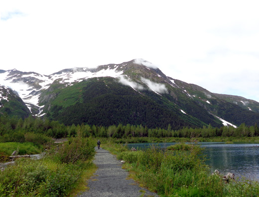
Jim rides past one of several lakes on the Williwaw Nature Trail; Middle
Glacier is to the left.
We didn’t see any wildlife except birds.
We saw plenty of moose and bear
scat, however. Guess we’ll have to go back to Anchorage to see
those critters on a regular basis! That's been our experience so far --
ironically, more
highly visible urban bears and moose on the Coastal Trail and at Black
Spruce Campground at JBER than we've seen in the wild. That should
change when we get to Denali.
We passed about a dozen people on
the trail this morning, not all that many for a summer day. On a sunny
summer weekend these trails are probably much busier -- and they
are popular with Alaskans in the winter for cross-country skiing.
Because more rain is predicted for Portage
Valley tomorrow, we're heading back to Anchorage this afternoon. It's
supposed to be more sunny there. We've had quite enough rain for a
while.
Next entry: the drive to Anchorage
and getting settled in at JBER again
Happy trails,
Sue
"Runtrails & Company" - Sue Norwood, Jim O'Neil,
and Cody the ultra Lab
Previous
Next
© 2012 Sue Norwood and Jim O'Neil
