Continued from the last page . . .
TINKERING WITH THE NATURAL ORDER OF THINGS
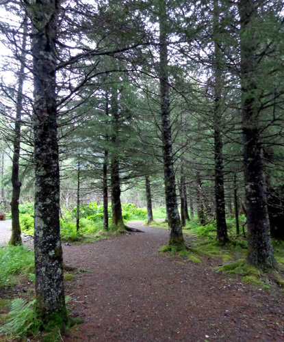
The whole Williwaw Nature Trail is interesting, and not for just the things you
think you see.
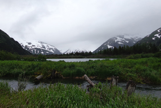
I assumed all the ponds and streams were naturally formed by the glut of
snowmelt and rain water that flows through this valley. In addition to
all the ponds and streams, a lot of what looks like meadows with solid
footing is actually wetlands.
Well, I was right about how much water flows through this valley. I was wrong
about Mother Nature and Father Time being the sole landscape architects,
however.
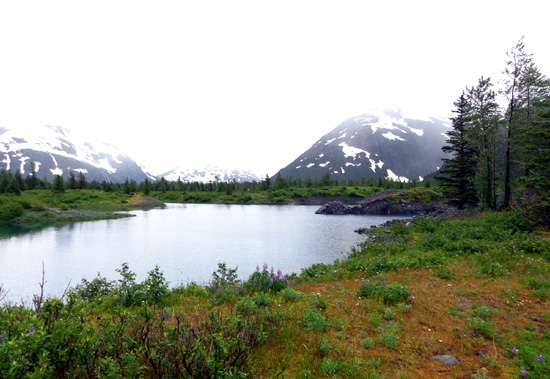
According to the information I read on one of the
interpretive panels on the other side of the road, several or all of the ponds you see near the
Williwaw Nature Trail on the map farther down this page are actually gravel
pits -- and some of the streams are man-made.
They're all part of the Fisheries Habitat Enhancement program,
described on this sign:
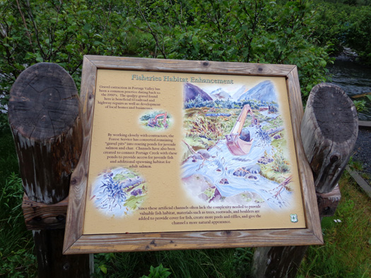
Gravel extraction in the valley has been a common practice since the
1960s. The quality of the gravel is good for highway and railroad
construction/repair and various other building projects in the private sector.
Much of the valley is public Forest Service land. As a good steward of
that land, the USFS has converted
the gravel pits into rearing ponds for juvenile salmon and char. It's an
ongoing project, as gravel continues to be extracted from the ponds and
an increasing number of salmon return to the area to spawn.
The remaining photos of this pond (below) and the others on the north
side of the road show what a good job the Forest Service has done to
maintain the beauty of Portage Valley. If I hadn't seen that backhoe I
probably wouldn't have even noticed what was going on.
When the Forest Service decided to use the ponds for spawning grounds it
had another challenge -- finding a way to get the fish to
the ponds. Some or all of the original gravel pits weren't on waterways
that were suitable for the salmon to swim upstream.
The solution was to dig several water channels to connect these ponds
with Portage Creek so fish can reach them to spawn each summer.
Since these artificial channels lack the complexity needed to provide
natural fish habitat, materials like trees, roots, and boulders were
added to provide cover for the fish, create more pools and riffles, and
give the streams a more natural appearance.
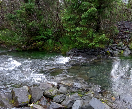
This is one of them:
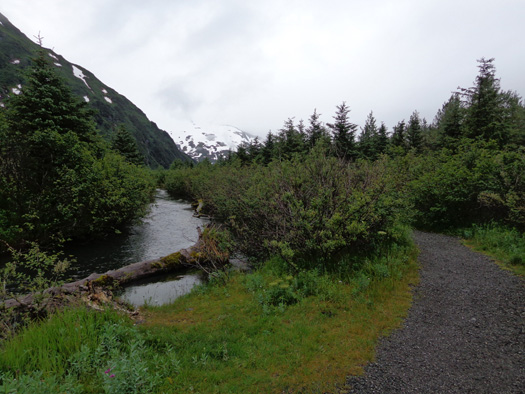
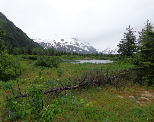
When I walked by the the streams, I
sometimes couldn't tell "natural" creeks from these
"artificial" ones except where the explanatory sign was located.
I think this whole Habitat Enhancement project is an interesting win-win
situation where potentially competing interests have been satisfied to
the benefit of everyone concerned -- private industry, public
works, recreational pursuits of residents and visitors, and the wildlife
that calls the valley home.
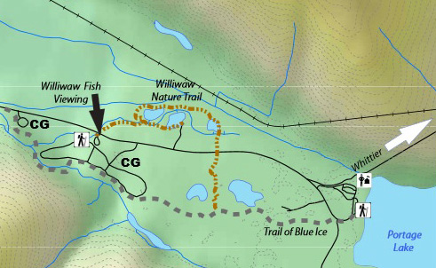
VIEWS FROM THE NORTH SIDE OF THE WILLIWAW LOOP
The Williwaw trail crosses busy Portage Valley Hwy. twice. On the east
side of the loop there is no bridge, tunnel, or light. Be careful
crossing the road in that spot because traffic can be fast and heavy.
Going CCW on the Williwaw Nature Trail loop on the other side of the
road was even more interesting to
me because I had great views of the Kenai Mountain Range and glaciers on
the south side of the Portage Valley "behind" our campground.
On the north side of the highway the trail runs between wide,
fast-moving Portage Creek
and the highway. It's far enough from the road to not hear or see traffic, just
more scenic ponds, streams, wetlands, and mountains.
Here's a map of the trail again:
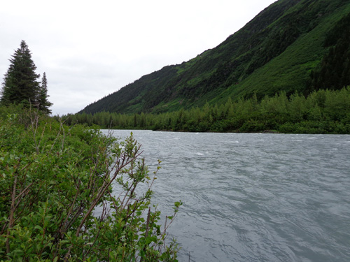
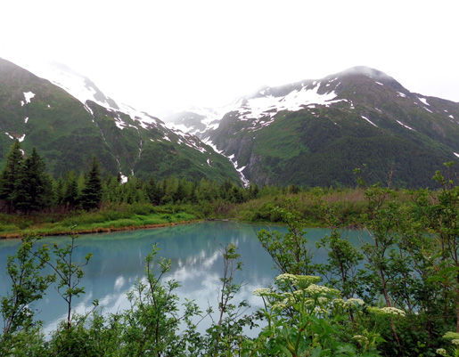
As I made the turn to the left (west) above the third pond I followed a
short side trail to a point where I could clearly see Portage Creek.
Looks more like a river to me:
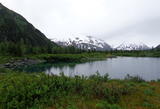
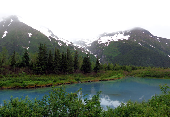
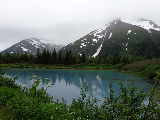
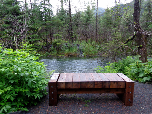
The ponds (also old gravel pits??) on this side of the road are also
that gorgeous deep turquoise color from all the glacial silt flowing
through them. The angle of whatever light was coming through the thick
clouds made the ponds over here look even more blue:
In addition to salmon and char, these ponds also support trout. Fishing
is popular here.
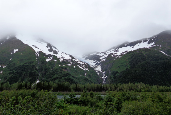
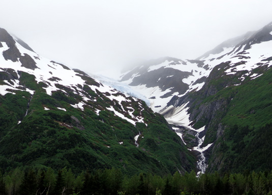
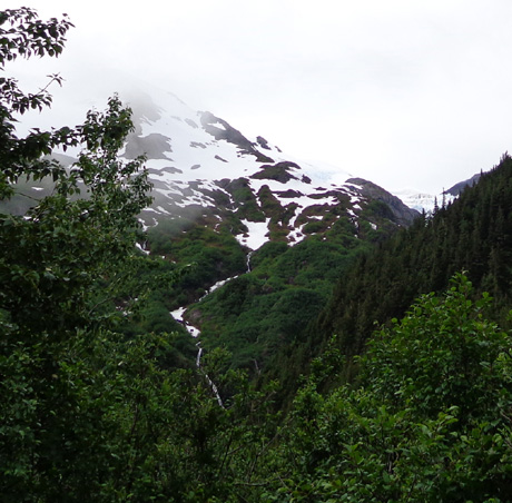
Despite the misty conditions and lingering low clouds this evening I had
the best views of Middle Glacier from this vantage point across the road.
I could see the valley where the glacier "hangs" soon after I turned west on the
Williwaw trail, going CCW on the loop:
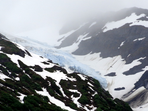
The closer I got to the road as the trail swung back south toward the
fish viewing area, the more I could see the blue ice:
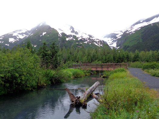
About half a mile before I reached the road I crossed this pretty creek on a wooden bridge:
The trail splits and visitors can either walk out and back on the other
side of the ponds for about a quarter mile or continue along the creek
toward the road, salmon viewing area, and Williwaw Campground.
The trail continues through a tunnel under the busy Portage Valley road
at this point, ending at the popular Williwaw Fish Viewing Platform.
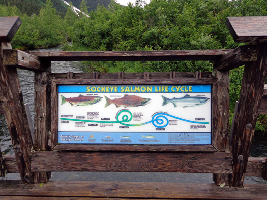
SALMON VIEWING AREA
From late July through early September at least four kinds of salmon
travel up Williwaw Creek to spawn in the streams and ponds I've shown on
these pages.
This handsome viewing platform is located just off the Portage Valley
Highway between the entrances to Black Bear and Williwaw campgrounds.
The U-shaped parking area is big enough for large rigs to park and turn
around..
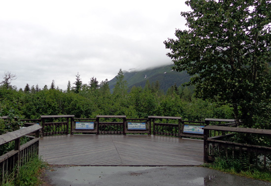
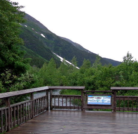
Interpretive panels describe the life cycle of red (sockeye), chum (dog), pink
(humpy), and coho (silver) salmon:
No fishing is allowed in the creek in this area but it would be fun to
watch the salmon swim by when they're on their way to the ponds to
spawn. We were here too early to see any of them.
AS MUCH EXERCISE (& BEAUTY) AS YOU WANT
Combining various configurations on the Blue Ice and/or Williwaw Nature
trails you can run, hike, or ride a bike any distance from zero to about 15
miles. Add another four miles going to Bryon Glacier and back.
If all that's not enough, you can repeat some of those miles or get on the road
and run/ride between Portage and Whittier.
Jim and I plan to get out on these trails
tomorrow morning before we go back to Anchorage and ride our bikes the
other direction (west toward the Seward Hwy.).
I'll show photos of that part of the Trail of
Blue Ice in the next entry.
LAND OF ENCHANTMENT
That may be New
Mexico's state nickname but I think it is even more apropos for Alaska.
Despite the rain, I’m in love with this state. So many places are simply
enchanting.
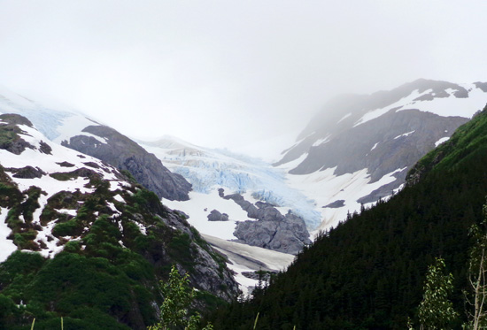
As I record these notes we’re both sitting at our computers at Williwaw
Campground, looking out the windows of our Cameo at lush green
mountains, a waterfall that’s several hundred feet high, and the blue
ice at the top of Middle Glacier:
It’s almost 10 PM and even with lingering low clouds, it’s still light
outside. It feels like 6 PM.
Any minute a moose with twins or a bear with triplets could walk by our
windows. We’d be delighted, but not surprised because we've had such
wildlife encounters in Alaska already. They'll be magical no matter how
many times we experience them. Ditto with glaciers.
I can see why some people either keep coming back to Alaska or move here
full- or part-time. In so many ways, it's like no other place I've ever
been.
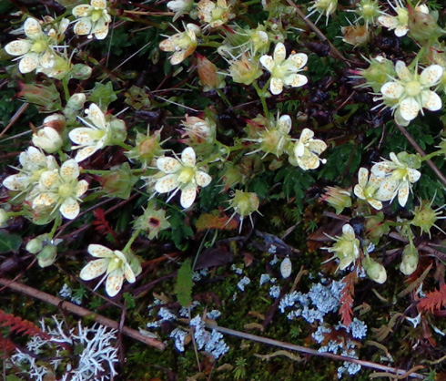
GORGEOUS FLOWERS
Here's another reason to visit (or live in)
Alaska -- some flowers you may not see anywhere else.
I found this
article tonight on the AlaskaDispatch.com site.
There is a slideshow of more than 30 beautiful macro photos of flowers
blooming this past week at the Alaska Botanical Gardens in Anchorage.
I'll have to go there soon to see them. We're heading back to JBER
tomorrow.
Next entry: photos from the other
end of the Trail of Blue Ice
Happy trails,
Sue
"Runtrails & Company" - Sue Norwood, Jim O'Neil,
and Cody the ultra Lab
Previous
Next
© 2012 Sue Norwood and Jim O'Neil
