Continued from the previous page.
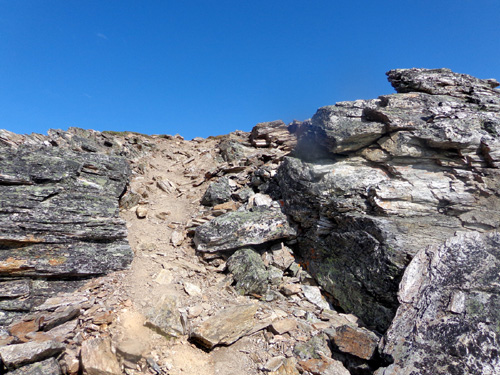
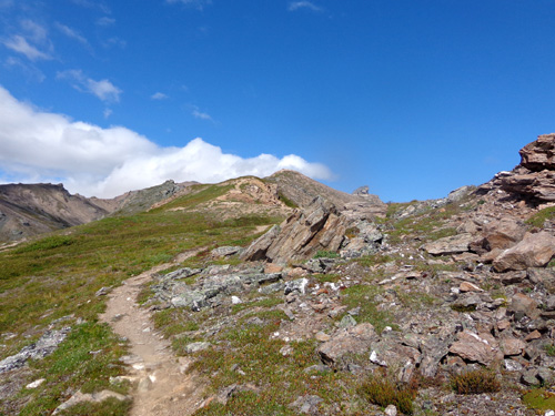
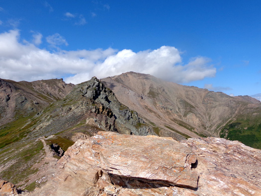
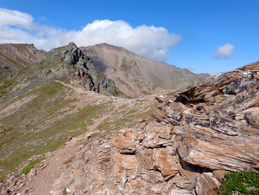
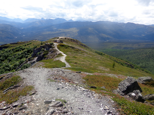
HIKING ALONG THE RIDGE
I thoroughly enjoyed the expansive views from the tundra on the Mt.
Healy Overlook Trail and for another mile and a half on what I'm calling
Healy Ridge. I haven't found another name for it.
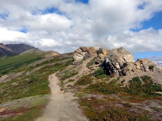
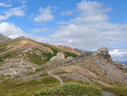
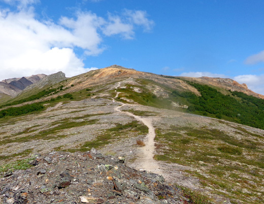
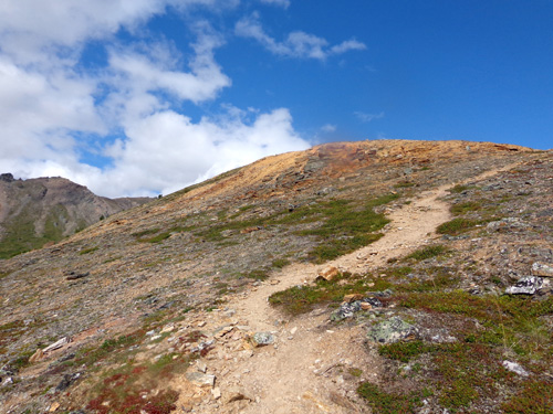
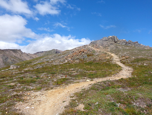
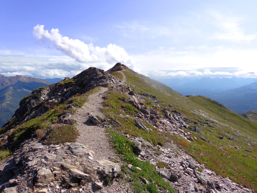
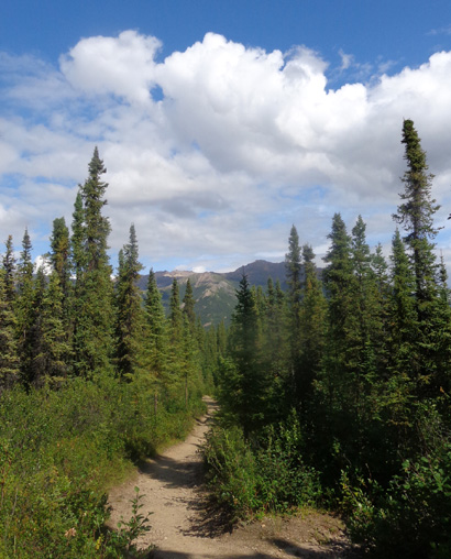
The photos on this
page are mostly in chronological order as I went out and back on the
ridge. Note the interesting rock formations and how nice the trail
usually looks. The 5,700-foot summit of Mt. Healy is visible in the
background of most of the outbound pictures.
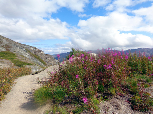
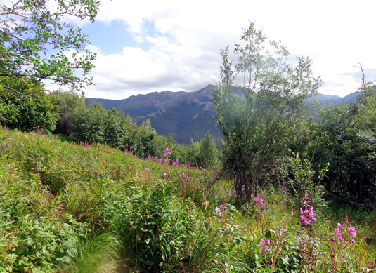
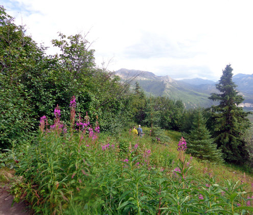
I didn't know fireweed could grow in the tundra.
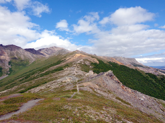
Is this trail near-perfect, or what?
The reddish alpine plants on the ridge are an interesting
contrast to all the green. Is autumn close?
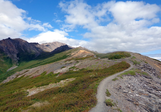
The trail undulates but has an overall elevation
gain outbound (north).
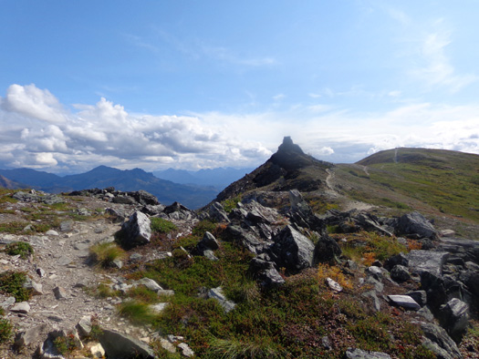
I called the hill in the distance "Gold Hill" for obvious reasons. You
can see it above and below.
On the next page I'll show close-ups of some
of the interesting rocks I found there and in other places along the ridge.
When I began hiking along the ridge I had no idea how far I'd go. I just
played it by ear, curious about what was beyond each high point I
couldn't see beyond until I got there.
I figured I'd just go as far as the trail was manageable for me.
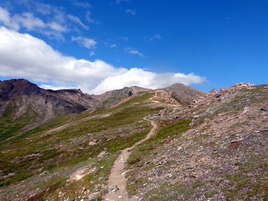
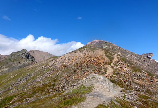
The summit of Mt. Healy looks much closer now.
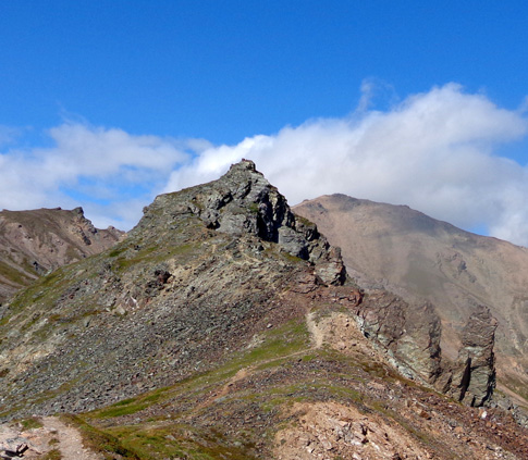
I turned around at the top of the next rock formation because the trail
took a decided drop down to a saddle on the other side and started looking
more like a rough, narrow "squirrel trail."
I could tell that it would take me too long to reach Mt. Healy's summit.
I didn't have enough fluids, calories, or time to go that far today. I'd sure
like to find out more information about the trail past this rock
formation, however, and maybe try to reach the summit on another hike
someday.
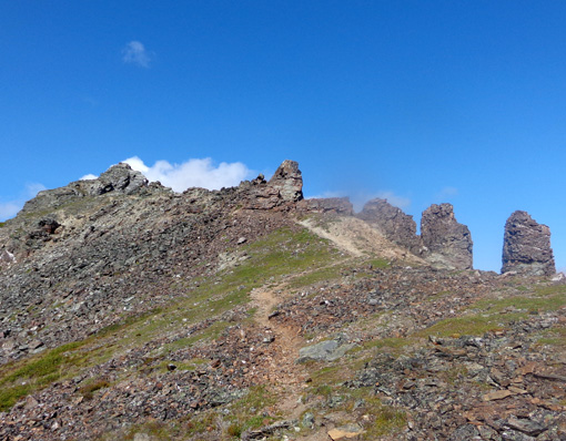
Healy-henge??
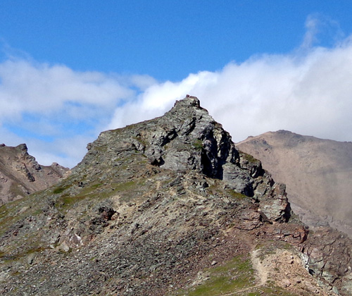
So close and yet so far: Mt. Healy's summit
is in the background, right.
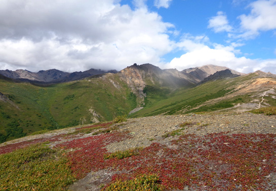
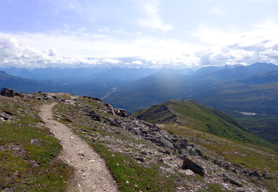
Along the ridgeline I had almost 360-degree views, and definitely
panoramic views on the point where I turned around at 4,157 feet. The
views down to Nenana Canyon and the park were excellent.
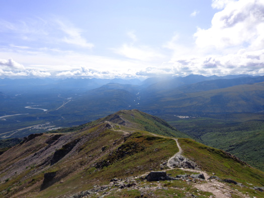
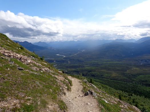
DESCENDING THE RIDGELINE
The perspective
looking back down the trail was also interesting. Somehow it looked more
steep and rugged that way! See the trail way down on the right edge of
the next picture?
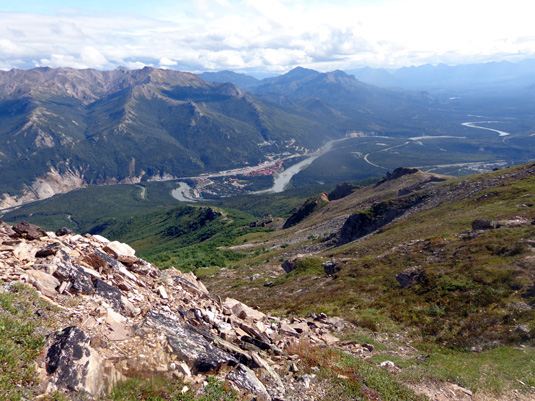
View down to Nenana Canyon
I could see lots of snow-covered peaks from the ridge but the clouds were low
enough that I couldn't see Denali’s summit, only farther down the mountain.
I thought it might be Denali and a local hiker verified it is.
I highlighted Denali
in the next photo:
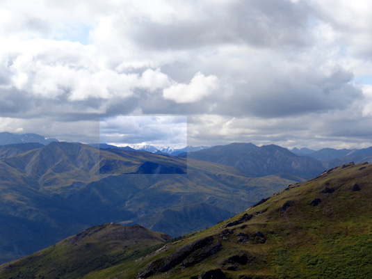
I'd love to be up on the ridge on a
day when Denali's summit is visible.
Here are more photos as I descended the ridge to the official overlook
at 3,500 feet:
The ridgeline trail isn't all smooth but it's not
too gnarly.
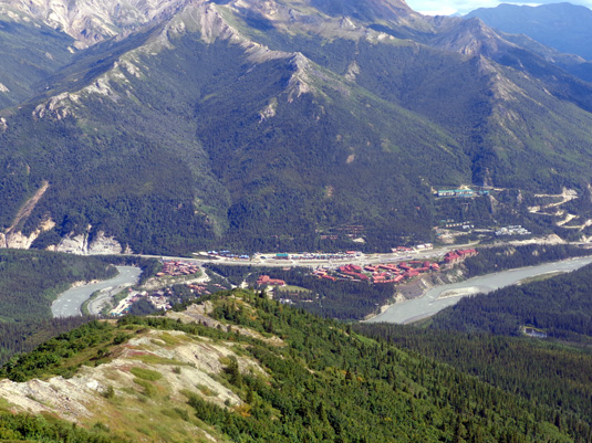
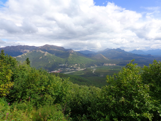
Closer view of the shops and accommodations in
Nenana Canyon.
Almost back down to the overlook
While I was on the ridgeline above the official Mt. Healy Overlook Trail
I saw a total of about eight hikers. I loved the solitude. I talked with
most of them. None has ever been all the way to the summit of Mt. Healy
but two guys did go farther than I did this morning.
DESCENDING THE OVERLOOK TRAIL
When I got back to the overlook there were more than eight people there,
and at least two dozen on the way up.
I chatted with most of them. If they hadn't been up on the ridge before,
I encouraged them to continue walking there if they had adequate fluids,
calories, and time. I don't know if any of them went farther. I soon
lost sight of the ridge as I descended the trail.
Here are a few more pictures on the way down to the trail head:
Before I knew it, I was back down at the trailhead at the railroad
tracks. I had enough time to cross the tracks and hike the shorter trail
down to Horseshoe Lake, which I'll describe in the next entry.
SOME FINAL THOUGHTS ABOUT THE MT. HEALY OVERLOOK TRAIL
I loved this trail even through it was a bit difficult in some sections
with large rock steps or loose rocks. I was glad I had both trekking
poles on the descent for stability and to help cushion by Granny Knees.
Otherwise, I thought the main trail and the ridge trail were both mostly easy
to moderate in difficulty. As noted earlier, I saw people of all ages on
the main trail and up at the overlook.
The few hikers I saw on the ridgeline trail were younger (20s and 30s),
more fit-looking, and probably more experienced. Ironically, that trail
-- at least for the mile and a half I followed it -- is
smoother and more gradual than the last mile of the Mt. Healy Overlook Trail.
For my own selfish reasons I'm glad there weren't more people on
the ridge while I was up there but I'd encourage other hikers to go out
as far as they are comfortable on it.
Since I was hiking alone and I thought I might be hiking through some
dense forest or undergrowth I wore a bear bell and carried bear spray. There were
enough other people on the main trail that I doubt any bears were around.
I don't worry about surprising a bear above treeline but the spray might
have come in handy there nonetheless.
The only critters I saw were birds, squirrels, marmots, and groundhogs. One ground squirrel
near my turnaround point "posed" for me beside its hole. I'll show
him to you on the next page.
Continued on the
next page: small natural wonders along
these trails
Happy trails,
Sue
"Runtrails & Company" - Sue Norwood, Jim O'Neil,
and Cody the ultra Lab
Previous
Next
© 2012 Sue Norwood and Jim O'Neil
