I can tell the author of that article is a younger, stronger hiker than most of folks the park service
expects to climb the Mt. Healy Overlook Trail.Why? Because the Denali
website, interpretive signs, and written information all describe this
trail as "strenuous," requiring three to four hours to hike 4.5
miles roundtrip. Does that sound like Eric's description?
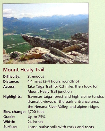
Trail description from an interpretive sign at the
main Denali visitor center
My perspective as a fit, athletic 63-year-old female hiker with bad
knees is that it is a trail of overall "moderate" difficulty. I saw about three
dozen people on this trail today. They represented a wide variety of
ages (under 10 to over 70, I'd guess) and all of them looked relatively fit.
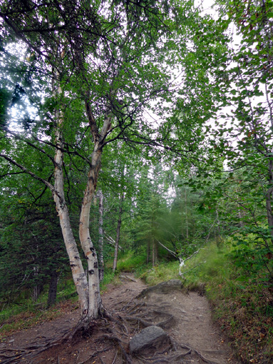
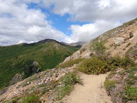
This trail is not flat and it's not all smooth, although some of it is.
There are some roots and rocks, sometimes in great abundance as
illustrated in this segment
about two thirds of the way up the trail:
I remember only once place on the maintained trail where the grade is a bit steep
(the park's website says 25%) but
it is a relatively short section. It has some big rock steps, too.
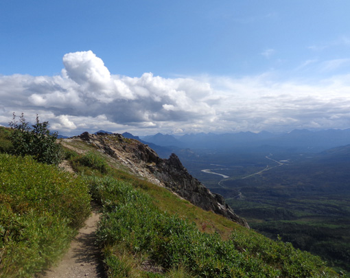
The elevation gain is about 1,700 feet in a little over two miles to the
overlook where the maintained trail ends and the real fun begins
-- the rolling trail along the ridge that's not counted in the
official distance. I thought the ridge was easier to hike than the last
mile to the overlook and the panoramic views are among the best
I've had in any tundra, anywhere.
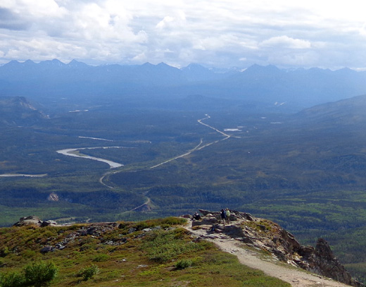
Looking down to the overlook,
where some hikers are enjoying the view to the south;
the Nenana River snakes away to
the left, the George Parks Hwy. through the center.
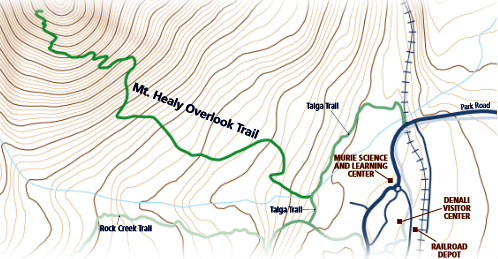
This map section from another
page on the park website shows topo
lines along the Healy trail. The darker lines appear to be 100-foot
intervals, the lighter ones 20 feet:
That page is also an interesting historical read.
The narrative compares the physical and mental challenges of climbing to
the overlook to the challenges facing the park's past creation and
current management to ensure that the scenery and wildlife are preserved
for many generations to come.
TODAY'S ROUTE(S)
I spent a little over six hours hiking 11 miles today and had a
great time! I talked to lots of the other hikers and spent time enjoying
the panoramic views and taking picture.
I just wish I could have shared the experience with Jim and Cody. Jim's
bum knee prevents him from hiking this far and Cody isn't allowed on the trails
at Denali.
The Mt. Healy Overlook Trail to the ridge was my main goal.
I added about three miles on the ridge (total out and back) because it, well, beckoned me
to follow it!
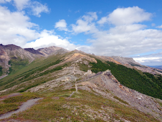
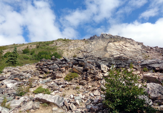
Literally and figuratively "above and beyond" the
overlook trail:
the ridge leading to Mt. Healy (the high
peak in the distance)
When I got back down
to the trailhead I had
enough time left to also hike the shorter Horseshoe Lake Trail, which I'll
describe in the next entry.
This entry will be
three pages long. I took 363 photos on just the Mt. Healy Overlook Trail
and the section of the Taiga Trail I hiked to reach the former. I edited
those down to 296 pictures. It took some restraint to limit the pictures
I selected for the website to about 90. The first two pages feature the
trail and scenic views from it. The third page will focus on natural botanical and geological details
-- interesting flowers,
alpine plants, mushrooms, rock formations and individual rocks, and a
little critter in the tundra.
Here's another map section that shows my route today. It's from an
interpretive panel and can also be found on the park's website:
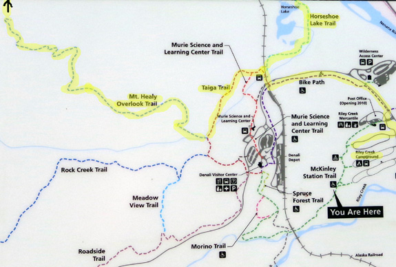
The trails I used are highlighted in yellow. The dotted Mt. Healy
Overlook Trail line stops at the overlook. I kept going another mile and
a half along the ridge (arrow).
I hiked from our site in the Riley Creek Campground (elevation about
1,664 feet) on the bike path to the trailhead along the railroad tracks
for the Taiga Trail:
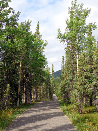
Bike path
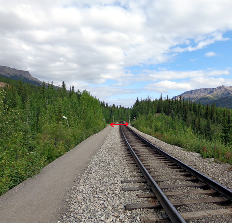
Taiga Trail begins left of arrow, Horseshoe Lake
trailhead to right of tracks
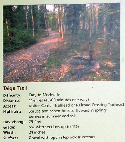
Here is a description of the Taiga Trail from an interpretive panel
(it's also on the park
website):
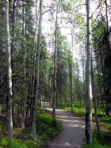
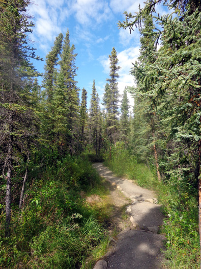
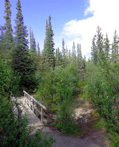
The Taiga (pronounced TY-guh) Trail connected me to the Mt. Healy Overlook Trail in about
one-third mile. I took the next pictures along this pretty trail
through the boreal forest AKA "taiga:"
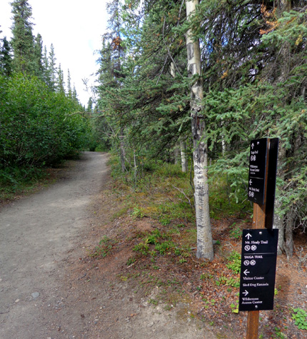
Intersection of Taiga and Mt. Healy Overlook trails
From the intersection of the Taiga and Mt. Healy Overlook Trails it was
about two miles up to the overlook at about 3,500 feet, a gain of about
1,836 feet from our camper. (If you start from the trailhead at the
railroad tracks the gain is about 1,700 feet.) This is the official end
of the maintained Overlook trail.
I gained another 660 feet of elevation, topping out at 4,157 feet, in a
mile and a half along the ridge before turning around and descending to
the trailhead.
At the end of that portion of my hike I crossed the railroad tracks and
went out and back on the Horseshoe Lake Trail before returning to the
campground on the bike path.
PHOTOS FROM THE MT. HEALY OVERLOOK TRAIL
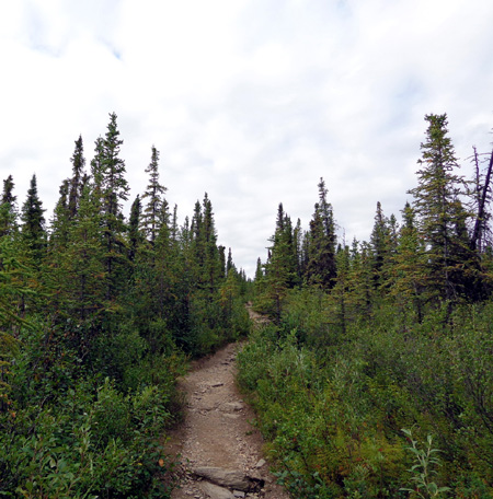
The lower Overlook Trail continued gradually up through beautiful boreal
forest terrain full of spruce, aspens, and shrubs that thinned
out and got increasingly shorter as I climbed higher:
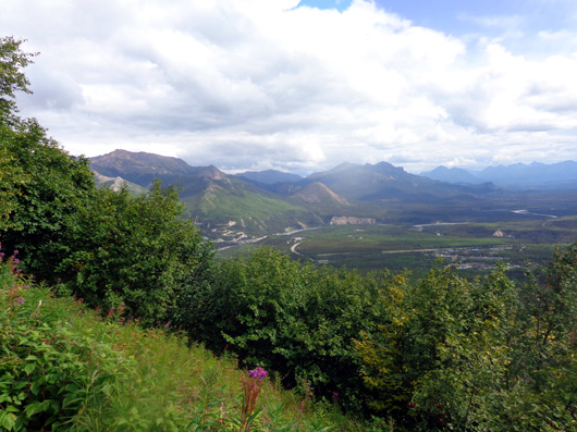
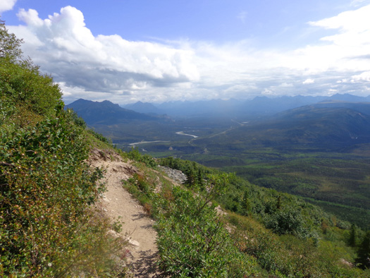
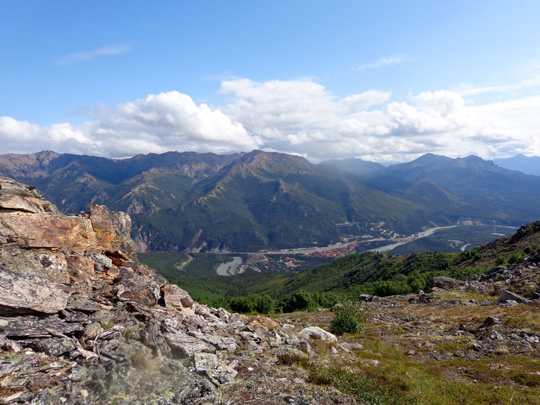
As I climbed higher and got out of the forest I could see more and more
of the valley to the west and south (the national park, Alaska Range,
and George Parks Hwy.) and east (Nenana Canyon and the Talkeetna Range):
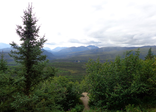
Just starting to see the valley to the south
(national park and beyond)
Nenana Canyon to left, park entrance (including our
campground) to the right
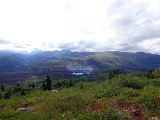
Park headquarters highlighted in center
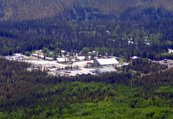
Close-up of park HQ buildings several miles back
the park road (not the visitor center)
I got above timberline at about 2,500 feet elevation.
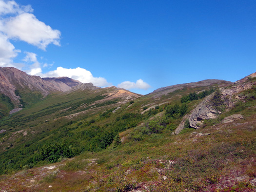
The next 1,000 feet of gain to the overlook afforded
even better views to the east, west, and south as the trail
switch-backed through rocks and sub-alpine plants. The trail was
alternately smooth and rocky, and became more narrow at higher
elevations:
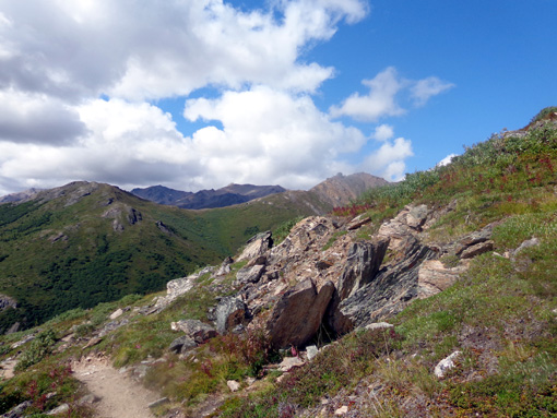
First view of what I call Healy Ridge; I haven't
found any other name for it.
Almost there!
The overlook area has several levels, all of which afford panoramic
views:
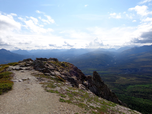
Looking down at two levels of the overlook; Nenana
River to left, Parks Hwy. in center
A river runs through it: Nenana Canyon AKA
"Glitter Gulch"
Keep going up to the sign on this knob that
indicates you've reached the overlook.
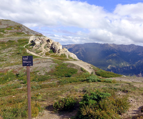
The sign says "Mt. Healy Overlook. End of
maintained trail."
So I'm standing on that knoll, looking all around me.
Most people stop
here and are perfectly satisfied with the beauty of the place and the
difficulty of the trail they've already climbed to stay a few minutes,
take pictures, perhaps eat a snack, and
then turn around and wind their way back down to the trailhead, successfully completing
a 4.5-mile hike.
People who know me can vouch that I'm not like most other people. <grin>
I'm trained for more distance than that and I have a craving for
adventure. Nothing satisfies me more than exploring terrain that is new
to me, especially above treeline. What I saw was a golden opportunity
for more fun and even more panoramic views higher up.
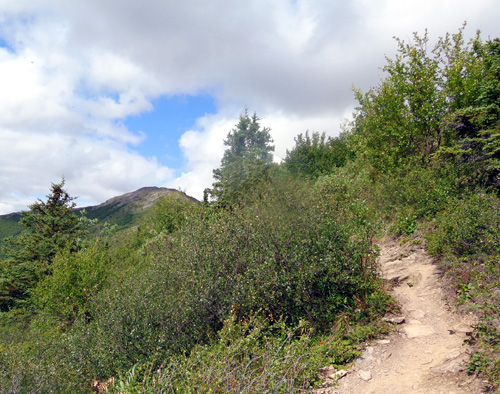
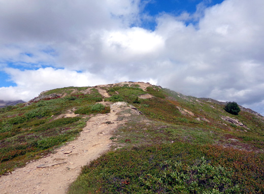
It doesn't take a rocket scientist to notice that the trail continues up
the ridge, and it doesn't look gnarly at all:
I would have continued up that ridge even if I hadn't seen any other
hikers up there. I had the time to do some more exploration and that's just
how I'm wired.
However, another hiker just happened to be coming down to the overlook
sign. He told me
the “un-maintained” trail was even better than the official Mt. Healy
Overlook Trail, so I continued on another mile and a half before turning
around.
He was right – that trail undulating along the ridge into the distance was
in far better shape than the last mile of the "maintained" Overlook Trail! On my way
down I encouraged several other people to continue on along the ridge if they
had the time, energy, and water.
Let's go see it now. Continued on the
next
page . . .
Happy trails,
Sue
"Runtrails & Company" - Sue Norwood, Jim O'Neil,
and Cody the ultra Lab
Previous
Next
© 2012 Sue Norwood and Jim O'Neil
