I woke up with the intention of doing a two-hour hike in Bayo Canyon
this morning but the clouds hanging over us this morning gave me some
pause.This was another interesting weather day in Los Alamos.
Wednesday it snowed in the nearby Jemez Mountains; we can still see the
white peaks from our campsite. Yesterday it not only snowed in the
mountains again, it also snowed in town! Luckily, the ground was
too warm for it to stick in town. In a subsequent entry I'll show some
dramatic photos from storms we've had during our ten-day stay in the
area.
Today was mostly cloudy with some glimpses of blue sky. Temperatures
were in the low 40s to mid-50s F., which is unseasonably cool for this
time of year. At least it didn't snow again.
FROM HERE TO THERE
This morning we moved our camper seven miles across town to a large
gravel parking area on North Mesa near the start/finish of the Jemez
race.
First we had to dump our gray and black water tanks at the dump
station at the Eastgate-Sunrise RV station and refill the fresh water
tank:
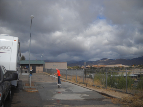
Note the menacing storm clouds over the Jemez Mountains to the west.
We thought for sure we'd get dumped on, but there was no rain in town
today.
As is typical in the mountains, just look at the pretty blue sky and fluffy white clouds a
couple hours
later at our new location on the adjacent mesa:
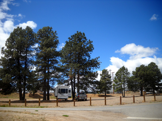
This is the third time we've taken the opportunity to use this
race perk.
The lot is owned by either Los Alamos city or county and
serves as a trailhead for one of the many multi-use trails in the local
trail network. Although the parking area is only open for day use at other
times (we've asked!), runners and volunteers are allowed to park here on
Friday and Saturday nights on race weekend.
We are very grateful for that. Each year a few more folks involved with the race discover they can park
their RVs in this area. Ironically, it's adjacent to the city's RV
storage lot, which you can see in the background in the next photo:
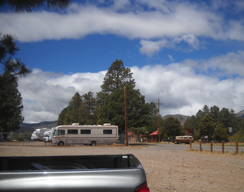
The Posse Shack is the red-roofed building behind the
van. That's where the Jemez Mountain trail runs start and finish.
Beyond that to the west are nice
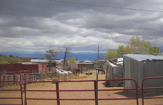
houses, a park, and an elementary school. To the north is Bayo Canyon. To the south are some
ball fields and more residences. To the east are horse stables,
a park, and Kwage Mesa. This is definitely a "mixed-use" neighborhood.
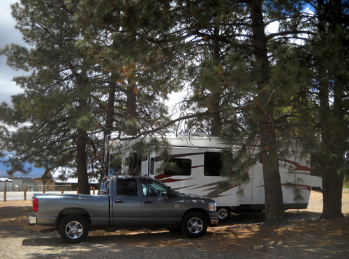
We like this parking spot a lot more than the one on the other
mesa where we stayed the first week. It's quiet, it's convenient to
several trails, we have shade, and our phone and MiFi signals are better
here. Too bad we can stay here for only two nights!
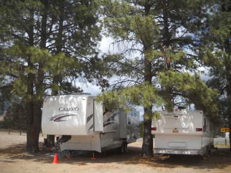
A few hours after we got situated in our site under the tall pines a
very long, low-slung Hi-Lo trailer circled the parking lot, looking for
a good spot. I've never seen any kind of pop-up camper anywhere near
this long before:
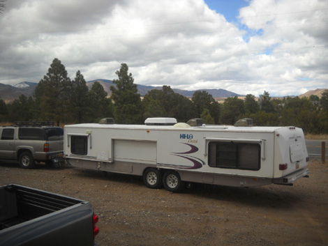
The driver ended up parking next to us under the tall trees
so he could also enjoy the cool shade and take up as little space
as possible:
Turns out, the trailer belongs to the ham radio guy who will work the start/finish of the race. Jim talked to him
but didn't get his name.
His Hi-Lo camper doesn't look as odd with the roof raised and the slides
out. It has hydraulic levelers, which surprised us. Those are
common on motorhomes but not on fifth-wheels or travel trailers. We
absolutely love our Big Foot hydraulic leveling system by Quadra.
It's a big reason we purchased a 2010 Cameo and not a 2009 model. It's
well worth the extra $$$ to us, as frequently as we move.
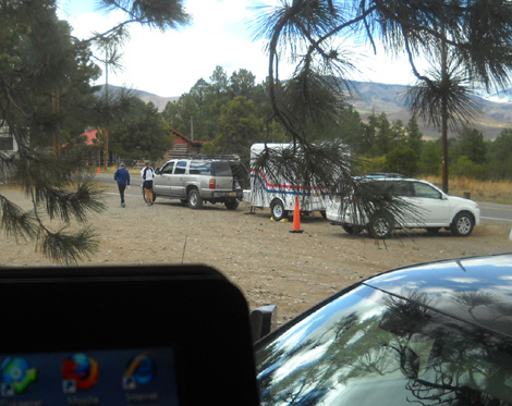
The view beyond my computer monitor . . .
Later in the afternoon the radio guy returned with a smaller trailer to
use for race communications (above) and several runners arrived in their
RVs, vans, and SUVs. About ten vehicles parked here overnight.
When we got up
the next morning at 5:30 the parking lot was full of 50-milers who'd arrived
very early for the start of their race at 5. Most 50Kers and half
marathoners must park farther away for their later start times.
WHAT IS THAT SMELL??
Horse poop from the nearby stables, but we really can't smell it from our camper! Fortunately,
the wind usually blows it the other direction and not toward us.
Not only is this parking area convenient for us when Jim runs the race and I work
it, it's also convenient to a paved bike path, two trailheads for trail
spurs into Bayo
Canyon, and a nice dirt trail loop on Kwage Mesa, which is one of the
two fingers of land extending east of North Mesa. (Los Alamos is built
on a series of east-west mesas with canyons between each finger of land.)
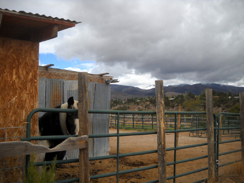
North Mesa Road makes a bend around the parking lot where we are
camped. Just on the other side of the road to the east of us is the
large North Mesa stable area. We have to go through it to reach the two
spur trails into Bayo Canyon and the trails on Kwage Mesa. You can see one of the
horse barns
beyond our rig the next picture:
The Jemez 50-miler also uses one of the dirt roads that loop through
the stables at the beginning of the race.
I always enjoy walking or riding my bike through the stables. I grew
up on a farm and love to see the animals. It's also cool to be on such
rural property in the city, right next to a nice park and residential
area.
I assume folks rent the plots of land and put whatever buildings up
that suit them. Although the barns and sheds are fairly old and
utilitarian, most of the fenced plots are neat and orderly. Some display
interesting signs, flags, or other personal touches.
Most of the plots have horses. Some have goats, chickens, and other
farm animals. Dogs often visit when their owners come to tend the
livestock.
All the sounds and smells nearly overwhelm Cody-Lab's keen senses as
we pass by the mini farms! He wants to examine everything along
the way.
There are two trailheads near our parking spot that go down into the Bayo Canyon.
One is directly behind us, close to the fence in the picture
above; that's where all of the Jemez runners will come back to
the Posse Shack at the end of their races. The other trailhead is about
half a mile to the east and through the stables; that's the route
the 50-milers will take tomorrow morning at the beginning of
their race.
Both of these spur trails from the mesa top access the Bayo Canyon
Trail and the entire Los Alamos trail network. The half-marathoners and 50K runners start on North Mesa Road and
go west to reach a third trailhead into the canyon.
SPUR TRAIL AND THE FIRST SECTION OF BAYO CANYON TRAIL
I have run/hiked a 5-6 mile loop above and through the Bayo Canyon at least two
times
before. It's a scenic, fairly easy hike on sometimes-rocky terrain
down into the canyon in either the clockwise or counter-clockwise
direction, up the other side to the "bench" below Barranca Mesa that I
wrote about a few days ago, down into the canyon again, and back up to
the camper.
After we got settled into our camping spot this morning Cody and I
took off through the stables for half a mile to the more easterly
trailhead into the canyon.
We dropped into the canyon on the spur trail and headed west like the 50-milers
will do tomorrow.
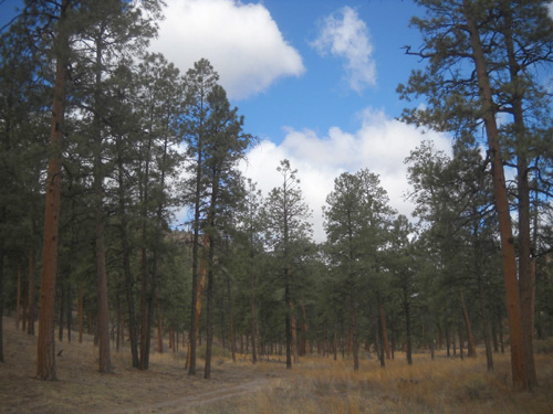
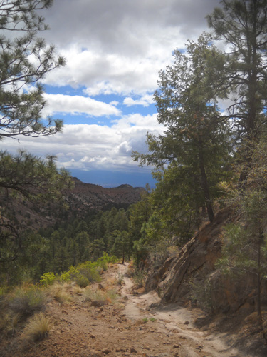
There are nice views of the Jemez Mountains from the trail:
Note the snow on the peak in the center background of the next photo. Caballo Peak,
to the left, also has some snow; the 50k and 50-mile
runners will go up that side of Caballo tomorrow:
Another thing to note in that photo is the flat-looking
trail across the canyon. That's the Bayo Bench Trail where Cody and I
will be hiking in a little while as we loop around the canyon.
Trail users on the bench trail can also look across the canyon and see
much of the trail Cody and I are currently on.
At the trail intersection down in the canyon a quarter mile later, the Jemez runners go
left (west) on the Bayo Canyon Trail; Cody and I went right
(east).
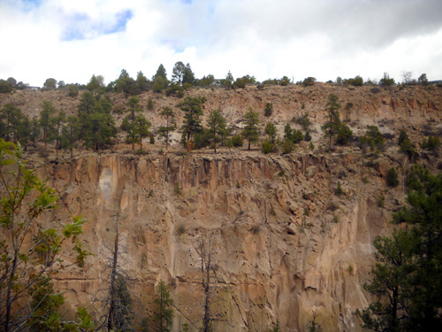
There are interesting views of the colorful rock walls
on the other side of the canyon and the Bench Trail:
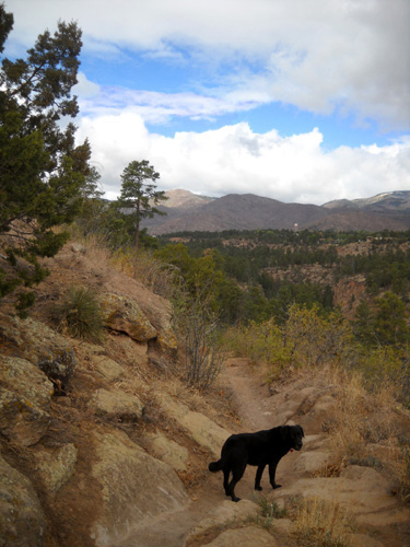
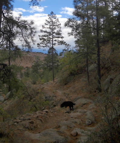
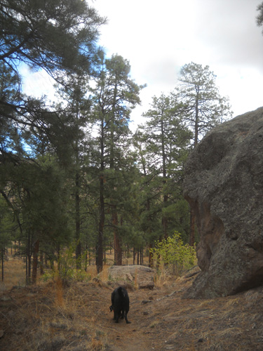
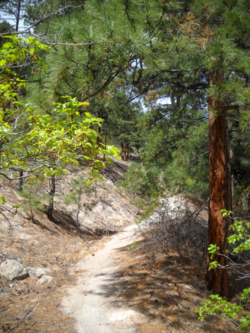
This trail gradually slopes down to the far end of Bayo Canyon on
sometimes-rocky single-track trail that goes through the forest and
includes some of the well-worn rock chutes that make this area of New
Mexico so interesting. I took the next two shots looking back up the
trail:
Before I knew it, Cody and I had reached the canyon floor. Here the
single-track and double-track trails are more flat and sandy:
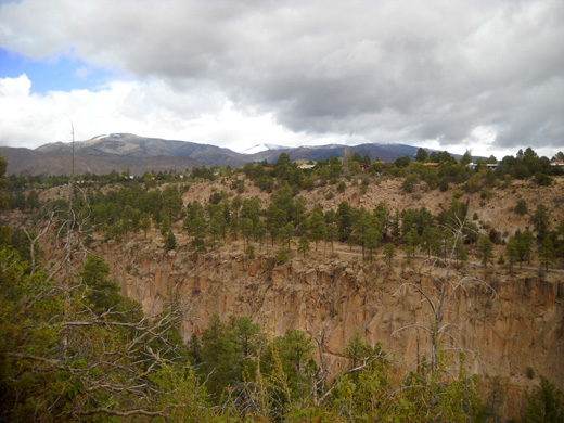
ACCESSING BARRANCA MESA & THE BAYO BENCH TRAIL
I had planned to hike farther east along the canyon floor as I've
done on previous runs and hikes but some workers were down there in noisy trucks.
So I
looped north and west to go up the other side of the "finger" of land on Barranca
Mesa that you can see in the next photo:
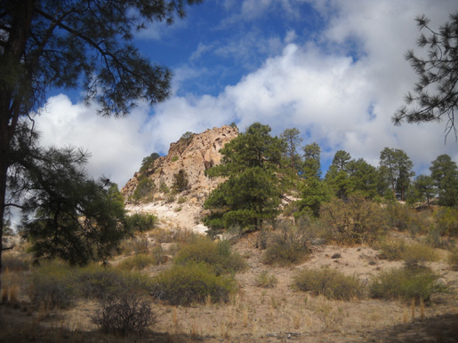
In a few minutes we'll be on top of that spit of
land, looking down here.
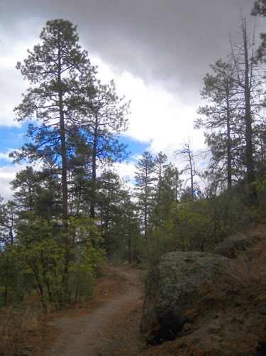
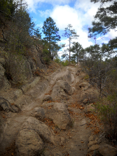
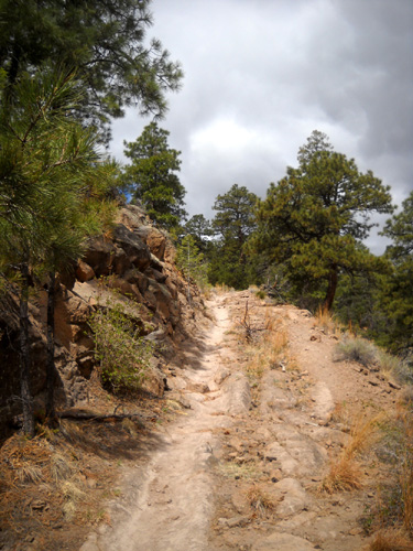
I don't see a name for this trail on my detailed maps. It climbs
about 200 feet in elevation to access
two parts of Barranco Mesa.
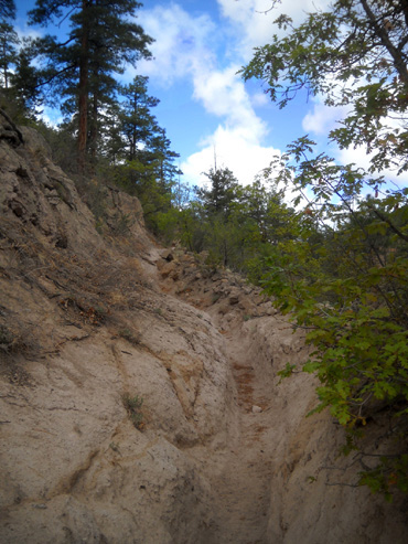
The trail starts off mostly smooth and shady:
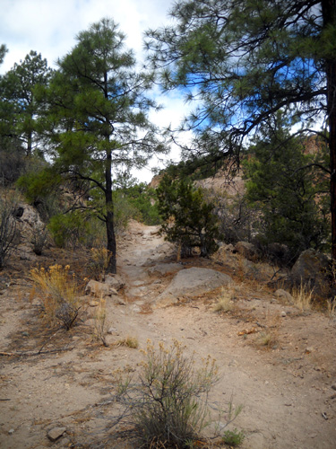
Farther up the hill it becomes rockier and less shaded.
The next two photos are looking back down the trail:
Continued on the
next page . . .
Happy trails,
Sue
"Runtrails & Company" - Sue Norwood, Jim O'Neil,
and Cody the Ultra Lab
Previous
Next
© 2011 Sue Norwood and Jim O'Neil
