Continued from
page 1.
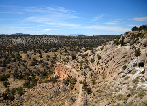
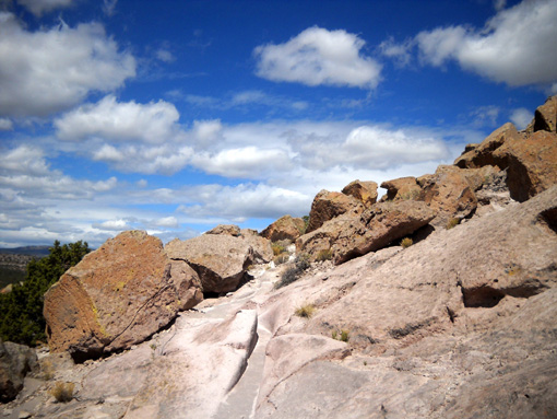
This is a look back at the ladder we just descended from
the mesa top:
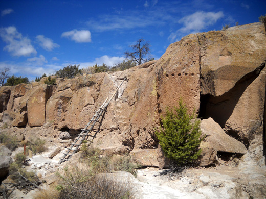
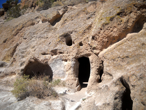
Do you see those holes in the upper right side of the cliff?
Those used to hold wooden supports for the roof of a talus pueblo.
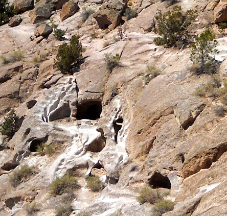
Most of the caves carved into the long stone wall you'll see in
some of the next photos had small masonry rooms constructed in
front of them for additional space and protection from the
elements but they have disappeared over time.
The people who lived here centuries ago took advantage of solar
heat when they dug caves and built rooms in these south-facing
cliffs. The thick stone walls retained heat in the winter and
insulated the inhabitants from excess heat in the summer.
Back at the ladder, modern-day visitors can take the higher or lower path
for a couple hundred feet until they reconnect. We've always
taken the lower one because of the interesting caves and very cool stone steps ahead:
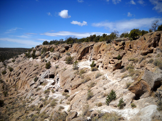
According to the park brochure, movement back and forth between this cavate area
and the mesa-top pueblo would have been constant. Stairways or
hand and toehold trails like these were cut into the stone to
provide easier access to the mesa -- although it wouldn't
have been easy to carry water, small children, and other things
up and down the steep rock face!
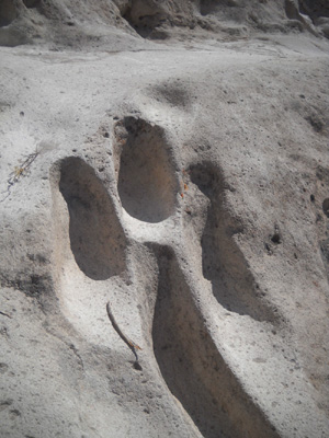
Here are two other nearby examples of steps that I marked with arrows:
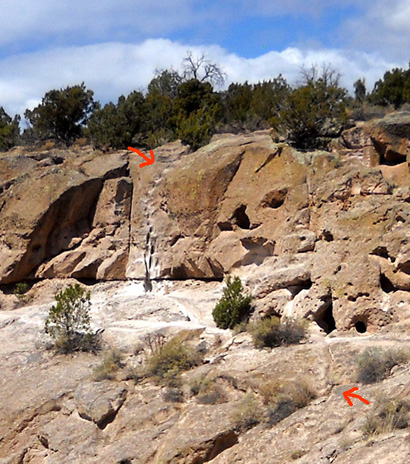
Over time -- and with heavy present-day use -- the
soft, fragile volcanic tuff has obviously worn down in some
areas and visitors are warned to avoid climbing on them:
There is an even lower established path along the edge of the
cliff but we've never taken it. I believe it starts near the
rock platform about 1/4 mile from the parking lot. I don't think
it's open to the public. It isn't even mentioned in the trail guide:
This entire site is still considered sacred to the ancestors of
the people who live here and they often visit Tsankawi. In
addition, scientists and park officials also have routes they
use through the site that aren't generally open to the public.
Visitors are expected to be respectful of the landscape and
avoid creating additional trails or climbing cliffs where paths
aren't already established.
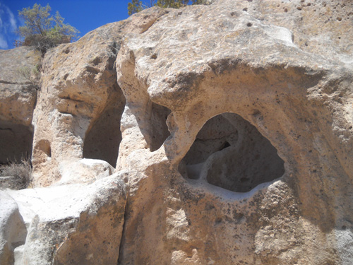
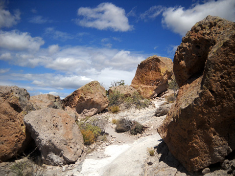
These photos continue along the main loop path. As you can see,
I'm fascinated with the caves -- from the outside in and
the inside out!
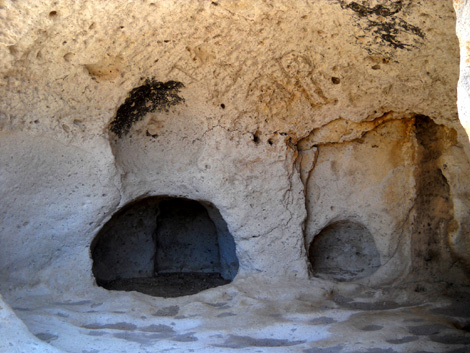
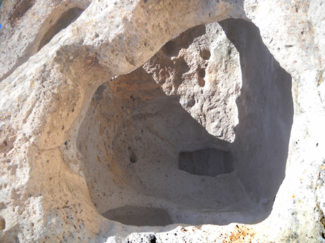
Small caves within a larger cave
Ceiling holes to peer through
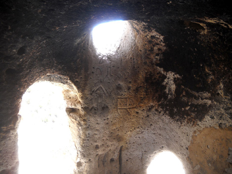
Soot on ceiling is probably original; I don't
know if the petroglyphs are.
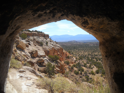
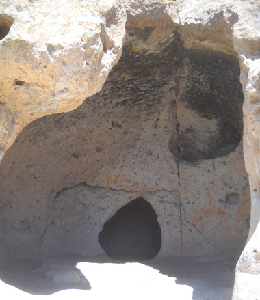
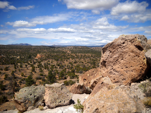
Home with a great view of the countryside toward the
Rio Grande and the Sangre de Cristo Range
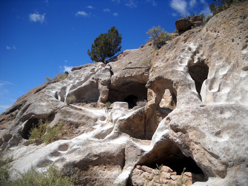
I just love this next set of caves; it's like a
prehistoric condo complex. The archways are intriguing, as are
the niches inside for storage of utensils, food, etc.:
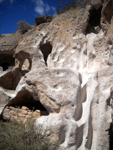
It's interesting to stand or sit inside these caves for a few
minutes and wonder what it would have been like to live
in them. These also probably had small stone rooms (talus
pueblos) in front of them for additional space and
protection from the elements.
At the end of this cave complex are the cool stone steps I
mentioned earlier. They are very steep but the footholds are
flat enough to climb OK:
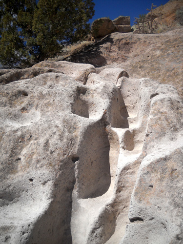
It's easier to climb if you bend over and use your hands on the
side of the steps, too.
Those steps take you up to the main cliff side trail. There
are fewer caves near the trail for the next half mile back to
the rock platform near the beginning of the loop but it's
obvious this has been a heavily-used path (maybe more by modern
civilizations than the ancients?).
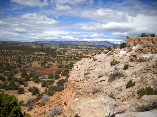
The views heading west on this trail are great. That's why I've
never hiked the loop in the CCW direction. I love all the
colorful rocks, too.
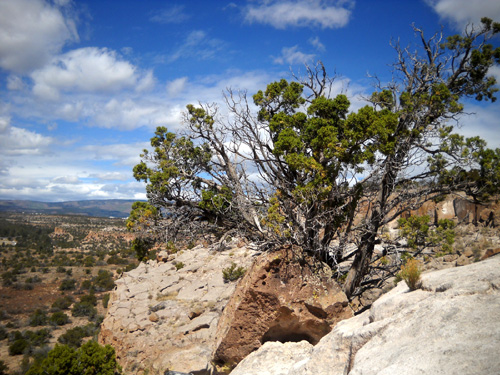
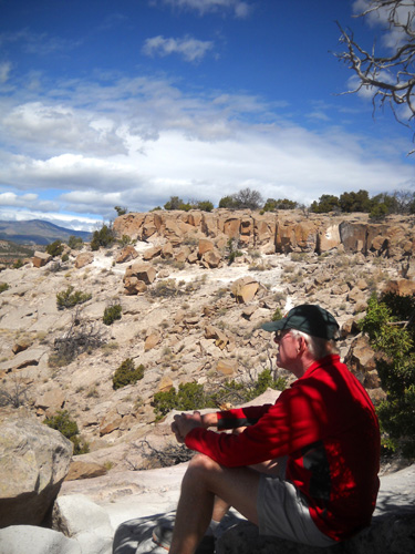
When I got behind Jim because I was taking so many photos, he found
a shady place to sit and gaze out over the valley while he
waited for me to catch up:
Petroglyphs and more on the
next page . . .
Happy trails,
Sue
"Runtrails & Company" - Sue Norwood, Jim O'Neil,
and Cody the Ultra Lab
Previous
Next
© 2011 Sue Norwood and Jim O'Neil
