Continued from the previous page.I CAN SEE FOR
MILES AND MILES AND MILES . . .
All the way to Leadville and beyond, in fact.
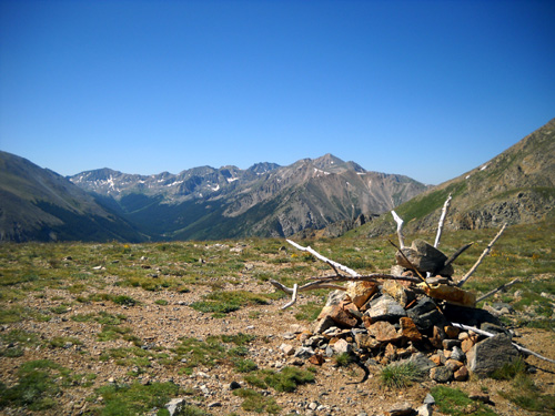
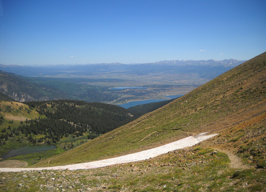
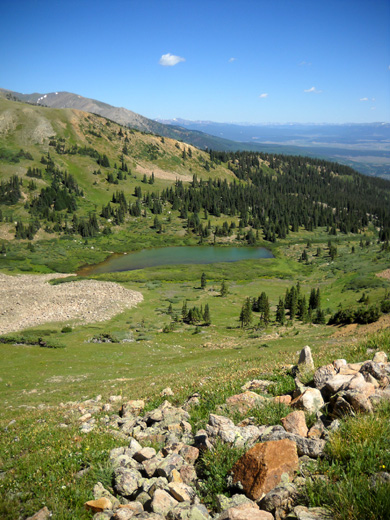
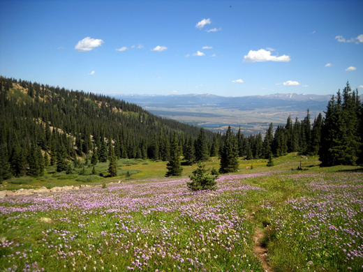
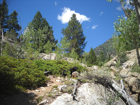
Here we are at Hope Pass, my
destination for today's hike. This is the view I had as I approached the
pass looking south, which is outbound for LT100 runners:
It was warm but windy on the pass, and the sky was still cloudless
in three directions. The views were superb from 12,600 feet.
Because of my lack of altitude
training in recent weeks, and all my stops for photos, etc. it took 3˝
hours to get there (a little over 5˝ miles, with backtracking at the beginning). I
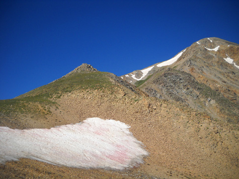
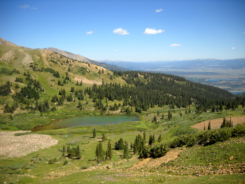
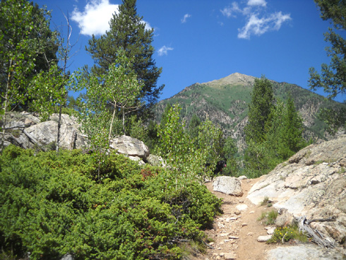
took photos in all directions and went down the south side a
couple hundred feet:
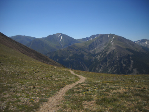
LT100 runners continue south on this trail to
Winfield. That side is steeper than the one I was on.
The trail descends on the slope of Mount Hope (right) to Winfield Rd. in the valley. In the
background
are (L-R) Mts. Oxford, Belford, and Missouri, all
14ers. I've climbed Oxford and Belford.
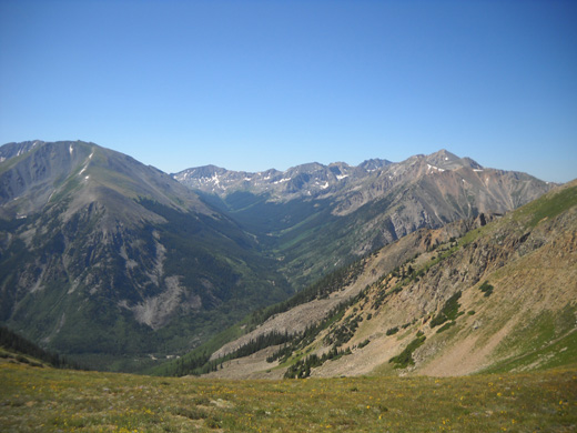
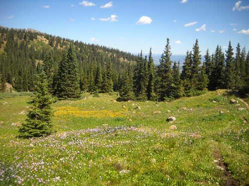
I wanted to sit down to eat and enjoy the view for a few minutes,
preferably out of of the wind.
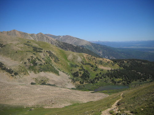
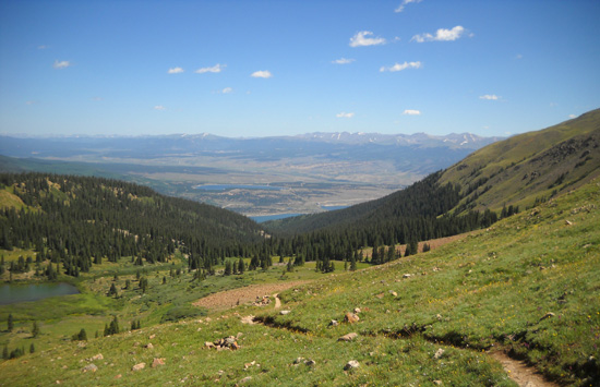
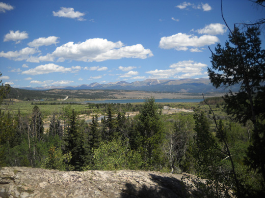
I went back down the north side a few yards to just above the snow patch
and had a beautiful view of Twin Lakes and the broad valley between it
and Leadville:
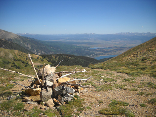
Looking north, the way I came up and the way I'd
go back down.
I rested for about ten minutes while we ate a snack, talked to Jim on
the phone (more Verizon phone bars up there than down in the valley), and
enjoyed the fabulous view to the north.
Then I reluctantly began the descent to
Lake Creek and Parry Peak Campground. I could have stayed up there all
day! Although the weather was great up high, I didn't want Jim to worry
about me if I was late to our rendezvous.
THE 3,400-FOOT DESCENT
Whee!!!!
Going down the north side of Hope Pass is an exhilarating freefall if
you can run it. I've done that numerous times in training. In the race
the descent is about Miles 55-59, when runners who are still in the game
are more than happy to let gravity do most of the work.
I'm not supposed to be running, especially downhill, but even
hiking back down is still a blast.
I came down faster than I went up, as always, although I took even more pictures
on my descent. It took me two hours to get down to the Willis Creek bridge at 10,000 feet;
I’d been going for 5˝ hours and still had two or three miles to go.
Here are some photos
from the descent:
The summit of Mount Hope
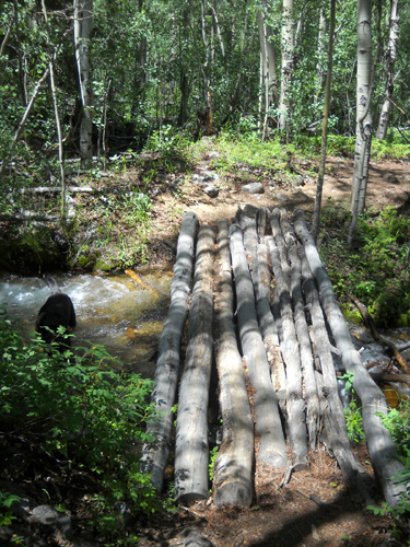
When I got down to the bridge across Willis Creek at 10,000 feet I still
had an hour left before
I planned to meet Jim. I knew I could get back to Parry Peak CG
that fast if I went down the trail on Twin Peaks that I came up, but I
really wanted to see that other trail that is down in the valley
closer to Lake Creek. It's the one I ran/hiked 10-12 years ago.
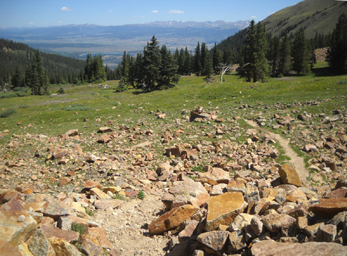
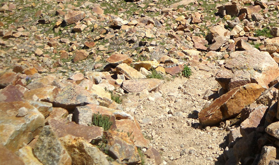
I decided to keep going down the (very rocky) LT100 course on the Willis
Trail until I got to the distinctive metal sign that says "Closed to All
Vehicles:"
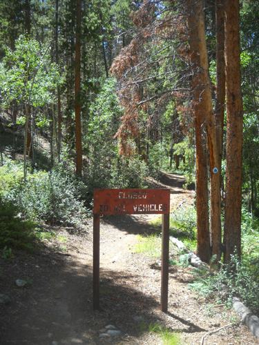
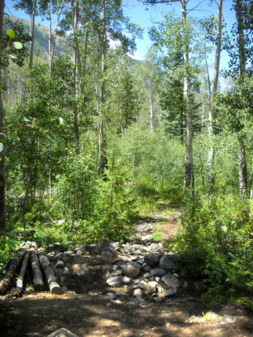
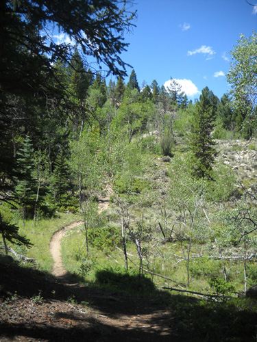
A little below that I turned left (west) on the narrow, unmarked trail that I vaguely
remembered from a decade ago.
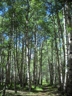
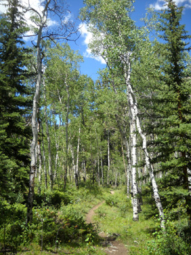
The first half mile was what I remembered – over some little creeks and
through groves of aspen:
Then the trail started going up. Ugh. I was on a roller coaster and no
longer recognized where I was:
Mt. Elbert dead ahead
The rocky terrain was interesting though, and afforded more views of Twin Lakes as I got
higher:
I finally got to the intersection I’d seen this morning re:
Twin Lakes down, Big and Little Willis up. Then it was just a matter of
going back down the trail past the beaver pond, wet area, and muddy trail to
dirt/gravel FSR 82A and then past the neat canyon and waterfalls again.
I was able to get much better pictures of the creek then than in the
morning when the sun was low.
The way back was at least a mile longer, plus I had to hike through the
campground (fee area), across the bridge, and out to the road to meet
Jim. He waited for me in a free parking area on CO 82
just west of the campground entrance until I called him to
pick me up.
HIKE SUMMARY
Total mileage = just under 12 miles. Total time = 6:48 hours.
Cody had plenty of water. I didn’t make him wear his pack today. I had
my Camelback with 100 oz. of water for myself and drank only 60 oz. of
it. I carried an empty water bottle in the pack for Cody and filled it
at the last stream so he’d have water on the pass. He drank that 20 oz.
and got water 7-8 times from streams. He also immersed himself in a pond
near the end.
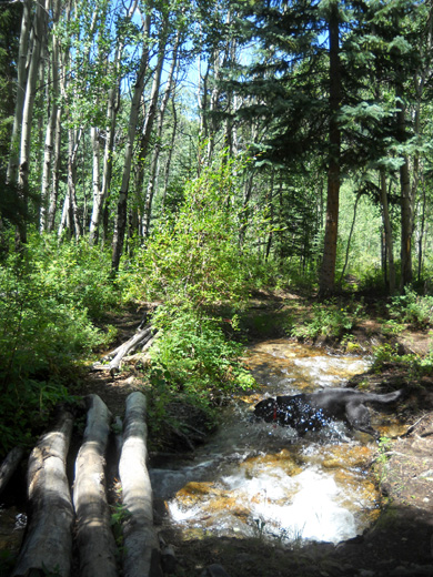
Cody splashes in one of the creeks about 1˝
miles from the end of our hike.
I saw eight runners going up or down the trail and a hiker with a dog on the
pass; he went down the other side toward Winfield Road. I also saw four hikers near
Lake Creek when I was almost done.
I had a great time out there today. I’m tired but not sore. The weather
was perfect, the scenery and flowers were gorgeous, and I felt good the
whole way. I ascended slowly but I'll get faster as I get more
acclimated to high altitudes.
JIM'S DAY
While I was having fun on the trail Jim was busy doing a variety of
things on his “rest day” (yesterday he rode 23 miles hard on the Mineral Belt
Trail).
After dropping me off at Parry Peak CG this morning he drove up as far
as he could with 2WD on the roads to Columbine Mine, where he will
probably be working radio communications on Saturday during the bike
race. He was able to get within 1˝ miles of the aid station location in
our truck.
What he’d like to do Saturday is have me take him up there to that
point, then ride/walk his bike the rest of the way. After the race he
wants to ride his bike down from Columbine on part of the race course
and back to our camper.
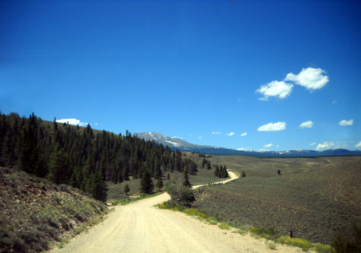
CR 10, part of the LT100 bike race course
He also did laundry, began reading a new book, and did other things around the camper
before coming back to Twin Lakes to pick me up.
On the way home he showed me part of the race course (CR 10) that he
plans to ride on Saturday.
After supper we enjoyed a couple hours’ conversation in our camper with
Marcia and John Rasmussen from CA. We hadn’t met them before but I’ve
enjoyed Marcia’s posts to the ultra list for several years. It was great
to meet them.
Next entry: wildflower photos from today's hike to Hope Pass
Happy trails,
Sue
"Runtrails & Company" - Sue Norwood, Jim O'Neil,
and Cody the Ultra Lab
Previous
Next
© 2011 Sue Norwood and Jim O'Neil
