Continued from the previous page.
FLORAL FANTASY
All the snowmelt and/or rain have produced more alpine and sub-alpine
wildflowers than IÆve ever seen
this time of year, too, but only up to the snow level.
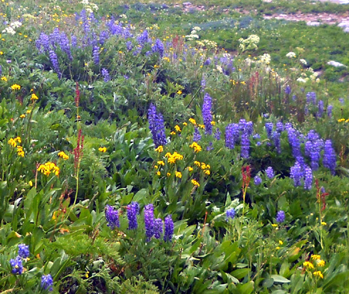
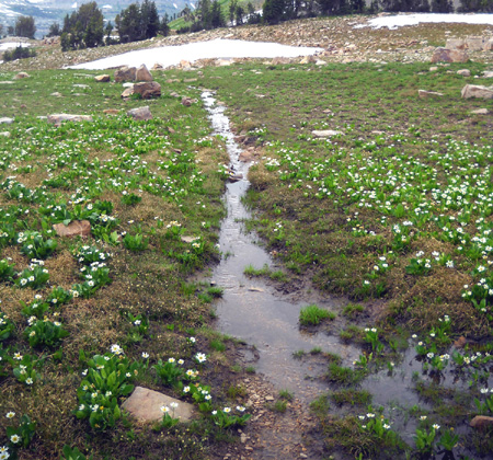
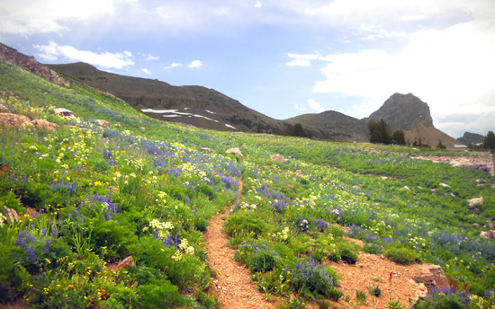
Lupines and other sub-alpine flowers in the basin
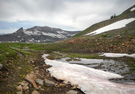
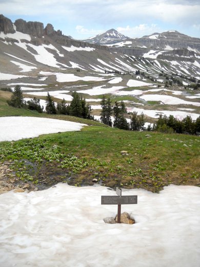
In the tundra above approximately 10,200 feet there were
fewer alpine flowers and fewer kinds of flowers than I've seen previously in some
places because the snow either just recently melted or it is still covering
the ground:
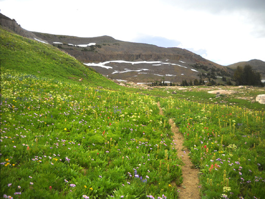
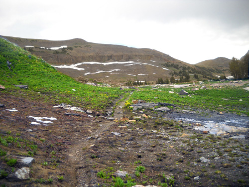
Above: lots of flowers in the upper basin in
this spot, then very few
a couple hundred feet later where the snow just melted (below)
This hike was kind of
schizophrenic in that regard -- so many summery flowers
juxtaposed with so much remaining winter snow.
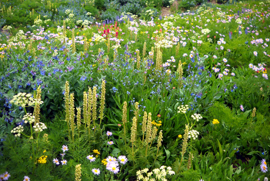
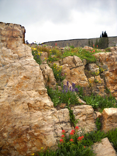
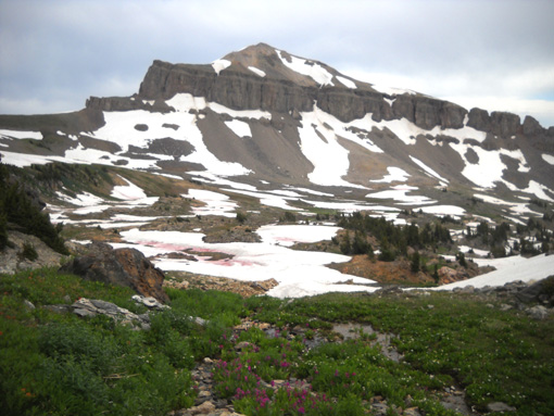
The flowers were just awesome all the way up to the basin and in sunny places where the snow
has already melted û fields of yellow balsamroot, shorter
yellow ôbuttercups,ö two kinds of blue lupines, dark blue monkshood and
larkspur, white, pink, and red Indian paintbrush, blue, white, yellow,
and pink columbines, purple asters, purple fleabane, bright pink
fireweed, pale pink wild geraniums, scarlet gilia, tall white cow
parsnip, etc.
They were so distracting that I took numerous flower photos. It's a
wonder I ever made it back to the camper!
With all the flowers,
snow, and scenery that looked different to me this time,
I took over 600 photos today. Gotta edit
and delete some of those, eh?
BASIN LOOP
This is a more
detailed map section of the area where I looped through the basin. It's
a picture I took of my large waterproof National Geographic Trails Illustrated Map of
the Tetons:
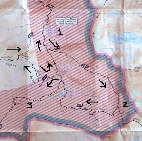
1 = Sunset Lake; 2 = intersection of Alaska Shelf
and Basin trails below Buck Mtn.;
3 = Teton Crest Trail going south toward Meek Pass
(I didn't go that way today)
Alaska Basin covers all of the area inside the trail loop and much of
the area within the wide blue line, which indicates the Grand Teton NP boundary. The basin also extends
to the left where you can see the Alaska Basin Trail. The pink section
is where campfires and horses/pack animals are prohibited.
When I got up to Alaska Basin from the Teton Canyon AKA Alaska Basin Trail
(#027) -- a distance of just under eight miles --
I turned left (north) on the Teton Crest Trail (#008).
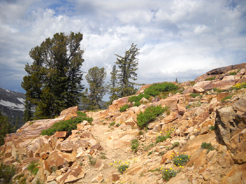
Teton Crest Trail on the way to Sunset Lake
It goes up fairly steeply, which is easier on my knees than coming down that way.
I came to the intersection
with trail #026 (Alaska Basin Shelf Trail) in 6/10ths of a mile but continued down
several hundred feet on the Teton Crest Trail so I could get a photo of Sunset Lake.
(I marked the lake #1 on the map above.)
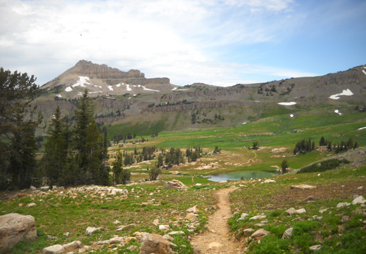
View toward Sunset Lake and Battleship Mountain
ALASKA BASIN SHELF TRAIL # 026
Then I returned to the intersection with trail #026 (Alaska Basin Shelf Trail) and went
clockwise around the upper part of Alaska Basin:
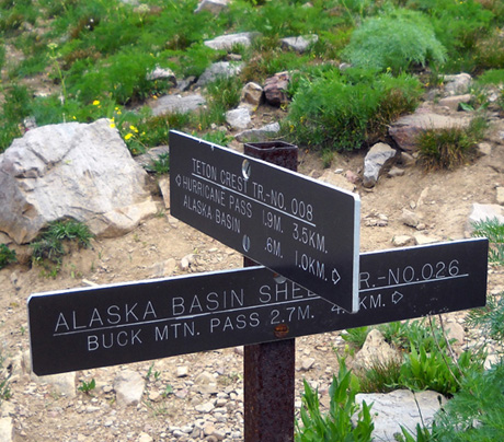
I've never been on this trail before. I had a general sense of
its location because I had my map with me but I wasn't sure exactly
where the trail went.
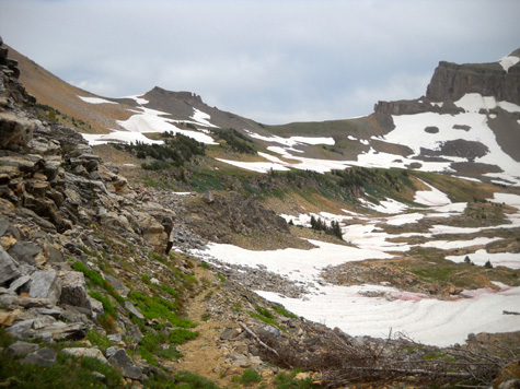
Route-finding
through the first mile of the Shelf Trail through the northwestern part
of Alaska Basin was easy, although the footing was sometimes wet or
rocky:
Marsh marigolds are one of the first flowers to
bloom when the snow melts.
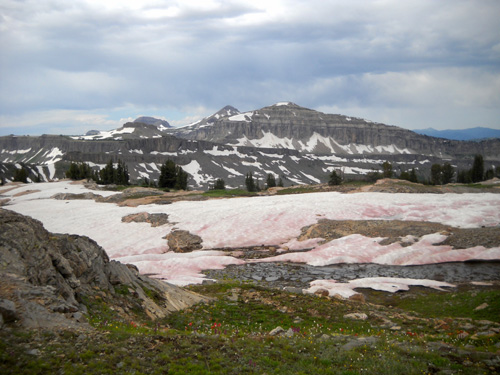
There were some very pretty fields of flowers, colorful rocks, and good
views toward Buck Mountain and the peaks on the south rim of the basin:
Fields of flowers as I head toward Buck Mountain
(R) in the distance
There were patches of
snow in the first mile of the Shelf Trail but both navigation and
footing became tricky after I dropped down a little to the southeastern
part of the basin, which apparently doesn't get as much sunshine as the
northwestern part.
There were so many snow banks to cross, some 300-400 feet across,
that I repeatedly lost the trail in the 2+ miles to the intersection
with trail #027. I marked that intersection on the map above with #2.
Each time I lost the trail I had to do some cross-country hiking on the
other side of the snow banks until I
found it again. That was mostly fun but it took extra time and effort.
Despite losing the trail repeatedly, I never worried about getting lost
in the basin. There are too many prominent landmarks to get lost up
there unless you have no map or sense of direction.
My main concern was all the time it was taking me to cross over
or around all the snow.
A secondary concern was safety since it was obvious no one else was up there
or had even been there recently -- I didn't see footprints
anywhere along the Shelf Trail. I had a phone signal in the basin but I
wouldn't have been able to reach Jim in the valley because he
didn't have a signal.
I listened carefully each time I approached a snow bank to hear whether a creek
was running underneath.
I was concerned about falling through into water and maybe being unable
to get back out but I never once
post-holed, let alone fell through. The snow was solid where I walked
-- sometimes around the edges of the mass, sometimes straight across.
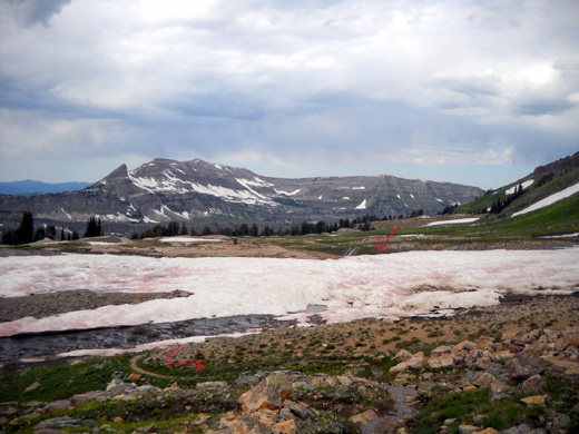
My arrows show the trail on either side of that patch
of snow.
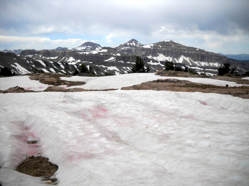
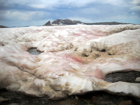
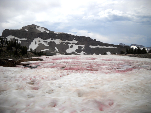
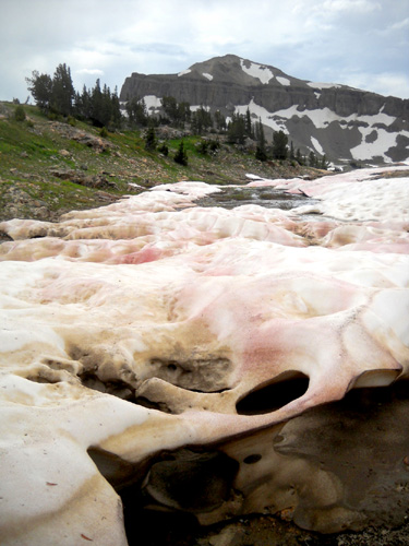
As you've already probably noticed in the snow photos, many spots were
pink or red from minerals in the crystals.
I slid down a couple snow banks that were
white û and when I got to the rocks below, my butt slides in the snow were red! My
pants probably were, too. Here's one of my butt tracks:
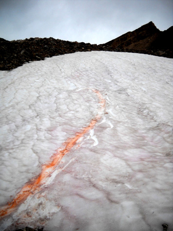
And here's a really wide red track that looks like a GIANT butt-slid
down:
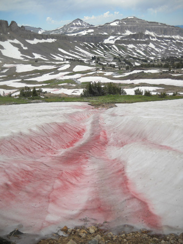
I didn't do that! It's much too wide. Just
thought it was funny in comparison.
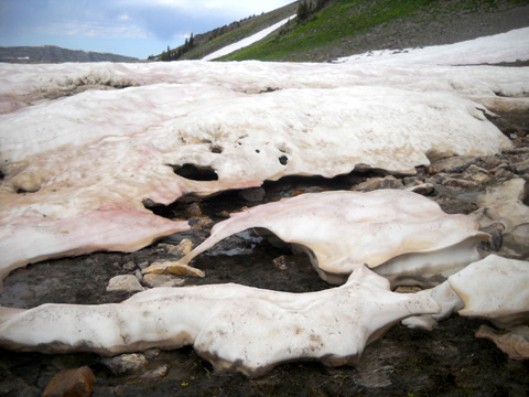
Not only was all the pink and red snow interesting but so,
too, were the various sculptures
where the snow has melted in some artistic designs:
As I got closer to the intersection with the Alaska Basin Trail (#2 on
the map 'way above) the Shelf Trail climbed higher and I could see the lower
part of the basin where I was headed:
Intersection of the Shelf and Basin trails
I'll show more photos from the Alaska Basin Shelf Trail in the photo
gallery.
Continued on the next
page . . . hiking the second half of the loop through the
southern part of the basin, hike summary, and how Jim spent his day
Happy trails,
Sue
"Runtrails & Company" - Sue Norwood, Jim O'Neil,
and Cody the Ultra Lab
Previous
Next
® 2011 Sue Norwood and Jim O'Neil
