Continued from the previous page.
THE REST OF TODAY'S ROUTE
This morning we left Vernal, UT and traveled
north through some scenic terrain to and past the Flaming Gorge
Recreation Area. I split today's journey into two
parts because of the number of photos I'm including and the details of
the route.
This page covers the trip between Manila, UT at
the UT/WY state line
and our home for the next couple weeks at Reunion Flat Campground on the
western side of the Grand Teton Range.
Once we reached I-80 at Green River, WY we were
back on roads we've traveled previously. We knew they were fine for travel in an RV. I wanted to go this way
again because I really enjoy the scenery, especially through the
Salt River Valley and the rest of the way north to the Tetons.
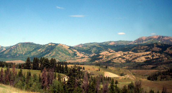
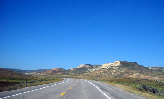
Colorful
hills along WY 89
Here are the remaining highways we used today:
-
WY 530 north to Green River, WY
-
through town to reach I-80 west at exit 89 (we just followed the I-80
west signs)
-
I-80 west from exit
89 to 66
-
US 30 north and west
to its juncture with WY 89
-
US 30/WY 89 north to the ID/WY line
-
WY 89 north
to Alpine, WY
-
US 26 west
to Swan Valley, ID
-
ID 31 north
to Victor, ID
-
ID 33 north
to Driggs, ID
-
Ski Hill Road east
through Alta, WY
-
Teton Canyon Rd. (FSR
9) to Reunion Flat CG
WY 530 NORTH TO GREEN RIVER:
Also a state highway
(i.e., "black" road on the AAA map),
this
road was smoother than UT 44, wider, and faster because it didn’t
have as many curves or hills -- or free-range cattle! There was even less traffic here
than US 191 and UT 44.
The highway lies on the west side of Flaming Gorge. We had some distant views of
the gorge and reservoir but not as much as the AAA map appears.
The terrain was rolling and mostly full of sage – no trees. It wasn’t
as interesting to me as the trees/mountains along 191 and 44. We saw
some antelope in the wide open rangelands.
There are fewer campgrounds on this side of the lake but several
marinas.
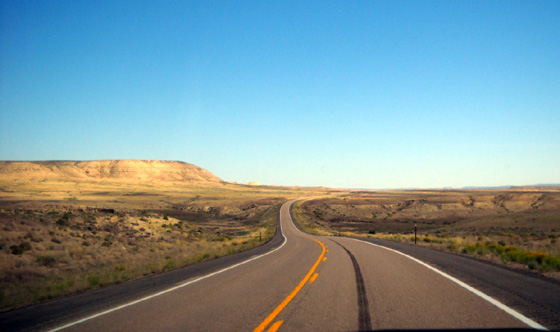
This road has a gradual net elevation loss to the city of Green River, WY, which lies at 6,100 feet.
The next picture shows
our descent into town from the south:
We stopped at Subway for a sandwich that we shared while Jim continued
driving. We followed signs for west I-80 that took us through a couple
miles of city streets before reaching exit 89 on the west side of town.
We found the least expensive diesel of the day in Green River ($3.78-9/gallon)
and should have topped off our tank there.
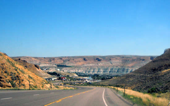
I-80 WEST OF GREEN RIVER, WY:
Nothing remarkable here -- rather uninteresting terrain,
comparatively (brown mesas and
rangelands) and moderate traffic moving much faster than we did
(kept it at 60-62 MPH).
We drove only a few miles on the freeway before exiting at MM 66.
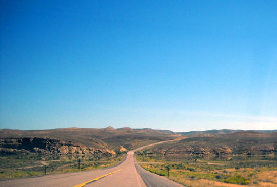
US 30 NORTH TO WY 89:
This is fast, smooth, wide two-lane road ("red" road on AAA map)
through increasingly hilly and more scenic terrain along Hams Fork and
the Bear River. What began as fairly brown, sage-covered rangeland
became greener and more attractive the farther north we drove:
We passed near Fossil Butte National Monument but didn’t go four miles back to
the visitor center. We didn't research that park and don’t know what’s there.
FRUSTRATION WITH FLYING J
We shoulda gotten diesel in Green River where it was less expensive. We got
some at Flying J in Cokeville, WY for $3.85/gallon in the RV lane.
You can get diesel for a camper in the RV, car, or truck lanes at
this station; I don’t know if the price is
different one place or another. Sometimes it is. We were able to get a receipt at
the pump. Jim was glad he didn't have to go inside for that.
He did go
inside first, however, to get an
RV discount card. Once again he was told “we ran out of
them.” We have asked at every Flying J/Pilot we’ve used the past year for the new
card and every station is either out or never had any. I think they’re
rationing them pretty tightly.
Jim dislikes the hassles we usually encounter at Flying Js but our options were more
limited today than when we’re on freeways more. We passed plenty of
stations but most were too small for us to get in and out with a big
rig.
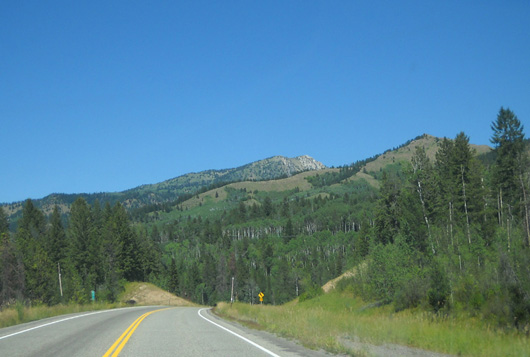
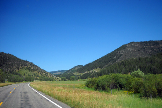
WY 89 & US 89 NORTH TO ALPINE, WY:
This highway parallels close to the ID border
through the beautiful Star Valley. The Salt River Range
(Bridger-Teton National Forest) is to the east, the Salt River itself (Caribou-Targhee National Forest)
to the west.
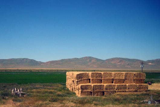
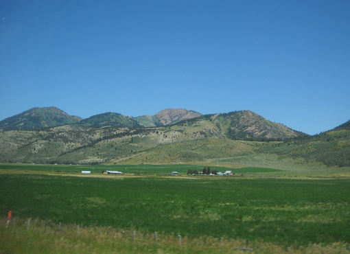
Star Valley is an idyllic agricultural area with more trees, lots of green
crops, farms, and small towns:
I'm always amused when we go through Afton, WY. Along the main drag there is
a large arch made of elk horns.
It's been a while since I showed it on
our website so here goes:
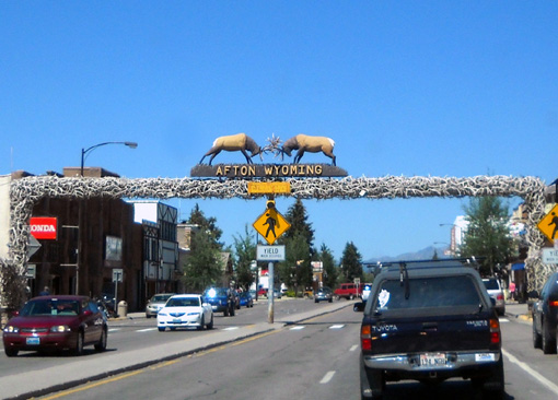
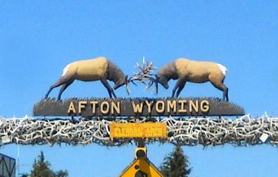
That's a lot of antlers! Someday we've got to stop and learn the story
behind the arch.
We saw another Cameo parked along the street in Afton, the first we’ve seen since
we stayed at the USAF Academy in Colorado Springs. We also saw an older Carri-Lite on the road somewhere
today.
When we see other Carriage, Inc. coaches we always wonder if they belong
to folks whose names we know from the Carriage internet forums.
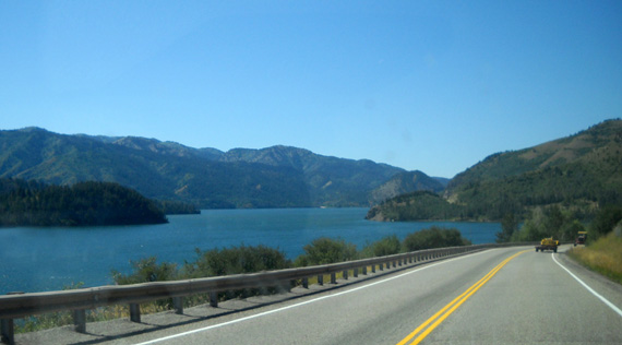
US 26 WEST FROM ALPINE TO SWAN VALLEY, ID:
This "red" road is not marked scenic on the Utah AAA map but if you like lake
views it’s the second-most scenic section we drove today.
We crossed into Utah just after the small town of
Alpine, WY.
This segment of US 26 is
smooth but it isn’t fast. I don't know why anyone would want to
drive fast through here. It's beautiful. There are lots of
curves and hills as it follows the northern shore of Palisades Reservoir and the
Snake River:
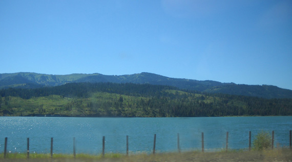
The Snake Range lies to the north
of this road, the Caribou Range to the south. The Caribou-Targhee
National Forest is on both sides:
I was driving from Cokeville, WY to Driggs, ID and couldn’t
take more than half a dozen photos of the reservoir because I was shooting into the sun
-- and I had to be careful with all the curves in the road.
I didn't want to wreck and wake Jim up. <grin>
I know it's not a good idea to drive with one hand on the wheel when I'm
hauling a seven-ton 5th-wheel behind me but I was determined to get
some pictures of this beautiful area. I held 'er so steady that Jim
didn't wake up until I slowed down to make the turn onto ID 31.
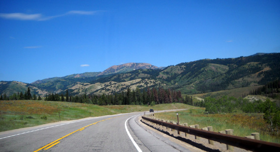
ID 31 FROM SWAN VALLEY NORTH TO VICTOR, ID:
This section is mostly uphill, then down to Victor at the end.
It topped out at 6,764 feet at Pine Creek Pass, which is a much easier
grade than Teton Pass's 8,431 feet if we'd gone on ID 22/33 west of
Jackson.
ID 31
is a good, smooth state highway (black on AAA map). It is very pretty through forested mountain
terrain in the Caribou-Targhee National Forest:
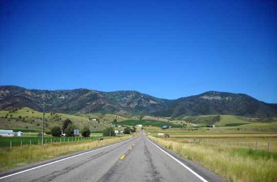
We came out of the national forest a couple
miles west of Victor. ID 31 ends when it intersects with ID 33 in town.
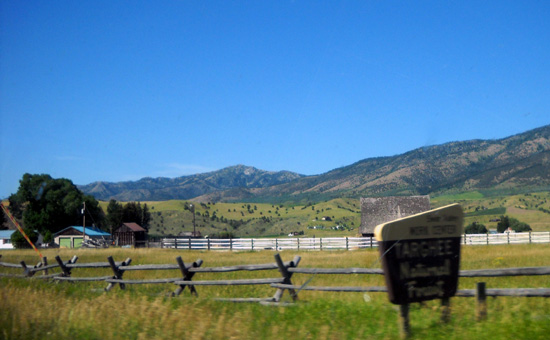
ID 33 NORTH FROM VICTOR TO DRIGGS, ID:
We drove the straightest miles of this trip, slightly uphill, on ID
33 to reach Driggs.
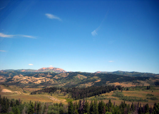
There are mountains
on both sides of this broad, attractive valley. Especially prominent are the Teton
foothills to the east, with some glimpses of the jagged peaks in the
Teton Range:
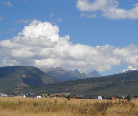
The huge Bridger-Teton NF is to the east of this valley (photo above), another
part of Caribou-Targhee NF to the west.
We noted a rails-to-trail bike path
on the west side of the road between Victor and Driggs; we'll
have to check that out while we’re in the area.
DRIGGS, ID
We discovered the main drag through Driggs is torn up
for a couple blocks north and south of the intersection with Ski Hill
Rd., where we turn to the east to get to Teton Canyon and our campground. We detoured OK
with the camper on wide-enough residential streets.
We stopped along Ski Hill Rd. on the east side of town to get online. We
won't have a MiFi or phone signal at our campground.
I also tried to call Bob, the neighbor who watches our house while we're
gone, but got his answering machine. Just before noon today a
5.8-6.0 magnitude earthquake struck in VA
between Washington, DC and Richmond. Our house is a couple hours
southwest of Richmond.
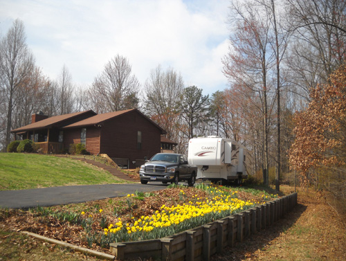
Our "stick" house and our rolling residence, as
seen in the spring
It’s highly unusual to have an
earthquake in the eastern USA. People could feel it as far north as
Canada, west to OH, and south to SC. The Capitol, Pentagon, and White
House were evacuated, as were tall buildings in several cities. There are no
reports of deaths or injuries yet. The extent of all the structural damage
is unknown at this point but people calling into radio stations and talk shows along the
East coast have reported pictures off the walls, broken objects, cracks in foundations,
etc.
We hope our house is OK. We want to ask Bob to check inside and out
for any obvious damage.
[Later -- Bob couldn't find any
damage, fortunately, but we were concerned until we were able to reach
him. We'll have to check walls, foundations, etc. thoroughly inside and out when we go back in October.]
SKI HILL ROAD & TETON CANYON ROAD TO REUNION FLAT CG:
Ski Hill Road goes east
out of Driggs, ID for about 12 miles to the Grand Targhee Ski Resort in WY. Most of
this narrow paved road is torn up for a couple miles outside of town but
the dirt surface is smooth. We’ll probably have to deal with paving each time
we go into Driggs.
We crossed the UT/WY
state line a few miles east of Driggs just before entering the small
community of Alta, WY. Our campground is in WY but we'll be going
down to Driggs, ID periodically to get online and run errands. There aren't any
stores in Alta.
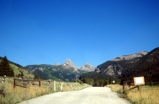
A little past Alta we
turned right on Teton Canyon Rd. (FSR 9), a
graded dirt
road through Caribou-Targhee National Forest land:
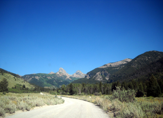
You can see three of the Grand Teton peaks in the
distance.
One of the aid
stations used in the Grand Teton Races is located at the juncture of Ski
Hill Road and Teton Canyon Road. Runners are on this road for about half
a mile in the race.
Half a mile into
Teton Canyon there is a large parking area at a trailhead just before
this fence and cattle guard (more free-range land):
Runners come down
that trail to the road and it's a place where we like to hike. The
parking area is where Jim usually takes his laptop to get online when he doesn't want
to go all the way into Driggs.
Reunion Flat CG is
another 1˝
miles back this dirt road. We don't have an internet or phone
connection there.
REUNION FLAT
CAMPGROUND
We arrived at the campground about 5 PM and got set up quickly in the
same site we occupied the three years Jim ran the Grand Teton Race (2007, 2009,
2010):
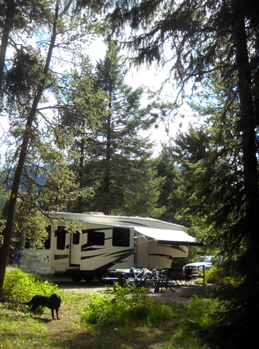
Cody loves this campsite; it has trees, a creek, and
grass to roll around in.
I'll have an entry about the campground after I have time to walk around
and take more pictures of it. We plan to be here through Labor Day
weekend.
We're all settled in this evening and very glad to be here! The
campground hosts came over to say hi after supper and made us feel
welcomed. We're their only visitors right now because it's a weekday.
This is primarily a group campground that is more likely to fill up on
weekends.
Next entry: photos from a gorgeous loop up in Alaska Basin
-- lots of wildflowers between 9,000-10,000 feet, lots of snow
above that
Happy trails,
Sue
"Runtrails & Company" - Sue Norwood, Jim O'Neil,
and Cody the Ultra Lab
Previous
Next
© 2011 Sue Norwood and Jim O'Neil
