Each of the Texas state parks has at least one feature that
makes it unique or memorable.
At Brazos Bend, for example, the outstanding attraction is the
large population of American alligators. You'll find symbolic
alligators in all sorts of places -- on park signs and
brochures, wooden cut-outs on the screened rooms, furry 'gator
toys in the park store. Ditto the bison at Caprock Canyons.
The unique feature becomes a trademark of sorts, the thing that
people remember first when telling their friends about their
visit to the park.
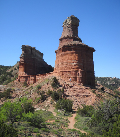
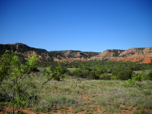
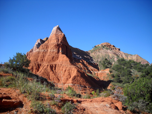
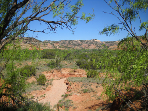
At Palo Duro Canyon, the main attraction is the spectacular
canyon itself, the second biggest in the country. The whole
canyon is a little hard to depict on promotional materials and
products, however, so one particular landmark has been chosen as the iconic symbol that defines the park
-- the distinctive Lighthouse Peak rock formation:
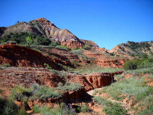
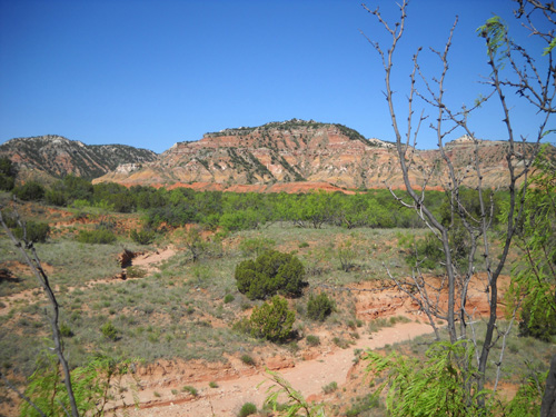
Getting to the formation itself takes more work than finding
alligators at Brazos Bend or watching the bison at Caprock
Canyons.
Although the trail that leads to the Lighthouse is rather tame by Jim's and
my standards, it's definitely not a smooth, flat, paved path
that an untrained person can easily negotiate by foot, bicycle,
or horse.
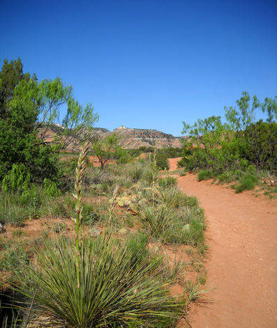
It's an undulating, sometimes
rough and rocky, dirt trail through hot, dry desert terrain. You
can't drive any sort of motorized vehicle on it nor is it
wheelchair-accessible. It's a
six-mile round trip, not including the steep rock climb at the
end that requires cyclists and equestrians to tie up their
wheeled or four-footed steeds and negotiate the last quarter mile
with their own hands and feet.
Yes, hands. If you want to see the Lighthouse up close
and personal there's a rock climb. It's not just a walk in the park.
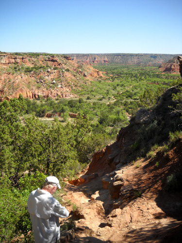
Jim checks his GPS before beginning the
steep part
of the descent below Lighthouse Peak.
You can see a little bit of the Lighthouse
Trail in the upper right third of the picture.
Most trail users don't do that climb to the base of the
Lighthouse itself; if they're like the folks we saw on
our run yesterday, they turn around when they see the
trail go almost straight up!
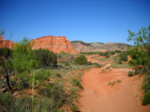
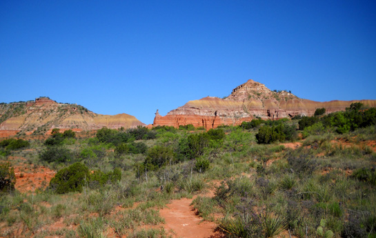
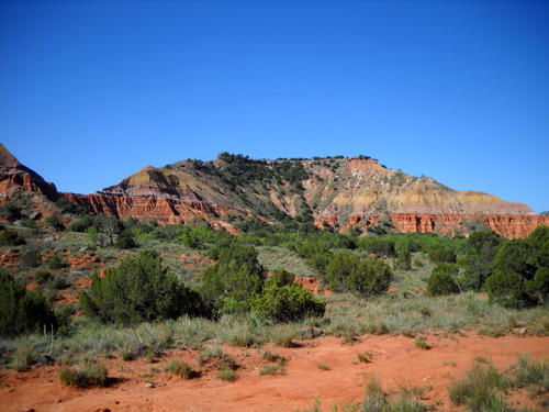
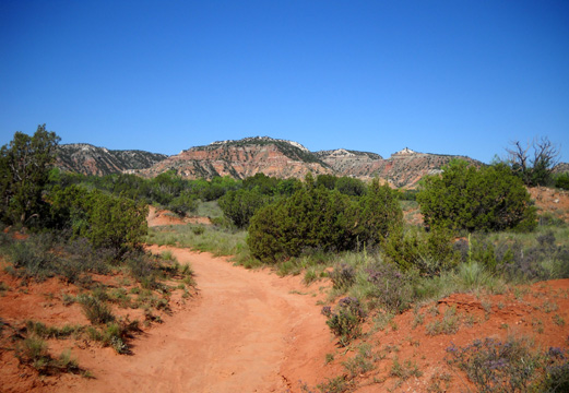
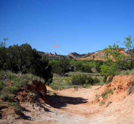
This is the view most hikers,
cyclists, and equestrians get of Castle Peak and Lighthouse Peak
if they walk back the trail at least two and a half miles:
Many people are satisfied with that view and turn around right
about there. Jim and I were more curious and wanted to see just
how close we could get to the Lighthouse. Turns out, you can
climb right up on the base! I don't know if rock climbers are
allowed to climb to the top of the two pinnacles or not.
JUST DO IT!
Of all the trails in the park, this one was our first priority
to navigate in the short time we were here. It was a good choice;
we loved it.
Here's a detailed map of the area:
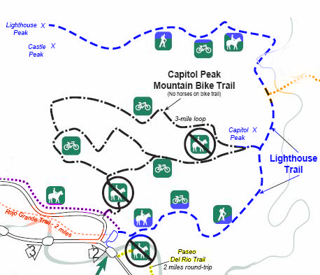
The Lighthouse Trail, in blue, is about three miles out and
three miles back. Note the location of Capitol Peak, Castle
Peak, and Lighthouse Peak. There will be a test!
Just kidding. That's for reference in the photos that follow.
Connecting or nearby trails are the
mountain bike trail (black), Givens/Spicer/Lowry Running Trail
(orange), Paseo Del Rio Trail (yellow), Juniper/Cliffside Trail (purple), and Rojo Grande Trail (red).
When we ran/hiked the trail yesterday, Jim started from our
campground, ran half a mile on the park road until he got to the
northern trailhead for the Juniper/Cliffside Trail, followed
it for three miles, then ran/walked out and back on the
Lighthouse Trail.
Part of Capitol Peak, which is too big for
one photo. Note the mini "lighthouse" pinnacle on the left.
Cody and I drove to the trailhead and hiked
only on the Lighthouse Trail. Jim
caught up to us about a mile before the Lighthouse, kept on
running, and climbed up to the rock formation to wait for us. We
walked/ran most of the way back to the truck together. Jim's
total mileage was about 10 miles, mine about 6˝.
Please come along for a virtual tour of the Lighthouse Trail
from the trailhead to the end and back.
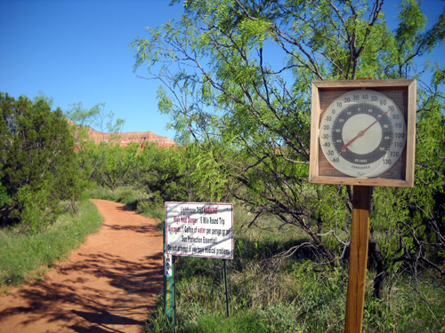
Trailhead warning: "HIGH HEAT DANGER.
6-Mile Round Trip. Minimum 1 Gallon Water
per Person or Pet. Sun Protection
Essential! Do not attempt if you have medical problems."
The temperature was already at 70°F.
when we started about 9AM.
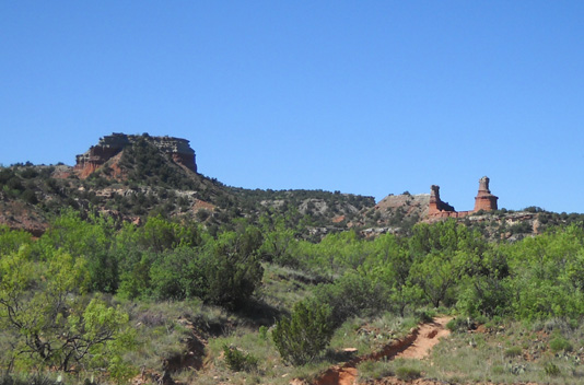
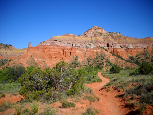
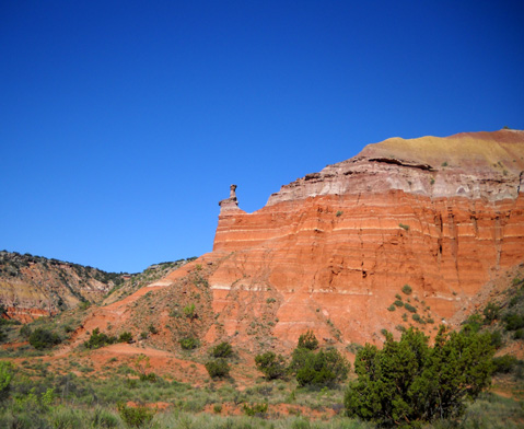
Approaching Capitol Peak (R)
Quarter-million year old Quartermaster
formations are very prominent in the lower half
of Capitol Peak (above) -- red sandstone and shale
stone with white gypsum stripes.
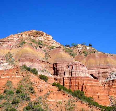
All four ancient rock epochs (Ogalalla,
Trujillo, Tecovas, and Quartermaster)
are evident in this close-up of the "front"
of Capitol Peak. See diagram below.
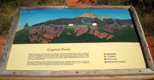
The eroded pinnacle on the left side of the
formation is called a "hoodoo."
The mountain bike trail intersects the
Lighthouse Trail from that side.
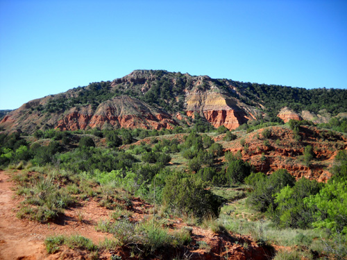
Multi-hued center section of Capitol Peak
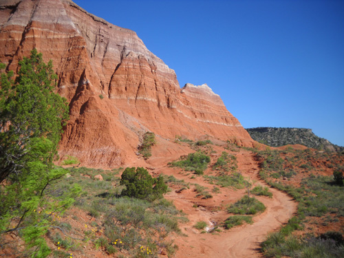
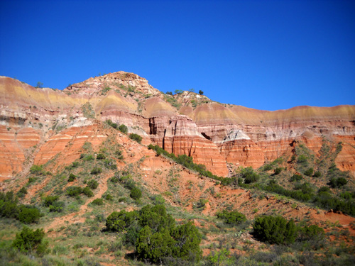
The Lighthouse Trail curves around the
right side of Capitol Peak (above and next three photos).
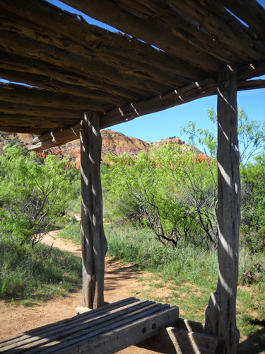
One of two covered benches along the
Lighthouse Trail
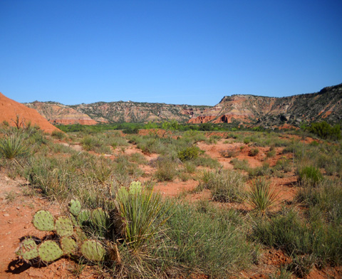
Many dry creeks cross the trail; we saw no
water in any of them.
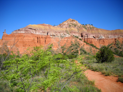
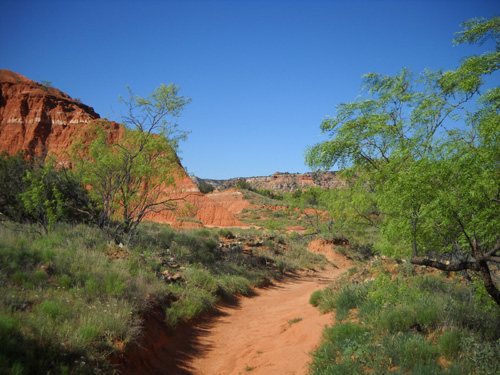
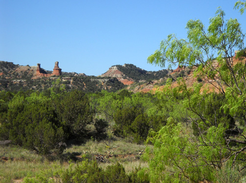
First views of the Lighthouse formation
(above and below)
Continued on next page so it's easier to load the photos . .
.
Happy trails,
Sue
"Runtrails & Company" - Sue Norwood, Jim O'Neil,
and Cody the Ultra Lab
Previous
Next
© 2010 Sue Norwood and Jim O'Neil
