The Ice Lake Trail is definitely an interesting trek. I
recommend going slowly enough to really enjoy it.One of the cool things about the run/hike to Ice Lake is that you can
see the peaks surrounding the upper basins long before you get there.
The closer you get, however, the less you can see of the pointy peaks because
they disappear behind the broad face of Fuller Mountain at the far end of the
lower basin.
You might have noticed that "vanishing" phenomenon in the series of photos I
showed you in the last entry.
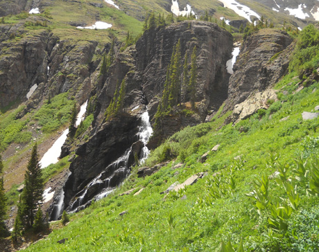
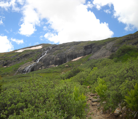
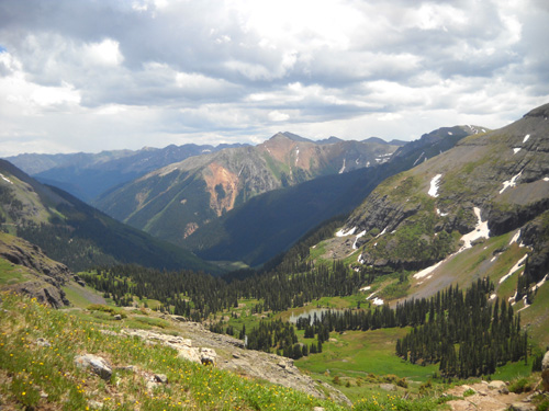
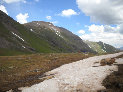
As soon as you enter the lower basin, you can also see the general
course you'll be taking to the right of several waterfalls at the far
end of the basin. The waterfalls are like a beacon, drawing you closer
and closer to the upper basins:
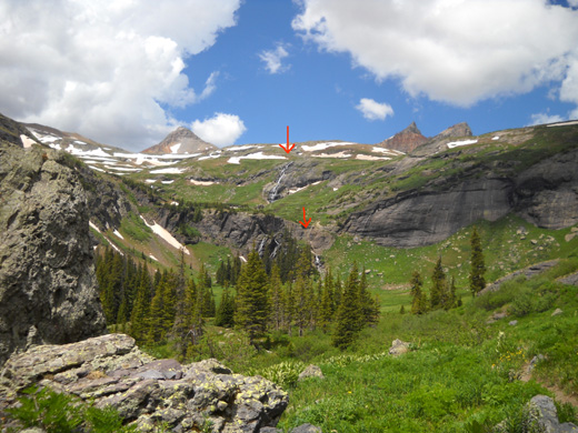
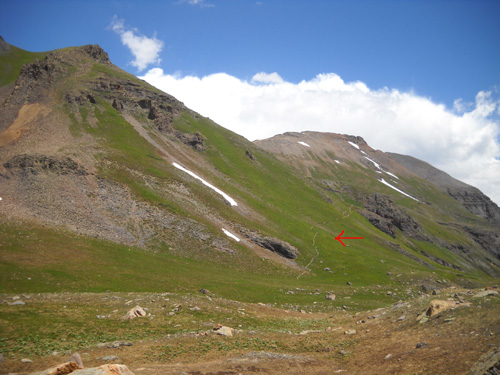
I marked two of those waterfalls with red arrows in the picture
above. There are at least two other waterfalls to the left of
the lower falls, and one or more left of the upper falls, but the
falls you see close up while climbing the slope are
the ones I marked.
Here's the map of the Ice Lake Trail and basins again. I
highlighted in orange the portion of the trail I'll talk about
in this entry. We've already covered the section marked in
yellow. The trailhead on South Mineral Creek Road is to the far
right:
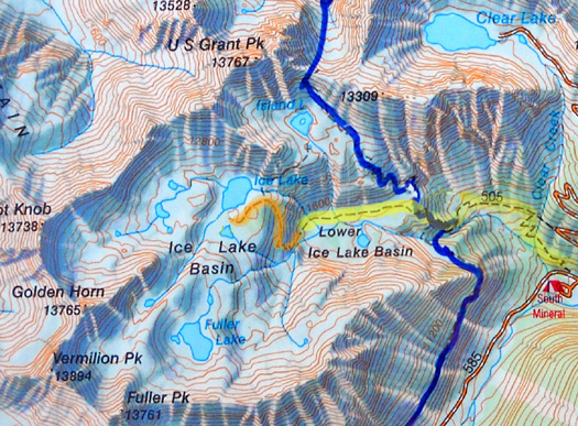
If you look at the contour lines you'll see that the first
segment of the trail to the Lower Ice Lake Basin gains over a
thousand feet of elevation. The section through the lower basin undulates
gradually, a nice break from all the climbing. Next is a continuous climb
of about 1˝ miles past several waterfalls
fed by all the drainage from the upper basins and up into
the lower part of the very large Ice Lake Basin.
Are you confused yet? Just check the map. You can see all the
contour lines indicating some major elevation gain.
This segment enters an alpine
world of rocky trail, low shrubs, perky wildflowers, and grand
vistas to the east, north, and south. We'll emerge into the
basin at an elevation of over 12,000 feet and end this segment
at beautiful turquoise-colored Ice Lake. In the last part of this
series, we'll explore the tundra in part
of the upper upper basin.
ROCK 'N ROLL
The next picture shows where we're going, approximately. Because of all the
shrubbery and rocks you can't see the trail up to the high
basins from below, so I've marked where I think it goes
on the next photo, beginning at the creek crossing where I ended
Part 2:
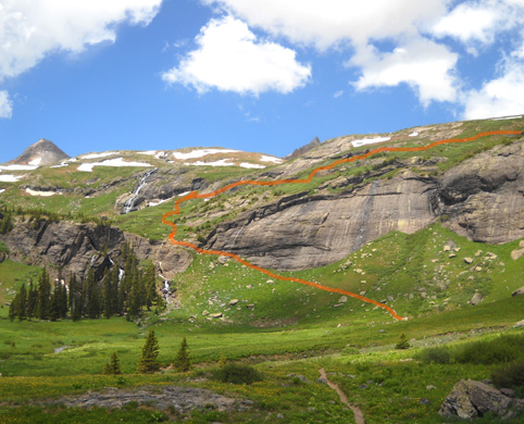
It's much easier to see where you've gone -- or will be
going on the return -- when you're up high and looking
down on these trails.
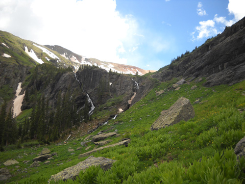
Here are a couple views of the lower falls as you approach them
from the creek. The trail passes close to the falls on the right:
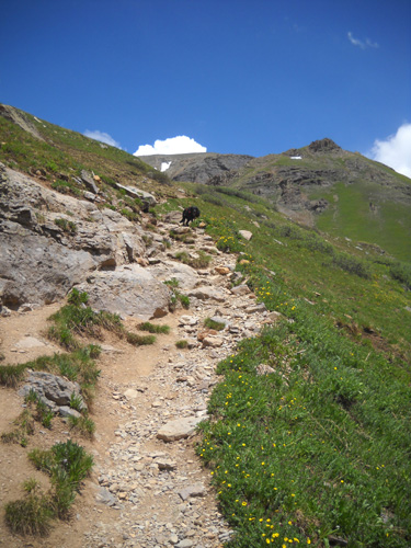
The part of Ice Lake Trail up to and past these waterfalls is
full of rock ledges and loose stones:
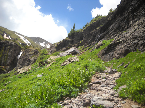
The trail passes rather closely to the top of the lower falls, so keep
your wits about you there.
Fortunately, I never have to worry
about Cody on cliffs; he's got a good sense
about edges and drop-offs:
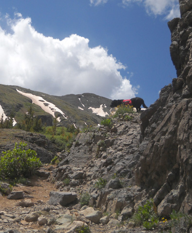
Cody-the-mountain-goat surveys the falls
from a safe distance.
I have to be more careful about
myself. Sometimes I lose my balance when I'm, um, focusing
on taking pictures, like the flowers below:
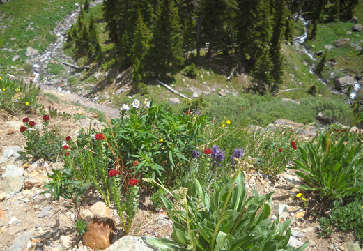
Flowers along the edge of the trail next to
the falls. Note the streams 200-300 feet below.
If I had slipped on the loose rocks here, it would have been a
painful fall down the rocky cliff next to the falls:

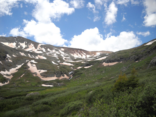
The trail continues to climb at a moderate grade as it winds
through the rocks and low shrubbery to the next waterfall:
One of Fuller Mountain's shoulders is on
the left in the photo above. A stream heads for the falls we just passed. The
upper and lower basins are one big drainage area
and stay wet all summer as the snow continues to melt.
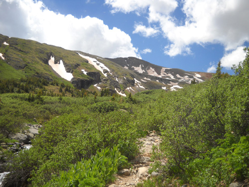
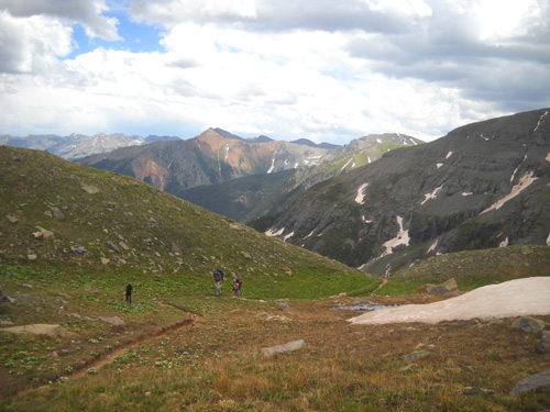
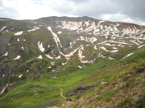
As you continue the climb up this side of Fuller Mountain there
are great views down into the lower basin. It's interesting to
see your progress as you get higher and higher.
During my predominantly westbound hike up to the high basins
there were a lot of clouds to the east and north. This view to
the north (toward Island Lake and Clear Lake) doesn't look too
promising, does it?
Well, I'm not a total dummy. Yes, I was hoping to make it to the
upper Ice Lake Basin and beyond, but I'm not going to climb into
a nasty storm. What kept me going was seeing bright blue skies
in the direction in which I was headed and observing which way
the wind was blowing. I didn't hear any thunder.
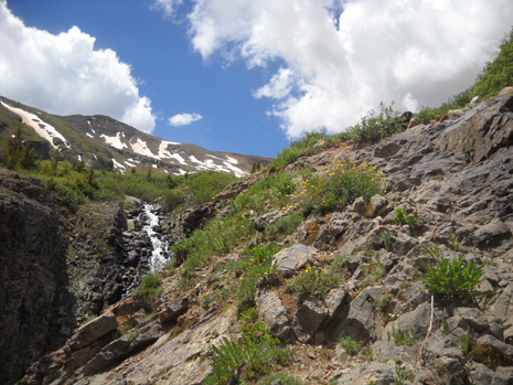
This is a view of one of the higher falls emanating from Fuller
Lake. The sky looked great to the southwest and west:
In the next picture you can see yet another falls left of that
one. There is a faint trail heading in that direction but I've
never taken it. Someday I'll go over there . . .
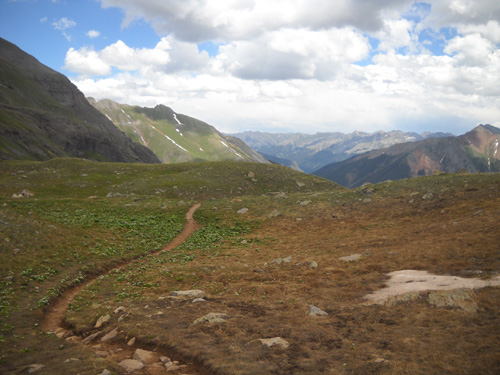
The trail takes a turn north to contour around the side of the
mountain. It is much smoother and less hilly in this section as it undulates
through a field of colorful wildflowers, bright green shrubs,
and soft alpine grasses:
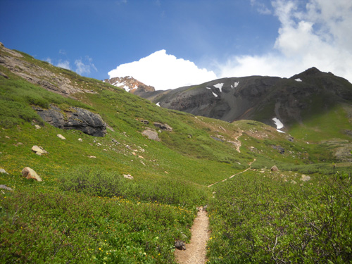
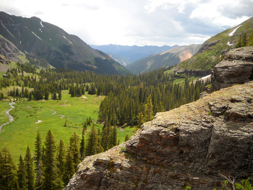
That changes before the grand entrance to the upper Ice Lake
Basin, as the trail becomes steeper and rockier:
Here's one last view down into the lower basin before we lose
sight of it:
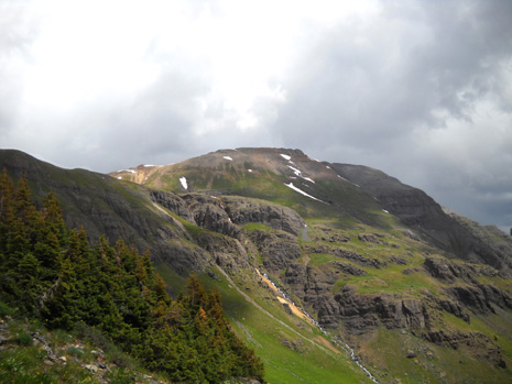
Now for the main show! We're about to enter . . .
. . . AN ALPINE FANTASY WORLD
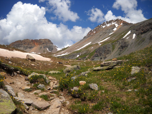
Welcome to the Ice Lake Basin!
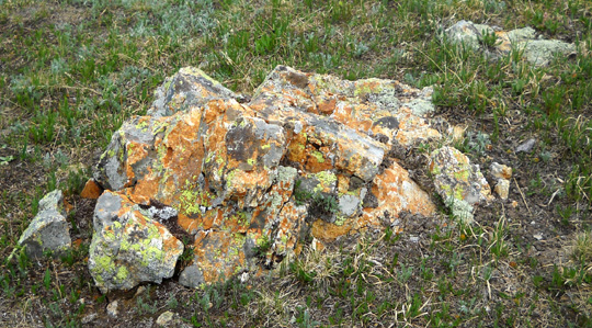
This is tundra territory, full of the remnants of many feet of
winter snow, ice-cold streams and lakes, colorful rocks and
lichens, squeaky marmots and pikas, and tough, low-growing
flowers and moss that are able to survive really long winters at
this high altitude.
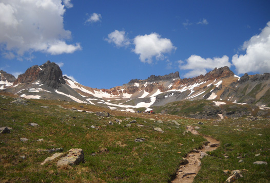
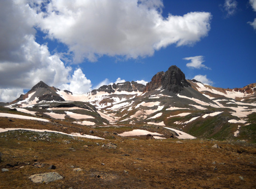
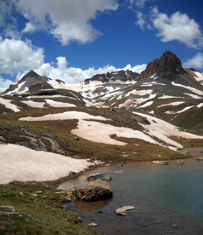
You can't see the lake for a little bit yet, but the surrounding
peaks are simply fantastic (I'm already running out of
superlatives and it's only June).
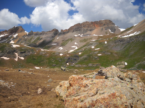
Not all the mountains are shown in any one photo below, but from
left to right (south to northeast) they are Fuller Peak,
Vermillion Peak, Golden Horn, Pilot Knob, and Grant Peak. They
are all in the 13,700-800+ foot range. Some of the folks who
come up here aren't just exploring the basin or lounging around
Ice Lake; climbing to the summits of these peaks is also
popular in the summer.
Here are some views from the
trail before you get high enough to see Ice Lake:
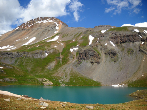
When Jim and I first saw Ice Lake last summer we had what is
probably a typical reaction: WOW! How beautiful!!
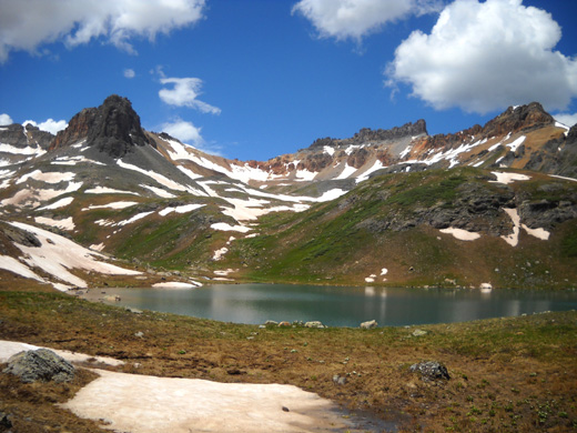
Like nearby Island Lake, on the Hardrock course (in the basin
over the ridge to the north), the water in Ice Lake is a lovely, deep
turquoise color that looks like a gem from higher up. Although
there aren't any glaciers in this area to my knowledge, the color of the water
in these two lakes looks just like glacial melt.
Ice Lake may resemble Island Lake in color but it is
a little bigger and definitely easier to access because it's much closer to the trail and not
down a steep slope.
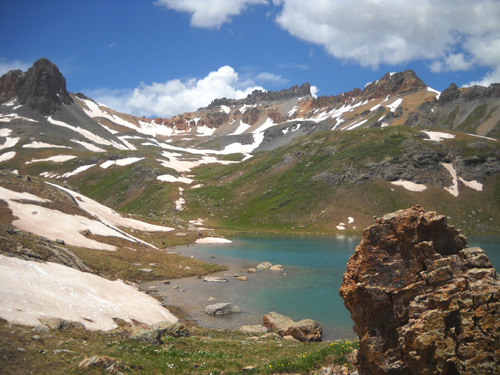
Today there were at least two dozen people enjoying the lake when
Cody and I got up there. I was able to take most of my photos without
strangers in them, however. Most folks were congregated at the
eastern end of the lake and I was more interested in the views
to the south and west.
Before heading up
further into one of the basins, I walked around the southern half of
the lake shore looking for photo ops from different angles:
There is a trail that connects Ice Lake Basin with Island
Lake. You can see it on the map at the top of this entry and in
the next photo (see arrow). Some folks were walking down that
trail today while I was admiring Ice Lake.
Neither Jim nor I have ever taken that trail. It would make a good
circuit run or hike either clockwise or counter-clockwise from the eastern end of the Lower Ice Lake Basin,
incorporating the Ice Lake Trail and the trail to Grant-Swamp Pass.
Two young women who were back-packing with a yellow Labrador retriever
asked me to take their picture in front of Ice Lake, then
offered to take
Cody's and my picture:
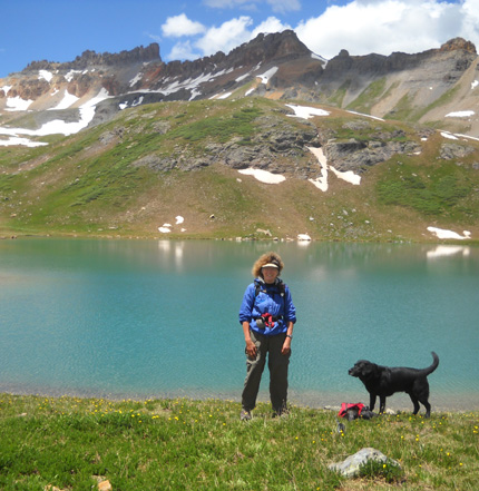
I had taken Cody's pack off so he could play with the other Lab
and chase the ball the women were throwing into the water. Cody
flew into the lake to retrieve the ball once, then declined to go back in
again -- it was that cold! He did wade into some of the other
lakes and streams in the upper basins while we
were up there today, but only to drink some water.
There were almost as many dogs on the Ice Lake Trail and up at
the lake today as there were people. With all the available
water, this is a good trail for dogs.
DESCENDING THIS SECTION OF TRAIL
Cody and I spent more than an hour exploring one of the basins
that's even higher than this one. I'll show photos from that in
the next entry. While I'm talking about this section of trail,
however, I'll include photos I took on the way back down.
The clouds to the west had definitely morphed from fluffy white
to angry dark gray so I knew it was time (perhaps past
time) to get down to a safer elevation. Some of the other
visitors to the lake had already begun their descent but there
were a few people still hanging around Ice Lake and I passed by:
By this time in the early afternoon, the sky was more blue to
the east and north -- again, the direction in which I was
heading!
As I reached the "portal" to the Ice Lake Basin, I met several
people who were hiking UP to the basin.
That surprised me, considering how ominous the skies looked in
that direction:
On my way back down to the lower basin I felt some light sleet
and rain off and on for a few minutes but I never did hear any
thunder or see any lightning. Before long, the
skies to the west were blue again. The storm clouds
passed by quickly and all was sunny again in the basin.
But you just can't tell with mountain storms. They're always a
crap shoot. I don't regret being cautious today.
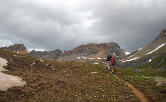
I followed a group of four young folks down to the waterfalls
but they gained on me because I kept stopping to take pictures:
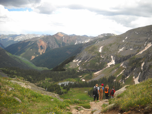
Isn't that a great view of the lower basin and the colorful
mountain (Bear, I think) on the south side of Mineral Creek Road?
This part of the trail would be fun to run down but then
you'd miss some of the little details and the expansive views:
I've found ways to compensate for not being able to run any
more! Now I see more things and talk to people more.
In
Part 4: exploring a few
higher basins above Ice Lake
Happy trails,
Sue
"Runtrails & Company" - Sue Norwood, Jim O'Neil,
and Cody the Ultra Lab
Previous
Next
© 2010 Sue Norwood and Jim O'Neil
