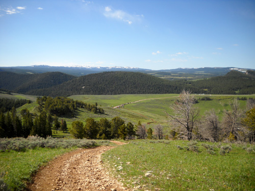
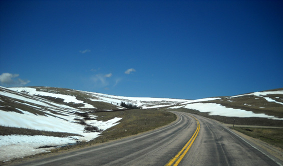
Just like last year, much of the snow magically disappeared from the
ridge in the first six miles of the 50K course from the Head of the Dry Fork
(headwaters of Dry Fork Creek) to Riley Point. But the Bighorn 50K
runners still had plenty of snow and mud to make things interesting in the
first
part of their race this morning!
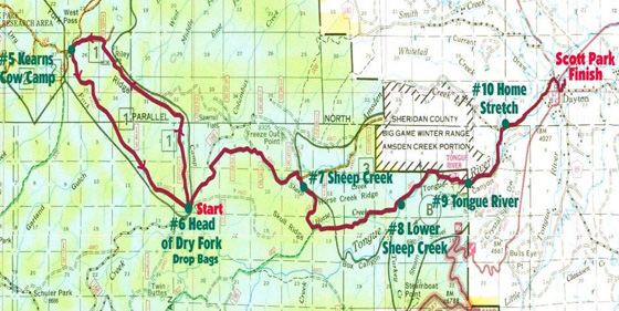
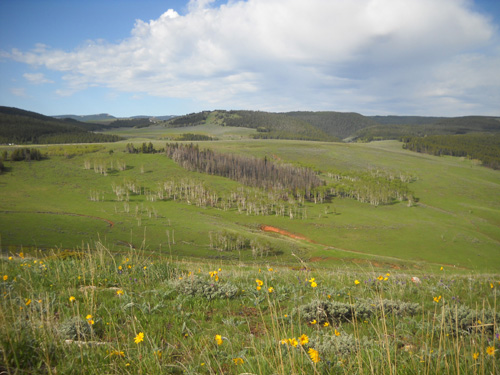
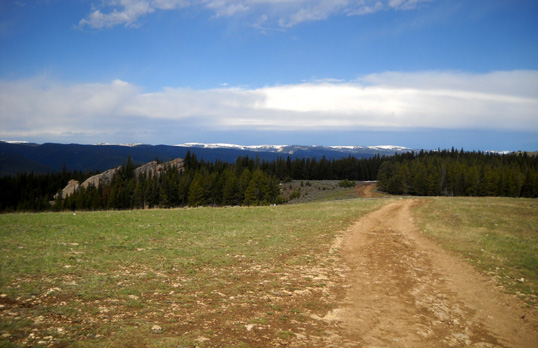
This section and the next two miles on Elk Trail down to Cow Camp are only on the
Bighorn 50K course. It's the right "half" (actually eight miles) of the
fourteen-mile loop in the course diagram
below:
RIDDLE OF THE RIDGE
I'm not sure what this ridge is called. We have two fairly detailed maps
of the Bighorn Range and the maps either say "Ridge" or nothing. I
recently read that it is called "Dry Fork Ridge" but folks also refer to
the lower ridge where the aid station is located as "Dry Fork Ridge."
The ridge I'm referring to in this entry (and on June 14) is 1,500-2,000
feet higher than the ridge marked "Head of the Dry Fork" above. It could
just as easily be called "Riley Ridge," I suppose.
In this entry I'll refer to it as Dry Fork Ridge, the high ridge (up to
~ 8,500 feet) that runs NE above the Dry Fork drainage area (where FSR 149
leads to Cow Camp).
I've run the entire 52-mile course, which is the same course the
100-milers travel (they go out and back on those 52 miles). Those races do not go up on Dry Fork Ridge or
to Riley Point unless there is so much snow that the course is seriously
re-routed. That's happened only once in recent memory (2008). And the 30K
course runs only from the Dry Fork aid station to the finish in Dayton, so those folks don't
see this ridge either.
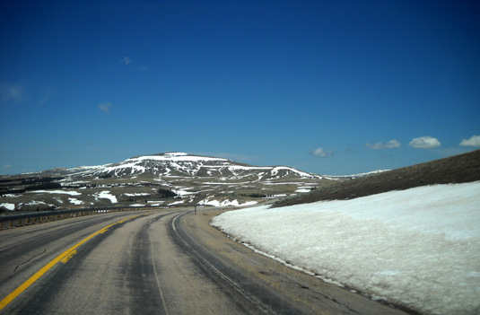
I think Dry Fork Ridge/Riley Point is one of
the prettiest sections of the entire race course. It's got great views and is
very runnable, especially once you get up to 8,000-8,500 feet. There is a
~1,000-foot ascent in the race from the Dry Fork end and a ~ 2,300-foot descent
down Elk Trail at the Cow Camp end.
Nice "rear" view on the ascent to the ridge:
I always
turn around occasionally
to see what the scenery looks like in the other direction.
I'm glad we finally discovered the ridge in 2007 when I first ran the 50K race. I
recommend that folks who usually do the other three races either run this part
of the course in training or enter the 50K for a change.
TODAY'S PHOTOS
About half an hour after the 50K runners began their race at Dry Fork this
morning, Cody and I followed their course outbound for about four miles, then turned
around and returned to Dry Fork; we
didn't have enough time to go quite as far as we did on Monday. My goals were to stay out of the way
of the runners in all four races (which I did), to take photos of the changes
in the levels of snow (which I did), to get in a good workout (which I did),
and to have fun (absolutely!).
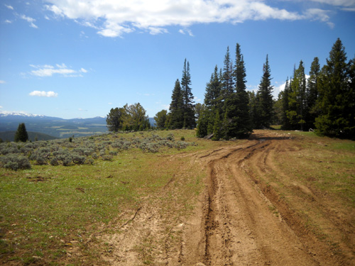
I saw more perky spring flowers today.
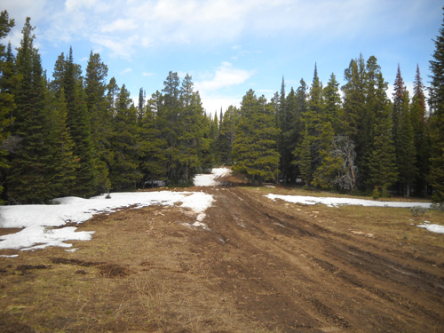
The main changes I saw from five days ago were:
- no snow at all in some areas that had two inches to two or three feet on Monday;
- fewer deep snowdrifts on the trail to post-hole through or detour around;
- more mud from all the snowmelt;
- and more flowers -- amazing how fast they grew in less than a week.
The course was still a challenge for the runners but much less than it was on
Monday.
The remaining photos are in order so you can visualize following
the course up to and across the ridge. Some of the pictures are looking backwards. The
50K runners were going only one direction, toward Riley Point (CCW around the loop
on the map above).
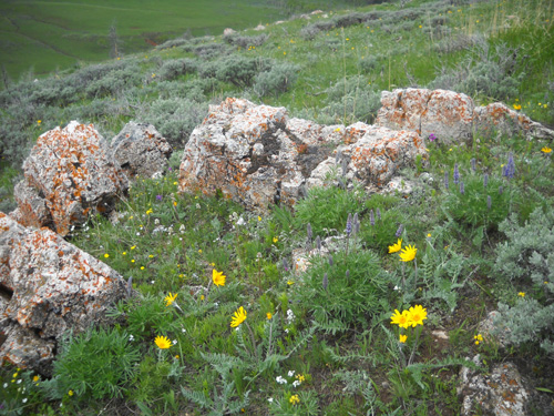
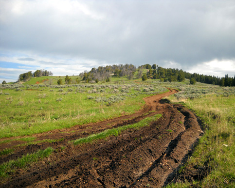
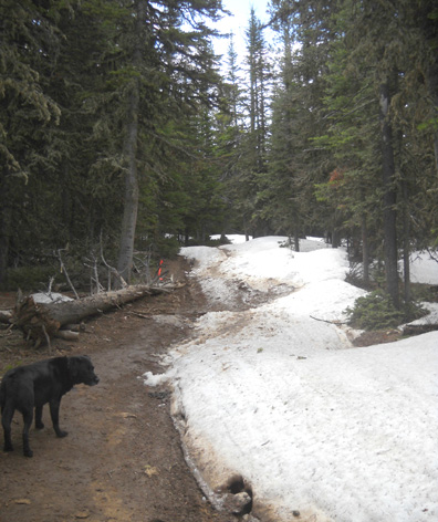
Cody heads up the ridge: FSR150 has some rocks and
ruts in the two-mile ascent to the ridge,
but the rolling four miles on the ridge are relatively
smooth.
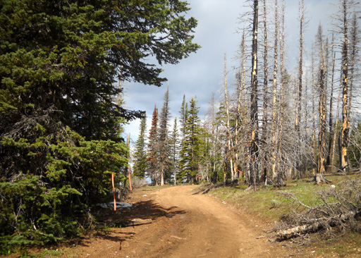
The slopes near Dry Fork along FSR 149
(which heads to Cow Camp) look even greener now.
That valley is the Dry Fork drainage area.
The ascent to the ridge was drier for the
race than it was on Monday,
but the ridge itself was muddier where the snow
had just melted.
Climbing up the ridge from the Dry Fork aid station: the
light was perfect for photos this morning.
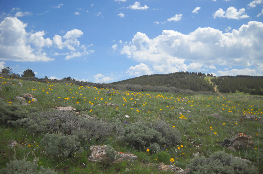
Lots more flowers today
Looking back down toward the aid station at
Dry Fork
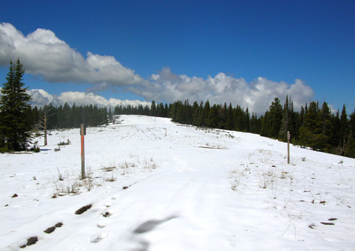
WHERE DID ALL THE SNOW GO?
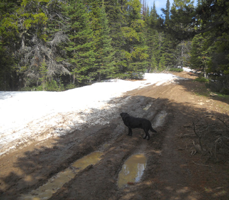
Before reaching the 8,000-foot level Cody and I entered forested and
open areas where the trail either had snowdrifts on Monday or
was buried under several inches of recent snow. Today these parts of the
course were mostly free of
snow, except for some patches here and there that Cody had to roll
around in!
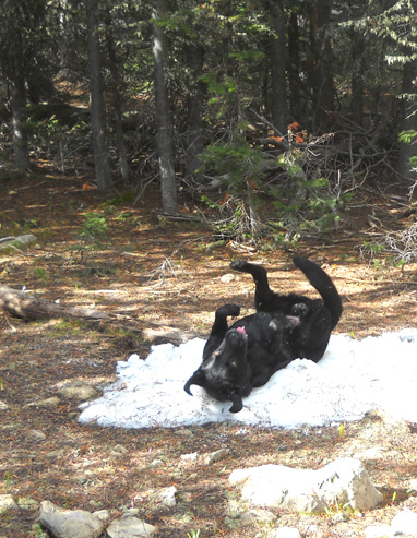
What a goofball! Cody constantly
reminds me that life is full of simple pleasures.
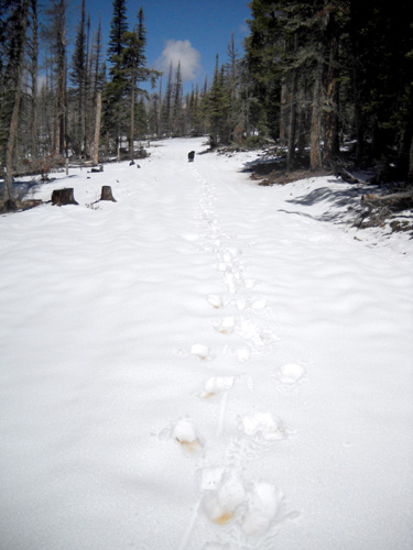
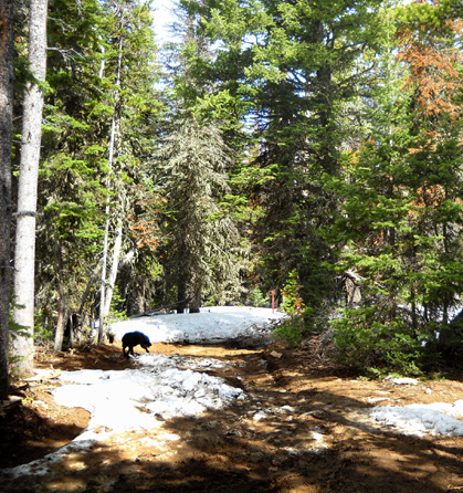
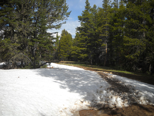
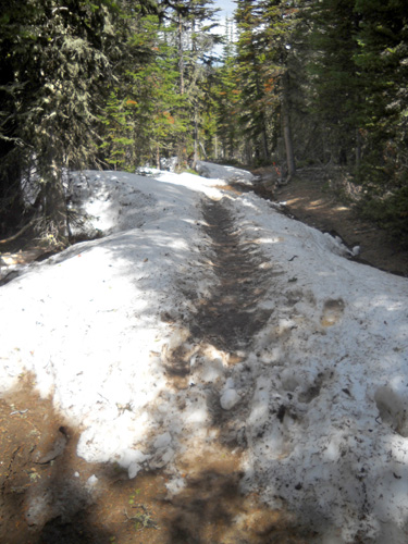
Here's the first really sloppy spot the 50K runners
encountered.
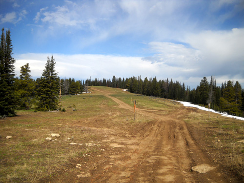
Big improvement here: no snow, much
less mud than earlier in the week
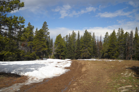
For about a quarter mile of trail before and after the fence line,
the course was under several inches of snow on Monday:
The next two photos show what this area looked like today:
Big improvement there and for the next mile:
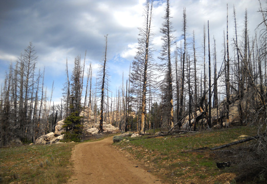
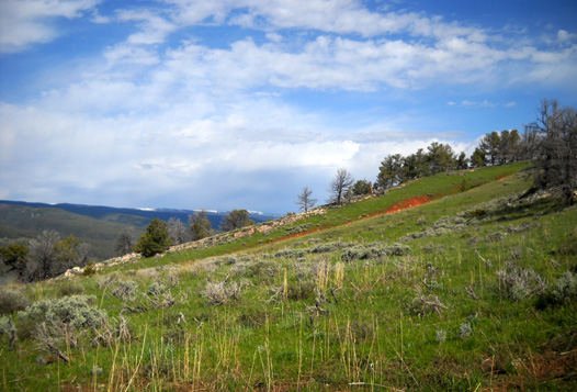
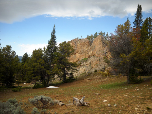
The strangely-attractive burn area with
interesting rock formations
Here's another set of before and after pictures. Jim took the
snow photo on Monday:
Snow-covered on Monday . . .
. . . Poof! All gone by Saturday.
This next part of the ridge was also under a blanket of snow on
Monday. I love the views from here:
Before (Monday)
After: nice and dry today
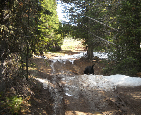
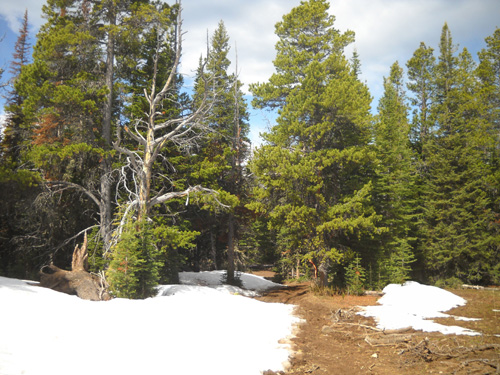
It was dry down the next hill but around the next bend I entered
the world of snowdrifts where we'd been post-holing on Monday. I
showed several of those photos in the
June 14 entry. Here's what the
next mile looked like today -- more slippery mud but a
lot less slippery snow (snow is cleaner but it usually slows me down more
than mud does):
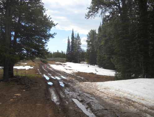
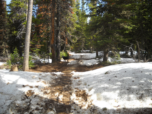
Believe me, this was much worse on Monday.
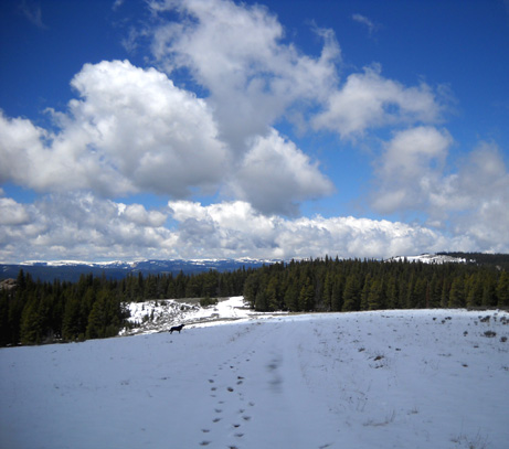
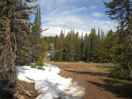
I was very curious about the next open area, which had so much
snow last year that we turned around during a training run
before race day. Five days ago the trail through the meadow was
under two or three feet of snow:
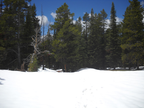
Photo from the center of the meadow on
Monday
I was more surprised about the change in that one section during
the last five days than any of the other spots on the ridge:
Approach to the meadow area today; the
drift was much higher on Monday.
Wow!! What a difference today: a clear path
for the runners to the right of the mud.
There was still some snow and mud to plow through (or waste time
detouring around) in the woods on the other side of the meadow
but the difference from Monday was significant. From there to
Riley Point the course continued to go into and out of patches
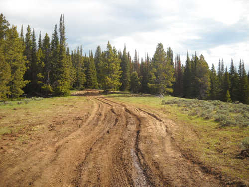
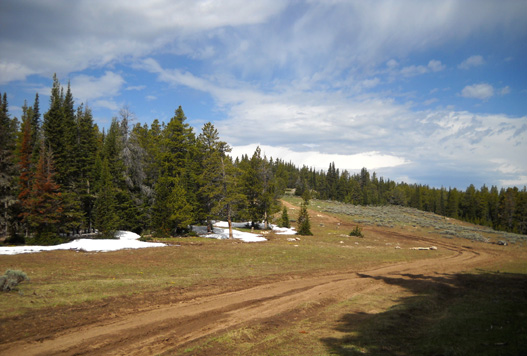
of snow and mud, alternating with nice dry spots:
My time was running out so Cody and I turned around before going
up this next hill, approximately two miles from Riley Point:
Jim was happy with these "improvements." He was able to make
much better time through the remaining sloppy areas today than
he was on Monday. He also reported much less snow on Elk Trail through the
woods below Riley Point and smoother, drier conditions on the
road between Cow Camp and Dry Fork.
INTERESTING HIKE BACK DOWN TO DRY FORK
For some reason, I figured I'd have the ridge to myself on the
way back down. Cody and I didn't see a soul on the way up.
When I was climbing up to the high point about five miles from
the aid station I could hear engines. Great. I hadn't even considered
that ATVers might be out enjoying the beautiful weather and
scenery, too. Other than the ATVs used in the race to supply aid
stations and patrol for runners who might be having problems,
I've never seen "recreational" four-wheelers on Dry
Fork Ridge.
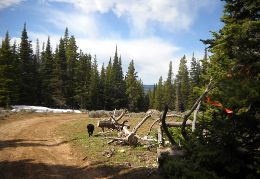
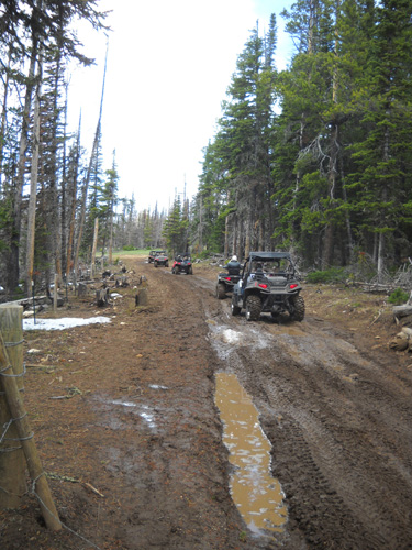
Well, they were out in force today. These were the first ones
that I'd heard coming toward me:
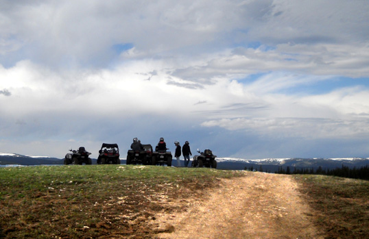
Before I got back down to Dry Fork, I counted fourteen ATVs in
four groups! Good thing they waited until the runners were all
past the section on the ridge or the sloppy parts would have
been even sloppier and dodging ATVs would have been a
nuisance:
There were some ATVs along other parts of the course during the
race but Jim
didn't have any problems with them. Nor have I in previous races
or training runs at Bighorn. They know about the race and are usually very
courteous.
S & R LOOKS OUT FOR ME
Just before the ATVs came toward me in that picture above, a
larger 4-wheel drive vehicle approached me from behind. He was
part of Sheridan Search & Rescue and had been out at the new
location for the Riley
Point aid station while the runners were coming through. He was returning to
Dry Fork, assured that all the runners were accounted for.
So he was wondering where the heck I came from! His first
assumption was that I was in the race but had turned around and
was heading back to Dry Fork. He was partly right. I
wasn't in the race but I was heading back to Dry Fork . . .
Surely his second thought was that I had a dog with me and
we weren't likely in the race. Is it that unusual for someone to be
hiking up there on a sunny June day? I don't think so, considering all the ATVs.
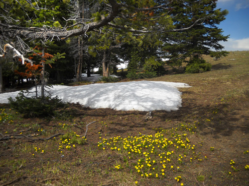
As soon as the snow retreats in late
spring, all kinds of plants start popping up.
Anyway, he asked me to please let the folks in the yellow S & R
bus at Dry Fork know when I got back down to the aid station so
they didn't worry about an unaccounted hiker/runner on the
course. I did that (mainly because he said he'd tell them that I
was coming down), but I was still figuratively scratching my
head about it. This is national forest land that is open to the
public 24/7, even on race day. Would he have asked a family with
a couple of kids in tow to report in?
I did tell Karen Powers, one of the co-race directors, what I
was doing before I hiked up the ridge. She was still at the aid
station for a while after the 50K race began. I didn't want her
to think someone had started half an hour late. She said she
wished she could hike up with me, too!
A LITTLE SIDE TRIP TO THE PORCUPINE/MEDICINE
WHEEL AREA
I
already described how I almost
missed Jim when he came through the Dry Fork aid station after I
got done hiking. He was well ahead of schedule, which was A Good
Thing.
When he left, he still had about eighteen miles to go to the
finish. I figured I had enough time for a little (?) detour in
the high country before I needed to head back down to Dayton.
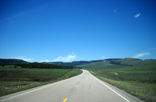
No snow at ~ 8,000 feet on US 14A a little
west of Burgess Jct.
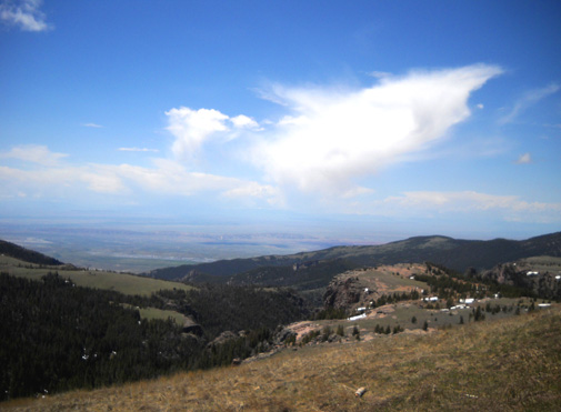
View from an overlook toward the broad valley
west of the Bighorn Mountain Range
Jim went up with Karen Powers and Rich Garrison to assess conditions near the
Porcupine Ranger Station last Sunday but I hadn't been past
Burgess Junction yet during this trip to the Bighorns. I was
very
curious about snow conditions at the 9,000- to 10,000-foot
level.
So when I drove back out to Burgess Junction, instead of heading
east I
went west for about 20 miles on US 14A. The higher I drove,
the more snow there was (duh!):
I originally intended to drive back FSR 13 to
the Porcupine aid station but changed my mind when I realized everyone
would be gone by then. Ditto for FSR 14 to the usual
crewing point on the trail a couple miles before that aid
station. I wasn't even sure if FSR 14 was the correct road to take since that part
of the course was re-routed this year.
I did drive three miles back to the parking area for Medicine
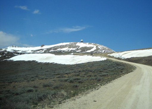
Wheel (FSR 112). It's just past the road to Porcupine.
On the way to Medicine Mountain there is a good view of the
government weather (or
communications?)
satellite ball on an adjacent peak:
I didn't hike the path to the Medicine Wheel monument today. At ~10,000
feet, it is still under a fair amount of snow and I figured it
would take me too long to hike in and out (it's about a mile
each way). After almost missing Jim at Dry
Fork, I sure didn't want to miss his finish!
In case you
haven't seen photos of the Medicine Wheel before, I took this picture last year:
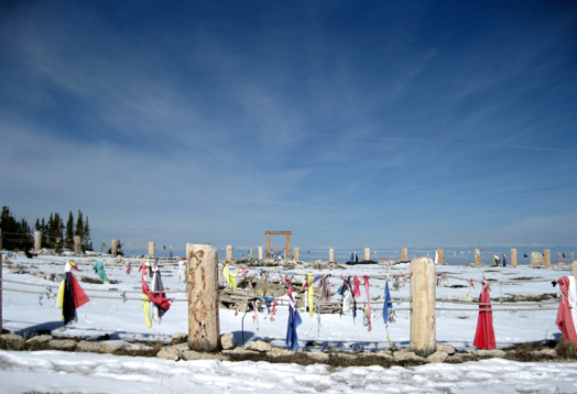
Medicine Wheel (photo taken 6-13-2009)
If you don't know the significance of this place but are
interested in learning more about it, you can either read a
previous
entry I wrote or do a web
search.
I was able to get back down to Dayton -- at least 50
miles from Medicine Wheel -- in plenty of time before Jim
finished his race.
Between the race start and finish, my hike, socializing with
lots of friends, and seeing all the cool scenery up in the
mountains, I had a great day!
Next entry: the awards brunch for the 100- and 52-mile
races, including pictures of the finishers' awards for all four
race distances (some of the nicest ultra race awards around)
Happy trails,
Sue
"Runtrails & Company" - Sue Norwood, Jim O'Neil,
and Cody the Ultra Lab
Previous
Next
© 2010 Sue Norwood and Jim O'Neil
