This is a pretty cool 14-mile loop. Too bad I can't (shouldn't) run or
even hike it any more. It's that killer drop down to the Cow Camp aid station
that isn't good for my knees, and the main reason I'm not signed up to do the
race this year. It's even worse for me than the long descent from Horse Creek
Ridge to the Tongue River Canyon trail head.
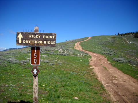
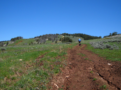
But I can still manage the climb from the start of the 50K race at the
location of the Dry
Fork aid station, hike along the ridge (also named Dry Fork) to Riley Point, and return back to Dry Fork with
significantly less strain on my knees. If there isn't too much snow on the
course today, that's my plan. That'll give me 11-12 miles and get me up to at
least 8,500 feet at the high point on the ridge.
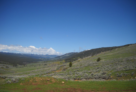
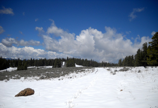
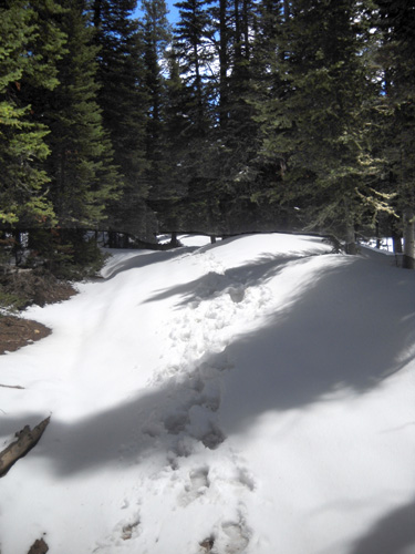
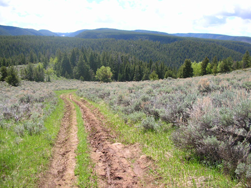
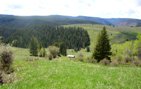
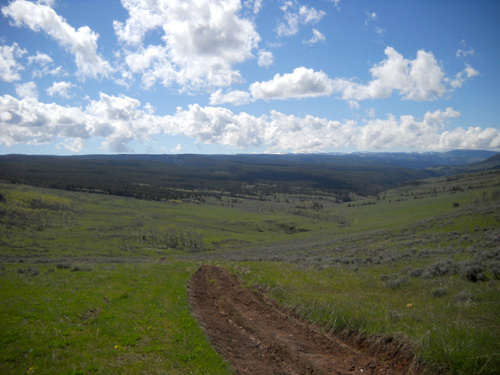
The ridge to Riley Point is to the right; the valley from
Cow Camp to Dry Fork is to the left.
Jim's plan is to do the entire 14-mile loop. We aren't sure if it is marked
yet but he thinks he can find his way down the single-track trail through the
woods below Riley Point to Cow Camp. This will be a good training run on the
first half (almost) of the course for him if he can make it all the way.
We'll have to play this one by ear, depending on how much snow is on the
ridge and down in those woods.
CABIN FEVER
By now we have cabin fever pretty bad. It's been raining off and on in
Dayton for the last four or five days, with snow falling some of those days up
in the Bighorns. We've kept busy with other activities but we have not
gotten out for as much exercise running, walking, and cycling as usual. I must
admit that as we get older we're increasingly more Weather Weenies.
Jim's excuse this week is that he's tapering for his race on Saturday.
OK, that's valid. My excuse is that it's not fun to walk or ride in mud and
cold rain. Temperatures the last couple days have been 15-20°
F. cooler than normal. Good thing we have a dry, snug camper now.
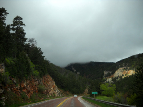
Low clouds at about 5,000 feet on US 14 west of
Dayton as we headed for Dry Fork
When we got up this morning we grumbled at all the clouds hanging over
Dayton. Once again we couldn't even see the mountains from the campground. But
. . . the prediction is for some warmer temperatures and sunshine today, so
we decided to head on up to Dry Fork to see what's going on up there. We need
our trail fix. We're sorry we
haven't been able to get out on the course as much this year (our
choice, because of the rain, snow, and mud) as in previous trips
We expect lots of mud. We have no idea how much snow or how many flowers
we'll find.
THE "OLYMPIC NATIONAL PARK" FACTOR
Jim and I learned a valuable lesson in the early 2000s when we almost
decided not to visit Olympic National Park when we were in the vicinity because
of all the clouds in the valleys (it's a rain forest, after all). I had been
looking forward to driving up one or more of the peaks so I could see the
scenic vistas along the Washington coast.
We were there for only a day. We had a ferry to catch the next day. If we
didn't do it then, it might be many years before we'd be back.
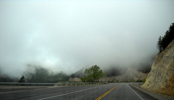
Still cloudy at about 6,000 feet on our
way to Dry Fork this morning . . .
So up the mountain we went. I don't remember if it was Angeles or Elk. It
doesn't matter. What matters is that lo and behold, well before we reached the
summit we emerged from the sea of clouds into gorgeous blue skies! The panorama
of ocean and mountains and low-lying clouds was spectacular.
Ever since, we've always been more willing to head up other mountains on
foot or in a vehicle even
when the valleys were shrouded in fog. Many times we've emerged into sunshine
at higher elevations. It's a good life metaphor.
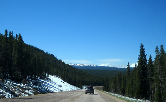
Sunshine in the high country at ~ 8,000
feet on US 14 this morning
You know where I'm going with this, of course.
By the time we got to the ship's prow rock formation this morning on US 14
at about 7,500 feet we had risen above the clouds and entered the shiny,
blue-sky world we hadn't seen for several days. Some clouds rolled in over the
high country while we were up there between 10 AM and 4 PM but, all in all, it
was a gorgeous day in the Bighorns.
WHAT A MESS!
Not the weather. That was near-perfect. The course was a
mess.
It's a good thing I'm writing this entry well after the date I'm
attaching to it because this description of trail conditions and the photos I'm
including might scare off some of the Bighorn runners!
Just kidding. I think most of them enter this race because it is
so wild and scenic. After what he plowed through today, Jim is wondering if
even choosing the 50K distance was a good idea this year. We are
crossing our fingers for lots of warm weather and wind between now and
Saturday to help dry out the trails and rough roads.
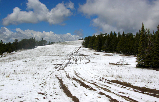
A fresh new blanket of snow (photo by Jim)
We sort of guessed what we'd find by the condition of the roads
we traveled to get to Dry Fork. There was more snow than we'd
seen last week and it was such a pristine white that it was obvious it had
just fallen recently. In some places on the Riley loop there
were several inches of new snow above 8,000 feet. We wonder how
much more there is at the higher elevations between 8,500 and
9,000 feet on other parts of the course.
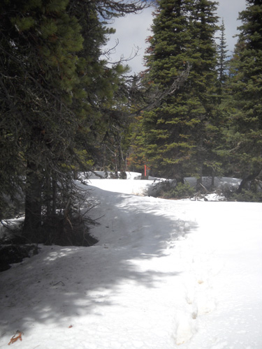
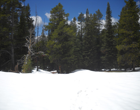
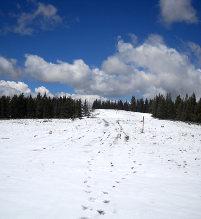
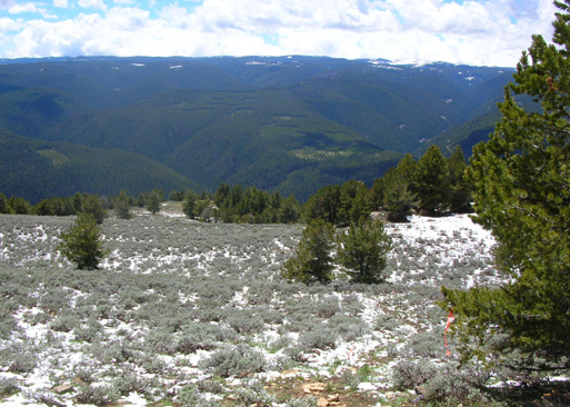
Most of Dry Ridge to Riley Point is at or above 8,000 feet. Most
of the trail on the ridge was covered in snow today. We slid
around or post-holed for several
miles before I got tired enough to turn around after 4˝
miles. I'm amazed that Jim kept going! More about his run in a
bit.
BREAKING TRAIL
Jim was ahead of me this entire
trek. He wanted to see how fast he could do the loop so he could
better determine his projected splits on race day.
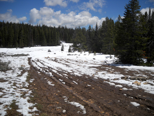
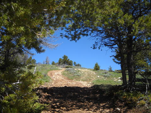
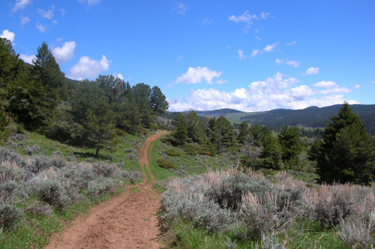
There was no snow where we began at
Dry Fork, which is about 7,650 feet elevation. Even in sunny
areas like the photo above, the 4WD road (FSR 150) was damp or muddy
except where it was more rocky:
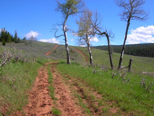
We began running into snow in less
than a mile, around the 7,800-foot level, mostly in shady spots:
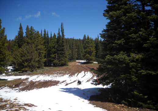
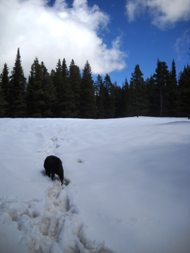
Cody was in doggie nirvana, rolling around in the first
snowdrifts he saw. After a while just plowing through the
snowdrifts became a chore for all of us.
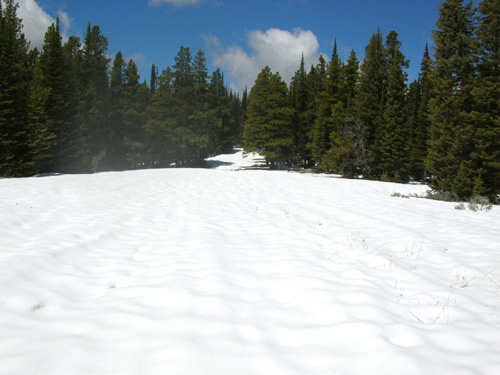
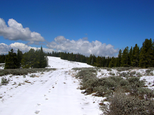
We had a patchwork of snow the
first three miles, with more snow in shadier areas and
increasing snow cover as we gradually climbed higher:
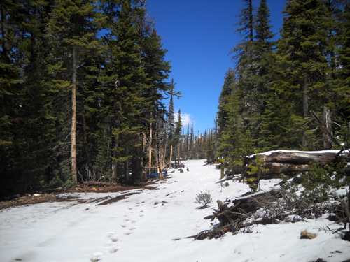
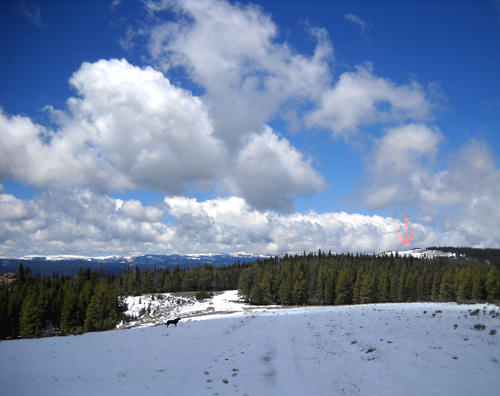
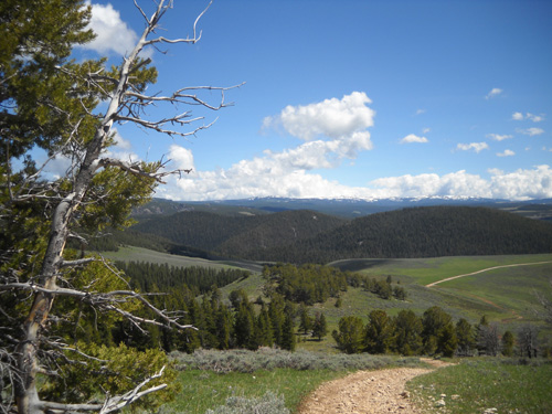
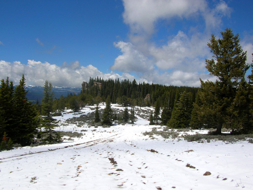
There are some marvelous views from Dry Fork Ridge. In the photo
below you can see snow-covered mountains in the distance and the
final ridge (marked with a red arrow) where 50K runners peak
before dropping down a bit to Riley Point:
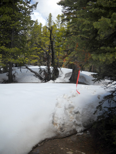
The section between the photo above and that last peak marked
with the arrow held the deepest snow for us today. Some of the
drifts on the course were over six feet high. They were
beautiful but challenging; we were not wearing snowshoes.
Having two people ahead of me to
break the trail was an advantage to me.
Two people? Yep.
We discovered that Wendell had just marked the
course this morning or yesterday!
Jim took this photo; there was just one set
of footprints in front of him the whole way.
I took this photo nearby a few minutes
later -- I was following two sets
of footprints (or three, when Cody was in
front of me).
So I had footsteps to follow,
literally. That helped me avoid some post-holing. Jim sometimes
used Wendell's footprints and sometimes made his own. Ditto for
me. Whenever possible, I detoured around the highest drifts
to avoid the deep holes Jim and
Wendell had made. That added to my distance but was less work.
Sometime we could all stay on top of the snow in the deeper
drifts:
Other times we sank up to our knees or higher:
Cody was both comical and smart with the snow. It was a novelty
at first, but he soon got tired of breaking his own trail by
jumping around haphazardly. He was in over his head several
times. Then he started using Jim's and Wendell's (or my)
footprints in the deeper areas.
We finally both learned to
circumvent as many drifts as we could. Cody got so good at that
by the return trip that I often followed his lead! For
example, in the photo above, we skirted to the left of the
deeper snow or even farther into the woods.
We got smart and start avoiding the drifts
when possible by going around them.
What wasn't covered in snow was covered in mud or snowmelt, as
you can see by the photos.
It
was interesting to see the difference in the snow and standing
water when I turned around and went back to the truck --
it had already warmed up enough by noon to cause noticeable
melting, turning some of the downhill sections into little
creeks.
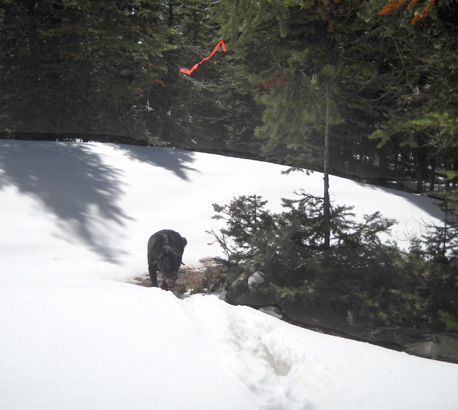
FLORA AND FAUNA
Despite the difficulty walking/running in the snow, it was
beautiful -- so clean and virtually untouched except by Wendell,
us, and wildlife.
We both saw some moose, deer, marmots, rabbits, squirrels, and
numerous animal prints today.
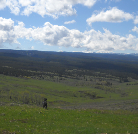
At the beginning of our run/hike at Dry Fork we could see some large animals
about half a mile down in the
valley where the runners come up FSR 149 (marked in red below)
to the aid station. We couldn't be sure with the naked eye,
but we thought they were moose. Cool! I took some
high-resolution photos with my 10-megapixel camera, zoomed in
after getting back home, and confirned that they were, indeed,
moose.
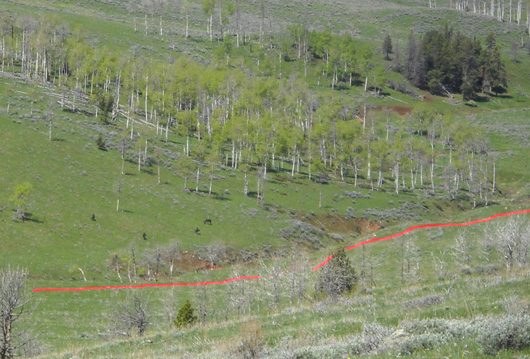
The moose are the four black specks to the
left; I highlighted the Bighorn route in red.
Jim looked for the moose when he was finishing up his loop but they
were gone by then.
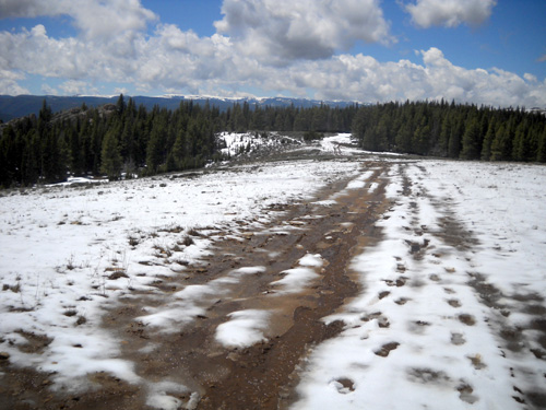
Jim reported that this 4WD road from Cow Camp to Dry Fork was
rougher than usual. It's at a lower elevation and any recent
snow had melted by this morning. The dirt was already fairly dry
there. Many large animals (elk, moose, deer) had walked on it
when it was muddy, however, leaving big holes from their hooves
and making running difficult today. There was also
a lot of erosion from snowmelt and rain, creating more ruts than
usual:
Because of all the snow, there were very few flowers that were
visible on Dry Fork Ridge where I was taking pictures. Some may have been buried
under the new snow. We saw some Pasque flowers (below) and six or eight other kinds
of flowers blooming in the
first half mile up from the Dry Fork trailhead but none above ~
7,800 feet.
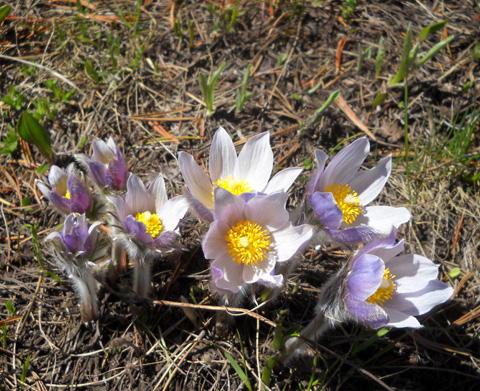
Newly-emerging Pasque flowers and grasses
Jim saw more flowers along FSR 149 between Cow Camp and Dry Fork
but didn't take pictures of them.
On my way back to the truck I crossed paths with two young men
who were running up the mountain from Dry Fork. In our
conversation they said that they are running the 100-mile race
for the first time and they wanted to see some of the course. I
told them that this
trail is used only by the 50K runners unless the 100-mile course
is seriously re-routed. They were following the wrong flagging
but didn't seem duly concerned -- they were getting in a
good workout and had even better views from the ridge than if
they'd gone the other two directions from Dry Fork where the
100-milers go during the race.
My nine miles of hiking (no running) took about four hours with
all the slipping and sliding, post-holing, detours, photo ops, and other stops. I came back
down the final slope carefully to avoid hurting my knees,
slipping in muddy spots, or sliding on loose rocks:
JIM'S RUN
Although Jim was getting tired of all the slippery snow and post-holing on the
ridge to Riley Point, he kept on plowing through. He was
determined to do the whole loop.
Here are some
of the photos he took beyond the point where I turned around.
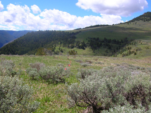
The Riley Point aid station is usually down this hill, before
runners reach the rock formation that juts out over the valley:
Runners begin their descent into the valley here,
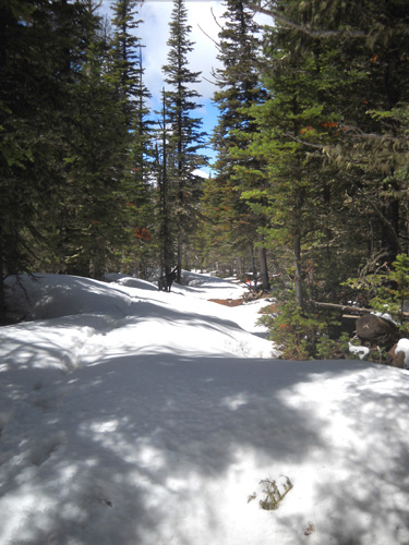
then head into the woods for about a mile. Jim didn't take any
photos in the shady forest, where there was deeper snow. He was
able to follow the trail because of the markers and Wendell's
footprints.
This is a scenic view down into the valley
where he was headed:
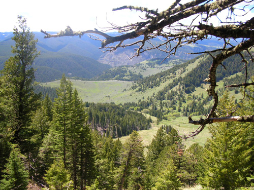
After emerging from the woods about a thousand feet below Riley
Point, the snow was gone. The remainder of that narrow trail was
wet and rough as Jim continued his descent to Cow Camp:
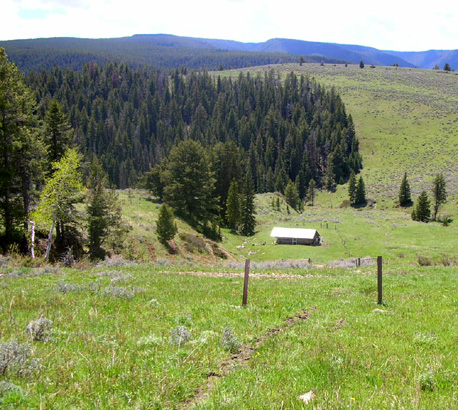
During the race there will be a full-service aid station on the
dirt road (FSR 149) below the posts to the left. Everyone will pass
through it at least once except the 30K runners. Cow Camp is
about the eight-mile mark for the 50K runners.
Jim turned left onto the dirt road and ran/walked the
six miles to Dry Fork.
The undulating road has a net elevation gain from 6,750 feet to
7,650 feet. When you're running it, it feels like most of the
gain is in the last two miles before Dry Fork, although there
are some good hills before that:
Lots of hoof prints + one of the uphill
sections

The long uphill to Dry Fork, marked with an
arrow
Cody and I were sitting in the grass at Dry Fork when I was able
to spot Jim over a mile down the road:
No, you can't see him in that picture. He was much farther away
(and much smaller than the moose we saw closer up) and zooming
in just results in fuzzy pictures in both cases.
I kept telling Cody that Jim was coming up the long hill. He'd
go a few yards away to look, as below,
then run back to me. He wasn't fully convinced until Jim was about a quarter of a
mile away. When Jim started calling Cody's name, he made a beeline down the hill to greet him.
Jim finished his slippery run in 4:43 hours. He
hopes to do it significantly faster on race day with (hopefully) less snow, better-packed trail and road
surfaces, and
other runners for competition.
Last year there was quite a bit of snow on the Riley loop a few
days before the race but most of it melted and we all survived.
We assume the same thing will happen this year.
It'll be interesting to compare that part of the course with
these photos on Saturday. I plan to do the same out-and-back
hike after the 50K race starts so I can record the changes and
get in another good workout.
Next entry: pre-race and volunteer activities
Happy trails,
Sue
"Runtrails & Company" - Sue Norwood, Jim O'Neil,
and Cody the Ultra Lab
Previous
Next
© 2010 Sue Norwood and Jim O'Neil
