(Continued from
Part 3)Dangit, I wish I could have
gone down there again, too! Despite the ruggedness of this canyon, it's
a beautiful trip down the CT to the Animas River.
Selective memories
again . . . savor the spectacular views and unique features of this segment,
forget the incessant rocks and long ascent back up to the pass! The
optimist's curse.
I'm glad Jim got to experience this part of Segment 24 for the first
(and only, he swears) time. It was rougher than he expected --
or I remembered from four years ago. It took him significantly longer to
negotiate
this 14-mile section than he estimated, even though he had read the trail
description in the CT guidebook and my journal entry from
July 11, 2006.
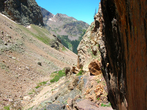
Skinny trail hugging the rock
walls on the right; not much water this high up in Elk Creek
You just don't know for certain how challenging a section of trail will
be from someone else's description or by how long it took them to
run/hike it.
All of the photos in this entry except the last seven are ones Jim took on his way down the
canyon, across the river, and up to Molas Pass. I'll add some
descriptions and relate his comments (the printable ones!). Photos at the end from Molas Pass are ones I
took while I waited for him to finish his run.
THE BOTTOM DROPS OUT
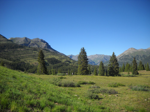
Jim took the first several pictures from the Continental Divide at the top of Elk Creek Canyon,
which is near the point where I turned around this morning:
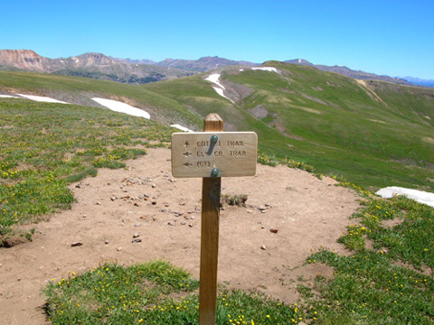
Looking back north at a
directional sign on the Divide:
turn here for the CT and Elk
Creek Trail down to the Animas River.
Ahhh . . . there's that awesome
view looking west again!
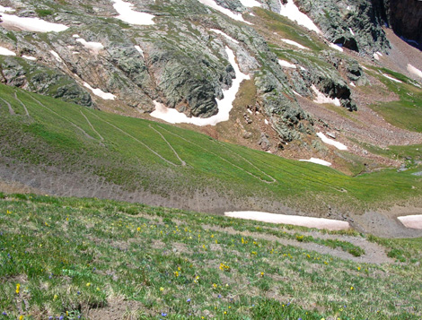
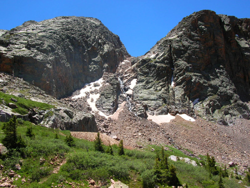
This is where you step over to the edge of the ridge, look down, and
see the trail waaaay down below you . . . and you wonder how the
heck you're supposed to get down there:
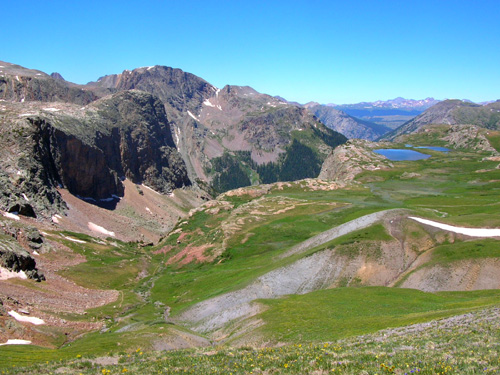
The trail and Elk Creek look
awfully small and far away down in that valley.
At first glance it looks like a
precipitous free-fall down into the lower Elk Creek basin because you really can't see
the trail yet that goes down there. You're at the lofty elevation of
12,690 feet on the Divide and you've got an immediate 585-foot drop that
appears to be just over the edge. Yikes!
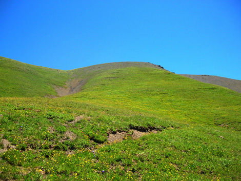
Sometimes looks are deceiving. Just go down the trail to your right a
little bit and you'll see what I mean:
While standing on the trail in
the first part of the descent (foreground) you can
see the multiple switchbacks you'll be going down.
The slope is steeper
than this picture shows -- but the switchbacks are very gradual.
There, that's not so bad, is it?
It's really only a 585-foot drop in 9/10ths of a mile to reach
the "bottom" of the first big descent. That's because the trail
has about thirty switchbacks and descends very gradually over the
distance. If a person went straight down that steep slope, it'd be a
585-foot elevation drop in perhaps a quarter mile -- much, much
steeper (and steeper than the perspective in that photo).
Looking back up at some of the
switchbacks, which are harder to see from below.
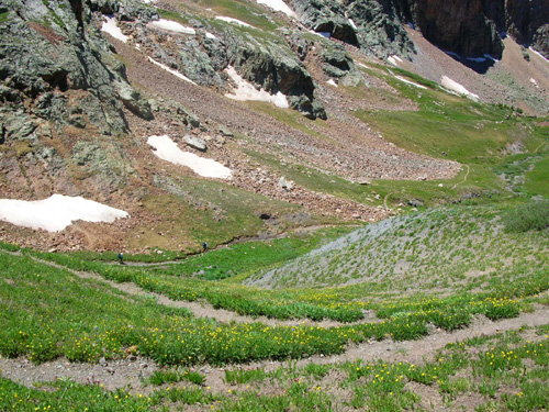
Two hikers are below Jim in the
lower basin, where
the canyon becomes less steep.
Looking back up to the Divide from the
lower basin near the old mining shed
I remember looking back at this point four years ago and
thinking how glad I was that I was going down and not up that
mountain! It's really not that bad of a grade, however, just
tediously slow hiking up all the switchbacks.
The view is better going down the canyon, too.
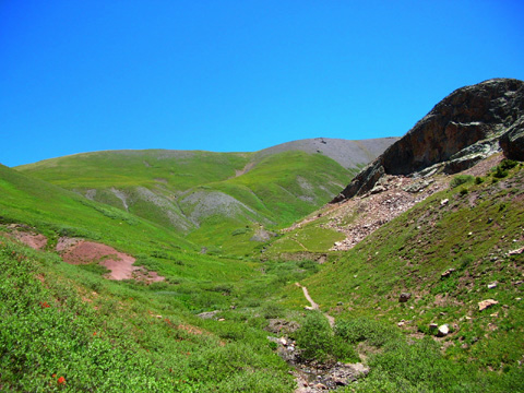
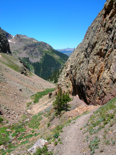
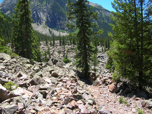
ROCK DANCING
Jim had fun running down those switchbacks.
In fact, that might have been the most fun he had all day. After
that, the trail became more gnarly.
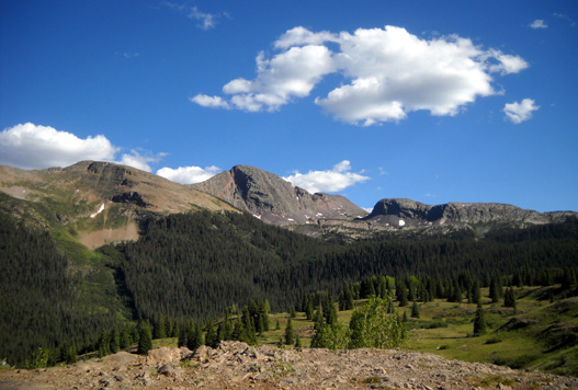
The rugged Grenadier peaks are on the
left (south) side of the canyon
all the way down to the Animas River.
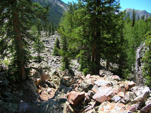
These are the Grenadiers, after all, a unique mountain range
with soaring, jagged quartzite faces and plenty of hard, sharp quartzite
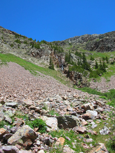
rocks lying all around the canyon. The colors of the rocks
are pretty to look at but after a while the ones right on the trail
can wear you down.
Shortly after passing the old mine cabin/shed on your right the
trail becomes very narrow along a rock wall:
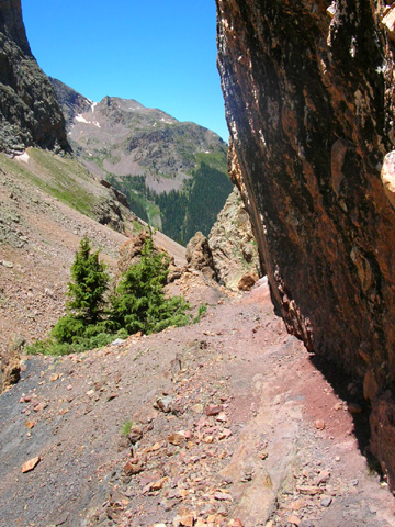
I still wonder how equestrians make it through such narrow
places in the canyon.
Elk Creek is your constant companion most of the 8+ miles down
the canyon. The trail crosses it several times in the upper part
of the canyon where it is very small this time of year:
The
creek gets much bigger as it drops down, down, down to the
Animas River. Many streams flow from the ridges on both
sides of the canyon, adding to the volume of water.
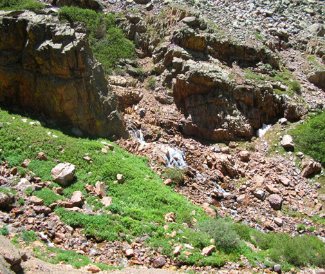
If you look
around, you'll often spot a waterfall down to your left
in Elk Creek or up on one of the steams tumbling down a
mountainside:
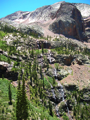
What's even more cool is when the creek completely disappears
under the boulders a little farther down the trail. You can hear
the water but you can't see it!
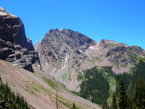
One of the Grenadier peaks; climbers love
the sheer northern faces in this mountain range.
I'm pretty sure Jim was cursing the rocks by this point about
halfway down the canyon:
There are some nice wooded areas with smoother trail. I
distinctly remember those! <grin>
MORE MELLOW IN THE WOODS
Here's the classic Vestal-Arrow Peak scene with the beaver ponds
in the foreground near the trail:
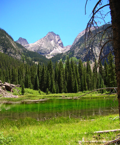
The CT guidebook shows a picture of that and it certainly grabs
your attention when you're walking or running by. The ponds are
about 5˝ miles below the
Continental Divide.
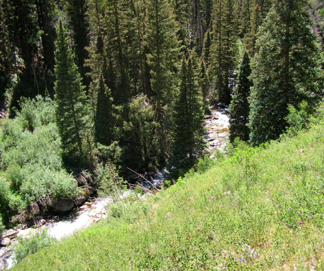
The trail mostly goes through pine forests in the last three
miles to the river. Jim took this photo of Elk Creek in this
section; you can see how it has grown and how fast
it's moving:
The CT leaves the Weminuche Wilderness near the mouth of the
gorge, a little before reaching the river:
Jim had been in the wilderness since early this morning, when we
entered it in
Cunningham Gulch. It's the largest wilderness area in Colorado,
almost 500,000 acres of protected land.
ALL ABROARD!
A tenth of a mile later Jim came to this sign:
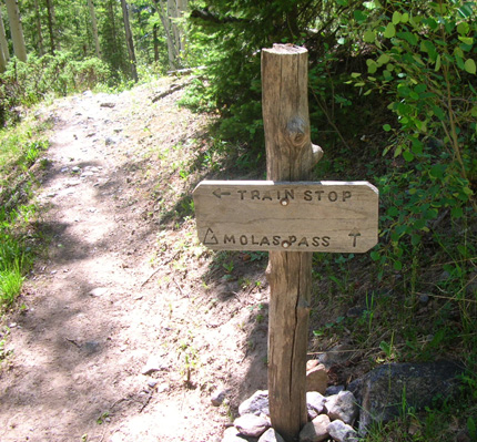
Train stop??
Yes, indeed. The Durango and Silverton Narrow Gauge Railroad
line runs next to the river and will stop to load or unload
passengers near the Colorado Trail! That's particularly handy
for CT thru-hikers who need to get supplies in Silverton, and
pretty cool for anyone else who wants to combine a hike with a
train ride.
Before Jim got down this low he could hear a train heading for
Silverton but he was too far away to see it or take a picture. I
just barely missed one when I came down four years ago, but did
catch
sight of it.
By the time Jim got low enough to take the next photo he could
see the river and the train tracks from the trail:
Pretty soon Jim arrived at the railroad tracks and the river,
which are separated by more land a little farther upstream:
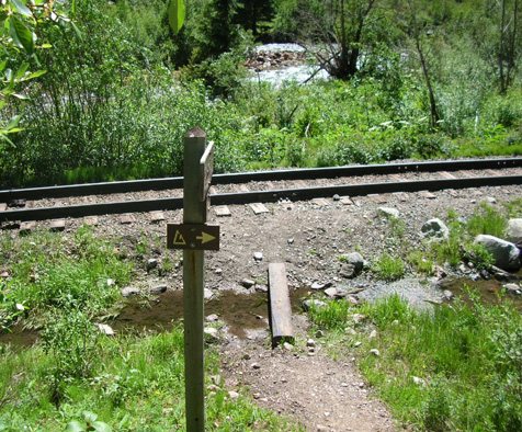
That-a-way →
The elevation along the river is about 8,920 feet, the low point
in Segment 24. The CT follows the tracks for a few
hundred feet before crossing them and running between the tracks
and river.
The CT passes by a little pond next to the tracks.
There are great views of Mt. Garfield (peak
on the right, below) and other Grenadier 12-13,000 footers from this part of
the trail and as it climbs up another set of switchbacks to Molas Pass:
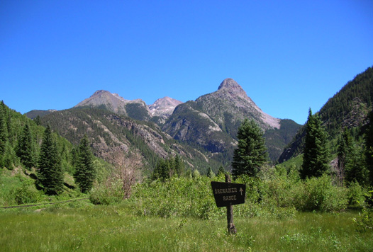
A sign identifies the Grenadier Range.
Southbound (more like westbound here) trail users can also see
the next big climb that looms ahead of them:
Before leaving the tracks to head up that mountain, Jim was
surprised to see a little vehicle coming up the tracks
toward him:
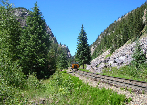
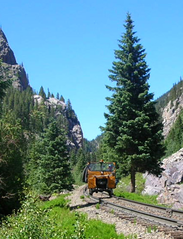
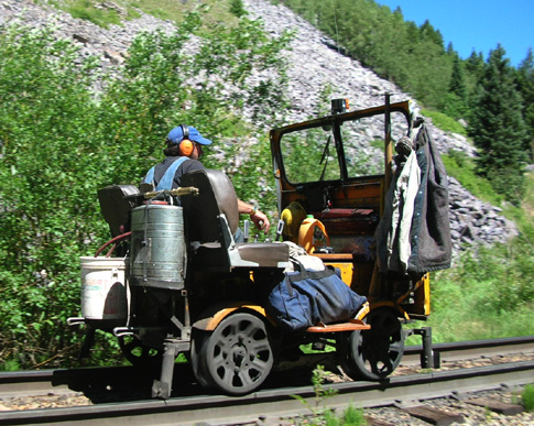
That was almost as good as seeing the train!
From what we heard later, we think this fellow's job is to follow the steam train and
put out any fires it may start along the track.
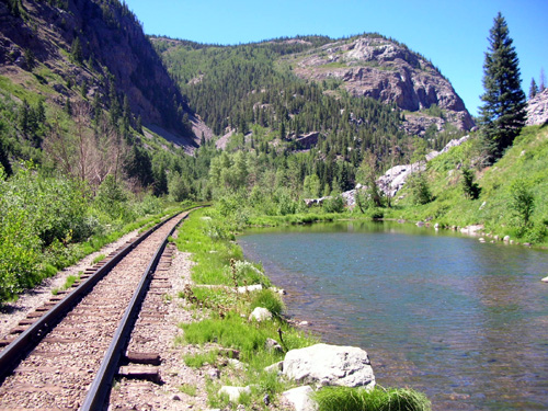
THE LONG HAUL TO MOLAS PASS
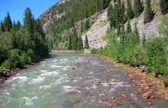
Nine miles from the Divide (and five miles from Molas Pass) the
CT crosses the Animas River on a sturdy foot bridge. Good thing,
because it is categorized as a Class Five whitewater river at this point,
although today it didn't look that bad:
Soon after the river the CT crosses a creek on two fat logs (or
you could ford it)
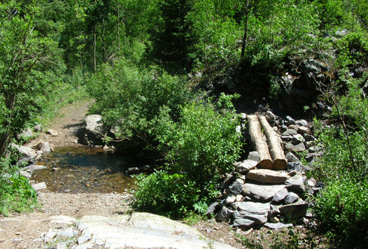
and then begins a relentless climb of about 1,400 feet in just
over two miles. There are reportedly 33 switchbacks that end at
an elevation of 10,300 feet, but neither Jim nor I have counted
them.
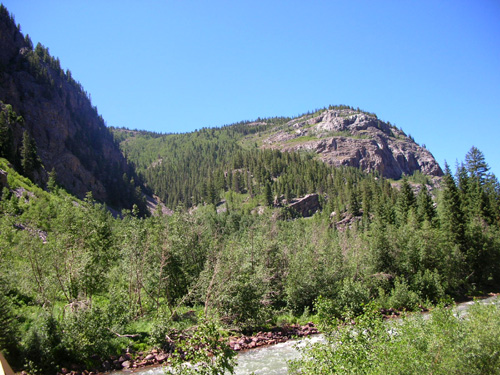
On the way up it's a good idea to stop a few times and look out
at the scenery, both near and far. There are interesting rock
walls and increasingly-distant views of the Grenadiers to
distract you from the ascent:
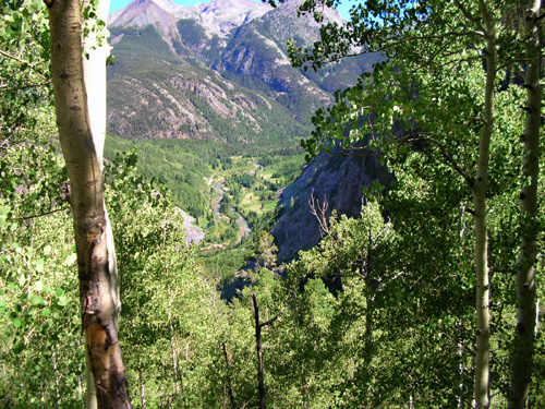
Scenic view down to the river and out to
the Grenadiers
Part way up the switchbacks Jim could hear the train going back
to Durango, but once again he was too high up to get a good
picture of it.
That was the last picture that Jim took today, even though he
had another four miles to hike at that point. He
wasn't running this long ascent, and with three more miles after
the switchbacks and
another 600 feet of net gain to Molas Pass, he was focused on
getting done, not taking pictures.
I would have used the climbing as an excuse to stop and take
some pictures, but that's me. I'm just happy he took as many as
he did. It brought back good memories to me (I enjoyed "being
there" again) and it nicely illustrated this entry with current photos.
GOOD: THERE'S SOMEONE TO RUN WITH!
The best thing that happened to Jim on the ascent to Molas Pass was
"running into" one of our ultra buddies, Bill Heldenbrand, a few miles
from the end.
Bill knew we were doing this hike today and decided to time his
own shorter run/walk to try to meet Jim somewhere along the CT as he
came down Elk Creek. Because of the delay up
on the Divide to let Cody rest (and allow me to see the top of
the canyon), and because it took Jim longer to negotiate all the
rocks than he estimated, Bill had already gone out several miles from the pass and had begun heading back when Jim caught up to
him. They continued together the last three or four miles.
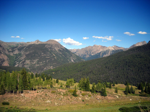
Scenic mountains and valley south of the
overlook at Molas Pass
Meanwhile, Cody and I had gotten to Molas Pass about 3:30,
fully expecting Jim to be waiting for me but secretly hoping
he'd be a little "late" so he didn't have to
wait for me after running and walking for 21 miles.
Ha! He and Bill didn't show up on the horizon for over two more hours.
By then, I was pretty concerned that Jim had taken a wrong turn
somewhere or was injured. I got a taste of what he goes through
every time I'm out hiking/running alone, especially on an
unfamiliar section of trail, and seriously
underestimate how long it will take me to get back. There's a
lot of worry involved in that.
Fortunately, Jim was OK but I didn't know that until he showed
up at 5:45 with Bill. Even though we both carried our
phones, there is no Verizon cell service at Molas Pass or
anywhere we hiked today. It's nice when we can call each other
to note our progress, but that's a rare luxury on the type of
trails we run.
I found a rock ledge to sit on above the
parking area at the pass and watched people come and go from the
overlook. Cody got to take another nap as he laid by my side,
interrupted occasionally by people who wanted to pet him.
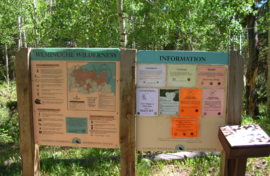
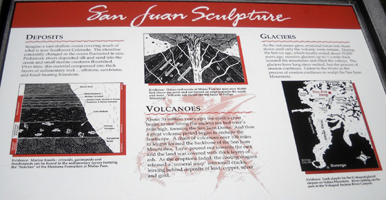
There
are several interesting interpretive signs at the overlook like the one above.
They describe the geological and
cultural history of the area, identify the mountains in every
direction, talk about the Weminuche Wilderness and Colorado Trail,
etc. A path leads up to the overlook and is a popular
place for tourists to take pictures of one another with gorgeous
mountain backdrops.
Besides people-watching, I also had all this great scenery to
enjoy. Except for becoming increasingly concerned about Jim, it
was quite relaxing.
I deliberately faced the large valley to the north and east
of the overlook. I knew approximately where the Colorado
Trail came up to the pass through the woods and meadows but not
exactly, and I couldn't see the trail itself from my vantage
point.
View east toward Elk Creek Canyon and the
Grenadiers from Molas Pass
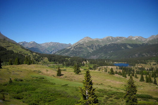
Valley and mountains north of Molas Pass
(toward Silverton)
Although I was scanning the valley intently to see some movement
along the trail that I knew was somewhere out there, I
missed seeing Jim and Bill until they were just a few hundred
yards away:
They are the two little white dots in the middle of the photo
above.
Even with a 10-megapixel camera on its highest setting I can't
get a very good photo by zooming in on that picture close enough
to see their faces. (That might be a good thing, as tired as
they were.)
I took this shot when they got closer, after
I'd sent Cody down to greet them:
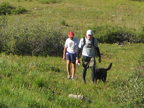
When Jim and Bill saw me they got off the CT and cut cross-country to
come up to the parking area. Otherwise, they would have had to
walk along busy US 550 to get to our vehicles. The CT crosses
the road about 1/8th of a mile from the parking area, which is
fine for thru-hikers but requires a short detour for folks who
park at the pass.
Jim was one tired puppy after all of the climbing and
rock-dancing he did today -- twenty-one miles,
mostly above 10,000 feet and at 12,000 feet or higher for at
least six miles. Although he couldn't run as much as he wanted,
he did get a challenging workout (altitude and "hill" training,
time on his feet, long distance),
saw lots of fantastic scenery, and got to talk to Bill and
several other folks out on the Elk Creek Trail.
It was a memorable day for both of us.
WANNA-DO LIST
So after finding a suitable trail from Cunningham Gulch to get
up to the CT along the Continental Divide . . . I've got
a new list of at least five variations I want to do on
subsequent hikes:
- Go up the same trail from Cunningham Gulch and go left on the CT
for a couple of miles toward Stony Pass (opposite the direction I went
today). Cross the road and keep going northeast on CT Segment 23.
Several miles of Seg 23 were also re-routed in 2007 to follow the
Divide instead of Pole Creek, and I haven't seen the new part yet.
Turn around after a few miles and go back the same way (no good way to
make that a closed loop since I can't go as many miles in a day as I
used to).
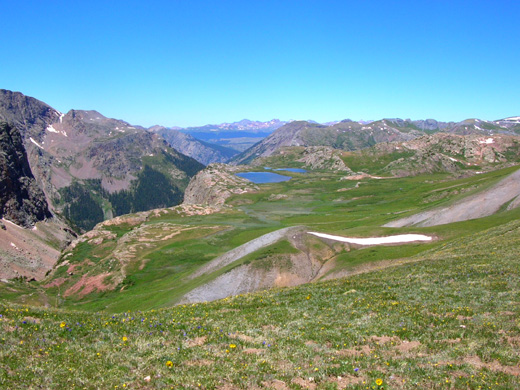
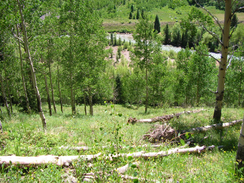
- Go the same way I went today but take time to see Eldorado and
Kite Lakes, which are both about 4/10ths of a mile beyond the
intersection at the top of Elk Creek Canyon.
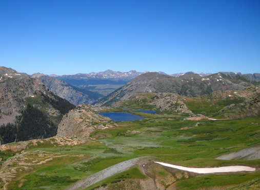
- Go the same way I went today but take time to explore the high
basin just north and west of that intersection (around the lakes in
the photo above). I don't know if there is a
trail or a realistic way for me to get down there from the ridge, but
I'd like to try. It'd be cool to look down the canyon from the edge of
the basin on the far side of the lakes.
- Hike the Highland Mary Lakes →
CT → Cunningham Gulch trail loop.
That will require further research and a more detailed map because I
don't know where all of the trail intersections are located. I'm not
sure how long it is but other hikers I talked to were doing it as a
day hike today.
- Hike up into Spencer Basin, if it is separate from the Highland
Mary Lakes loop. I love high basins.
Now, if only my knees hold out long enough for me to accomplish
all this . . . So far, so good. Love those Orthovisc
injections!
This is such a beautiful area. I hope other runners and hikers
will discover it and enjoy it as much as I do.
Next entry: Hardrock Hundred pre-race activities
Happy trails,
Sue
"Runtrails & Company" - Sue Norwood, Jim O'Neil,
and Cody the Ultra Lab
Previous
Next
© 2010 Sue Norwood and Jim O'Neil
