(Continued from
Part 2. This page is a little more
photo-heavy, so it may take longer to load. It's worth it!)Although I didn't have time
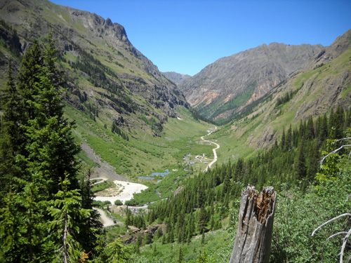
to check out Eldorado Lake or the alpine ponds in the high basin near
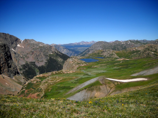
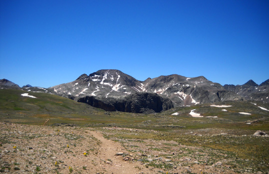
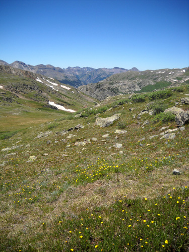
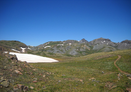
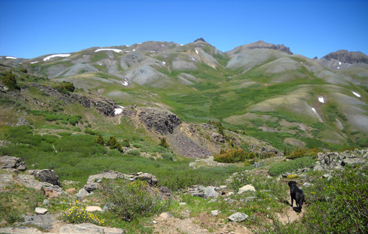
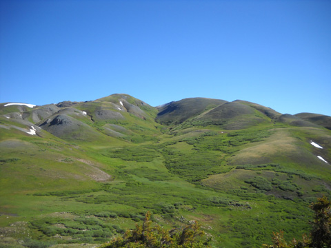
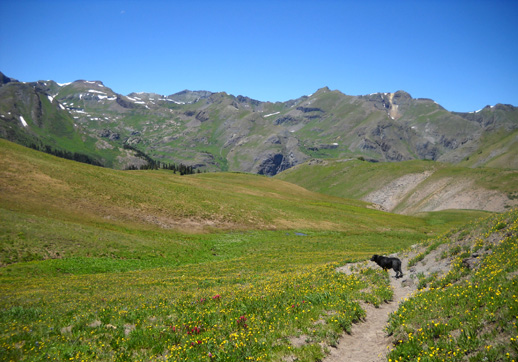
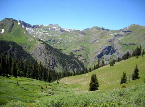
the top of Elk Creek, I was satisfied this morning to have seen my Most
Favorite View along the entire Colorado Trail, the one looking west from
the top of the canyon on the Continental Divide:
Now I needed to go back about two miles to the spot where Jim and
Cody were waiting for me. Hopefully, the 90-minute break was sufficient
for Cody to rest and be able to walk five miles to our truck. (I
explained in the last entry how he pooped out on us, both unexpectedly
and uncharacteristically.)
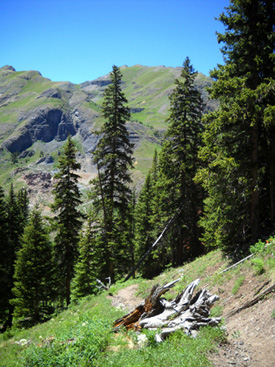
I climbed back up to the Divide from the first switchback going
down into the Elk Creek canyon and turned to the north at the CT
sign along the double-track:
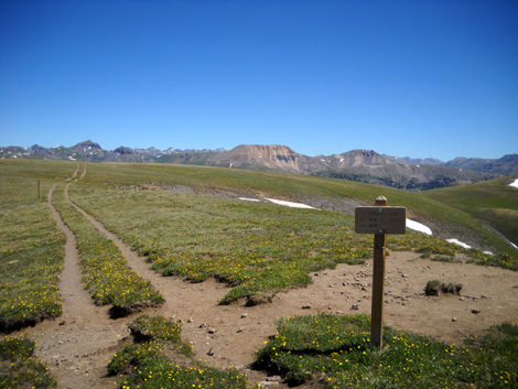
This is when northbound CT hikers first hit the Continental
Divide on their journey from Durango to Denver (more thru-hikers
go southbound from Denver to Durango).
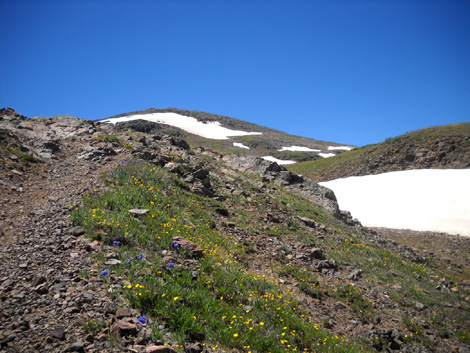
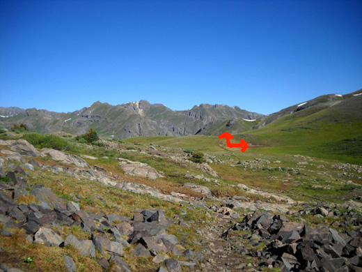
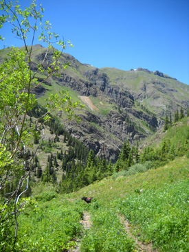
The trail went up a rise and back down a little bit. I soon came
to another CT sign directing hikers to the right (next photo,
arrow right). That's the new CT
route I used up the slope to get to the canyon -- the
route I vowed not to take going back.
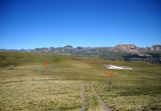
See that obvious trail next to the arrow on the left, going over
the top of the mountain?
That's where I went. That's the way I've done it twice before.
It's much simpler and straightforward, leading directly over the
hill and down the other side to the spot where I left Jim and
Cody. It also avoids the rough and wet sections on the newest CT
relocation around the east end of the mountaintop and cuts off a
third to half mile in distance.
Note that we weren't trampling fragile tundra (Jim also went
that way outbound after seeing how I came down the hill on his
side). There is already a trail there and no signs at either end
saying it's closed.
The top of that hill was our high point today at 12,745 feet. It
goes up higher than the reroute around the mountaintop but the
climb on either side is easy to moderate -- no worse than the
reroute, which starts at a lower elevation.
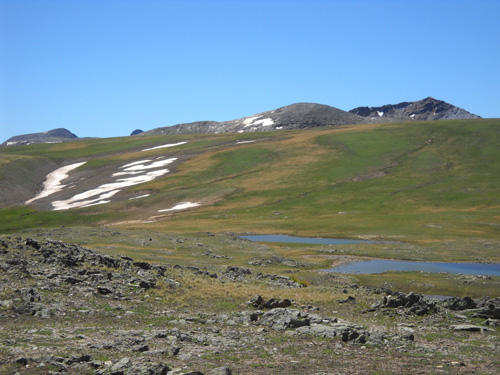
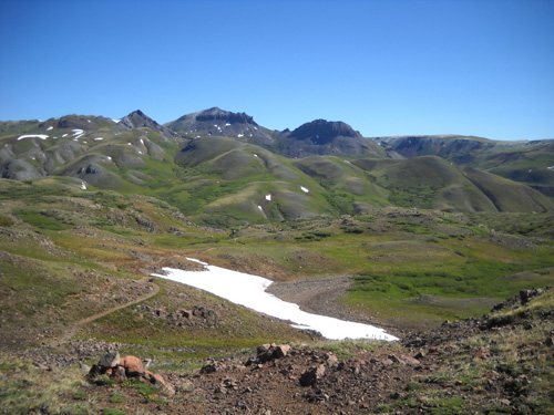
I wound around the ponds on Jim's side of the slope in the
picture
above (I took it looking back), connected with the CT again, and zeroed in on
Cody and Jim, who was propped up
against some rocks on a hillside ahead of me.
It was easy to
spot them because of Cody's bright red backpack:
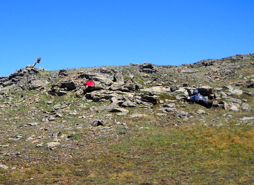
I stopped and talked to Jim for a few minutes as we both
prepared to move on in separate directions. It was now almost
noon.
The sky was still perfectly clear with nary a cloud. That was
good news for both of us, especially Jim since he had a lot of
tough miles ahead of him on his way to Molas Pass, where I'd
pick him up. Despite the significant drop in elevation to the
Animas River from the Divide, some of the trail along Elk Creek is
very rugged. Then there's that big climb up to Molas Pass . .
.
Jim estimated it would take him about three hours to get to the pass and
said he'd wait for me there in case he arrived before I did. He
knew I might have to go back to the truck very slowly because of
Cody. And he knew my proclivity to take lots of pictures.
I thought his time was optimistic but possible if he ran a lot
of it, so I did
my best to get there at the ETA.
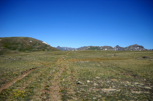
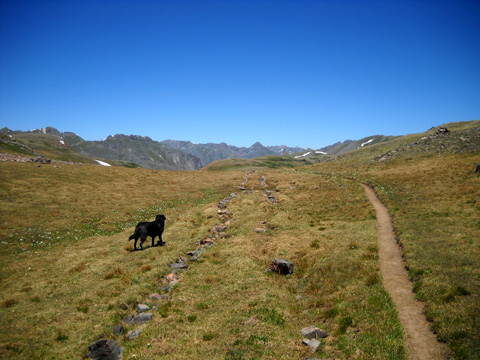
TREKKING BACK ACROSS THE DIVIDE
Now it was my turn to carry Cody's empty pack. He led the rest
of the way and walked and
acted quite normally (alert, energetic) as we climbed up
and down over small hills and
proceeded in a mostly-northerly direction along the
Divide:
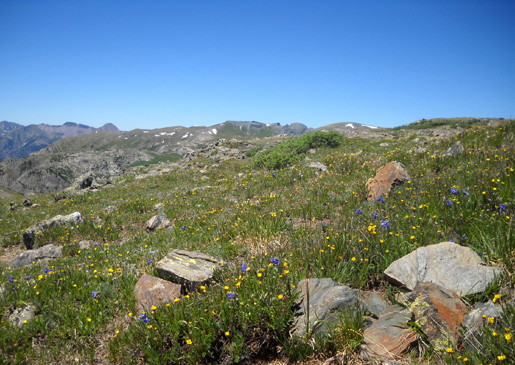
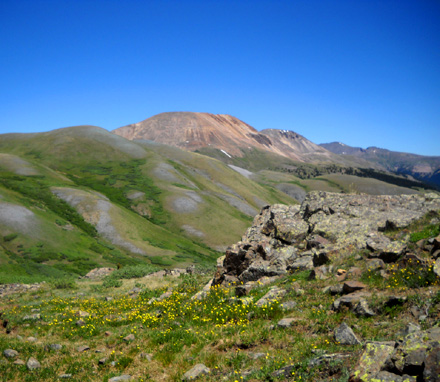
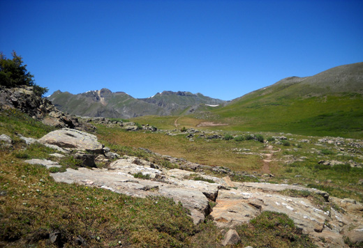
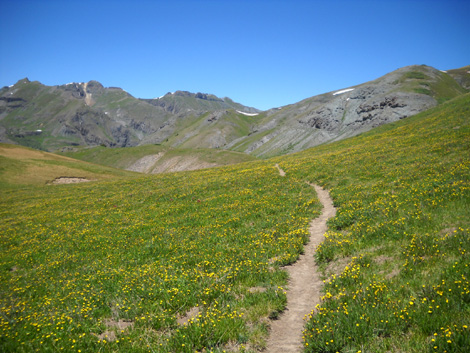
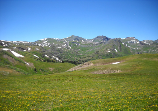
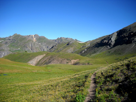
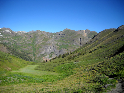
The next three views are looking west and southwest:
On each high point for the first ten minutes I looked back to see Jim's progress around
the little lakes and up the shortcut on the hill. After a few
minutes we'd both gone far enough that I couldn't see him any
more. Cody seemed to be doing fine, too.
Good -- I
don't have to worry about either of my guys now!
My thoughts turned to the beauty surrounding me. I was happy to
go slower "for Cody's sake." Ha! It was pure pleasure to meander
the last five miles at a more leisurely pace than I'd done the
first nine. I took even more photos than I did outbound, and
stepped off the trail several times to see the details of rocks
and flowers or to find a better angle for a picture.
I was truly in my element. The advantage of not being able to
run any more is that I feel less "guilty" when I stop to take
photos.
Still, wouldn't it have been great to run through this awesome
landscape?
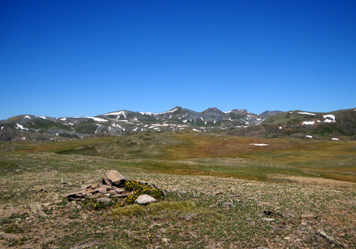
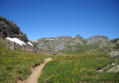
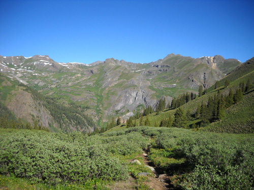
Here are more photos for a virtual tour going northbound on the
CT along the Divide; a few pictures include comments:
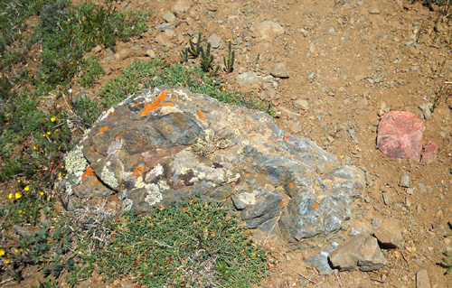
There are lots of colorful rocks up here.
Some rocks have been deliberately placed to
discourage hikers from using renegade trails.
When I need to de-stress, I visualize a
serene setting like this.
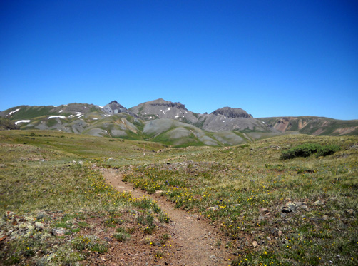
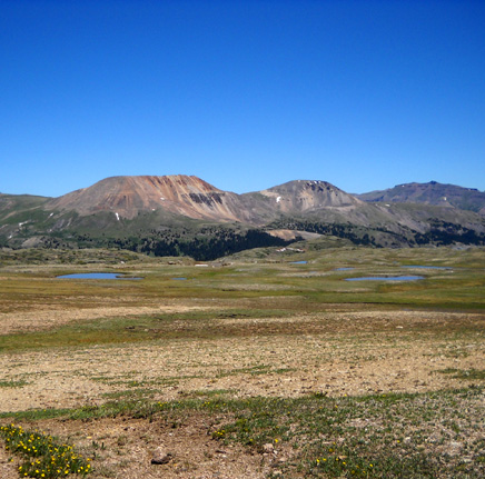
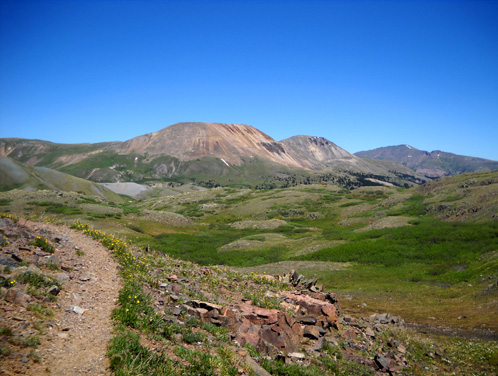
I hiked toward these mountains for a couple
of miles. They include Green and Canby,
both 13ers along the Hardrock course.
Looking NE toward Stony Pass, where CT
Segment 24 begins/ends
(I turned a couple miles before the pass)
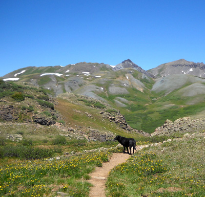
Mom's still carrying Cody's pack and he's lovin'
every minute of it.
I wonder if he outwitted us? I'm just glad
I don't have to try to carry HIM!
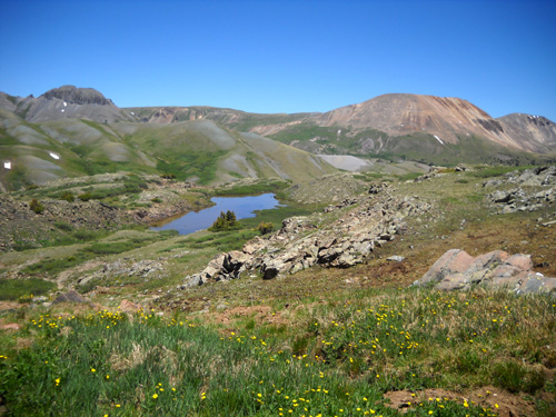
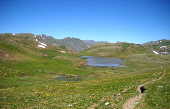
Yet another gorgeous lake view
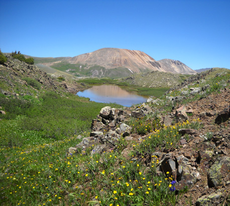
Same lake, different angle
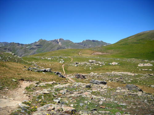
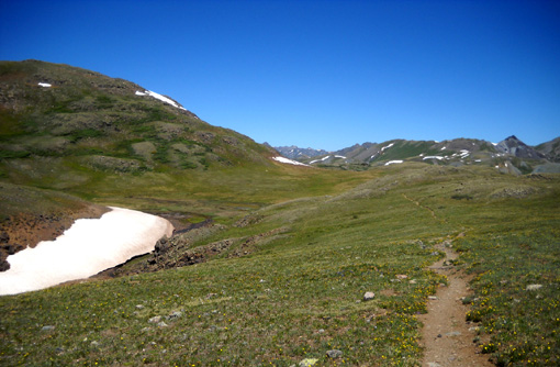
At a trail junction ahead, the CT will go to the right and wind
around the bases of these peaks on its way to Stony Pass in
about two miles:
The next photo shows where the CT heads right. The access
trail I took to get back down to our truck in Cunningham Gulch
goes a little toward the left:
There is no name or number identifying that access trail, even
anything to indicate where it goes. Signage can be pretty slim
or even non-existent in wilderness areas. Better have a good
map!
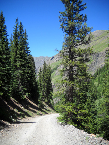
DESCENDING TO CUNNINGHAM GULCH
The 2,000-foot drop in just over two miles to the spot where we
parked the truck started off gradually through the valley above
the tree line and became increasingly steep in the second half
through the woods:
Cody's still leading the way and completely
lost his limp.
As I dropped lower and turned toward the west I began getting
excellent views of Spencer Basin to the left:
Soon I was down in the trees again, and the trail became
steeper. The steeper it was, the slower I had to go to avoid
hurting my knees and sliding on the loose dirt and small rocks.
I was glad I had both of my trekking poles. They help me on steep ascents and descents, as well as through creeks, snow,
mud, and rocks.
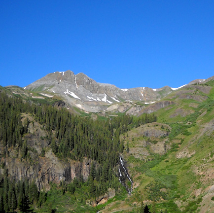
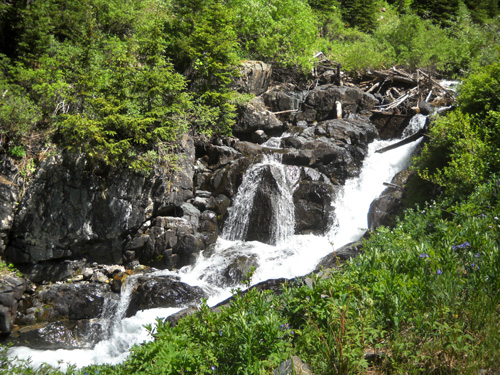
I was able to enjoy the superb views of Spencer Basin and the
Mountaineer Creek waterfalls even more on the descent than
when I was huffing and puffing this morning
as we went up the trail:
I knew we were getting close to the end when I started seeing
Cunningham Gulch through the trees:
Cody and I exited the wilderness, crossed Cunningham Creek, and
walked about half a mile down the forest service road, shown
below,
to our parking spot below the old mine.
The road follows the
creek through most of the gulch. It's popular with fishermen and
there is a nice waterfall near
the old mine site where we parked:
CUNNINGHAM GULCH TO MOLAS PASS
I got back to the truck about 2:45 PM.
Fortunately, Cody did fine all the
way back down and I didn't have to slow down any for him. No way
could I have carried him if he'd needed it!
Jim had
optimistically estimated that he'd reach Molas Pass about 3 or 3:30, so
I quickly "got in gear" and drove about thirteen miles to the pass as
fast as I could, considering how rough the first 3˝
miles were on dirt Cunningham Gulch Road. Then I had another
couple miles on smoother dirt/paved CR 110 . . . a mile
through the length of Silverton, which was still full of
holiday visitors . . . and
switch-backing up US 550 another seven miles to the pass.
Whew! That took a while and I was
a little stressed out thinking that poor, tired Jim was getting
antsy waiting for me after running up and down for 21 miles at
high altitude.
There were still several campers
in the spot where the Cunningham Aid Station is located during
the Hardrock race but fewer than we saw this morning,
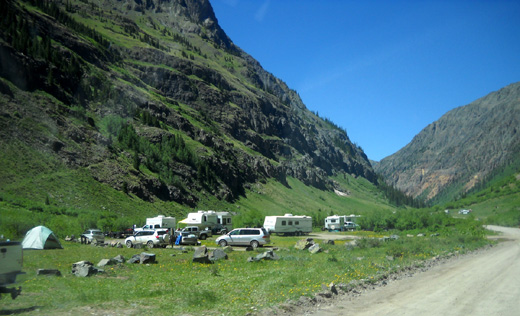
and many other folks around enjoying the
creeks, mountains, and 4WD roads for the day. Even though it's a
Monday, many folks were off work today for the Fourth of July
holiday.
With all the people in Cunningham
Gulch I'm surprised we
didn't see more hikers on the access trail or CT. I saw only six
hikers and no equestrians in the 7+ hours I was out there (no
bikes allowed in wilderness areas). Jim saw more folks
in the 14-mile section he ran and hiked between the Divide and Molas Pass, but not as many as you'd expect on a beautiful
holiday weekend.
Next entry: Jim's photos and a description of the CT from
the Divide to Molas Pass and my photos at the pass while I
waited for him (yep, I got there first!)
Happy trails,
Sue
"Runtrails & Company" - Sue Norwood, Jim O'Neil,
and Cody the Ultra Lab
Previous
Next
© 2010 Sue Norwood and Jim O'Neil
