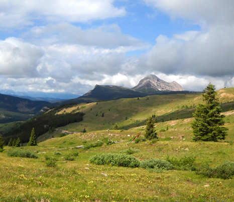
I found most of my sunshine on this morning's hike in the colorful
flowers and Cody's antics!Two days
ago Jim and I hiked
some of the middle of Colorado
Trail Segment 25 through the alpine basins near Rolling Mountain Pass.
We reached it from the Mineral Creek Trail, which is a much shorter way
to get there than from either end of Seg 25: Molas Pass or
Bolam Pass.
Today our intention was to run/hike out and back from the trailhead
at Little Molas Campground for several hours. Jim hoped to reach Rolling
Mountain Pass, a distance of about 10.3 miles one way and 20.6 miles
roundtrip. My plan was to hike outbound for
three or four hours and turn around, getting back to the truck about the
same time as Jim. Cody and I have done some 10-13 milers recently but we aren't currently trained to go 20+ miles.
Jim and I weren't real optimistic about
the likelihood of being able to stay out six or eight hours today, however. There was a 60-70%
chance of rain in Silverton (which always means a higher chance in the
mountains) and the morning was decidedly overcast. It's much more common
for the skies in the San Juan Mountains to look like this in the early
afternoon, not
at 7 AM:
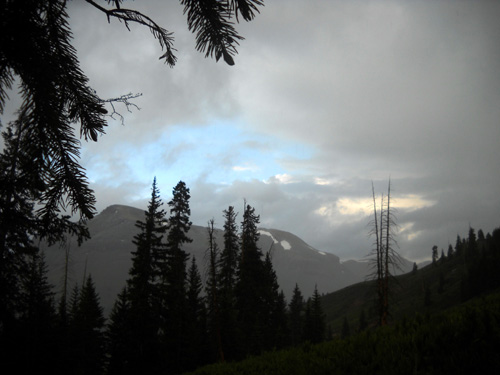
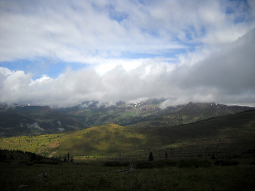
Clouds hang over the Grenadier
Mountains to the east of Molas Pass.
So why did we even start this run/hike, let alone keep going outbound
for an hour with the
near-inevitable prospect of a storm? Well, besides craving to get out on
the trail, we know from experience that mountain weather is a crap
shoot. It can look menacing, then quickly clear up -- or get even
worse, of course.
We didn't want to be sitting in our camper at 10 AM and discover
what a beautiful day it was!
So off we went toward Molas Pass. Long story short, it got worse,
then got better. By the time it got better, however, Jim had already
made his decision to turn around and try again tomorrow. That turned out
to be a good decision.
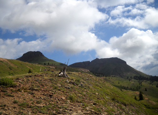
STORMS AROUND US
This segment can begin either at the Molas Pass parking area several miles
south of Silverton on US 550 or at the trailhead a mile west in the
Little Molas Campground. We chose to start/finish our trek today at the
campground trailhead so we'd have a bit of a head start on the distance
to Rolling Mountain Pass (it's about a mile shorter each direction from
there).
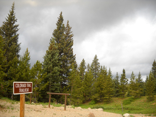
The elevation at the campground trailhead (above) is about 10,921 feet, a little lower than at Molas Pass. Jim got up to 11,735 feet before turning around
and I topped out at 11,660 feet.
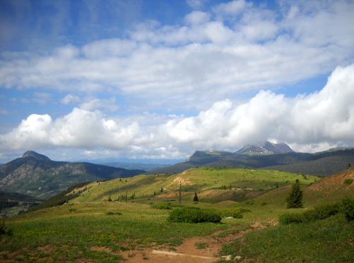
This segment is ideal for running,
hiking, cycling, and horseback riding because it is relatively smooth most of the way, it
undulates without any real steep grades up or down, and it
gradually gains its peak elevation of 12,520 feet at Rolling
Mountain Pass over 10-11 miles going westbound, depending on which
trailhead you use.
Note that we usually run/hike the
eastern half of this segment; the other half continues
west and south to Bolam
Pass. That trailhead is a lot longer and rougher drive from
Silverton. From Rolling Mountain Pass it's a gradual net descent
on the CT to Bolam
Pass, elev. 10,090 feet. The only time I've done the whole
21-mile segment was in 2006 -- on
July 2, exactly four years ago
today! (If you compare those photos with the ones I took in the
basin and at Rolling Mountain Pass two days ago, you'll see
several almost identical pictures. I didn't realize that until I
was writing this entry.)
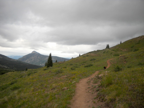
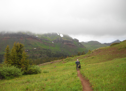
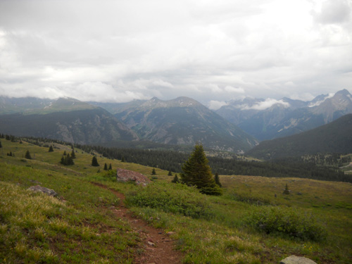
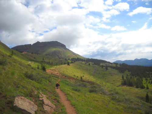
There is about a 500-foot elevation gain from the Little Molas Campground
trailhead as the CT winds through some trees, past some rock
ledges, and up several switchbacks (photo above) to a double-track
(photo below) heading
north toward Grand Turk, Sultan, and Bear Mountains, which were
mostly obscured by low-hanging clouds this morning:
Above and below: heading north toward Grand
Turk and Bear Mtn.
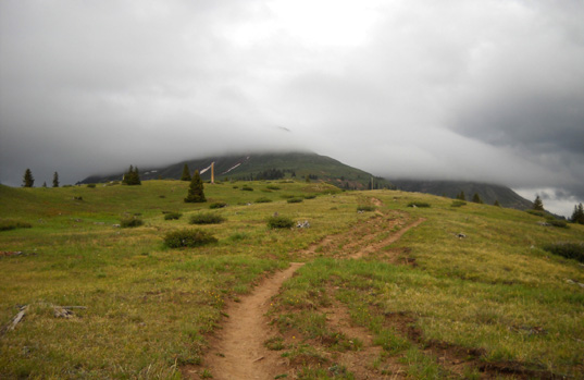
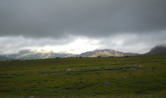
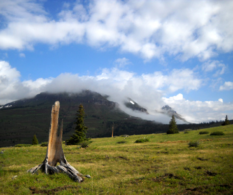
At this elevation (about 11,600 feet) it was obvious that we
were surrounded by storm clouds in every direction:
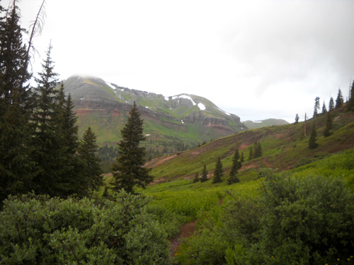
Looking east toward the Grenadiers
Southwest toward Rolling Mountain Pass (in
far background)
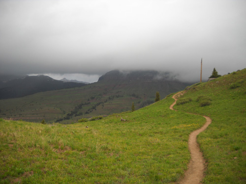
West toward the Twin Sisters
Not too promising, eh?
Here are some other pictures I took outbound:
A glimmer of hope to the south: a little
patch of blue sky
Above and below: still gloomy to the west,
though
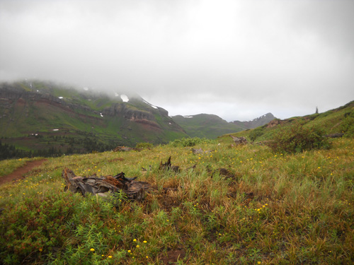
We could see patches of snow on mountainsides in the distance
but didn't get high enough today to run into any snow along the
trail.
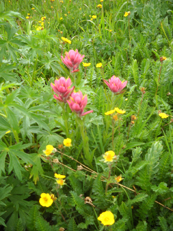
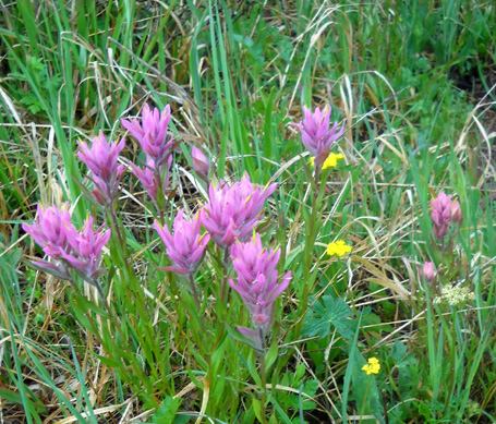
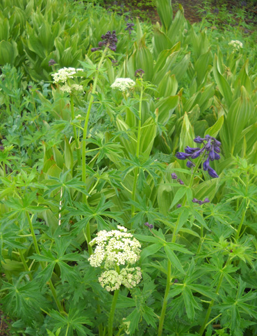
Despite the stormy skies, I was able to enjoy all the perky
flowers close to the trail -- Indian paintbrush in a
myriad of colors, several varieties of bright yellow flowers,
blue penstemon, larkspur, and monk's hood, lavender clover, tall white cow
parsnip, fluffy fringe flowers, and others. Here are a few of
them:
Jim and I each continued forward separately for about an hour
until rain, sleet, and sticky mud made Jim miserable enough to
turn around after 3.6 miles. Ironically, the trail had been
quite dusty when we started out this morning. Jim also heard
thunder in the distance, and wondered if he'd just get into
worse weather (lightning? snow?) if he continued climbing
toward Rolling Mountain.
Since the focus of this outing was Jim's long run, it was his call
to make about whether to keep going or wait for better weather.
I didn't mind turning back because I'd rather hike in nice
weather with great views. On a clear day, we would have been able
to see Rolling Mountain Pass and the high basins from the
first few miles of the trail. Today that was nearly impossible.
I didn't hear the thunder but could see that it was raining just
ahead of me.
Cody and I ducked under some trees in dry pine needles for about
ten minutes to avoid the rain and sleet when it reached us.
After it passed over, we
continued forward until we saw Jim coming back toward us:
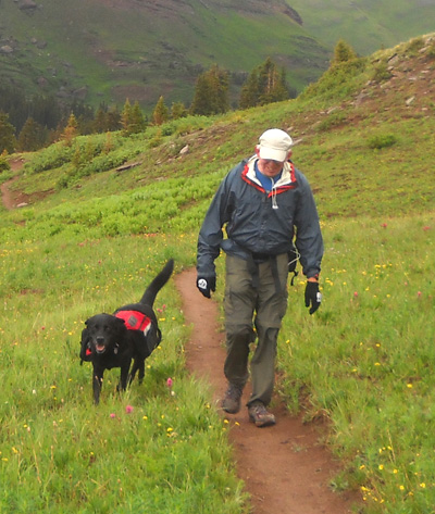
I'd gone only about 2.5 miles at that point but didn't have much
desire to keep going, either.
Jim continued running back to the truck and reached it about
half an hour before Cody and I got back (we walked). The weather seemed to
be improving and I wasn't in any hurry. I detoured about half a
mile to follow a side
trail; I've seen it previously and always
wondered where it went.
I kept taking pictures, of course. Some of the most dramatic
scenes in mountains (or anywhere else, for that matter) are
during storms. I was fascinated with the fast-moving clouds and the
change from gray to blue in the hour-and-a-half that it took me to get
back to the truck.
Grenadiers to the east
Rolling Mountain to the southwest
Twin Sisters to the west
Engineer Mountain to the south
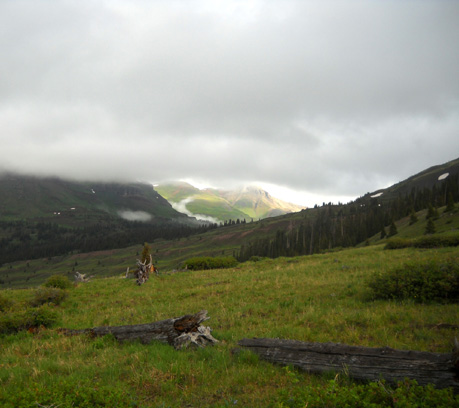
WHAT STORM??
With less than a mile to go to the trailhead, it was looking
like maybe we'd made a mistake to turn around. The clouds were
morphing to white in every direction, even toward Rolling Mountain:
Turns out, however, that Jim made the right call to turn around and wait for
better weather. I'm not positive that this section of the CT was
a mess all day, but we got intermittent rain and sleet the rest
of the day and evening at our campground on South Mineral Creek
Road -- which isn't far, as the crow flies.
While Mother Nature played havoc with the weather this afternoon
and evening, we stayed dry inside our camper watching our
campground fill to beyond a comfortable capacity with
holiday weekend revelers in everything from tents to Class A
motorhomes that cost more than our house and 12 acres of land in
Virginia . . . and were glad that we had found a campsite
where no one could crowd us.
We also thoroughly enjoyed talking with several running and ham
radio friends who stopped by to visit with us today --
Marcy and John B., Mark and Margaret H., Roy and Laura, and Bill
H.
What a great day, despite some rain! Sunshine comes in many
forms.
ADDENDUM:
The next day we set the alarm for 6 AM so Jim could attempt his Molas-2-Rolling
long run again.
We looked outside and the campground was socked
in with fog -- couldn't even see our closest neighbors. Rats! Jim slept two more hours; I was wide awake
and couldn't go back to sleep so I stayed up.
At 8 AM it was still foggy but
Jim decided to get ready anyway. By the time he reached the
trailhead, the fog had lifted. It may have been OK before that
at Molas Pass but we couldn't tell from our campground on the
other side of Bear Mountain.
Turns out, he had a great run/hike and made it all the way to
Rolling Mountain Pass with good weather. He did get into a bit
of
hail, sleet, and rain on the return; he never heard any
thunder or saw any lightning, which was good. Jim was tired when
he got back but pleased with his 21-mile training run.
I decided not to hike today -- too tired and sleepy to be
out there all day. We don't have any more current photos to show
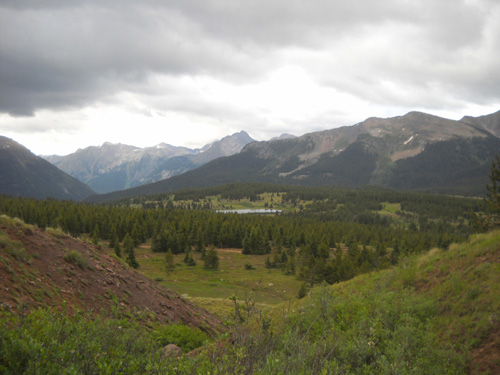
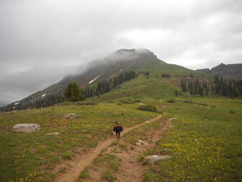
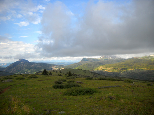
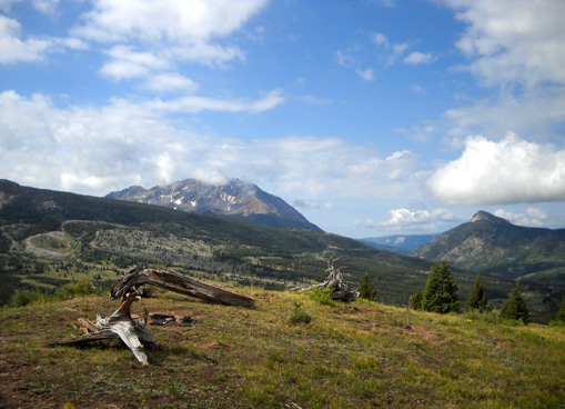
from the trail because Jim didn't take a camera. Here's one I
took July 1, 2009 before we reached the upper basin, which you
can see from this vantage point. Jim said there were just as
many dandelions this year:
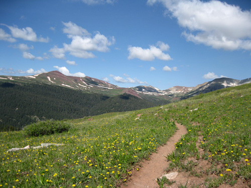
Three or four miles before Rolling Mountain
Pass (photo taken 7-1-09)
He reported less snow in the high basins that we explored just
three days ago; the snow is melting fast, a very good
sign for the upcoming Hardrock race and our own high-altitude
runs and hikes in the next week.
Next entry: celebrating the Fourth of July,
Silverton-style
Happy trails,
Sue
"Runtrails & Company" - Sue Norwood, Jim O'Neil,
and Cody the Ultra Lab
Previous
Next
© 2010 Sue Norwood and Jim O'Neil
