|
2007 ULTRA RUNNING ADVENTURES
| ||
|
Runtrails'
Rocky Mountain Journal
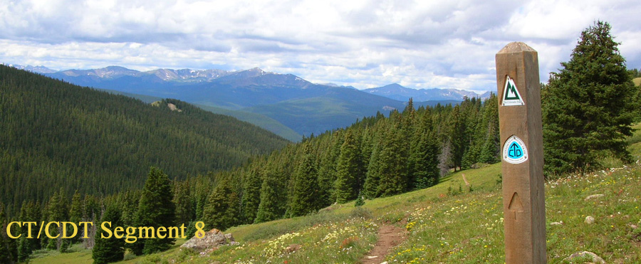
CT SEGMENT
4:
Always gotta have a Plan B, you know. OK. So this wasn't one of my best ideas, trying to run a couple of CT
segments this early in the year. The plan worked on Segment 3 because of
its lower elevation, but it was too soon to be doing Segment 4. My bad.
Read on to see if I finished anyway. <grin> I mentioned yesterday that I had some concerns about Segment 4 and
yes, I did lose sleep over them. I was worried about possible deep snow,
especially in shaded areas. Could I get through it? Would I lose the
minimally-marked trail? It's been a very wet spring, so flooded creeks
were a concern. So was deep water through the sub-alpine bog area
mentioned in the CT guidebook as causing continual grief to trail
maintainers. What about a nasty afternoon storm through the high Lost
Creek Valley? Maybe there would be impassable logjams, downed trees, or
rockslides . . . oh, my, can I come up with worst-case scenarios
when I'm trying to go to sleep!
Not all of my fears were realized, fortunately. In fact, the first
nine miles -- the ones I was most worried about because they are at the
highest elevations -- were a total delight. I didn't run into "major
obstacles" until the tenth mile, and by then I was so far in that I was
determined to keep going. I spent over an hour wondering if I'd made the
right decision. So much for Plan B. THE REASONING BEHIND PLAN "A" Hiked, run, or ridden southbound (actually westbound in
this area), Segment 4 has a net elevation gain of about 2,840 feet and
loss of about 1,300 feet. We had two goals today: for me to run
the whole segment from end to end, and for Jim to do twelve to fourteen
miles in the same out-and-back fashion as yesterday. That meant he'd
drop me off at one end, drive around to the other, and run in from there
to meet me. According to the profile in the guidebook, there is a
fairly gentle seven-mile climb going southbound from 8,280 feet up to
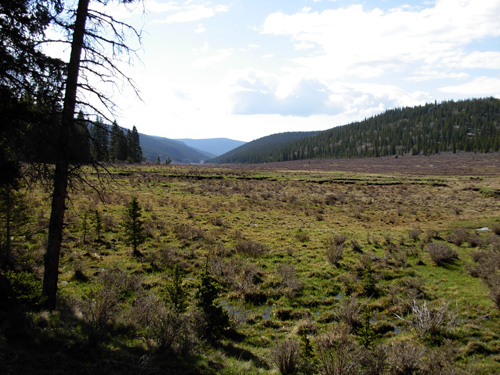
10,650 feet, the second-highest point in the segment. The next seven
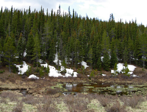
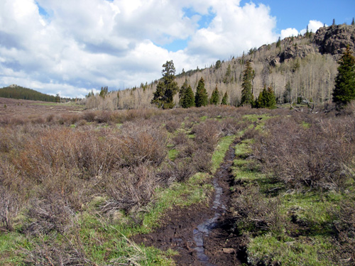
miles are all above 10,400 feet through the Lost Creek Valley (photo
below). On the
profile, this section looks sort of like a large "bowl," topping out at
nearly 11,000 feet at mile 14.4. The last two miles drop
815 feet to the Long Gulch trail head.
On paper, it appeared that the best way for Jim to get in a
good climb up and down would be if he started on the northern/eastern
end at Wellington Lake Rd., climbed up in the southbound/westbound
direction to meet me on the trail, and turned around to go back down to
the truck. It was fine with me to go the "wrong" way on this
section because it meant I'd be running the highest section first and be
less likely to get into the usual afternoon thunderstorms on the most
exposed part of the course. It also meant I'd be running a net downhill
of 2,840 feet, helping to equalize our times better (Jim's faster,
especially uphill). Finally, since it was in the high section that I was
most likely to encounter any problems, if I had to bail out and
turn around it wouldn't take me as long as retrace my steps. Because the guidebook directions are written only
southbound, I hand-wrote them in my little notebook to carry with
me. Jim programmed the GPS with the waypoints and I carried that gizmo
for the first time since last August. That would prove to be the best decision
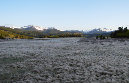
I made today. HOW MUCH ADVENTURE IS TOO MUCH? When I walked the dogs early this morning I noticed lots
of frost in the meadow between our campground and Kenosha Pass. At
nearly 10,000 feet, the air was decidedly cooler than it was at the fire
station. I took this photo of snow-capped mountains toward the east, the
direction I'd soon be running and hiking. Yikes! It was beautiful, but
intimidating. It's not like we thought to bring our snowshoes with us!
We drove about fifteen miles to the Long Gulch trail
head. Cody and I got an earlier start this morning (7:45 AM). My pack
was full of extra water, food, clothing, and gear in case my paranoia
turned into reality. I felt an odd mixture of trepidation and
excitement, hoping for a good adventure but not TOO much adventure. Know
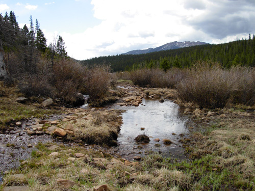
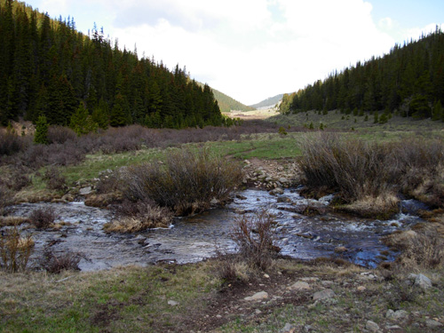
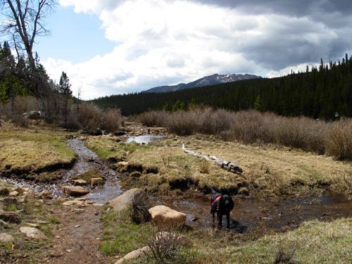
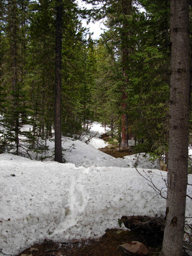
what I mean? I kissed Jim goodbye, crossed my first overflowing creek
right at the trail head (photo below), and headed up the nice
switchbacks to almost 11,000 feet at mile 2.2 (going "backwards,"
remember).
It took Jim over an hour to drive all the way around to
the other trail head on Wellington Lake Rd. He started his run the
"correct" direction about 9:15 AM, hoping to rendezvous with me on the
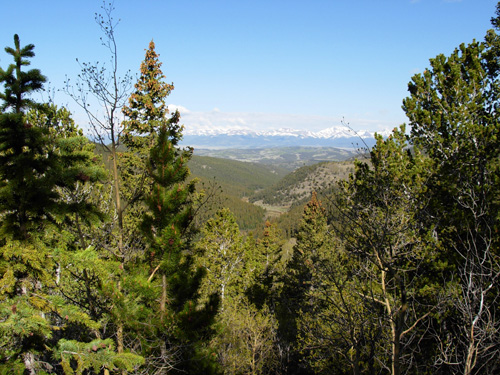
trail about six or seven miles in. I loved my first section of trail up, up, up through a
mature forest of spruce and fir. The trail was pretty smooth and there
were a few vistas toward the snow-topped Continental Divide to the west (below)
Despite my fatigue from running as much as I did yesterday, I was able
to climb better than in the last four miles of Segment 3. I think it was
the adrenaline. It sure wasn't from a good night's rest.
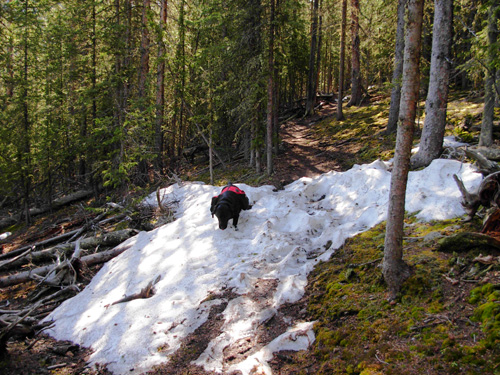
I was sort of excited when I first saw some
snowdrifts across the trail around 10,500 feet. Cody was a riot, jumping
into the middle of each drift, burying his nose and scooting through the
loose snow, then rolling around in it like a cat in catnip. Too funny!
He always does this if the snow is soft enough.
We ran into maybe ten low drifts on the way up to the
high point. I was able to skirt around most of them. Boy, was I
relieved! My fear of bad snow conditions was apparently completely
unfounded, since the rest of the segment was at lower elevations. Seven
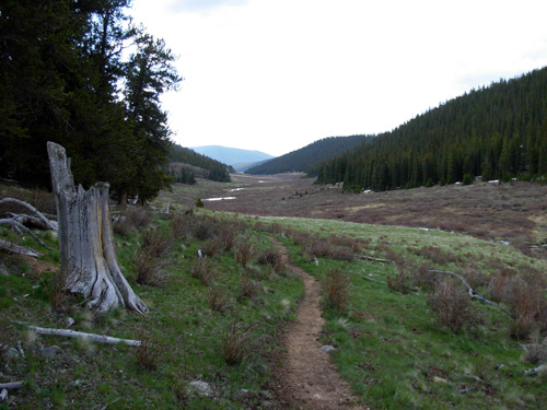
miles later I'd realize how wrong I was. VALLEY HIGH When I think of a valley, I picture something much lower
than the surrounding mountains. Yet the Lost Creek Valley averages
10,500 feet in sub-alpine territory, with the mountains on either side
rising only about 500 feet above the valley floor. Running through this part of the segment reminded me of
the Cochetopa Valley in Segment 20. Most of the trail was through open
meadows a little below the trees, with the creek meandering in typical
serpentine fashion on my right.
On the other side was more marshy meadow and pine trees
to the top of the mountain. Although there was no snow on "my" side, I
could see many snowdrifts on the far side of the creek. That fact didn't
concern me, however. After all, I'd been higher up already and had no
problem with snow.
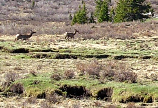
I was delighted to see a small herd of elk when I first entered the
valley. Even though Cody and I were far away, they were alert to our
presence and began running:
For someone acclimated to the altitude, this seven-mile
section through the "bowl" is fairly runnable. The trail undulates
gradually with no steep or long hills. I could run OK downhill, but this
high up I was soon gasping for air if I ran the flats and uphills. My
pace today was significantly slower than yesterday's because of the
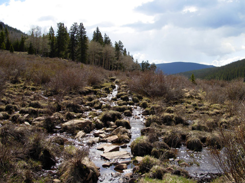
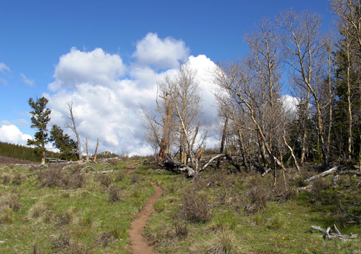
terrain and altitude. Much of the trail through the Lost Creek Valley was
smooth and dry, but it was frequently punctuated with wet, muddy, and/or
rocky sections where little creeks came down from higher ground. I'd
guess it's drier in August than in early June. There were also some
narrow trenches that were hard to navigate (third photo).
Cody loved splashing around in all the water. We both
got thoroughly wet and muddy feet and legs. I think I had almost as much
fun through there as he did!
There were no leaves on the shrubs or trees at this
elevation, but I did see a few low, sub-alpine flowers like white and Alpine Phlox, pink Moss Campion, and Marsh Marigolds.
I saw lots of evidence of wildlife and more domesticated
animals (droppings from moose, elk, bears, horses, and cows) but saw no
other critters than the first small herd of elk. Since it was a weekday,
I didn't see any equestrians or cyclists. This would be a rough trail to
ride a bike, and they aren't allowed in the six wilderness miles I was
approaching. There is a long road detour for cyclists doing this
section. I saw only one hiker in this part of Segment 4. When I asked him
about trail conditions ahead, he told me only that it was "wet."
Apparently he'd gotten on the CT at one of the intersecting trails, or
else he wanted me to be surprised in a few miles. About 8.6 miles into the run the trail started following
an old logging road and entered the Lost Creek Wilderness Area. I had
already begun a gradual two-mile ascent to the second-highest point in
the section at 10,650 feet. I was well ahead of my 2 PM "deadline" to
meet Jim near that summit and told Cody we should be seeing him pretty
soon. I was also pleased that so far I'd run into no insurmountable
problems with excess snow, water, or deadfall. Why had I been so
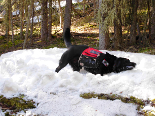
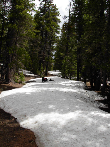
worried? Hmm . . . what's this? More and more snowdrifts started appearing
around 10,400 feet on the shady logging road:
As the snow got progressively deeper and more difficult
to bypass, the CT hung a right onto a narrow trail through
the mature pine forest at 9.4 miles going my direction. I almost missed the turn because the
intersection was marked with only one small plastic CT sign cut into a
tree. It would be one of only two or three markers I'd see in the next 1.8
miles until I dropped back down to a logging road again (not sure if it
was the same abandoned road). I noted the
time at 11:30 AM when I got on the trail. As the trail narrowed, it became increasingly difficult
to follow with the ground mostly covered in snow. I relied on three
things to get me through this section: Cody's nose, other hikers'
footprints, and my GPS.
I had continual doubts that I was on the right trail.
Sometimes the footprints went in different directions when people
apparently went the wrong way and came back to the real trail. At one
point, I completely lost the footprints for about a minute, and then
realized there was a switchback. The trail was narrow enough that
I usually couldn't just look ahead and tell exactly where it went. It
was such a relief when I would see a CT marker and know I was still on
course. I also frequently checked the GPS, which I had zoomed in real
detailed, to make sure I was going the right way. Oddly, I felt more
relieved to see markers than I was to be on the right GPS track -- I
guess they were more tangible. Cody was more adept at going around the deepest
snowdrifts; it was difficult for me to get past some the low
branches and fallen trees so I ended up going through the snow more than
around it. I tried everything from using the existing holes other hikers
made to taking my own route. Neither was very satisfactory. The snow was
so soft that I often post-holed up to the top of my thighs and had to
roll out of the drift because it was impossible to lift my other leg
high enough to get into the next hole! I dropped and rolled more frequently than I accidentally
fell. In one accidental fall my left calf seized up and it was very hard
to get myself out of the hole I was in. Twice my right foot got stuck
and I had to dig it out with my hands and the one trekking pole I
carried.
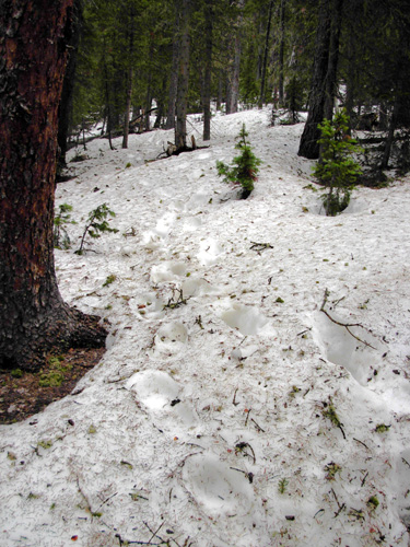
It was an excruciatingly slow slog through the snow! The
photos above are near the beginning of the snowdrifts. As they became
deeper and I realized I was up against that 2 PM "deadline" with Jim, I
was totally focused on getting through the mess as quickly as possible
and not getting hurt or lost and I didn't take photos of the worst parts
of the snowfield. THERE'S NO TURNING BACK Never once did I consider going back. I had come too far
and I knew I'd soon be dropping down to lower elevations out of the
snow. At times I just had to laugh at myself. I'm sure I was a sight,
flailing about in the waist-deep snow! Too bad no one else was around to
take my picture. I was also aware of the total silence and serene beauty
of the snow, despite the problems it was causing me. I had plenty of
fluids, calories, and energy and I was moving steadily enough to keep
warm in shorts and a lightweight, long sleeved technical shirt. My legs
and arms got all scratched up from the sometimes-crusty snow and rough
tree branches, however. It took me about 75
minutes to travel the 1.8 miles that traversed the NW side of
that mountain until I dropped back down to a logging road below the
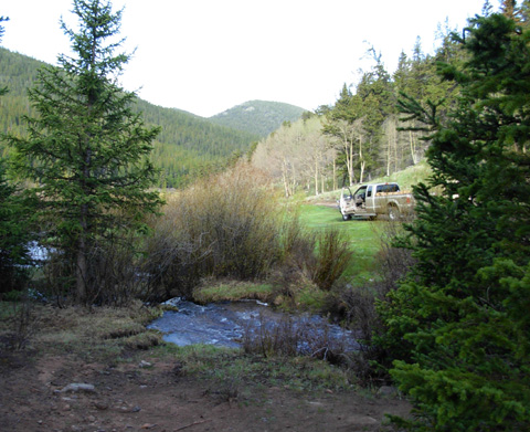
snow level at 9,900 feet. And then a miracle happened. There were three CT markers
on the trail I'd just left for people going the opposite way, but none on the logging road
going my direction. I stopped a
minute to check my notes and GPS, then turned right and began walking
down the rough, narrow "road." Jim saw me, yelled, and walked
toward Cody and me. We were both very relieved to see each other! I wasn't as worried about Jim as he was about me. I was just trying to
get down that mountain as fast as I could so he'd know not to return to
the first trail head to pick me up. I figured he got up to the snowfield
and decided to wait for me farther down the mountain. He hates snow and
couldn't wait to move from Montana when he retired after having to deal
with it for eighteen years. I have more fun in it than he does because
it's more of a novelty to me. "JUST FOLLOW THE FOOTPRINTS" Turns out Jim
missed the turn to the trail I'd just come down, at the intersection
where we "connected," and he'd slogged through increasingly deep snow as
he ascended the logging road off-course for about a mile. I believe I was
traversing the correct trail above him on the same side of the mountain
while he was lower down. I imagine he got close to where I found the
trail near the top of the mountain, the place where he finally turned
around. He said he often called out for Cody, but
was too far away for Cody to hear him. On his way up the mountain, Jim met two female hikers
coming down who warned him about the snow and advised him to just follow
the footprints. Well, a bunch of those footprints also missed the left
turn and went on up the mountain on the logging road instead! The only
reason Jim turned around was because the footprints suddenly stopped
when the folks ahead of him apparently realized they weren't on the correct trail. Now consider all the possible scenarios that could have
occurred if Jim had not returned to that intersection at the same moment
I did. We're talking "nightmare" here. He wouldn't have known I'd
already gone down the mountain -- even if he saw dog prints in the snow
farther up the right trail. It could be someone else's dog. He might
have kept going up through that mess, never seeing me. I could have
gotten down to the truck and waited for hours, wondering what happened
to him. Etcetera. The possibilities are endless and grim. Is it any wonder that Jim said, "Never again!" ??? It was a long 5.4 miles down that rocky logging
road to the end. We were drained physically and emotionally. Jim said it
was one of his worst days ever on any trail because of all the worry
about how I was faring all morning at the higher elevations. And he didn't
even get in a quality run because of the rough uphill trail. I felt very
guilty that I'd put him through that stress and I was tired
from fighting my way through over a mile of deep snow. Neither of
us felt like running the remaining miles and we didn't enjoy the pretty forest, bright blue
sky, and boisterous streams as we
gradually descended to the trail head on Wellington Lake Road.
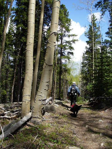
We came out of the Lost Creek Wilderness Area about two miles from the
trail head. We got off the logging road and onto a beautiful trail full
of bright green aspens with
one mile to go. The sky had darkened by then (about 2 PM) so we hurried
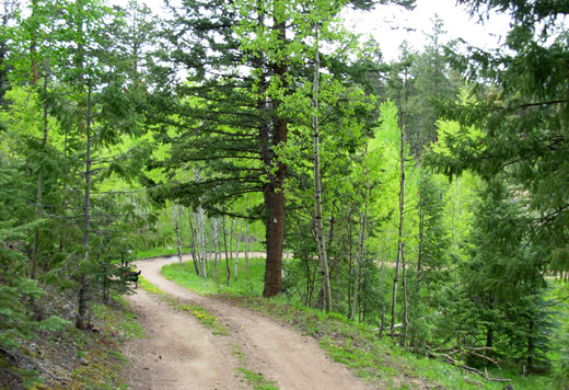
faster to beat the rain. The last three-tenths of a mile was on a smooth
dirt road:
It was good to be done. It took me a long 6˝ hours to go only 16.6
miles. Without the snow, I would have finished about an hour faster.
We headed back to the camper at Kenosha Pass, ate a late lunch, got
cleaned up, and decided to start our trip to Dayton, WY today so we could
still reach the campground there tomorrow. We were fortunate to hit
light rush hour traffic around Denver at 5:30-6 PM. We stayed at a
Wal-Mart in Cheyenne overnight. My whole body felt like I'd been hit by
a truck, but I slept deeply.
I'll do some Monday-morning quarter-backing in my next entry about what we did
right and wrong today, and how to balance my quest for adventure with Jim's
concerns about my safety.
Sorely yours,
Sue
© 2007 Sue Norwood and Jim O'Neil |