|
2007 ULTRA RUNNING ADVENTURES
| ||
|
Runtrails'
Rocky Mountain Journal
CT SEGMENT
3:
On top of that, it's a great section to run!
I cannot begin to tell you how happy I am to be back on the Colorado
Trail. It was the highlight of my summer last year, and I've been
anxious to return to finish the seven segments I didn't have time to do
then. I left the area with about 370 miles completed and another 113 to
go. If you haven't read about the segments I did last year, I encourage
you to check out the relevant entries in the 2006 journal (link at left
for the topics page). There are numerous photos in each CT entry, many
showcasing the drop-dead beautiful panoramas along this trail. This
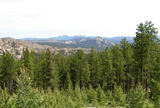
segment doesn't have expansive vistas above tree line, but it is quite
pleasant nonetheless. A couple weeks ago, I came up with what I considered a brilliant
alternative to our original summer plans. Instead of
going directly from our home in Virginia to Wyoming for the Bighorn
races, why not head first to Colorado to run two segments of the CT near
Denver? We
could still arrive at the Foothills Campground in Dayton, WY on June 5 as we'd
planned, although it would mean leaving home a few days earlier and
increasing the mileage a bit by going to Colorado first. But it would
enhance my chances of finishing the CT this summer and having more
time to run sections of the Continental Divide Trail.
I figured my two "missing links" (Segments 3 and 4) west of Denver
aren't at such high elevations as the five (Segments 15-19) farther
south that I'll do after Bighorn, so altitude shouldn't be as much of a
problem there. We'd be coming from only about 1,000 feet in elevation at
home, but perhaps I could sneak in quickly and run the segments before
my body realized it was 6,500 to 9,500 feet higher than it was used to
-- a strategy runners often use when they're traveling to a high
altitude race. Well, that seemed to work pretty well today until I hit the four-mile
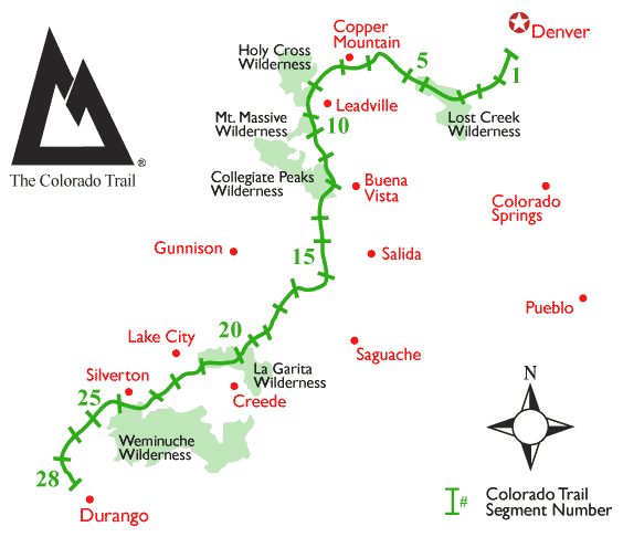
climb at the end! WHATEVER WORKS More about today's run in a moment. First, go look at the large CT
map (link at left) to refresh your memory of the trail's layout. Note
that the first seven or eight segments go mostly east-west, then the
trail heads due south. The last half of the CT runs in a NE-SW
direction. It's kind of a convoluted "S" curve, as you can see
in the
Because of increasing altitude and severe weather, most thru-hikers go
southbound from Denver to
Durango. (See more about this in my introductory remarks
from
June 24, 2006.)
Last year I did most of the twenty-one segments I ran in that direction,
but for various reasons I sometimes went north or east instead of south
or west. I even did that occasionally during my end-to-end journey run
on the Appalachian Trail in 2005. My goal with the CT is just to finish
every mile in whatever order or direction works best intermingled with
our races, volunteer commitments, and the training Jim needs for his
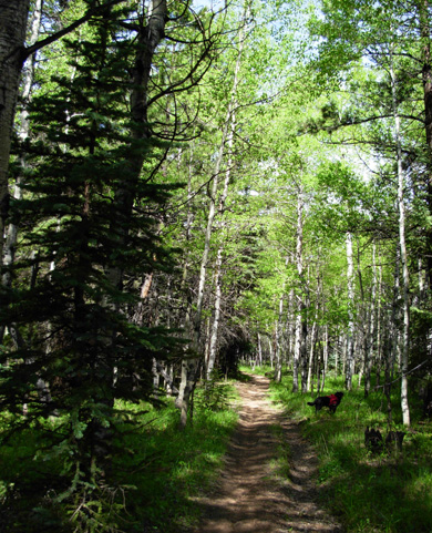
hundred milers. PERFECT RUNNING TRAIL Today I went the more popular east-west direction on Segment 3. Jim dropped Cody
and me off at the campground where I ended Segment 2 last summer off FS
550 (photo below) and drove around about thirty miles to the other end of the segment
at Wellington Lake Road.. He did a ten-mile out-and-back run from that trail
head.
The weather was great: warm and sunny when I started at 8:45
AM (Jim began about 10) and no rain despite thunder and menacing clouds
in the distance, beginning around 11 AM. That's kind of early for the
typical "afternoon" storms to begin. We did get into some rain as we drove back to the camper, and into
the evening.
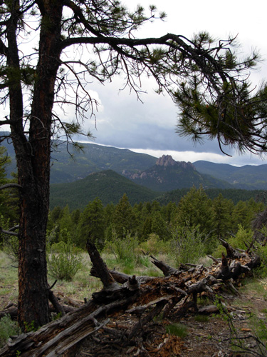
This is a relatively easy section -- as the CT goes -- with only 1,520 feet
gain westbound and about 600 feet of loss. Elevations
range from 7,420 to 8,290 feet. There is some confusion about the
distance of this segment. The CT guidebook indicates it is 12.7 miles, but
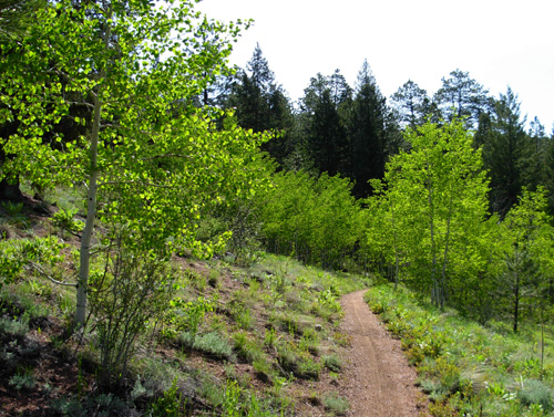
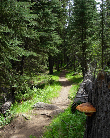
the official GPS waypoint software and our unit say 13.7, so that's the figure I'm using. Segment 3 is a near-perfect course to run or ride,
with many miles of smooth, gritty trail. There are roots and rocks, of
course, but not too many. That's saying a lot from this rock-challenged
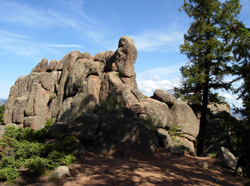
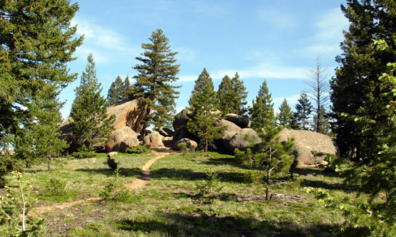
runner who easily trips and falls down! There were lots of interesting
boulders in the eastern half of the segment. Unlike the AT, hikers
aren't directed over them.
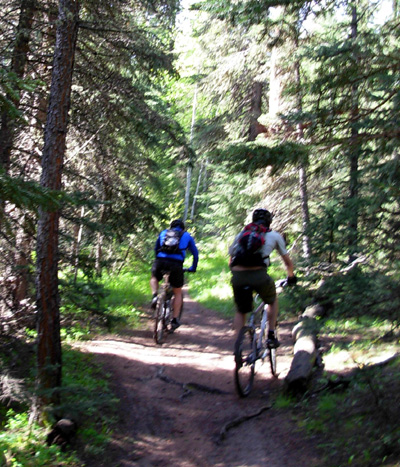
And because of its proximity to Denver, hikers and cyclists flock to
Segment 3, as indicated in the quote at the beginning of this entry. I
expected the worst on this sunny weekend day, and I wasn't disappointed.
In the first nine miles Cody and I were passed by eighteen cyclists,
some going 'way too fast down hills (we almost got run over twice).
Because some of them stopped along the way or did side trails, they
passed me multiple times. I was real happy when two women riders coming
from the opposite direction followed cycling protocol, ironically
included in the guidebook chapter on this segment, of stopping to let me
pass (instead of me having to jump out of the way). Below are two of the
guys who were very polite and gave us lots of warning:
I didn't see any bikes the last four miles, but met about three dozen
hikers out for the day or weekend. There were three groups of teenage
boys (Scouts?), a couple families, and several twosomes. Because the
next segment gets up to 10,500 feet, I asked everyone if they'd been up
there this weekend, but no one knew the course conditions on Segment 4.
I also didn't see any equestrians on this segment today, although there
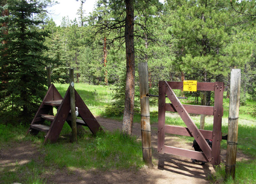
were the usual signs they'd been there recently. This sturdy stile (for hikers) and gate (for cyclists and equestrians, but I
used the gate!) are near the Meadows CG:
Despite the altitude, I ran a very good pace the first nine miles
until I saw Jim along fast-flowing Buffalo Creek at the beginning of a
four-mile climb to the end. Despite taking over fifty photos, getting
out of the way of cyclists over a dozen times, stopping for Cody to
drink and cool off in the numerous streams, and talking to hikers, I
averaged a blistering (for me) pace of under 14 minutes/mile the first
two-thirds of the course. I was much
slower going uphill the last four-plus miles, but still finished in 3:42.
I definitely felt the altitude on that uphill section, as did Jim. Of
course, he's still got some fatigue from running fifty miles a week ago
at the Old Dominion Memorial 50-miler.
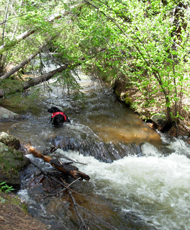
This is also a great section for dogs, especially the first nine
miles. There was lots of water from the spring run-off. Later in the
year, some of the seasonal streams are probably dry. The last four miles
were dry until near the Wellington Road trail head. Jim brought Tater in
from the dry end and she was very thirsty by the time they met Cody and
me. Fortunately, Tater could hop into Buffalo Creek just then. She was
starting to lag, so I took her to the end with Cody and me while Jim
kept going another mile before turning around. Cody had unused water in
his pack that both dogs drank in the middle of the dry section. This appears to be a very wet spring in the Colorado mountains. Jim heard
on the radio that the paved road up to the top of nearby Mt. Evans (a fourteener) had just been cleared
and repaired, and we've heard other reports of higher/later snow levels in CO and WY this year. Last year was an early spring
and lower than normal snow levels. You know, dealing with heat in the
90s in Virginia before we left home, I just didn't even consider that
snow might be a problem if for no other reason than we're hitting the
trail twenty-two days earlier than I ran the first segment on the CT
last year. I should have realized snow and snowmelt could be a problem. Fortunately, it wasn't a problem on this section. I didn't have any
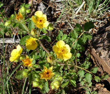
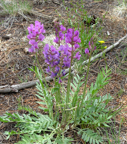
deep creeks to cross, and the trail itself was remarkably dry. Many wildflowers
are out. I saw a dozen or more different kinds today, including the
cinquefoil and lupines below:
This segment is mostly wooded and full of mixed pines and aspens
sporting fresh green leaves below 8,000 feet.
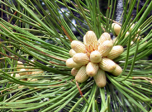
Tender, light green spring growth is evident on the tips of the fir and
spruce trees, and new little pinecones are forming on the
branches:
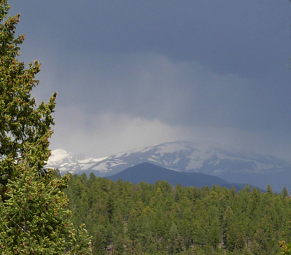
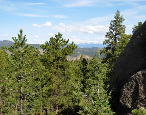
There aren't a lot of expansive views, although I could see distant
snow-capped peaks (Mt. Evans? Gray? the Ten-Mile Range?) several
times from rock ledges.
Jim and I both enjoyed this section. I'm getting anxious about Segment 4
tomorrow, however. Most of it is over 10,000 feet. After hearing that
there is more snow this year than last, I'm concerned about snow
conditions. A fella at REI in Denver told me snowdrifts on the shady
side of mountains could be a problem that high up this week. And
what about all the water from snowmelt and recent rains? Will the
sub-alpine boggy area that drives CT volunteers crazy in Segment 4 be
passable? Will
the creeks be too high to cross safely? What if I have to turn around
and can't reach Jim to tell him where to pick me up? <sigh> I'm not sure how much sleep I'll be getting tonight! Maybe
coming out here this early wasn't such a brilliant idea after all . . . Anxiously yours,
Sue
© 2007 Sue Norwood and Jim O'Neil |