|
2007 ULTRA RUNNING ADVENTURES
| ||
|
Runtrails'
Rocky Mountain Journal
CT SEGMENTS 18-19:
~~~~~~~~~~~~~~~~~~~~~~~~~~~~~~~~~~~~~~~~~~~~~~~~~~~~~~~~~~~~~
I have not been particularly eager to run these two sections because
they are not real scenic, twenty miles are on jeep roads that are open to motorized traffic, less
than two miles are in the woods, and it is too arid to take Cody with me.
The one thing I was looking forward to was more running, since so
much is on dirt roads and the grades are mostly easy. According to the CT guide, a lot of the "trail" in Segments 16-18
follows existing motorized routes because the organization was in a
hurry to open the trail end-to-end back in the 1980s. I don't know if
there are still plans to re-route any of these miles onto real trails or
not. It seemed like I was only 200-300 feet from nice, cool woods on
much of today's trek. I hope that someday trails are built there.
Fortunately, on this sunny summer Sunday I didn't have to share the
dirt roads with hoards of ATVs, dirt bikes, motorcycles, jeeps, or other
4WD vehicles - only about three pick-up trucks went by me. That's very,
very good, because I was running and walking though deep dust most of
the day. It's been very dry out here, except for runoff from snow and
the occasional mud that creates. GETTING HERE After finishing Segments 14-15 on Friday afternoon we
pulled out of our dandy overnight camping spot at the Poncha Spring
visitors' center and headed westbound on US 50 about sixty miles to
Gunnison so we'd be closer to today's trail heads ("closer" being
relative for this remote part of the CT). This drive is scenic, but it was a bit hazardous to
our truck. Soon after leaving Poncha Springs, we had to climb about
4,000 feet to Monarch Pass (elev. 11,312 feet). The truck's diesel
engine started to
overheat again, requiring a short stop to get it cooled down. Not a good
sign. The long grade down to Sargents also took considerable focus to make sure
the brakes didn't overheat, too. This is one of Colorado's more
challenging passes if you're hauling a camper or driving an RV. Last year we looked long and hard for free forest
service or BLM camping
spots in this area, knowing we'd be back to finish the CT. We didn't
find anything suitable, so we decided to pay real $$$ and stay again at
the Tall Texan campground near Gunnison. Although we were parked next to
a real curmudgeon (the worst I can ever remember in my entire camping history),
it was nice to have WiFi at the office, a decent cell phone connection
to get on-line in our camper, and a clean, inexpensive laundry room to do six
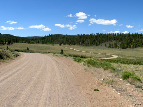
loads of dirty clothes, towels, and dog bedding during our three-day stay. From Gunnison, it's a one-hour drive on twisty, turn-y paved CO 114 to
the CT trail head. I love this road because it follows the Cochetopa
Creek through a scenic canyon with colorful rock walls. We had been down that road most
of the way to North Pass last year, but not as far as the trail head we
used this morning.
What we didn't know was that we could have camped
FREE there last night in the huge parking area where the trail crosses
the road. Rats -- too late for this time, but we can use it when we return in three or four
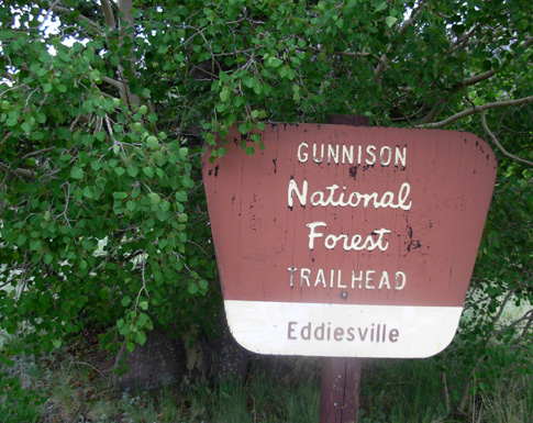
weeks to do Segments 16-17. Getting to the other trail head for the section I ran today --
Eddiesville -- is about
the longest drive on the entire CT, at least the rendezvous points to
which I've subjected Jim (there are others that are even worse that I
have spared him by doing two sections in one day).
This was the second
time Jim's had to go to Eddiesville, which is just a trail head and
camping area, not
a town. It's a two-hour drive from Gunnison. Most of the
sixty miles are on dirt roads that are fairly smooth (2WD accessible)
but just SLOW. I would need that tree, above, at the end of today's
segment. In order to get an earlier start -- and to be able to follow the
trail directions more easily -- I decided to run the "right" way this
time by going southbound (which is mostly west in these two sections). Jim chose to
return to the campground instead of waiting for hours at the Eddiesville
trail head, but it meant being on the road a total of six hours. Ugh!
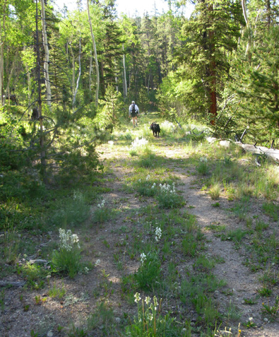
It actually took longer, with the flat tire. More about that later. HITTIN' THE TRAIL I got to share the first 6˝ miles of today's run with
Jim and Cody, then they turned around and went back to the truck.
Although there wasn't enough water for Cody to do the entire 27+ miles
with me, he could carry what he needed for thirteen miles. As
advertised, there were no water sources for him after the first half
mile and we had to give him water from his pack four times. Because of the distance, we got an earlier (7 AM) start
than last time. I estimated it would take me 9-10 hours.
Jim almost ran out of water on this very sunny, very
warm day with little to no shade. He was carrying three 20-oz. bottles
with Boost and/or water, but gave me about 15 oz. of water when he
turned around. I'd already gone through most of a 28-oz. bottle of water
in the first 6˝ miles and had "only" 95 oz. in my Camelbak bladder
for
another 21+ miles. I also carried a 28-oz. bottle of concentrated Perpetuem
and the two
flasks of Hammergel, both of which require plain water to chase down. I rationed my water
the whole way, although I could have used iodine to purify water when I
finally reached Cochetopa Creek. I still had a few ounces of water left
at the end. This is a stock tank just before I reached the Cochetopa
Creek. It's not a good source of drinking water, but I sure wanted to
jump in after not seeing any creeks or ponds for eighteen miles!
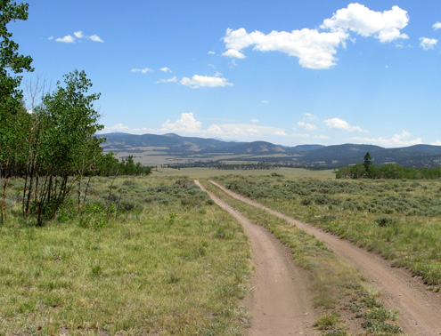
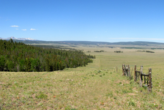
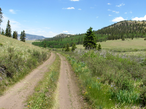
Segment 18 is very runnable because of all the roads and
mostly-easy grades. Jim got to see the most interesting part of this
segment in the first six miles he was with me, which were gradually
uphill. He got to run more going back down to the truck. He also
enjoyed more shade than was on the rest of the course.
Soon after that, I was mostly in
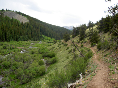
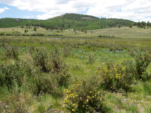
hilly, wide-open rangeland for about thirteen miles until the Cochetopa Valley.
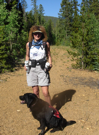
Jim took this photo of me before I struck out on my own:
I was already wishing I had on running shorts and not zip-leg pants. I
was hot then, and toast later on. Sunscreen kept me from getting a
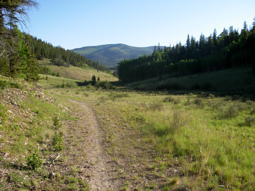
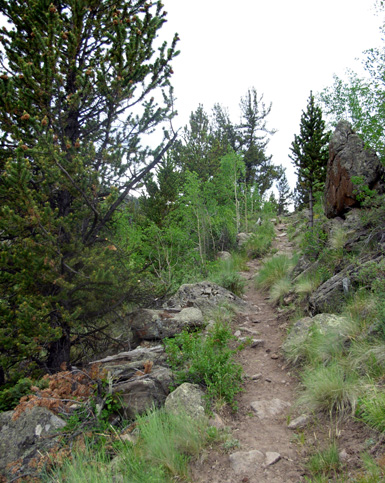
sunburn, however. The northern (eastern) half of Segment 19 is also mostly
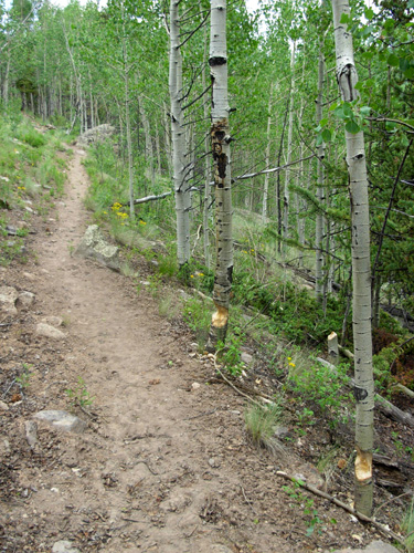
roads, then primarily rough single-track for about seven miles along
Cochetopa Creek to the Eddiesville TH. Going my direction, Segment 19
was mostly uphill so I wasn't running much. The single track was
sometimes smooth, sometimes rocky
and full of dry, rough divots made by horse and/or cattle hooves.
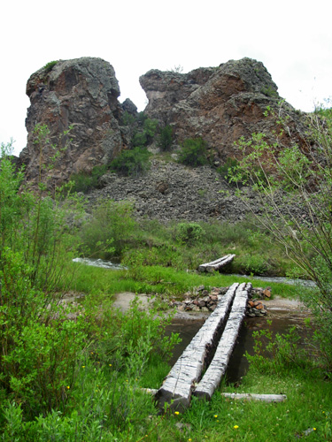
The trail crossed Cochetopa Creek only once, on these
two bridges, then stayed fairly high above the creek the last few miles:
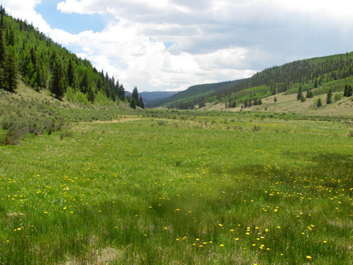
Despite the rough trail, I enjoyed this section the most
because of the meandering creek and more interesting terrain. I don't
see how that creek EVER gets to its destination the way it wanders
serpent-like through the drainage and along CO 114.
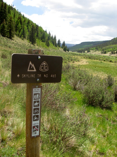
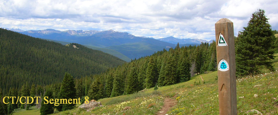
All of today's mileage was also on the Continental
Divide Trail. This isn't my idea of "running the Divide" -- just goes to
show that the Divide isn't always on precipitous knife-edge mountain
summits all the way from New Mexico to Canada. The Colorado Trail was well-marked
the whole way today, with many more markers on posts than the CDT had.
This post at the northern (eastern) end of the Cochetopa Valley has
symbols for both trails:
I ran as much as I could today, considering the heat,
the altitude, all the fluids I was carrying, and very sore knees when I
ran downhill. For someone acclimated to an average of 10,000 feet, these
two sections are pretty fast to run or hike (Segment 19 would be faster
"backwards," though). Elevations range from 9,430 to 10,355 feet in
these two segments with only three or four short, moderately steep
climbs or descents. The rest are very gradual. It took me a couple minutes over nine hours to complete
this section. I'm pleased with that time. The official distance is 27.5
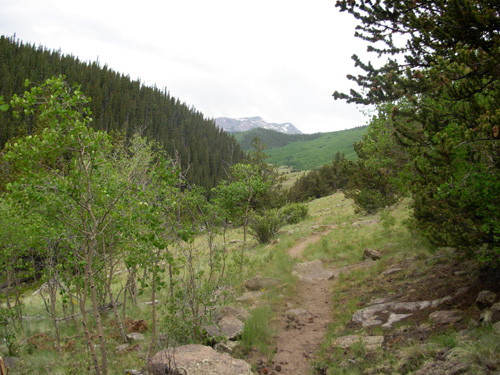
miles, but our GPS indicated over 29 miles -- not sure whose gizmo is correct. I could see snow-topped mountains in the distance but
didn't run into any snow on the trail at all today. The distant
mountains were like a beacon drawing me toward the San Juans -- I loved
seeing my progress all day as I trudged through sage brush-filled
rangelands that felt like a desert and dreamed of being back in the
mountains. Despite the dust, the lands around me were still fairly green
from spring snows and rains.
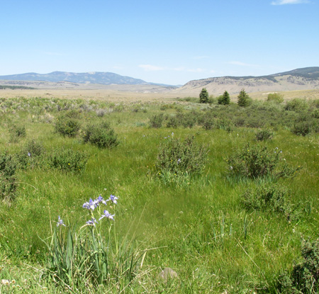
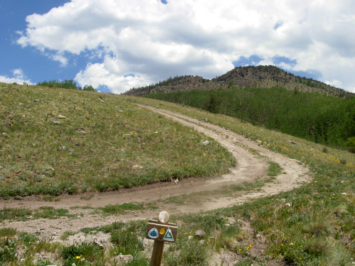
The view below was the most discouraging today. I could
see a distant, snow-capped mountain in my direction but there were many
miles of visible trail through scrubland to traverse before I'd get anywhere near it:
I tried my best to see the beauty along the way, so as to distract
myself from the openness of the land.
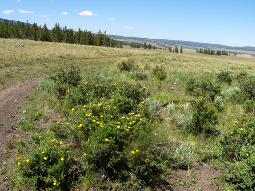
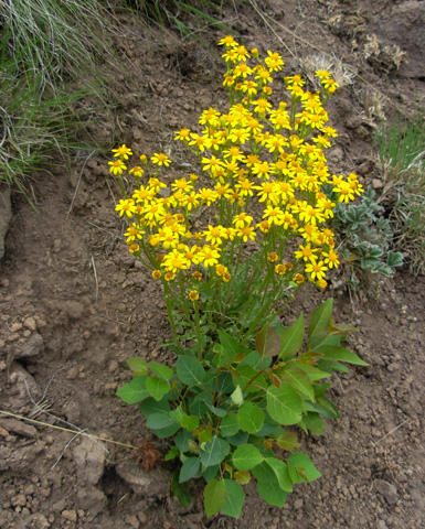
There were more wildflowers than I expected (I always
say it's better to have low expectations of a new trail and be surprised
than be disappointed when high expectations don't pan out!). I loved all
the white Lupines about four miles into Segment 18 and the blue iris in
a few marshy spots. Some of the most
colorful flowers were in a couple little wetland spots that were fenced
off to keep the cattle (and people) out.
There were also lots of flowers
in the Cochetopa Creek area:
I didn't see as many cattle as I expected, just a couple
small herds hunkered down in the shade under small stands of trees.
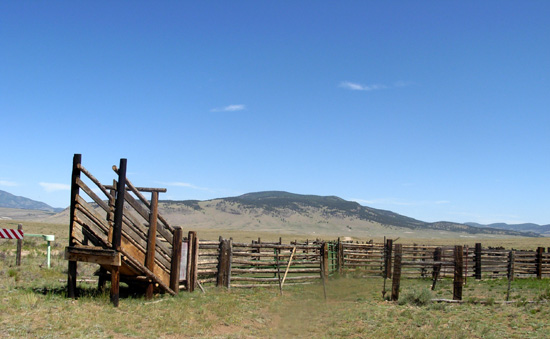
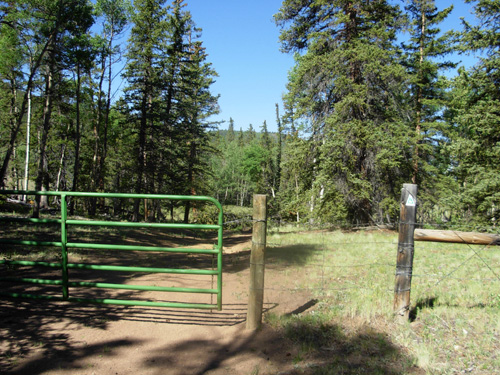
There sure were a bunch of cattle guards and gates I had to get past, though, probably
twenty. A couple had such tight wire closures that it was difficult to
open and close them. This one of the sturdier gates:
This was a red-letter day for wildlife. Jim spotted two moose
about three miles into the run but they were gone by the time I caught up to
him. The
only wildlife I saw along the trail were pika, marmots, and rabbits. There was
bear scat but no bears in view. The best wildlife sightings were along CO 114
as we drove to and from the trail heads in the early morning and late afternoon
-- mountain goats in the canyon, pronghorn antelope, deer, and a beautiful
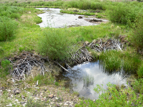
egret in a pond. Beavers were in evidence in the Cochetopa Creek area. They'd
been very busy cutting down trees, These partially-chewed ones were about 300
feet above the creek, which surprised me . . .
. . . and just below that, many stumps but no trees
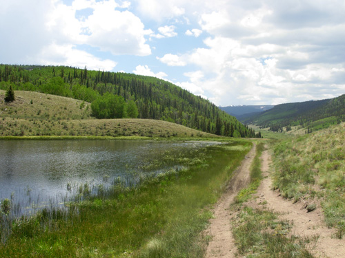
lying on the ground. Below is a beaver dam at another location in the creek:
There were two things I badly needed on this run and didn't
have with me -- my Dirty Girl gaiters for all the dust, and insect repellent.
The biting flies drove me crazy during the middle third of the run. Oh, and a pair of young, fresh legs would have been nice, too! Even though this is a remote section of the trail, I was
surprised I saw no one else all day except in the three trucks. No hikers, no
equestrians, no cyclists (there is a bicycle detour around the last few miles
in the La Garita wilderness). It was lonely out there.
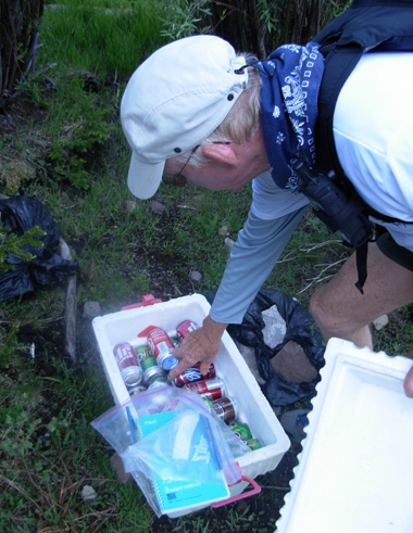
We were very
surprised to find the only "Trail Magic" I've seen on the entire CT about a
mile in from the CO 114 trail head this morning -- a cooler full of cold canned
drinks. I signed the register and wished I'd had time to read some of the
entries. The last to sign were the two CDT hikers Jim met on Friday, Pouch and Nemo. They'd been there four days ago.
They wrote that they've never seen Trail Magic on the CDT in New Mexico and
Colorado. It's such a lovely tradition on the busy Appalachian Trail, but the
CT and CDT see many fewer hikers and other trail users.
The sun shone brightly the first seven hours of my run,
then it became blessedly overcast. Fortunately I finished just before a
big storm struck. I was in some sprinkles the few minutes. I got done
earlier than Jim expected me to (it's always so hard to guestimate my
times) and beat him to Eddiesville by twenty minutes. I'd been running
in a singlet and shorts most of the day, but had to put on my pants
legs,
Marmot rain jacket, and gloves at the trail head because it got cold, windy, and
started sleeting -- quite a contrast to the rest of the day! That's when
I hunkered down under that tree in the photo with the Eddiesville sign
at the top of this entry. I was still warm when Jim drove up, despite
the storm. That wasn't the end of the drama though. About twenty minutes into the long drive home, Jim
unexpectedly hit a
hole and before long the left
front tire of the truck went flat. He wasn't expecting truck tire
problems this summer (we had to get new tires in Durango during last
summer's odyssey) so he didn't bring along a
"real" jack. He had to use the puny one that comes standard with a Ford
F-250. It worked OK and he was done changing to the full-size spare in
about twenty minutes, but it was the last thing he needed after such a
long day driving remote Colorado roads. Fortunately, it happened AFTER Jim picked me up, on a
lonely road and not a busy highway, when we weren't pulling
the camper, and it wasn't raining. Gotta look at the bright side! We could see the storm raging behind
a ridge and just hoped we didn't get deluged. We didn't. One more night at the Tall Texan and then we're headed for Silverton
tomorrow. We're really looking forward to about three weeks in the
stunning San Juan Mountains. Can I put my feet up now? I'm tired.
Sue
© 2007 Sue Norwood and Jim O'Neil |