|
2007 ULTRA RUNNING ADVENTURES
| ||
|
Runtrails'
Rocky Mountain Journal
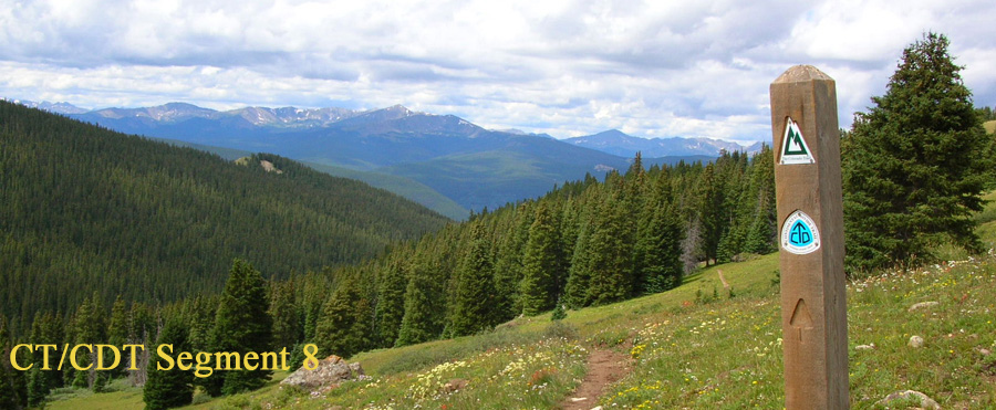
CT SEGMENT
14-15:
~~~~~~~~~~~~~~~~~~~~~~~~~~~~~~~~~~~~~~~~~~~~~~~~~~~~~~~~~~~~~
It sounded like a good idea last year: leave the southernmost six
miles of Segment 14 to run with the 14.2 miles in Segment 15,
making for a nice 20-mile run. The
mileages also worked out best that way for the segments before and after
these two. At 1:40 PM today, however, I was crossing US 50 west of Poncha
Springs and wishing I didn't have those last six miles to go! Since I
went "backwards" (northbound) today, that partial segment came last and
it was the least interesting and hottest part of the run. Make that "hike." I did more walking than running today,
despite a net elevation loss of about 3,700 feet. Those 20.2
miles took me 7:35 hours with all my various stops, 146 photos
(37 of them here), and
navigating through the snow. Snow?? Yes, I had more problems with snow today despite the best laid
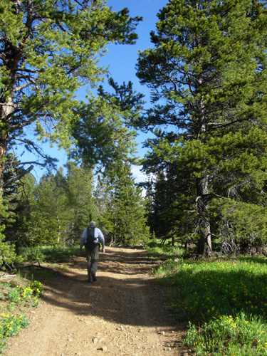
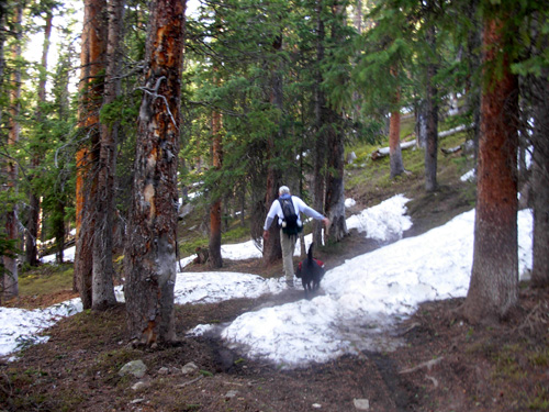
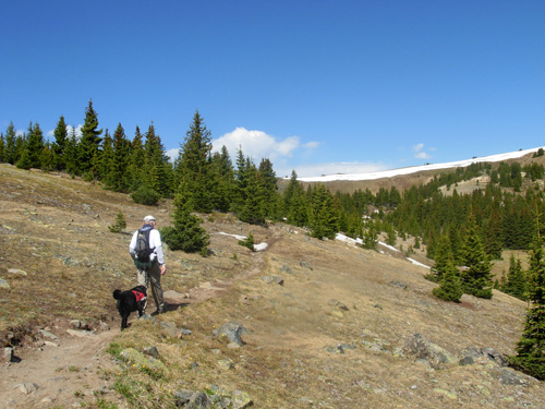
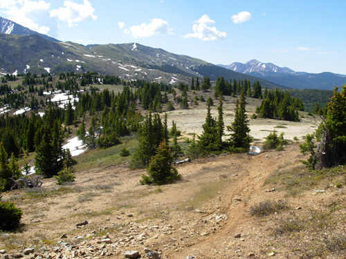
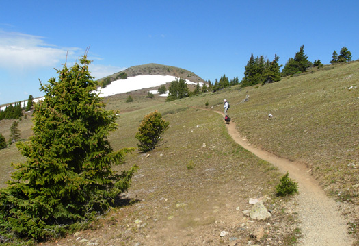
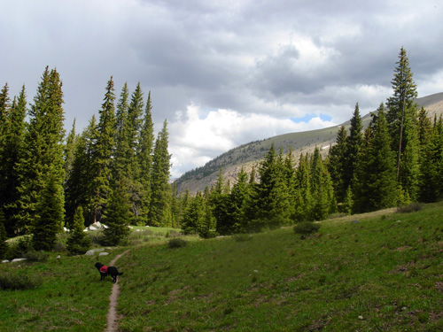
plans. But let's begin at the beginning . . . GORGEOUS TRAIL This morning, Jim, Cody, and I started up the trail from Marshall
Pass (elev. 10,842 feet) at 8 AM in bright sunshine with temperatures in
the 50s - 60s. I should have shed my zip-off pants legs and jacket long
before we reached the high point at 6.4 miles, but I didn't want
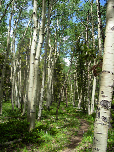
to take the time to stop until then. This first section was my favorite part today. The trail was good,
the pine and fir forest was lovely, and the views above tree line were
very nice.
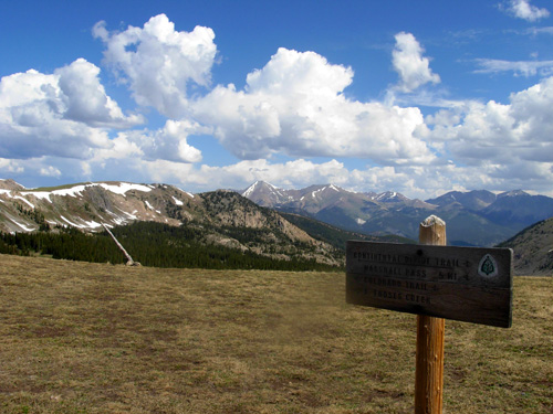
Signage at trail intersections was good and volunteers
had recently been up this way doing trail work:
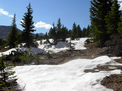
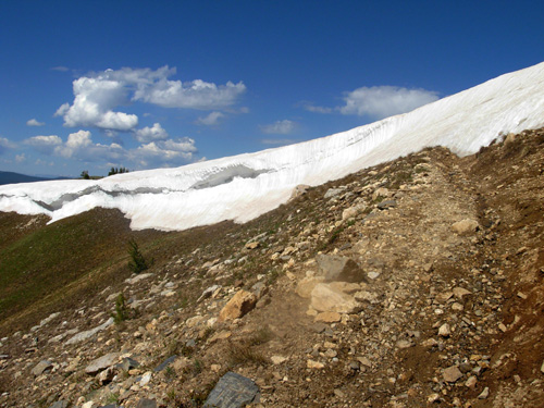
We encountered increasing amounts of snow as we ascended to 11,978
feet but we could skirt around most of the drifts on the trail. The ones
we had to walk through weren't an issue (except for one steep, slippery
snow cornice) and we could easily follow the trail. Not a problem!
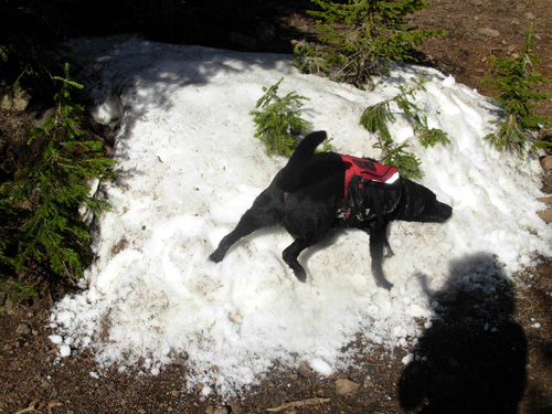
Cody loved the drifts and did his comical wallowing around in several
of them, making us laugh. He definitely needs more practice catching the
snowballs Jim throws to him, though.
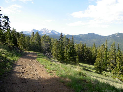
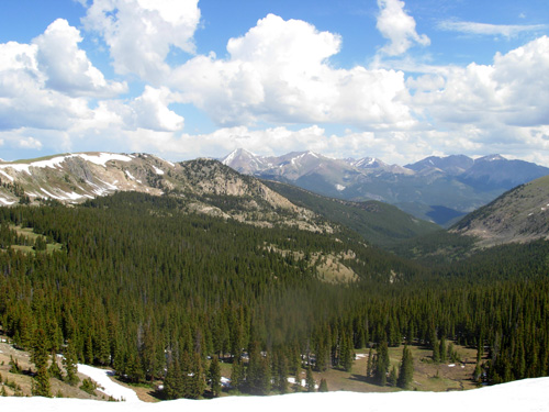
Me and my shadow, literally and figuratively Through and above the trees we had great views of snow-topped
mountains to the north, west, and south as we hiked and ran in a
mostly-northward direction. We got our first glimpses of the lofty San
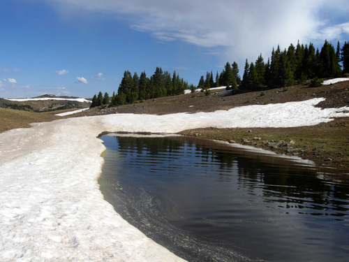
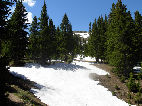
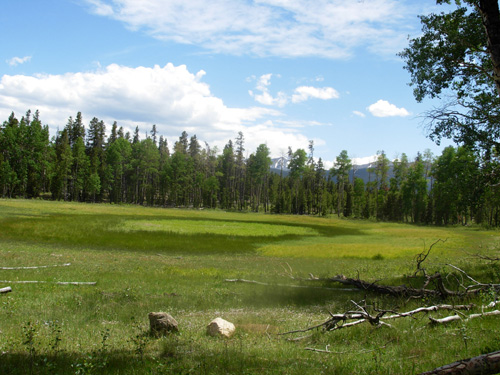
Juans to the southwest, our next major destination. Above tree line and about a mile from the high point we reached an
scenic plateau with a pool of water and the biggest patch of snow
yet:
Cody loved splashing around in that. We had good views up the NW slope of Mt. Ouray
and in all the other directions. It was more flat and runnable on this high plateau and we
started seeing more flowers than there
were below tree line. We dropped back down through an odd area with trees down
(avalanches?) and back into the trees. Note the line of snow to the left
in the distance. That's a big snow cornice we came to a little while
later:
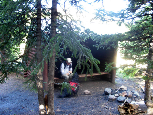
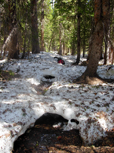
Down in the trees we found the shelter mentioned at the beginning of this entry
at the intersection with the Greens Creek Trail. It
didn't look very accommodating to overnight guests, but would be shelter
from a storm or cold winds. There was one "floor" board to step over at
the front of the three-sided wooden building, but no other floor boards,
just bare dirt inside. Makes even the most rudimentary shelters on the
Appalachian Trail look positively posh in comparison!
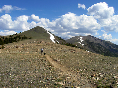
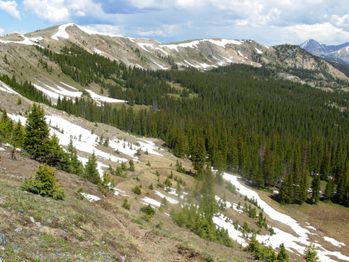
The next couple of miles to the highest ridge (Peel Point) were fun and
scenic. We were in and out of snow the rest of the way:
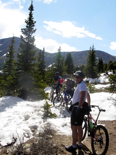
We could see a large area of snow up ahead, which we thought might be
our high point, and several tiny figures
rapidly descending the slope. We'd already seen bike tire tracks the
whole way in. This is a popular section, combined with the Monarch Crest
bike trail, for cyclists, so we weren't surprised to see nine cyclists
coming toward us in short order.
Looking back to the south at Mt. Ouray and other peaks as we got
past all the cyclists:
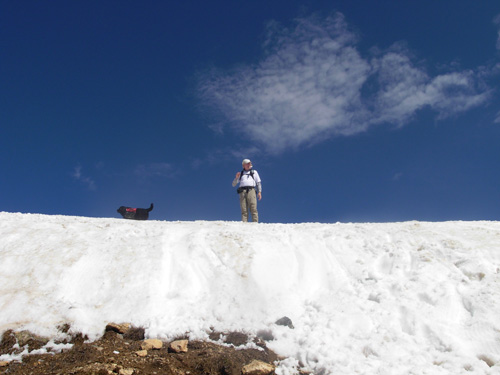
When we got to the snowy area we could see it was a thick cornice. We
knew from out GPS distance elapsed that it was NOT our high point. We
wondered how bad the snow was going to get even higher up!
We
could NOT see up and over it to the trail on the other side, but
followed the footprints (and buttprints!) to the right and steeply UP.
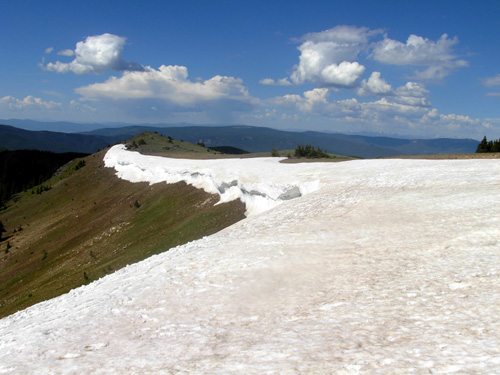
Ah, there's the trail pretty close by. It was mostly clear of snow on top this ridge
(still not our high point yet) and the panoramic views were
terrific. How those cyclists carried their bikes down that slippery
twenty-foot drop is
beyond me!
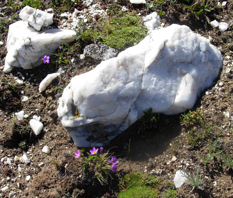
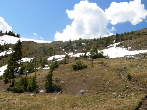
I loved this area with all of its colorful alpine wildflowers and
interesting white crystalline rocks.
I felt like I was on top of the world. I'm so glad Jim got to see it,
too. I kept stopping to take pictures, then running to catch back up to
Jim.
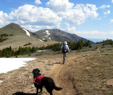
As we gradually climbed I could run parts of this section
for short stints (we were close to 12,000 feet, remember):
I know what Jim's thinking (below); he wasn't supposed to see me
taking another picture!
RUNNING HIGH So far, we'd also been following the Continental Divide Trail. Once
up to Peel Point (elev. 11,978 feet), the CDT veered off to the NW and the CT took a
precipitous dive a bit NE into the Fooses Creek drainage area.
I was initially concerned about the snow cornice on the side where I
was heading (very bottom of next photo), but on closer inspection
realized the trail was almost completely snow-free down to the tree
line.
It looked steep and muddy, but I could see it snake down the slope to
the trees:
Going northbound, the trail drops about 3,200 feet in eight miles
to US 50. One thousand feet of that is in less than two miles from
this ridge, one of the steeper descents (or ascents, going southbound)
on the CT. Here's a photo looking back up. As usual, it doesn't look all
that steep in a photo!
Jim and I surveyed the trail before us and decided it looked just
fine for Cody and me to proceed northbound to the Angel of Shivano trail
head. We could see some snow down in the trees but it didn't look bad
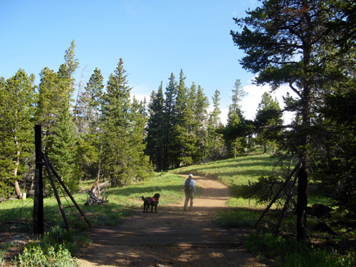
from our vantage point. I was comfortable going forward. Naive optimist! We took about a ten-minute break here to take off excess clothing,
give Cody some water, swap the GPS, put on sunscreen, etc. We kissed
goodbye and I gave Jim an estimate of 3PM at the rendezvous point. I was
hoping to be there much faster, but thought that'd be more realistic if
I ran into any problems like snow or rocks. Jim ran back down to the
truck at a quick pace and Cody and I headed out for more adventure than
I wanted. SURPRISE, SURPRISE! WHAT HAVE WE
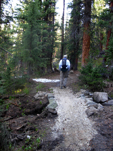
HERE?? It was a fun free-fall to tree line. I would have enjoyed it even more if
I hadn't stressed my knees at Bighorn in the long descent from Horse
Creek Ridge to the road. My knees definitely hurt on this steep grade,
but the footing was pretty good. Uh, oh. What's all this SNOW that we couldn't see from the ridge??
And where the heck is the trail???
The snow was much worse on this side of the ridge, of course, now
that I had only one brain to use for navigation! Cody wasn't any help
because absolutely NO ONE had been up this side. There were no footprints
or bike tire tracks to follow through the snow. I didn't start seeing
footprints and tire tracks until the snow had mostly petered out. Weenies!
They saw the snow and turned around. The snow was not as deep in
most places as it was in Segment 4, but it covered more of the trail and
I simply couldn't see where it went for most of the first mile.
And there were no CT markers either, by the way. Although we saw
signs and markers on the southern part of this section and I saw more
the last couple miles, there weren't any where I really needed them. I didn't panic, but I was definitely concerned about getting through
this section. I relied on the GPS and creek(s) to get me down below the
snow at about 10,800 feet, a distance of about two miles. It took me
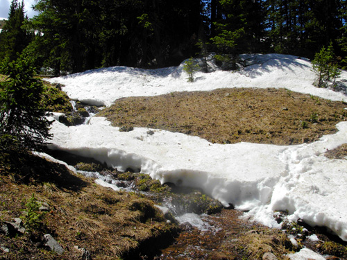
well over an hour to accomplish that little feat. I knew that I'd be following S. Fooses Creek most of the way down to
US 50. So I kept the first little creek in view when I couldn't find the
trail. I'd find a short piece of trail that wasn't covered with snow and
follow it until it disappeared again. Then I'd look ahead to see where
it was most likely the trail went through the trees. If that wasn't
obvious, I'd pick my way through the snow the easiest path near the
creek. I'm not sure if that first creek I followed was Fooses or a
tributary, but it worked. See, there it is:
I kept my sense of humor and wonder. The woods and creeks and flowers
and, yes, even the snow, were beautiful through this difficult section.
I knew I'd eventually find the real trail, and I did. Meanwhile, Cody
had a blast in all the snow and water the next few miles. I finally passed the last remnants of snow around 10,800 feet and then needed
the GPS only for distance. I was able to run most of the trail the last six miles down to US 50,
although sometimes it was too rocky or wet. I cannot tell you how many
times I crossed that creek!
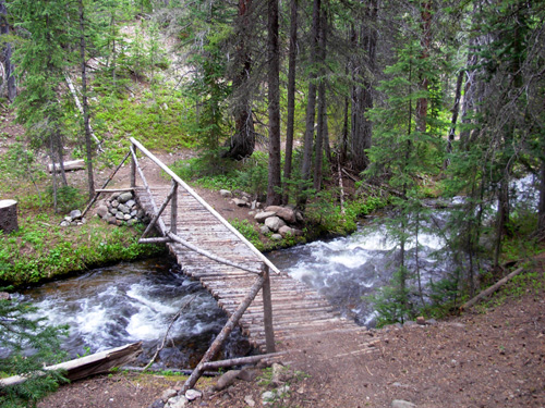
There were several very nice wooden bridges across it as it gained
depth and momentum farther and farther down the mountain, so I didn't get as wet
as I did crossing it umpteen times closer to its headwaters. Gravity wasn't as helpful the last six miles because the next
2,000-foot drop was so spread out. Even going downhill gradually was
work at this altitude. Someone more acclimated could run this section
northbound very quickly. I passed through several eco-zones with
different types of trees and flowers as I descended:
I began seeing dark clouds to the north -- my direction of travel -- about 11:30 but it remained
sunny to the south the entire afternoon.
Some sprinkles came down around noon as I dropped lower and lower
through the pines and aspens. I didn't even get wet. Jim got into
heavier rain as he drove back to the camper. There were severe storm warnings for the entire
southwestern part of the state. By the time I reached the end of Segment
15 at US 50, it was
sunny and hot -- too hot. My least favorite part of Segment 15 is the last two miles before the
highway when the trail follows a dirt road through a logged area and
under some power lines. I much preferred the shady single-track south of
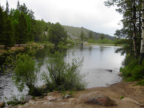
there. We passed a tiny reservoir (below) and forest service potty and
eventually reached US 50.
Labs cannot pass by a pond without jumping in! I
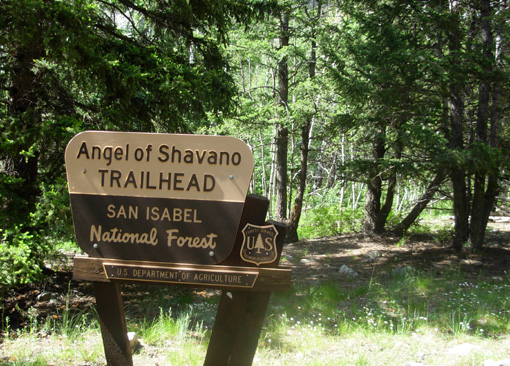
almost did, too. GOAT WADDI & THAT LAST LITTLE PIECE OF SEG.14 I tried to call Jim from the trail head at the highway. It was 1:40
PM and I knew I couldn't do
the next six miles in Segment 14 uphill by 3 PM. But there was no signal
so Cody and I carefully crossed the busy highway and trudged up the
rocky, exposed trail under the power lines (yuck!) to the top of the
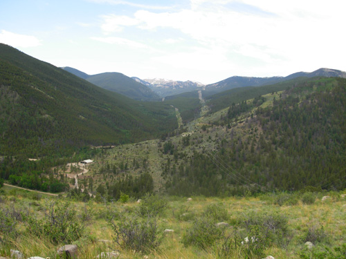
next hill, about a 600-foot climb. On the way up the first hill it was interesting to look back to the
Fooses Creek valley I'd just come down. I could even see the snowy ridge
where Jim turned around:
Very cool. Glad I wasn't aware of those two power line cuts until I
got near the bottom. I didn't take many photos through the southern six miles of Segment
14. I was hot and tired and just wanted to be done. There weren't very
many good views, and by then all the forest eco-systems started looking
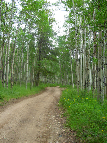
alike -- even the beautiful aspen groves:
Fortunately, there were more CT markers in the first five
miles than the entire length of Segment 15, so I didn't have to use the
GPS or even my brain to figure out where to go. That wouldn't last,
however. The most interesting part of this section was the "goat waddi" halfway
through:
The what?? Gotta admit, I've never heard of a goat waddi
before. It's a large circular meadow where goat herders used to hold
annual reunions. I have no idea what they actually did there and
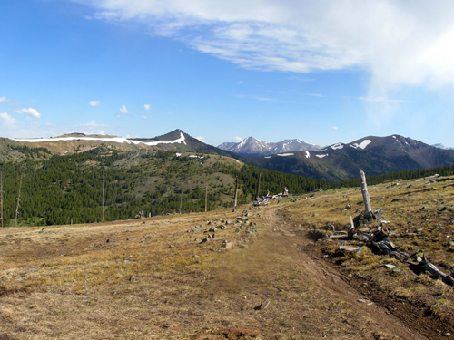
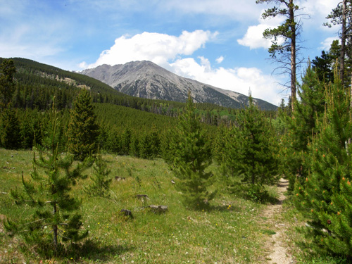
not enough internet time to investigate it further. I was happy to see Mt. Shivano getting closer and closer because that
meant my trail head was pretty close now:
The last mile down to the Angel of Shivano campground and trail head
was fun to run. The trail was pretty smooth and I could let gravity
carry me down. Unfortunately, there weren't any markers through here and
I initially took the wrong trail at the bottom when I crossed the north
fork of the Arkansas River. I found my way back to it with directions
from the campground host, and finally found the trail head (and Jim!)
where I stopped last year in this section:
It was good to be done today! Only four more segments to go . . . FINAL THOUGHTS ON SEGMENTS 14-15 Jim had a good run back down to the truck from Peel
Point. It took us 2:20 hours to get up there and only 1:30
hours by himself to get down. He was happy to have found a pretty
runnable section of trail. He talked with two CDT section-hikers, "Nemo"
and "Pouch," and one other CT day-hiker. He also saw several more
cyclists. Nemo and Pouch did the New Mexico portion of the CDT
last year and are tackling Colorado this year.
Somehow David Horton's name came up in their conversation. They know of
his 2005 speed record on the PCT, another trail they've hiked. If you're in the area and want an interesting day-hike or run, I can
enthusiastically recommend the southern 6.4 miles of Segment 15
from Marshall Pass to Peel Point and back for almost thirteen miles of
beautiful forest and panoramic views. I probably would have appreciated
the eight northern miles if I hadn't had so much trouble with the snow
-- in a few weeks it will be nice, too. The footing on the southern half is
better than the northern portion of the segment. However, there aren't
as many water sources on the southern side, so carry plenty for yourself
and any four-legged buddies. The only places I had to give Cody water
were on the high ridge when we were above all the water sources and in the middle of the dry six-mile section of
Segment 14. If there's anything I learned today, it's that I'm NOT going to do
Segments 16-17 this week! Because of a near-inaccessible trail head
between them at Sargent's Mesa, I intend to do both segments the same day -- a
total of 35.6 miles, the longest run I'll have done on the whole
CT. Twenty-one of those miles ride the Divide between 11,000 and 12,000
feet. That's really tempting fate. I'll have to save that run for another three weeks -- after Hardrock
and before Leadville. By then the snow should be all or mostly gone and
I'll be better acclimated to the elevation so I can run more and get 'er
done within daylight hours. Now it's on to Gunnison and Segments 18 and 19 after a day of rest . . .
Sue
© 2007 Sue Norwood and Jim O'Neil |