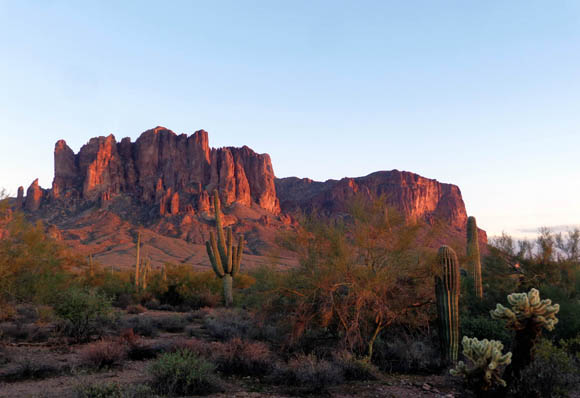
Las Vegas is surrounded by several mountain ranges. The Spring Mountains
rise up from the desert on the west side of the metro area and include
11,811-foot Charleston Peak, the high-altitude town of Mt. Charleston,
the Tolyabe National Forest, Spring Mountains National Recreation Area,
Spring Mountains Ranch State Park, and Red Rock National Conservation Area.
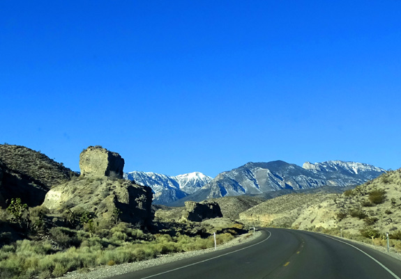
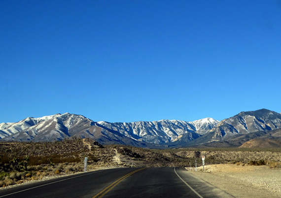
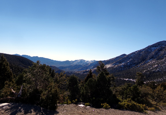
Charleston Peak is in the
background, its summit covered in snow.
The Spring Mountains National Recreation Area, which we drove
through today, is a popular venue year-round for sight-seeing, hiking,
cycling, rock climbing, horseback riding, camping, skiing and other
winter sports, watching birds and other wildlife, nature and scenic
photography, picnicking, and other outdoor activities.
Today there was snow above 7,000 feet elevation but the roadways were
all clear. We made a big loop in the mountains with two shorter
out-and-backs at the higher elevations of the loop.
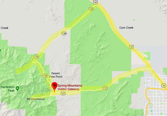
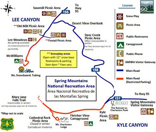
This map section shows our route through the northern section of Red
Rock Canyon National Conservation Area to the Spring Mountains
Recreation Area. The northwestern edge of Las Vegas is lower right:
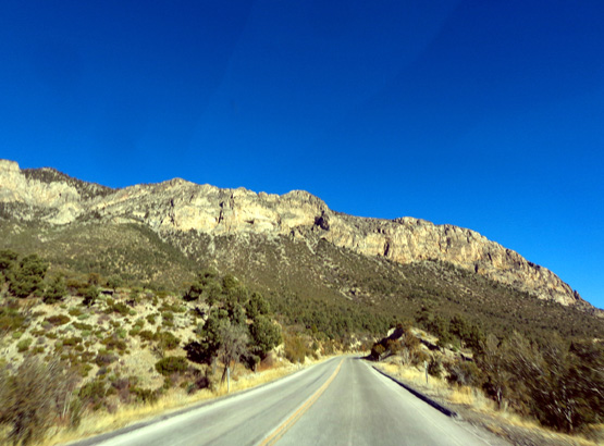
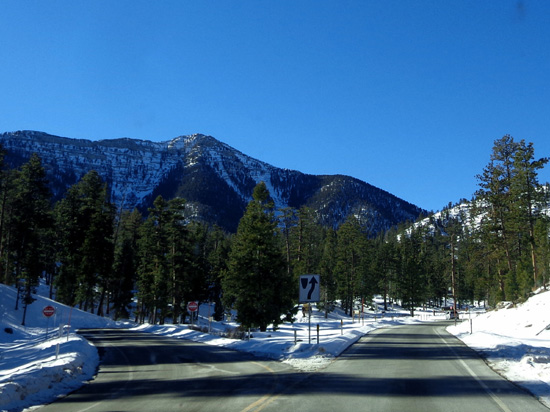
We drove north of Vegas on US 95 to NV 157. This wide two-lane paved
road goes up into the mountains to the town of Mt. Charleston.
Here are a couple more pictures I took heading west toward Charleston
Peak:
Above and below: There are
Joshua trees between 4,000-5,000 feet elevation.
Just past the boundary for the recreation area we passed
the Spring Mountains Visitor Gateway, a 90-acre complex that includes a
visitor center, education building, amphitheaters, picnic areas, and
trailheads.
Unfortunately, because of the partial government
shutdown this whole area was gated off. The recreation area itself was
open but campgrounds and restrooms along the way were also closed.
We just kept driving, curious as to what lay ahead and
determined to see as much as we could.
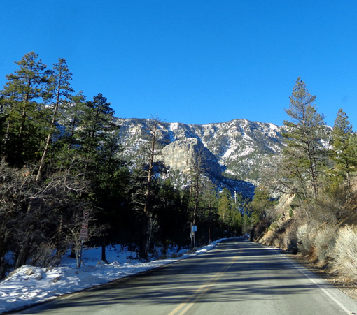
We continued west on NV 157 past the Kyle picnic area
and Fletcher View Campground to the little town of Mt. Charleston.
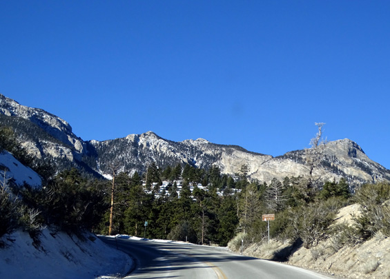
We reached snow near the Kyle picnic area, between
7,000-8,000 feet elevation:
Since we didn't have to shovel the snow, we enjoyed seeing it
and searched for places where we could let the dogs run in soft, fluffy
white stuff.
Didn't happen. In addition to difficulty finding
cleared places to pull off the road and park safely, when we did find a parking
area and trailhead in Mt. Charleston-the-town the snow had melted and
re-frozen enough times that it was very tricky for us or the dogs to
maintain our footing:
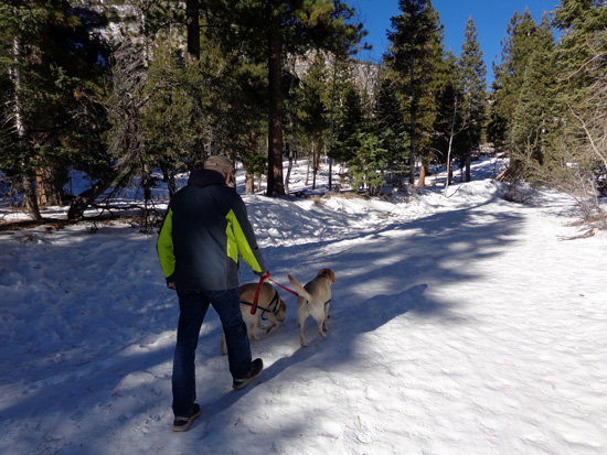
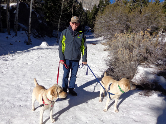
That was a pretty short hike of only half a mile. It
would have been more fun for Casey and Holly off-leash but there were
other people around so we kept them leashed. They can be a little too
friendly sometimes!
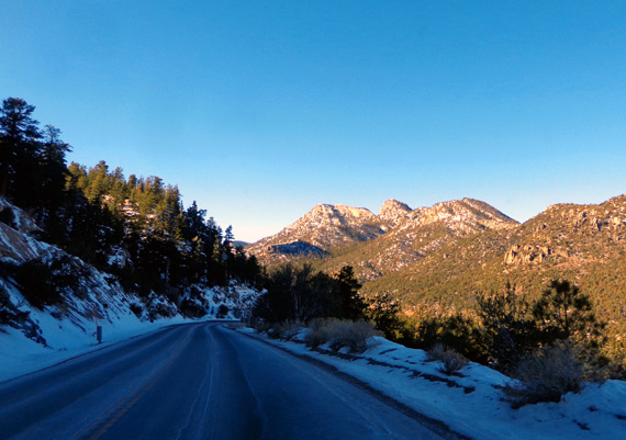
We drove through town and started up the road to
Cathedral Rock but soon turned around because of snow and ice. I took
this picture of some big, handsome houses on one of the mountainsides above town:
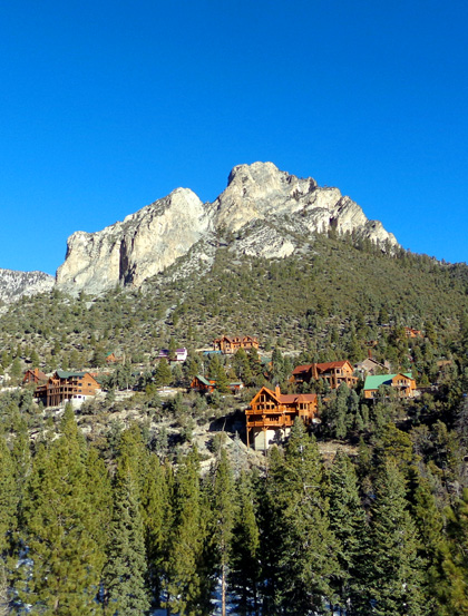
Those would be nice when it's hot, hot, hot down in the
desert.
We drove back a few
miles to the intersection with NV 158 and took it several miles north to
NV 156. We were soon high enough again to have snow next to the road and
above us under the trees:
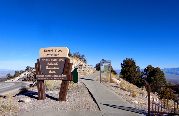
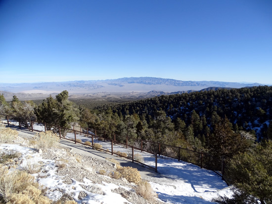
Along NV 158 we stopped at the Desert View Overlook, which has
expansive views into the valley:
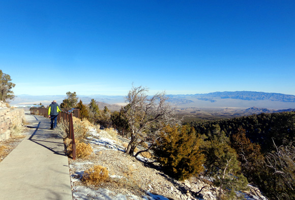
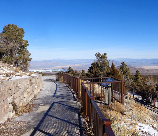
This wheelchair-accessible paved path zig-zags down the
slope and is 3/4 mile long round trip.
We didn't even make it to the
second set of interpretive panels because of a sheet of ice over the
concrete:
Continuing north along NV 158:
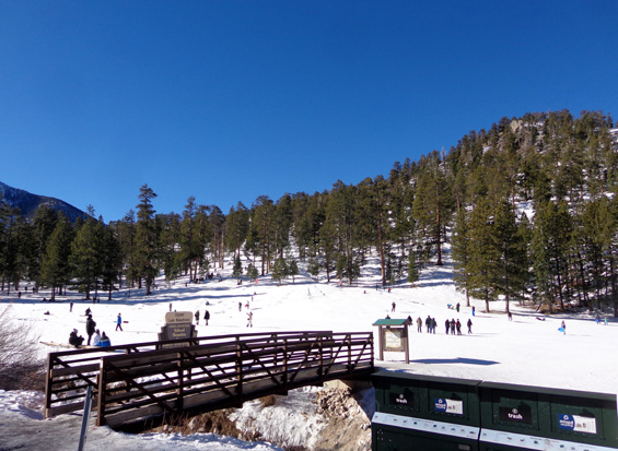
When we came to the intersection with NV 156 we turned left and
followed it southwest past the Old Mill and Foxtail picnic areas, which
were snowed in and closed, to the "snow-play areas" in Lee Meadows and
Lee Canyon.
Parking is not allowed along the roadway in this area, which has fees
for day use. We didn't stop and we didn't pay any fees, but took photos
of kids and adults sledding down a snowy hill:
We turned around before the ski area at Lee Canyon and continued
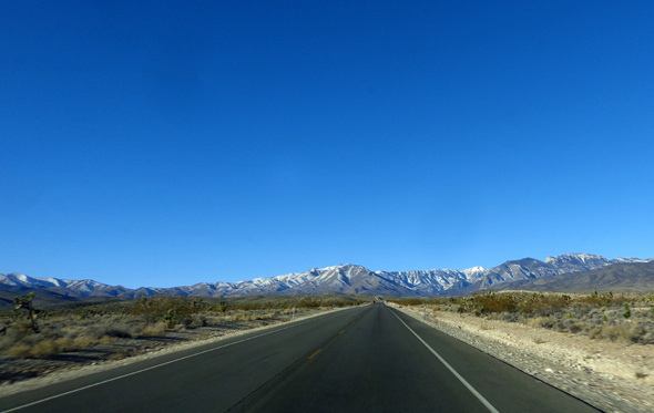
north and east on NV 156 as it descended to the desert:
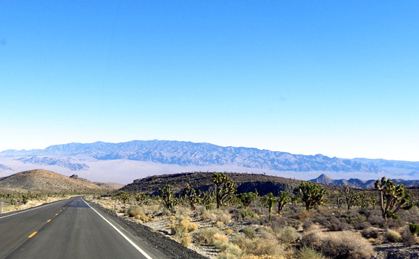
Back down to an elevation where
Joshua trees grow (between about 4,000-5,000 feet);
this view faces the Cactus
Mountain Range and a USAF testing site to the east.
At the end of NV 156 we turned south on US 95 and drove back to the city.
This was an interesting day drive in the winter since we'd never been
up there before but we'd have more fun hiking when there isn't any snow.
I'm sorry we couldn't see the visitor center; it was closed because of
the partial government shutdown. It appears there is a good variety of
activities to do year-round in the recreation area when everything is open.
Next entry: hiking and sight-seeing at Red Rock
Canyon National Conservation Area
Happy trails,
Sue
"Runtrails & Company" - Sue Norwood, Jim O'Neil,
Casey-Girl, and Holly-Pup
Previous
Next
© 2019 Sue Norwood and Jim O'Neil