Continued from the previous page.
DANTE'S OVERLOOK
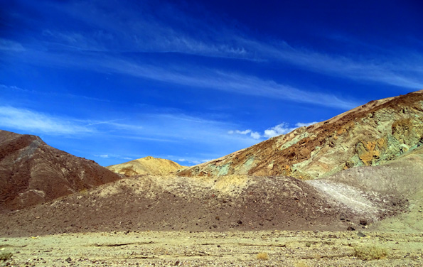
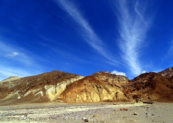
After dropping back down to Death Valley at the north end of one-way Artist's Loop
we continued north on Badwater Road to Furnace Creek, passing more colorful
foothills that looked different going this direction:
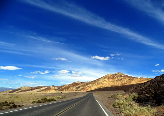
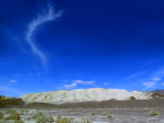
Above and below: There were some cool cloud
formations during the mid-day, too.
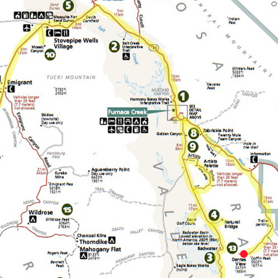
At Furnace Creek we turned right and drove south on CA 190 to the scenic
little road that goes to Dante's Overlook right above the Badwater Basin.
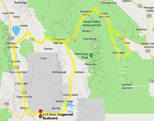
Here's that park map section again. I marked the overlook with a red dot
in the lower R. corner; the basin is #3:
It was windy and downright chilly even in jeans and long-sleeved shirts
at 5,475 feet elevation but that was rather refreshing after the heat down
in the valley.
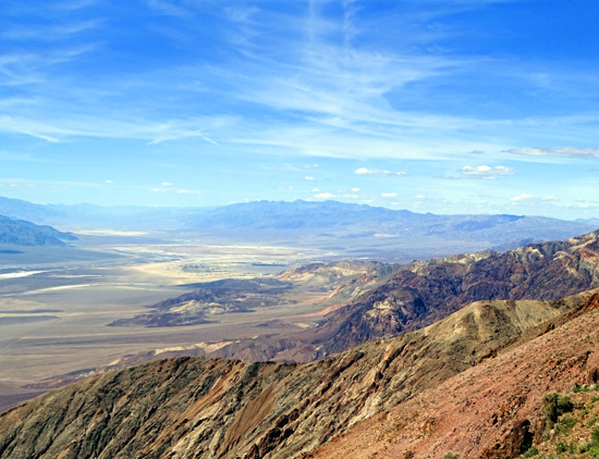
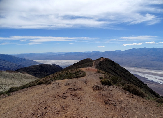
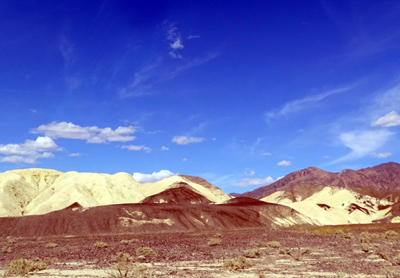
We walked around the overlook for several minutes to take in
the views, which were awesome up and down Death Valley and
toward the mountain ranges in every direction:
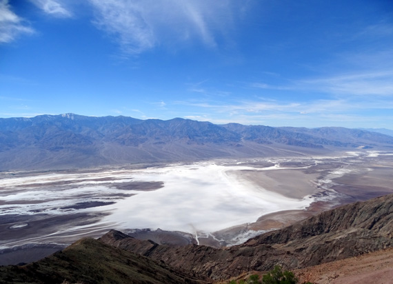
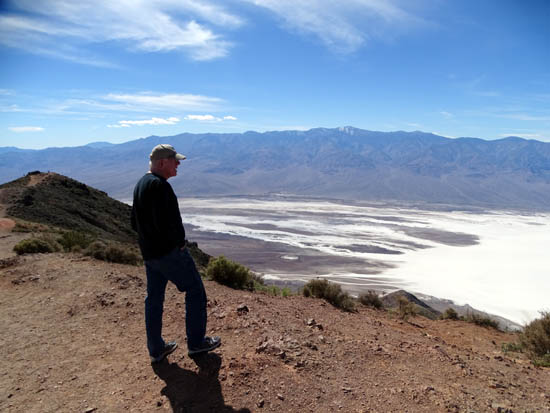
Badwater
Basin includes this large white salt flat.
Above and
below: Death Valley to the north
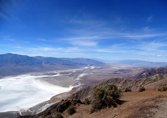
Greenwater Range
to the east
Above and
below: Death Valley to the south
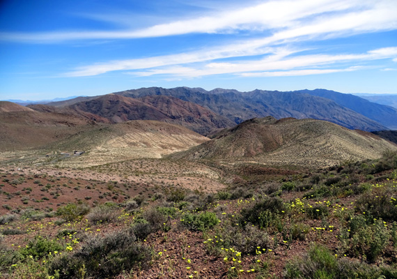
There were a lot of pretty wildflowers along the road to Dante's Overlook
and on top of the mountain:
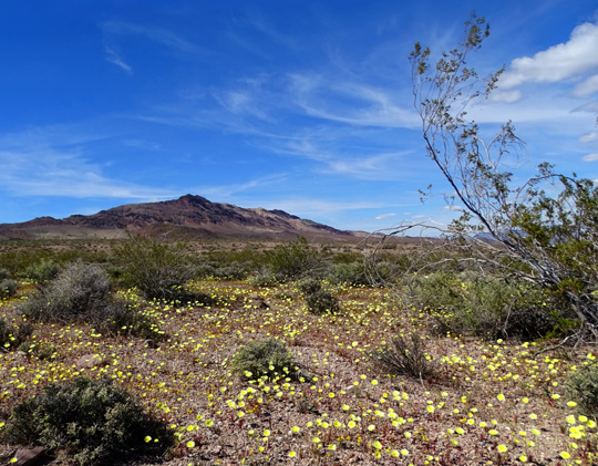
Mostly Desert Dandelions in this carpet of flowers
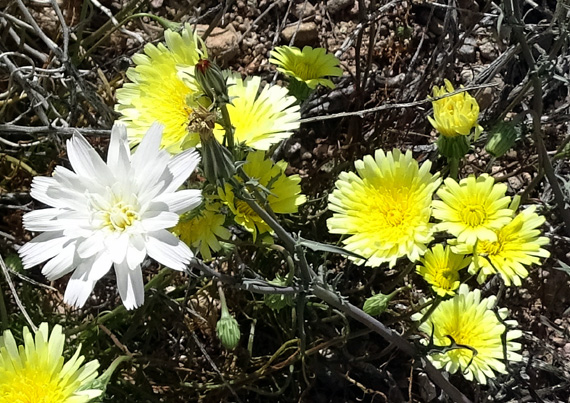
Desert Dandelions (yellow flowers) and a White Daisy Tidy
Tip
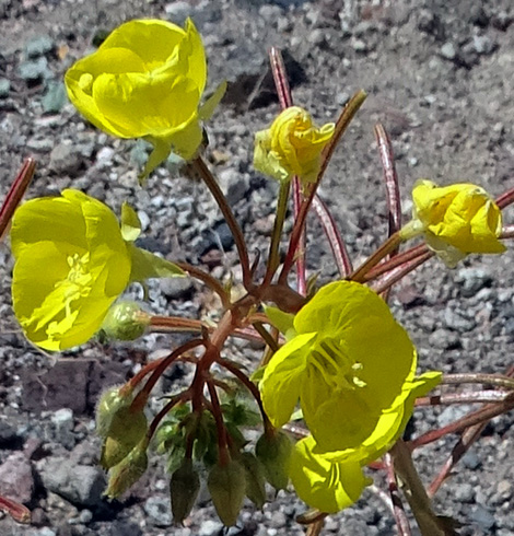
Desert Poppy
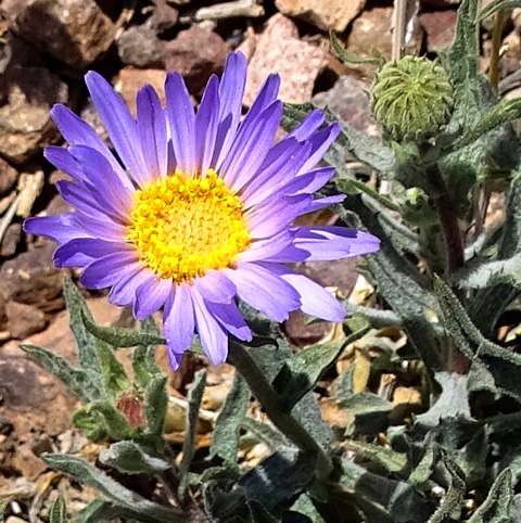
Mojave Aster
I noticed some new wildflowers on my various hikes
today, as well as many others we've seen in southern California the last
couple of weeks.
This is a good week to see wildflowers at Death Valley
National Park this year but the timing is dependent on a whole
lot of variables each spring. Since different species bloom at different
times at different latitudes and elevations, any spring trip will probably
be colorful if enough rain has fallen in the previous weeks and months.
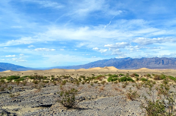
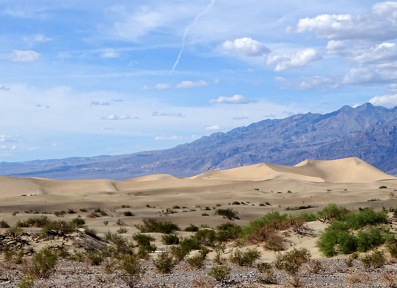
MESQUITE FLAT SAND DUNES
We drove back down to CA 190 and turned west
toward Furnace Creek again.
We began to see the light tan-colored sand dunes, which are marked #5 on the map section
above, near Stovepipe Wells before we got to two overlooks where we
parked so we could get out to see and photograph them better.
The sand dunes cover
14 square miles in the widest part of Death Valley. There are other
dunes in the park but these are the easiest to see from the road and
to access on foot.
Although there are no
trails since the dunes keep shifting in the wind, visitors are allowed
to climb the dunes and walk through them as far as they want. Hikers are
advised to carry plenty of water and go out in the coolest part of the
day. For lots of good reasons, pets are
not allowed in the dunes.
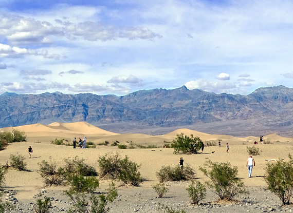
One of the interpretive panels
describes Mesquite Flat as a "sand trap" because of the way the wind and
mountainous terrain act to keep the shifting sand dunes in the same
general area.
Because of the increasing heat in the early afternoon we just observed
the sand dunes from the overlooks and didn't go out to play in them.
(Been there, done that previously at other more user-friendly places like White Sands
National Monument in New Mexico.)
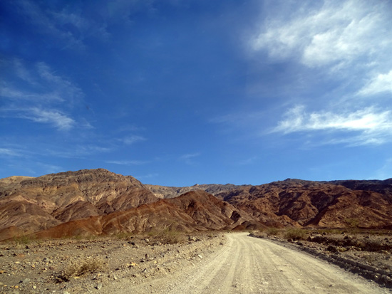
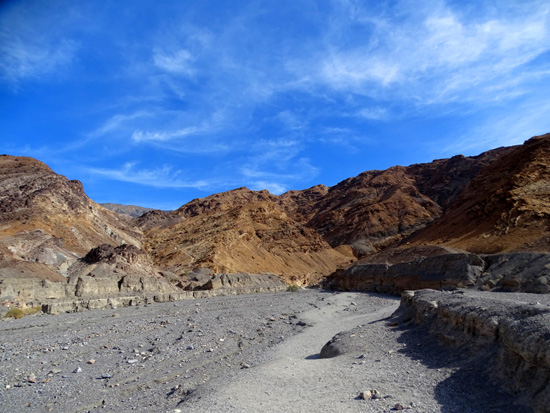
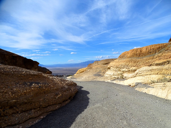
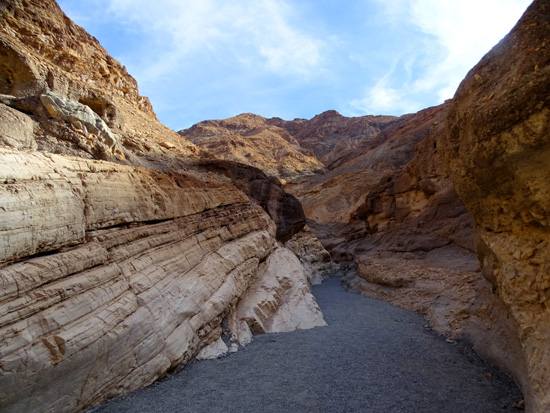
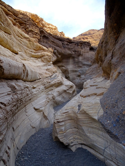
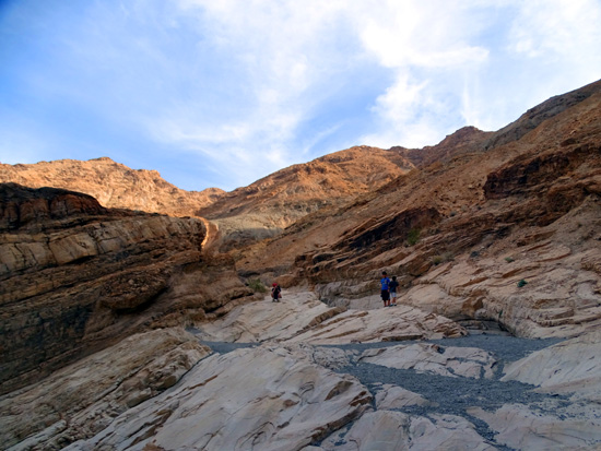
MOSAIC CANYON HIKE
Continuing west on CA 190 through the park and
just past Stovepipe Wells Village, we
drove up 2.4 miles on a rather bumpy dirt road to the Mosaic Canyon
trailhead, which is marked #10 on the map section above.
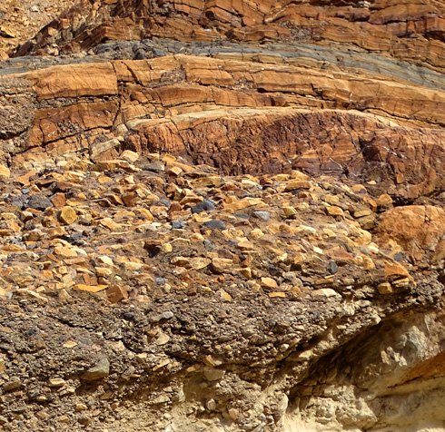
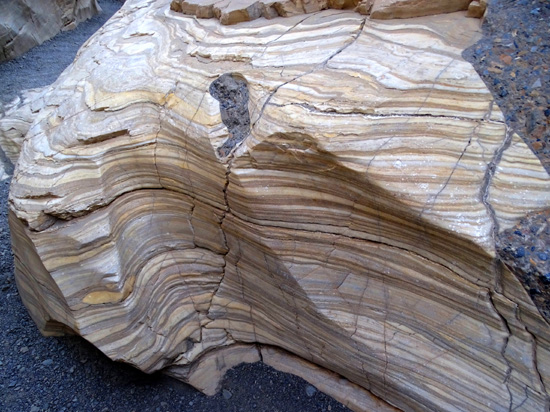
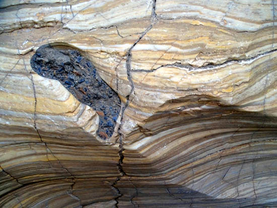
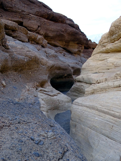
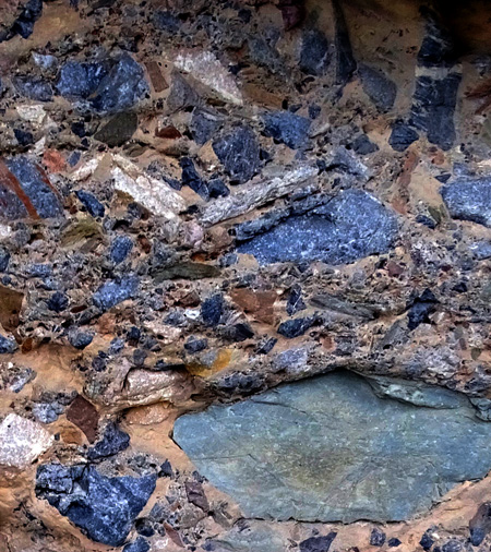
The entrance to the canyon quickly narrows to a
very interesting slot canyon in the first one-third mile, with a mix of smooth, striped
"marble" walls and textured mosaic conglomerate -- different
colors of rocks embedded in cement-like rock -- in the
surrounding canyon walls:
Above
(looking back toward entrance) and below: conglomerate rock
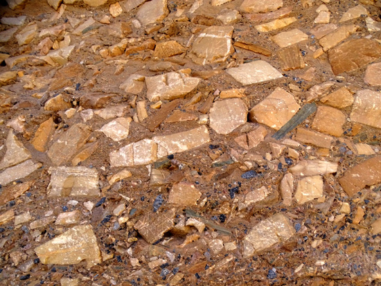
Like a
narrow marble hallway
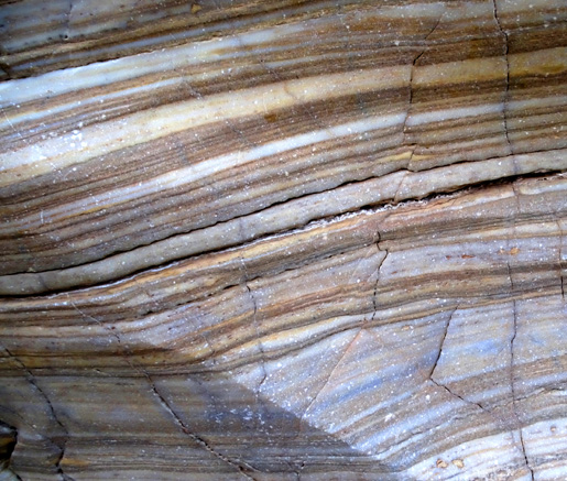
Above and
below: pretty blue conglomerate rocks
There was enough scrambling ahead of me that I turned around after half a mile.
If I'd been with Jim and had more time, I would have gone farther into the
canyon:
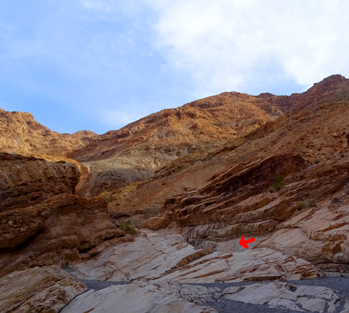
Where I
turned around

Back near
the entrance to the canyon
It's the most unique slot canyon I've seen so far. It reminds me of photos of some
slots in southern Utah that I'd like to see later this spring.
PANAMINT SPRINGS TO OLANTHA & HOME
When we got back to the intersection with CA 178 we decided to go a
different way home so we could see more of the Badwater ultramarathon
course and another part of the park.
We continued west on CA 190 through Panamint Springs to Olantha, then south
on US 395 around the west side of China Lake Naval Air Weapons Station
(gray sections on the map below). That was was about 25 miles longer
than the way we went to the park this morning:
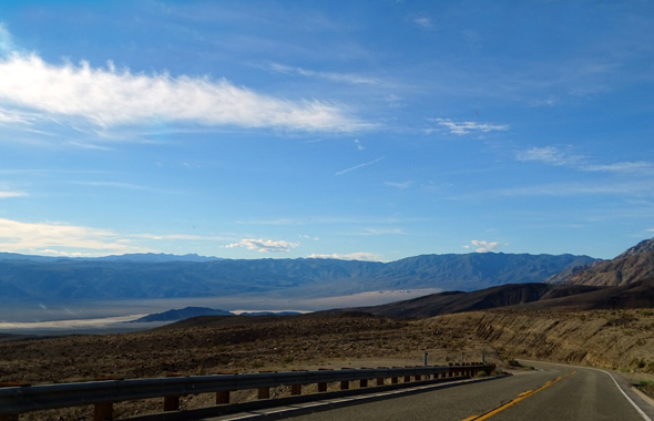
View from Towne Pass
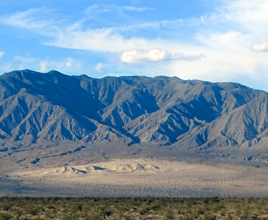
Panamint Dunes, another "trapped" dune area in the
park
CA 190 west of Panamint Springs is scenic but very narrow and slow up
another pass to the Father Crowley Vista Point before exiting the
park.
We
got back to our camper at China Lake about 7 PM,
just before dark. It was a long but memorable day.
FINAL THOUGHTS ABOUT DEATH VALLEY NP
The United States enjoys 59 national parks, which are part of the 417
"units" under the auspices of
the National Park Services. "Units" include national monuments,
memorials, recreation areas, seashores, battlefields, rivers,
scenic trails, parkways, historical sites, and more.
We've been to a bunch of them over our lifetimes, but I doubt
we'll ever see all of them.
There are some national parks where we could spend weeks or even months
exploring and not run out of things we enjoy doing -- Denali, Glacier,
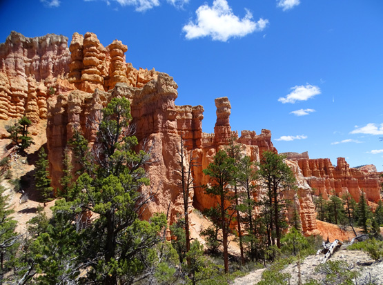
Yellowstone, Grand Teton, and Bryce Canyon are examples that are so captivating
to me that I simply don't want to leave.
In addition to the month we
spent near Bryce Canyon NP last fall,
we returned for two more months this spring and
fall.
Most national parks we've visited have kept us happily occupied
for a few days or a week and then we're ready to move on because
they are either too crowded or we run out of hikes, bike rides,
scenic drives, and other things we want to do. Examples are
Acadia, Zion, Joshua Tree, Arches, and the Great Smokies. Some of those
we have returned to at least once more.
Then there are the parks I call "One & Done" where --
for one reason or another -- one day or
one visit is enough and we have no desire to return. Death Valley is one of those.
We were curious for various reasons to visit Death Valley. We are glad we did
but we've seen enough of it in one pretty spring day to satisfy that curiosity.
Next entry: photos from the first of two hikes on the Pacific
Crest Trail from Walker Pass west of Ridgecrest, CA
Happy trails,
Sue
"Runtrails & Company" - Sue Norwood, Jim O'Neil,
Cody the ultra Lab, and Casey-pup
Previous
Next
© 2016 Sue Norwood and Jim O'Neil
