Hmm . . . I'm not so sure the network of roads in Queen Valley is the
ideal place to go mountain biking in Joshua Tree National Park.
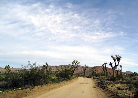
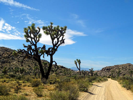
When Jim and I did our first scouting mission in the park earlier
this week we drove our Odyssey minivan a couple miles back Desert Queen
Mine Road (next photo) to a trailhead parking area and noted both how narrow the
roads are and how much dust is raised by cars and pickup trucks on a dry
day.
Today had even more traffic throughout the park, including Queen
Valley, since it's the beginning of a warm, sunny spring weekend. I
think Jim was wise to do his long bike ride on paved Park Boulevard this
morning rather than detouring through Queen Valley.
He was surprised by the amount of traffic on the main park road but
at least it's two-lane -- so motor vehicles could pass him more
easily -- and he didn't choke on dust.
This is part of the main park road where he cycled:
TODAY'S PLAN
I mentioned in the previous entry that Jim did a 30-mile bike ride this
morning. He came up with a great plan so we could both get in good workouts.
First he dropped me off at the northern terminus of the Boy Scout Trail at Indian
Cove, then drove around the park on US 62 to the west entrance. He parked at Keys
West, the southern end of the 8+ mile-long point-to-point trail I was hiking, so I
could drive the car home.
("Home" this week is the Twilight Dunes RV Park on the Marine base
north of the town of Twentynine Palms.)
Jim began his bike ride at Keys West. He followed the main park road
east and north through the park, past the Oasis of Mara Visitor Center,
through Twentynine Palms, and up to the Marine base. Although the volume
of traffic along this entire route was a nuisance, it was all on paved roads
and relatively fast, dust-free riding.
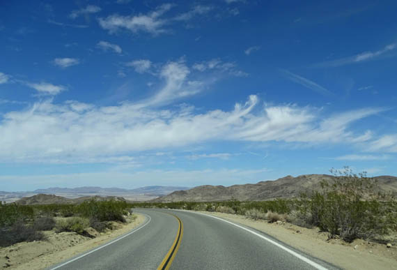
Descent to the park's north gate and Twentynine
Palms; Morongo Basin in the distance
After I got done hiking I decided to check out the other dirt roads in
Queen Valley that we didn't see on Monday.
I didn't notice the traffic on either Park Boulevard or in Queen
Valley quite as much since I was in the car and not on a bike. I was able to take most of my photos
as I was driving without having too many other vehicles visible in the
pictures. A few times I stopped and got out to take photos.
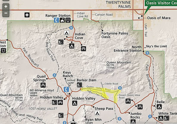
This map section of the park shows the Queen Valley roads. I
highlighted where I drove -- all but a part of Odelle Road:
JOSHUA TREE'S BACKCOUNTRY ROADS
Road and mountain bikes and all motorized passenger vehicles must remain on
paved or unpaved roads at Joshua Tree. Fortunately, there are lots of miles
of unpaved roads in the park for backcountry enthusiasts to enjoy.
ATVs and other motorized off-road vehicles are not allowed to
be ridden anywhere at Joshua Tree.
Mountain bikes and 4WD vehicles cannot be
ridden on any of the hiking trails or cross-country through the desert. Dogs
aren't allowed on the trails, either, and I think horses are allowed only
on the California Riding & Hiking Trail. Those
rules are common in many of our national parks.
The
park web page describing backcountry roads lists a network of
seven adventure-filled options, including the four interconnecting roads
in Queen Valley that I rode this morning.
Some of the roads are suitable
only for mountain bikes and high-clearance 4WD vehicles, but the Queen
Valley roads -- the only backcountry roads I'm familiar with at
Joshua Tree -- are OK on a dry day for 2WD vehicles like my
low-clearance Odyssey minivan.
Just don't get stuck in a soft area of sand if you turn around or
have to move over for another vehicle.
MORE SCENES FROM QUEEN VALLEY
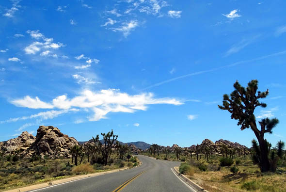
After leaving the trailhead at Keys West, I drove east on Park
Boulevard to the paved road that goes past the Hidden Valley Campground.
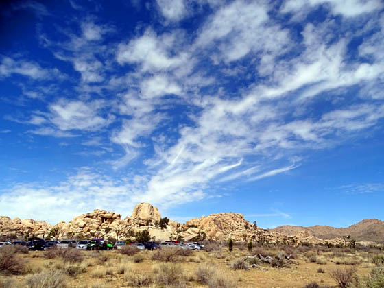
Just past the large parking area for the Barker Dam and Wall Street Mill
Trails, shown below,
dirt Queen Valley Road veers off to the right and goes several miles
east through the valley to the parking area for the Pine City and Desert
Queen Mine trails.
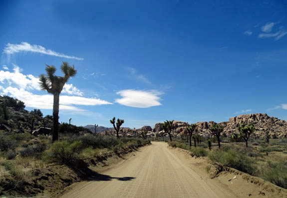
Three roads intersect in the valley with the Queen Valley Road --
Bighorn Pass Road, Odelle Road, and Queen Valley Mine Road. All are narrow,
sandy roads with not a lot of room to pass oncoming traffic.
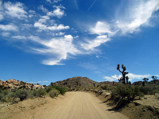
In most places the roads have been graded as in the picture below, with
a low wall of sand that can create problems if you don't have 4WD and
have to pull over to avoid getting hit by someone coming toward you in a
larger vehicle -- or driving too fast and being obtuse:
The photos in this entry are mostly from my drive through the valley
this afternoon. A few are from our shorter drive on Queen Valley Mine
Road four days ago.
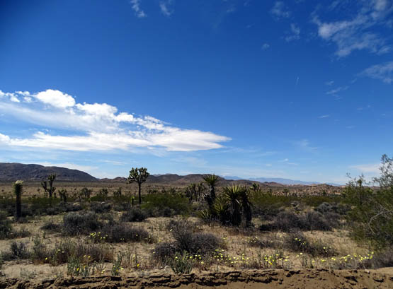
Here are a few more photos from the valley:
Above and below: The more
interesting rocks in Queen Valley are closest
to the Barker Dam-Wall Street
Mill end of the network of dirt roads.
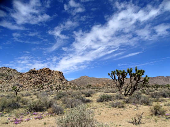
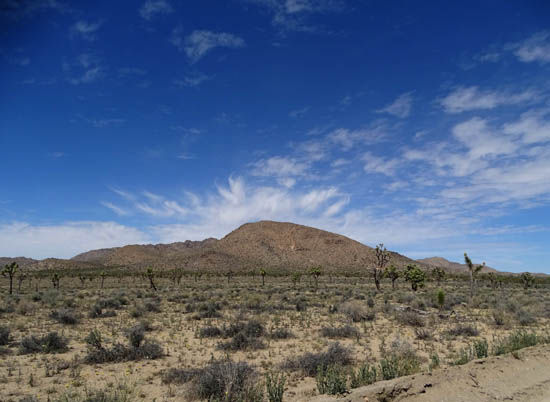
Queen Mountain (5,677' elevation)
Wildflowers along the road
Queen Valley is full of Joshua trees -- and wildflowers in a
good year -- but I didn't care for the relatively barren
terrain in this valley compared to the much more interesting rock formations along the
main east-west park road.
If you're short on time when driving through Joshua Tree, I think
it's most rewarding to stick to Park Boulevard and the road up to Keys
View. There are good reasons why those roads are paved!
QUEEN VALLEY FLORA
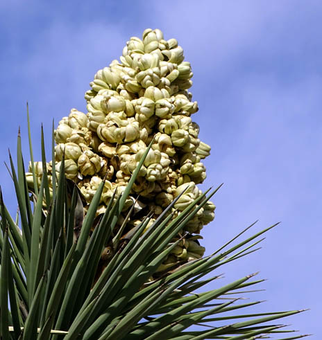
Our timing to visit the park this week was excellent to see many wildflowers
and the Joshua trees in bloom.
It's difficult in a desert to know when the flowers will be at
their peak because there are so many variables. Fortunately, some of the
flowers remain in bloom for several weeks and there is usually a
succession of different flowers throughout the spring, summer, and fall.
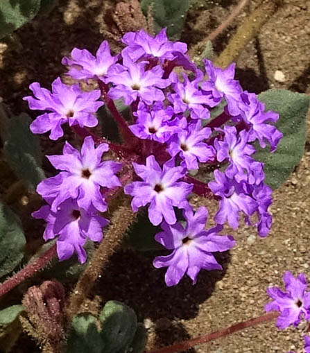
Here are a few of the flowers we saw in Queen Valley this week:
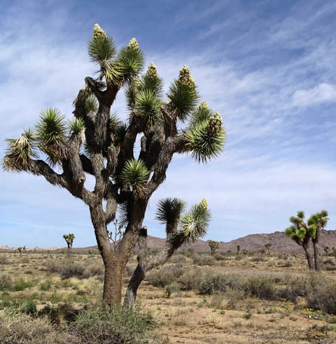
Above and below: The park's
iconic Joshua trees were at their peak.
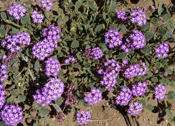
Above and below: I spotted lots of Desert
Sand Verbena near the roads in Queen Valley today.
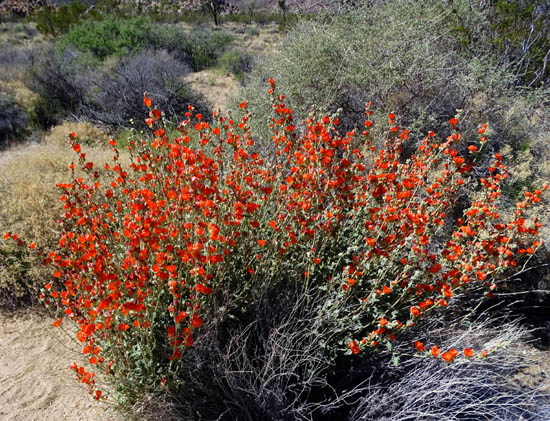
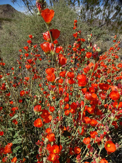
Above and below: Although I saw
Desert Globemallow on most of my hikes in Joshua Tree NP,
none of the clumps were anywhere near as
big as this one in Queen Valley (about 3x3').
TRAILS IN QUEEN VALLEY
Although there are several trails that can be accessed from the roads in Queen
Valley, I ran out of time to hike any of them this week.
If you're interested in more information about them, just do a web search
for the Pine City, Desert Queen Mine, or Lucky Boy Vista trails. Lucky Boy
can also be accessed from the Split Rock loop trail.
Next entry: murals, quirky art, and nice landscaping in and
near the town of Twentynine Palms
Happy trails,
Sue
"Runtrails & Company" - Sue Norwood, Jim O'Neil,
Cody the ultra Lab, and Casey-pup
Previous
Next
© 2016 Sue Norwood and Jim O'Neil
