Although I went farther north of Walker Pass today on the PCT than I
did yesterday, when I hiked south, I didn't get as far as Bear Mountain or as
high as 7,900 feet. I topped out at about 6,625 feet on the broad
eastern slope of Mt. Jenkins.
I hiked solo from Walker Pass at
CA 178 north for 5.63 miles before turning around, for a total
distance of 11.26 miles and more than 3,800 feet of
elevation gain and loss. Outbound (north) was mostly a gradual uphill,
so I got to hike mostly downhill on the way back to my car.
Here's my GPS track:
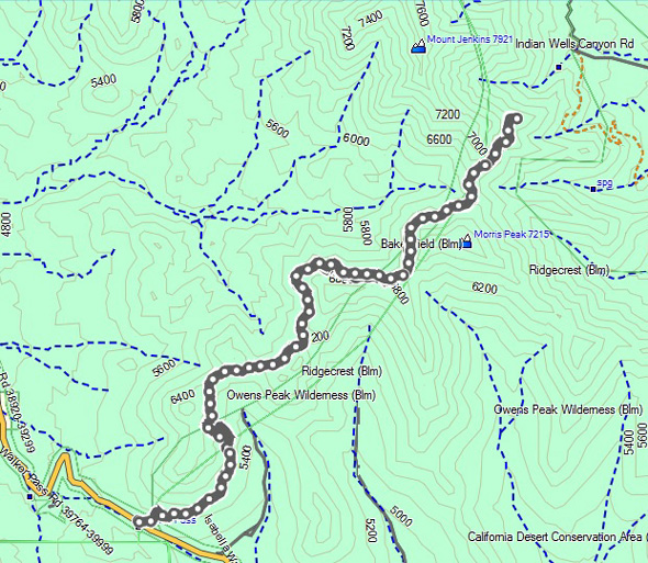
CA 178 is the solid gold-colored line at the lower left corner. The
Walker Pass Campground, where I parked yesterday, is below that. There
is a short section of trail, perhaps a half mile long, south of the
road connecting yesterday's and today's hikes that I haven't done.
Yesterday I parked in a very small parking area for hikers at the
campground. This time I decided to park in a long, wide, paved parking
area on the shoulder of the road, which turned out
to be a poor decision even though there was plenty of room to park on
either side of the pass. I thought it would be a safer and
more convenient option than the more remote parking area at the
campground.
Apparently not, as you'll see at the end of this
entry.
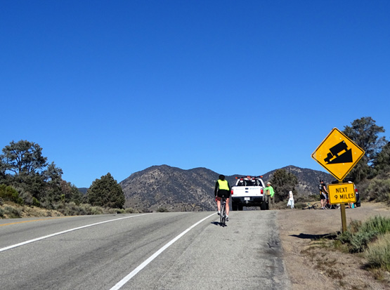
I
got to Walker Pass and began hiking at 9:30 AM.
About 30 cyclists from the Ridgecrest bike group were doing a ride from
Ridgecrest to Kernville, a distance of 62 miles/100K. I passed some of
them on my way to the pass, where an aid station was set up. I parked
well enough before it so I didn't block the cyclists' view of the aid
station. (I took the picture above from my car, zooming in on the
cyclist and truck; the aid table is behind the sign.)
I
talked with the older fella running the aid station, and four of the cyclists
who stopped for fluids and food, then began my hike.
I originally planned to turn around at four miles but the men all
encouraged me to go to at least five miles. They're locals and
have hiked the trail.
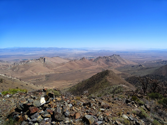
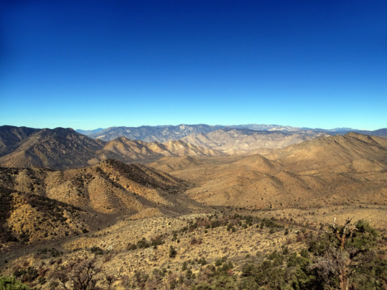
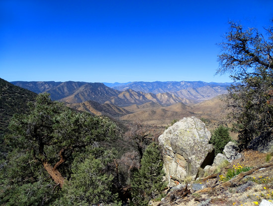
After I got past four miles, I understood why they recommended going a
little farther -- the views were awesome
when the trail morphed from the west side of Morris Peak to the east
side of Mt. Jenkins. I could see about forever to the east, across the valley where
Ridgecrest and China Lake are located. I also noticed lots of dirt roads in
the canyons below me:
The rocks were also suddenly very colorful along the trail and I got
some samples for my rock collection. I'll show pictures of them later in
this entry.
SCENES ALONG THE TRAIL
The photos in this section are in order going northbound, although I took some of
them looking back. I do that for various reasons even when I'm going out
and back on a trail.
That's not Owens Peak, just the
first mountain slope the trail traverses.
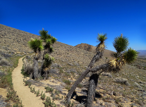
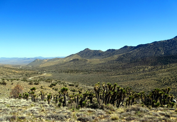
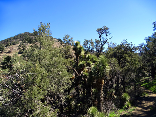
Above and next two photos: There
were only a few Joshua trees by the trail but quite a
lot on the slopes along CA 178
for a couple miles before reaching Walker Pass.
Joshua trees below the trail,
looking east down the valley
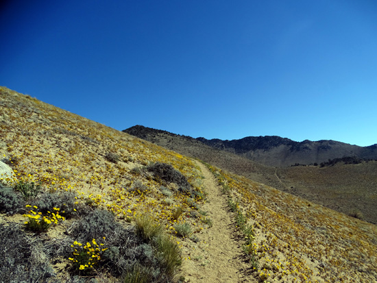
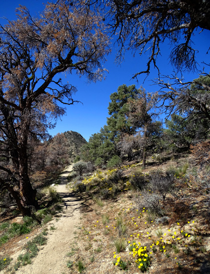
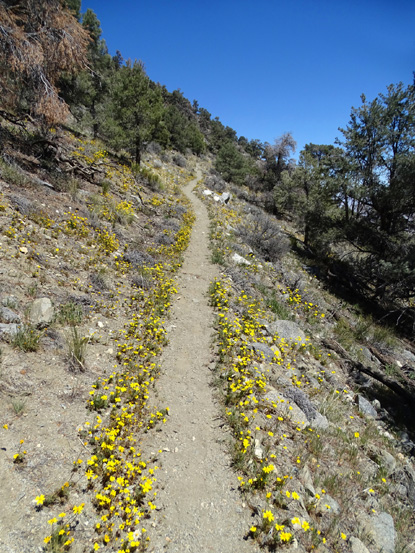
Soon the
trail passed through a large area of bright Desert Gold (AKA Desert
Sunflowers) that stretched up from the trail and down into the valley.
This is one of the hillsides that does look gold in the distance from
the road as you drive up to Walker Pass from the east:
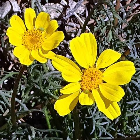
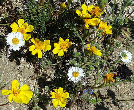
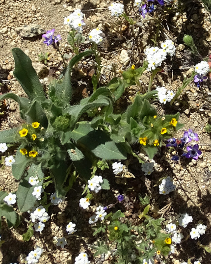
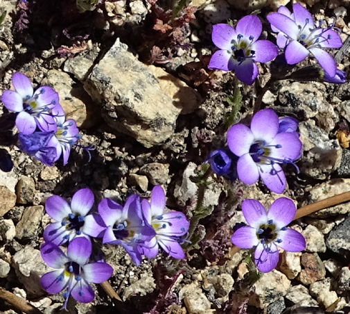
There are other wildflowers like Yellow Tack-Stem, yellow Devil's
Lettuce, Whitedaisy Tidytips, white Forget-Me-Nots, and blue Phacelia (most
are shown below) that are growing with the Desert Gold in the first
couple miles of the PCT north of Walker Pass, but it's the Desert Gold
that dominates and shows best from a distance:
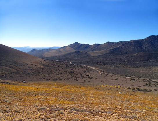
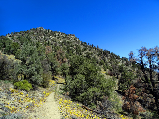
The trail continues to curve around the first mountain and switchbacks
farther up its north side, then crosses below a pass to the southeastern
slope of another mountain as it gradually gains elevation:
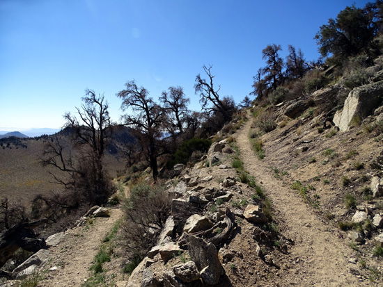
There are more junipers and
conifers at the higher elevations in this section.
Looking back at the switchbacks
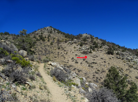
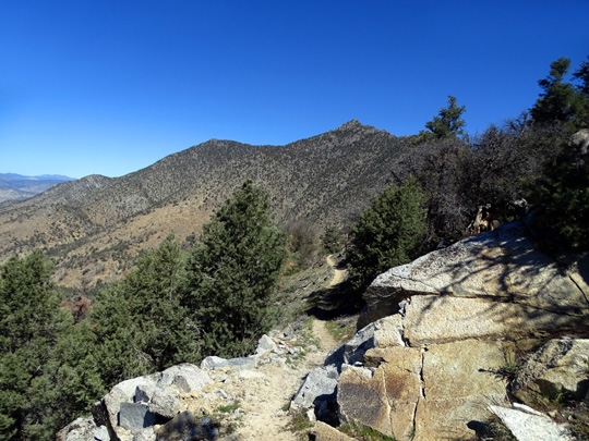
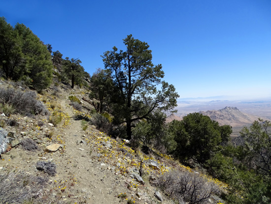
As the PCT gradually climbs higher in the second, third, and fourth miles it
skirts the western sides of two or three mountain slopes, with some excellent
views -- where the trail is exposed -- down to different
valleys, more mountains, and CA 178 on the other side of Walker Pass:
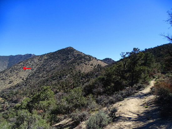
Arrow marks trail on western side of Morris Peak (I think),
to the north.
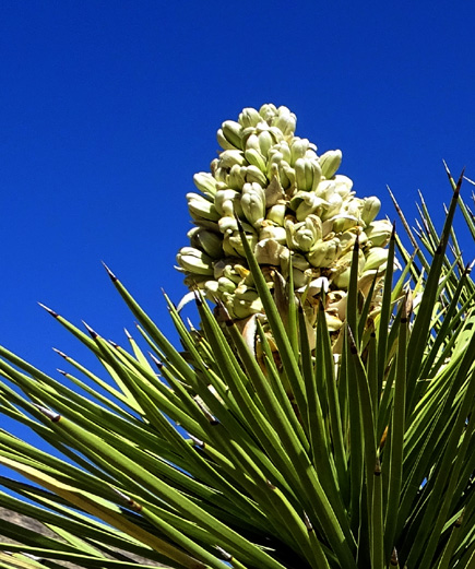
A few Joshua trees are in bloom up here.
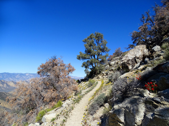
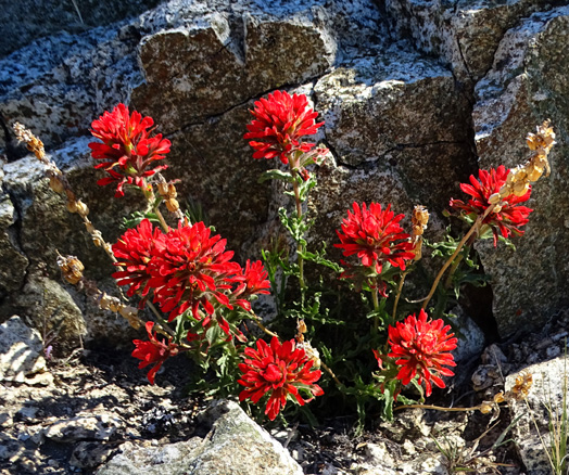
Desert Paintbrush
I really liked this part of the trail but acrophobics might not like the
steep drop-offs in some places.
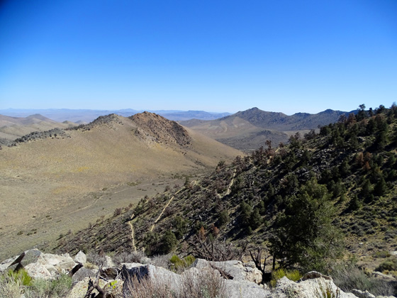
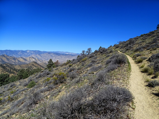
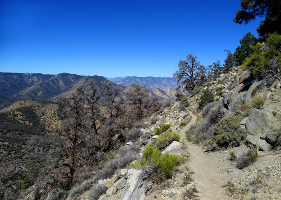
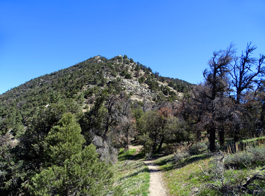
The trail continues high on the western and northern sides of Morris
Peak (7,215 feet elevation) in the fourth and fifth miles, with some
views of pointy Mt. Jenkins (7,921') up ahead:
Pass before Morris Peak
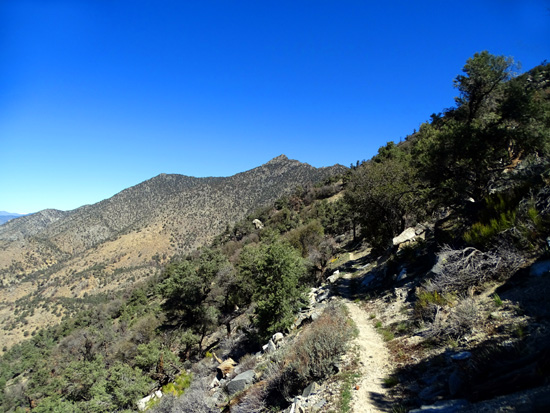
Above and below: Mt.
Jenkins' peak is in the distance.
Another scenic view to the west
At approximately 4.8 miles from Walker Pass, the PCT rounds
the northern slope of Morris Peak and gradually climbs the southeastern
and eastern flank of Mt. Jenkins:
And then I knew why the cyclists told me to keep going at least five
miles before turning around.
Continued on the next page: great views, colorful rocks,
and a nasty surprise when I got back to my car at the trailhead
Happy trails,
Sue
"Runtrails & Company" - Sue Norwood, Jim O'Neil,
Cody the ultra Lab, and Casey-pup
Previous
Next
© 2016 Sue Norwood and Jim O'Neil
