Continued from the previous page.
ON THE EDGE OF THE ABYSS: IS THIS THE SCARY PART??
This section has a lot more drama, especially for those who are
afraid of heights -- or simply clumsy. It's dangerous but adrenaline-inducing
for adventure junkies like me.
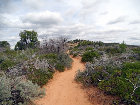
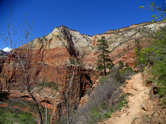
The good news is that most of the 2,200-foot elevation gain
has already been attained in the first three miles; the last mile
continues up gradually to the undulating plateau, which feels almost flat in comparison
to the rest of the trail.
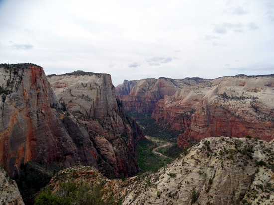
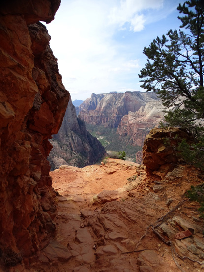
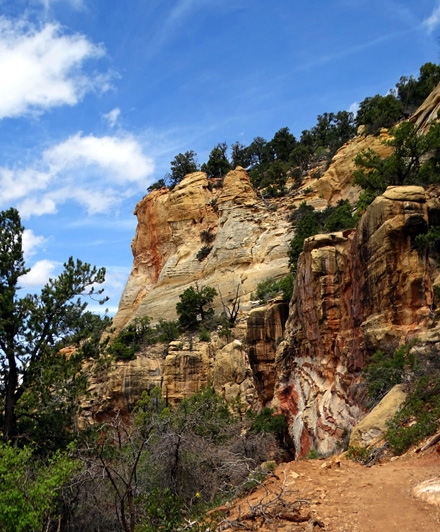
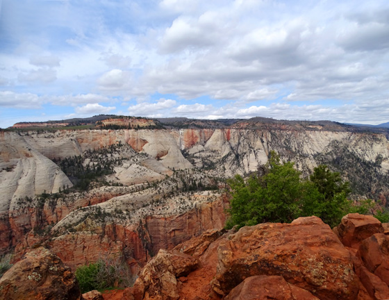
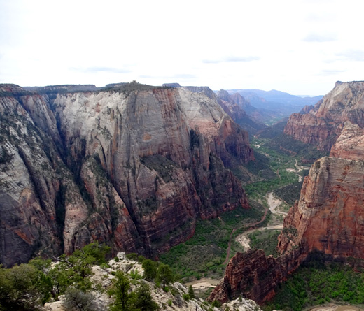
And the views are simply awesome
from the long "bench" in the White Cliff below the East Rim:
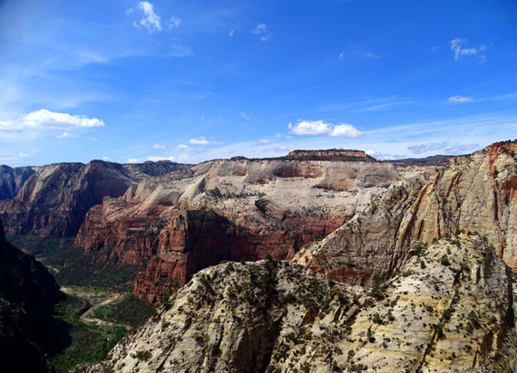
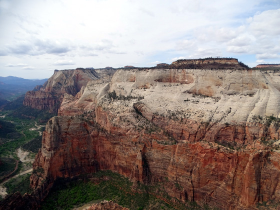
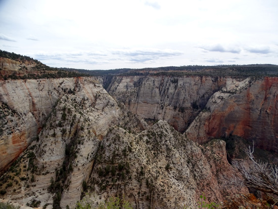
One of the views from the cliff toward
Observation Point (far upper R) and the West Rim
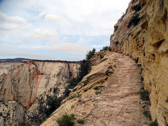
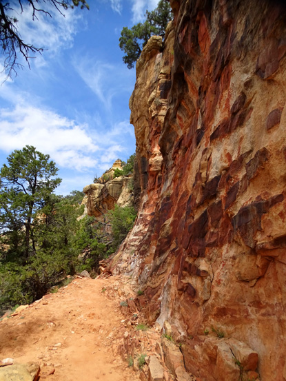
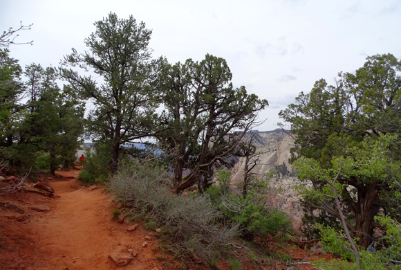
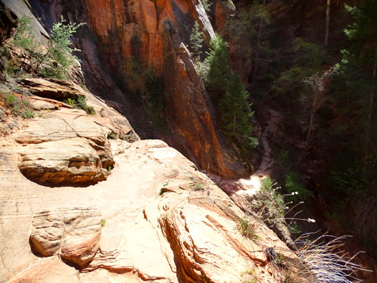
The first part of the cliffside trail has been blasted
and chiseled out of the rock walls and isn't very wide. There is nothing
between you and the edge of the trail except air.
The sheer drops range from several hundred feet to a
couple thousand feet but oh, my, the views in three directions are
great.
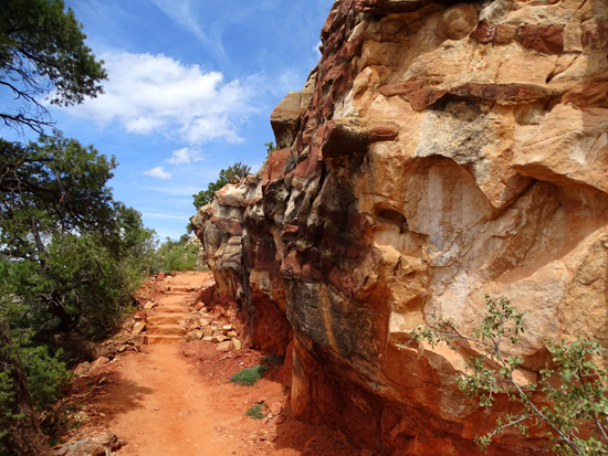
Some of the trail is fairly smooth concrete or slickrock.
Other parts are rather rough. Both can cause problems if the
surface is wet or you aren't paying attention. STOP to look around or
take pictures! (I wonder how many people have gone over the edge taking selfies
along here or at the Point??)
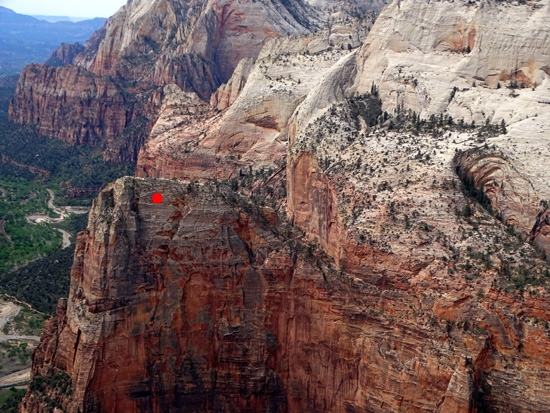
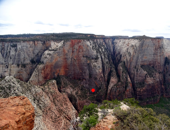
Photos in this section show views in both directions:
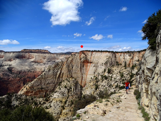
Observation Point is right under
the red dot, still about a mile away from this vantage point.
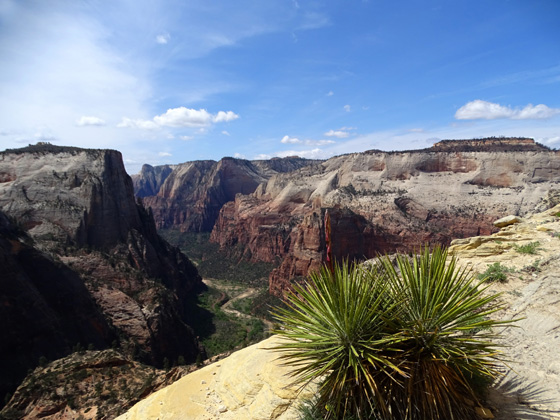
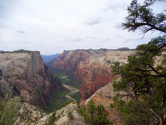
Above and below:
looking down into Zion Canyon
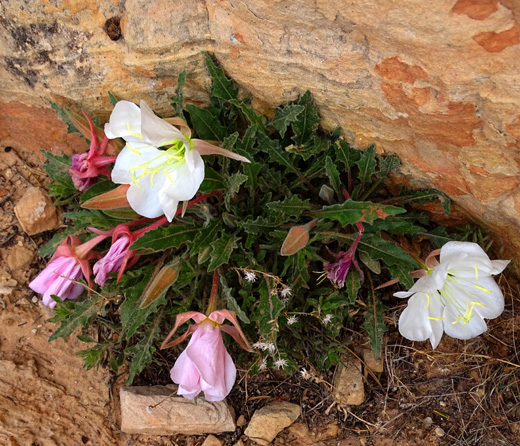
Evening primrose at about 6,200 feet elevation
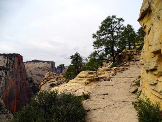
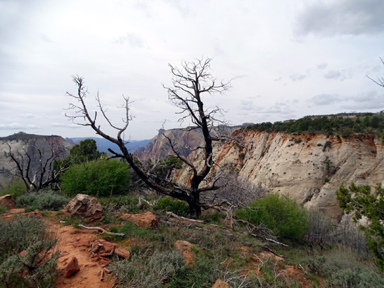
A little higher up on the side of the cliff, and when hikers first
reach the sandy plateau of the East Rim, there are some trees and shrubs that
can give folks a false sense of security.
Be aware that this part of the
trail is still very close to the edge and the drops are just as dangerous; you
just don't feel quite as exposed any more.
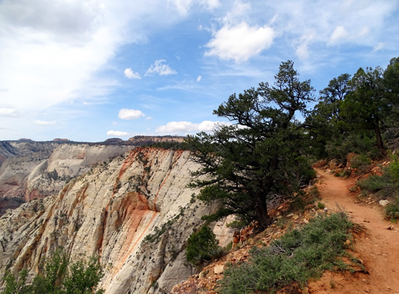
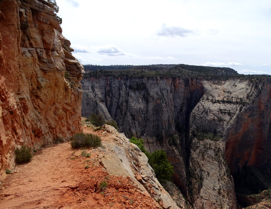
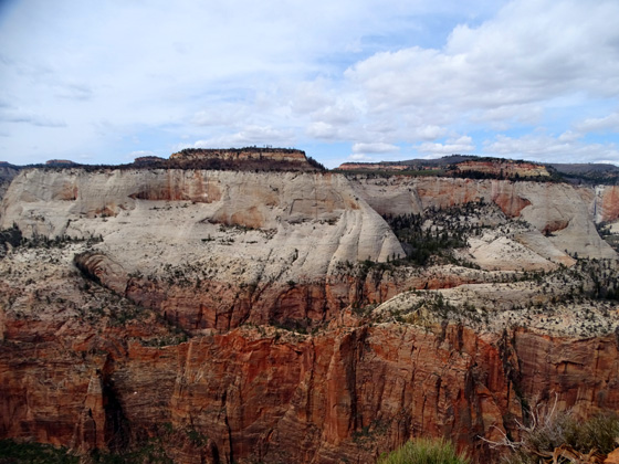
The views are even better down into Zion Canyon and over to the east
and west rims as you climb to the highest point:
Longer view south into Zion
Canyon

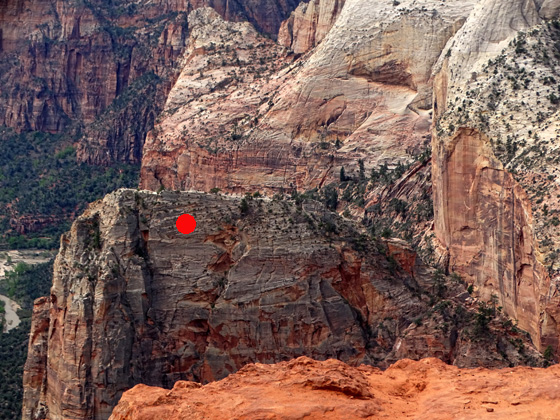
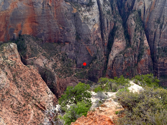
Zoomed in on Observation Point
(under red dot)
and over to the plateau on the
west side of Zion Canyon
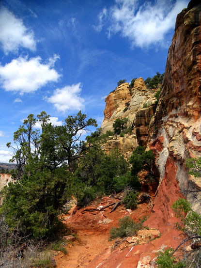
There are some beautiful colors and unique patterns in the cliffs in
this section, too:
I'm rather clumsy but not acrophobic, fortunately. With a dry trail
and due diligence this section wasn't scary for me.
I thoroughly enjoyed the views and the adrenaline rush on the way up
and down this part of the trail.
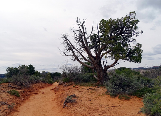
THE PLATEAU: ALMOST THERE!
The last third of a mile, approximately, on the sandy sage-covered plateau and out to
Observation Point is the flattest part of the trail.
You'd think the best panoramic views would be in this high section but the trees and
shrubs -- and lay of the land -- obstruct some of the
views unless you walk closer to the edge again:
A short section of soft
sandy trail
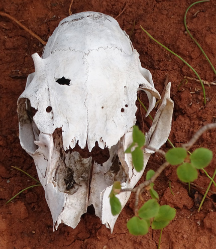
A bighorn sheep? a deer?
I found the plateau to be the least interesting part of the trail until
turning south on the peninsula as it narrowed near the Point itself.
Then the trail was closer to the edge of the cliff above Zion Canyon and the views over to
the West Rim and down into Zion Canyon were better in clear spots
between the trees:

I was so close to the other side of Zion Canyon that I
could easily see the distinctive white domes in Telephone Canyon and even parts of the
West Rim Trail that I hiked two days ago:
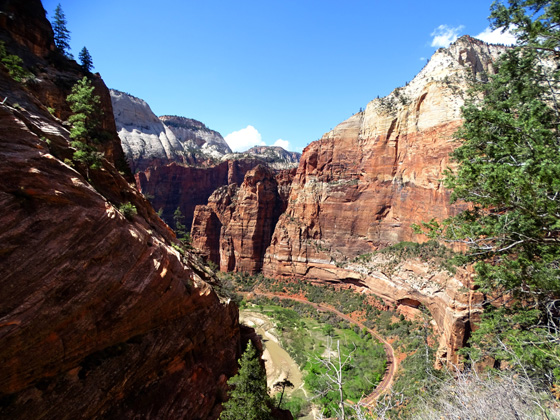
Right after that I reached Observation Point, my destination.
OBSERVATION POINT: IT'S A LONG WAY DOWN THERE!
You'll know when you get to Observation Point because you can't go
any farther except over the edge of the cliff and down into Zion Canyon which,
at that spot, is a couple thousand feet below you:
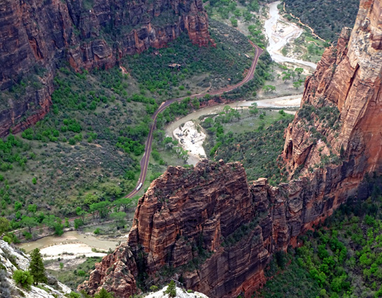
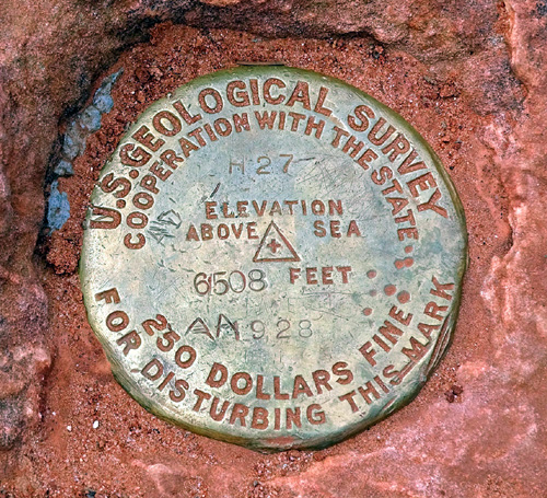
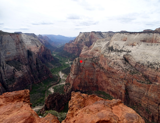
In fact, you're so high up at 6,508 feet that you're looking down
on the iconic Angels Landing, which I marked with a red dot in the
picture above. This view south in Zion Canyon is one of the very best in
the entire park. Too bad it wasn't more sunny when I took this picture.
Here are some other views from the Point -- you can walk around it a
little bit to see more of a panorama -- starting with some
close-ups of
Angels Landing:
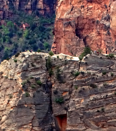
I could easily see individual
people on top of Angels Landing with my zoom lens.
Panning right from Angels Landing
to the West Rim
I've already shown several photos above of Zion's western rim
from near the end of the trail at Observation Point.
Now I'll pan to the left toward the East Rim and down to the
trail I took to get up here. It's an interesting perspective from the
Point to see the lower switchbacks and the steep drop-off from the
cliffside bench in the third and fourth mile of this trail!
Above and below: The red
dot is at the intersection of the Observation Point Trail
to the left and the trail up to
Hidden Canyon on the right.
The trail disappears for a couple miles after that
through Echo Canyon and the most exposed part of the cliff-side section.
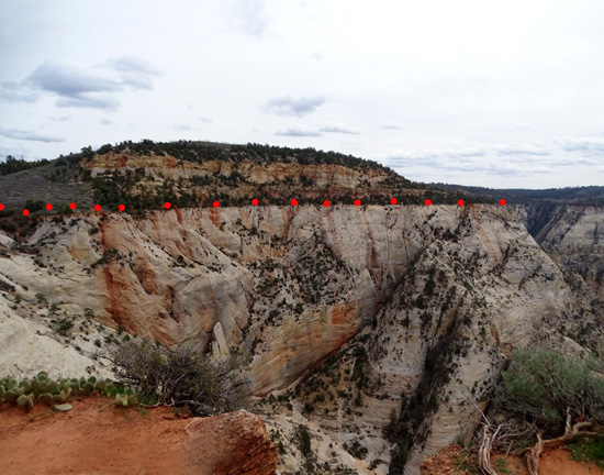
The next two pictures pan east and north toward the East
Rim where the Observation Point Trail is on the edge of the treed part
of the cliff. I marked the location of the trail with a series of little
red dots in the second photo below:
When I looked back at that section from the Point I was a bit shocked
at the drop-off! It's even more graphic from this perspective than when
you're on the trail itself. Ditto when I look at photos of Observation
Point from certain locations. Then you can really see how vertical and
steep some of the walls are in this park.
I spent 15-20 minutes at the Point looking at the scenery, taking
pictures, calling Jim, and eating a snack. You'd think such a fabulous viewpoint
would be crowded with people on a beautiful spring day but it wasn't
today. It's not an easy trail so fewer folks even attempt it. And I
started early enough this morning that I didn't see very many people
along the trail on my ascent. There weren't more than half a dozen hikers
at the Point when I arrived and I was able to get all the photos I wanted.
There were a lot more people going up in the early afternoon when I
was descending. It took me longer to get back down than going up because
I talked to more hikers who had questions re: how much farther?
what's the trail like? etc.
BEGINNING OF THE HIDDEN CANYON TRAIL
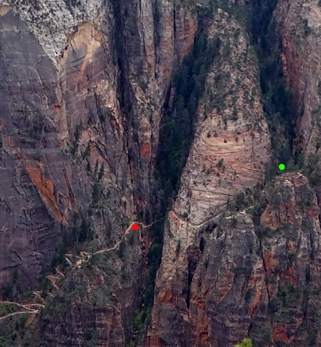
On the descent I turned up the Hidden Canyon Trail, which
you can see best from this photo I took up at the Point:
This trail begins about 3/4 mile up from the Weeping Rock trailhead
in Zion Canyon. The intersection with Observation Point Trail is in the
lower left corner above.
Per the park information, it is 2.5 miles out and back
(total) "along a steep cliff face to the mouth of a narrow canyon."
From what I've read, you can climb up farther after that if you can
manage the rough terrain.
The red dot is where I turned around
after about 1/3 mile. The green dot is the mouth of
Hidden Canyon. Note the very exposed trail between the dots!!
That's a heck of a steep drop, too.
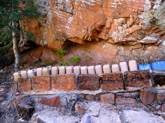
There were a bunch of water jugs (tan containers
in next picture), other supplies, and some equipment at the intersection with the Observation
Point Trail. Workers are currently making repairs on both trails:
I climbed up the series of short switchbacks at the beginning of the
Hidden Canyon Trail and hiked a little
farther into a side canyon until the trail went down into some rough
terrain, then back up the other side toward the exposed cliff face. When
I noticed chains to guide hikers, I turned around. I was too tired by
then to deal with a trail so difficult it required hanging onto chains!
Here are two views of the trail, which is rougher and more narrow
than the Observation Point Trail:
Another perspective of Observation Point,
from the Hidden Canyon Trail.
Nope, don't wanna fall off any of these cliffs!!
I turned around and went back down to the intersection with the
Observation Point Trail. I enjoyed the slightly different perspective of the
East Rim and the river valley
from the Hidden Canyon switchbacks:
Maybe someday I'll go back and hike the Hidden Canyon Trail out of
curiosity but it's not at the top of my list of Wanna-Do's.
I definitely want to hike the Observation Point Trail again, however.
I loved it, and want to share it with Jim on another beautiful spring or
fall day.
Next entry: a wintry day trip to Red Canyon National
Forest and Bryce Canyon National Park, which are at higher elevations
than Zion National Park
Happy trails,
Sue
"Runtrails & Company" - Sue Norwood, Jim O'Neil,
Cody the ultra Lab, and Casey-pup
Previous
Next
© 2016 Sue Norwood and Jim O'Neil
